All Activity
- Past hour
-
(002).thumb.png.6e3d9d46bca5fe41aab7a74871dd8af8.png)
E PA/NJ/DE Winter 2025-26 Obs/Discussion
ChescoWx replied to LVblizzard's topic in Philadelphia Region
Sorry to hear of your loss. I too have a funeral on Tuesday. -
(002).thumb.png.6e3d9d46bca5fe41aab7a74871dd8af8.png)
E PA/NJ/DE Winter 2025-26 Obs/Discussion
ChescoWx replied to LVblizzard's topic in Philadelphia Region
The snow has just about ended and looks to be mixed with drizzle now. The 0.5" of snow we recorded in East Nantmeal this morning will make November 2025 the "snowiest" November since the 7.3" of snow we saw back in November 2018. This is the 10th November in the 22 years I have been at this location that we have received measurable snow during our 11th month. 2025-11-30_9-45-26.mp4 -
SE trend is giving us the goods this time. Imagine February where a 2/19-20 tier storm is set to hit the Erie to Buffalo area but then it starts ticking further south and east with each successive run.
-
I actually agree with you. Yes the coast can see some flakes at the start but with a departing high, this will be an all rain event. There is no snow at the end of the storm on any model.
-
-
Also setting up a nice snowpack already in the Midwest is only going to increase our chances of cold.
-
Aside, does anyone know where I can access the Google DeepMind model? It crushed it this summer and I’d really like to see how it performs this winter.
-
It was track wise more than QPF output. 12-18 isn’t happening but 6-8 as depicted in p/c still makes sense
-
That’s way more snow than the Carolinas get these days.
-
My wife reported snain, right at the very beginning, brief though it was. Garwood NJ (central Union County)
-
The NAM absolutely crushed our area lol. 12-18” is def not happening with this system. I would say 4-8” is prob more realistic.
-

Nov 28-30th Post Turkey Day Winter Storm
hawkeye_wx replied to Chicago Storm's topic in Lakes/Ohio Valley
My total is 11.0". This storm had a lot of good qualities. One negative is it was mostly light to moderate snow, with only a couple brief bursts of heavy rates, which is why I was not able to get to a foot. -
True, but I prefer to panic while I'm young enough to have the energy.
-
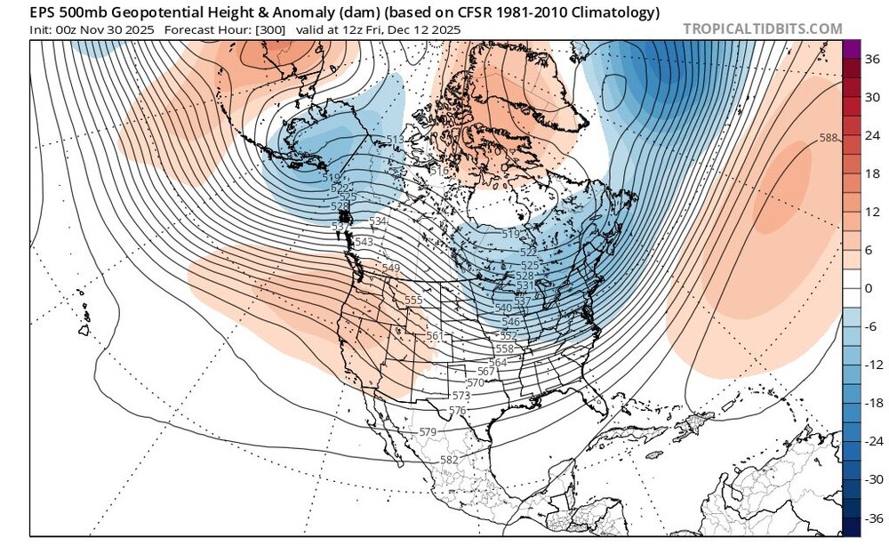
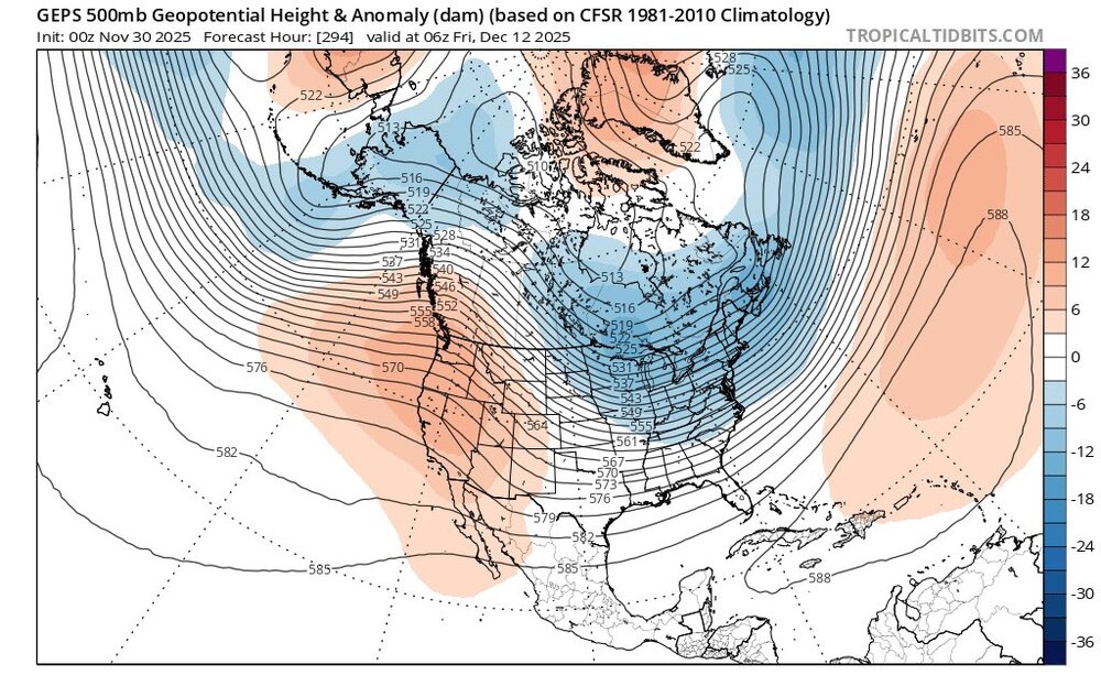
December looks hot. Updated: BWI: 25.5" DCA: 18.2" IAD: 27.1" RIC: 12.3" ----- SBY: 13.2"
-
I see that in the modeling. Interesting I read the event was more of a reflective manner, and did not couple the SPV and the TPV. Of note is the current AO which despite Canada, and basically a large portion of North America cold, the AO has not dropped. Wonder if that changes going forward. I looked a couple days ago and believe long range modeling has the AO going negative.
-
Got a dusting. Roofs, cars, mulch still covered when I woke up at 815. Pavement was wet, so it must've been more expansive prior.
-
This post is ridiculous. Now you’re posting completely untrue, false information about a model run and you should get a warning for it. The new 3K and 12K NAM have zero snow anywhere in NYC even at 10:1 ratios. The wishcasting needs to stop. Put it in banter, not in a serious thread
-
Overall idea hasn’t changed much, but we may get “luckier” with snowfall amounts.
-
Probably some white rain at the onset, maybe even a little grass accumulation at best but will all turn to rain with temps near 40F.
-
They aren’t as good of models to pick up on the small things that matter. Nam has trended south each run so it’s slowly getting there.
-
-
First Winter Storm to kickoff 2025-26 Winter season
dryslot replied to Baroclinic Zone's topic in New England
Looks like GYX stole my forecast. Tuesday Snow, mainly after noon. The snow could be heavy at times. High near 32. Calm wind becoming west around 5 mph in the afternoon. Chance of precipitation is 80%. New snow accumulation of 4 to 8 inches possible. Tuesday Night Snow likely, mainly before 10pm. The snow could be heavy at times. Mostly cloudy, with a low around 19. Chance of precipitation is 60% -

12th Annual Mid-Atlantic Snowfall Contest
NorthArlington101 replied to RodneyS's topic in Mid Atlantic
Making a very modest adjustment upward since I think we get off to a relatively hot start for December BWI: 13.4” DCA: 11.1” IAD: 15” RIC: 8.5” SBY: 9.1” -
Personally, I'd feel more comfortable with the Nam and Icon being on board. I know they have problems, but to be this close to the event and they have the rain/snow line 75+ miles north is odd, even for them, within 48 hrs.


.thumb.png.34e8ee1c06d472dab020d4714409ac23.png)


