All Activity
- Past hour
-
It poured all the way from Fredericksburg to IAD. Go figure.
-
Drive home from work was wet! Didn’t see what happened late afternoon to now, but I think the northern neck avoided the heavier stuff.
-
it's much worse now. oak trees are 3/4 brown. From what I read, the worst was N Falmouth Sandwich but it's spread way east to Yarmouth, Brewster etc.
-
September 2025 OBS-Discussion centered NYC subforum
SACRUS replied to wdrag's topic in New York City Metro
Highs: PHL: 78 EWR: 77 New Brnswck: 76 ISP: 76 JFK: 76 TEB: 75 LGA: 74 NYC: 74 TTN: 74 BLM: 71 ACY: 71 -
about an inch so far. temps have been similar to a strong cutter going well north of here in winter.
-
Yup
-
Yup . I noticed it on way to FMH for Julorch 4th. All the way in and out . At the time I was thinking caterpillars
-
It's nothing like the Cape browning... Your area may indeed be related to dryness. When I was on the Cape in early July and then again in mid-August, it was quite remarkable in the Sandwich / Mashpee area... Had never seen anything like it.
-
Yes and good amounts of rain. I have picked up .64” from a couple of rounds. Radar shows more coming from central CO.
-
Little over 3 months until we go the other way! Sent from my Pixel 10 Pro XL using Tapatalk
-
butterfish55 started following O'Brother Septorcher
-
Pray for Bermuda
-
So far the HRRR is too dry south of I-70. Very happy for the rain. Things are so dry that our soil moisture numbers haven't budged even in southern Maryland where nearly an inch of rain has fallen.
-
Anomalies and projections ... __________________________ DCA _NYC _BOS _ ORD _ATL _IAH __ DEN _PHX _SEA (15th) ___ (anom 1-15) ___-3.1 __-2.0 _ -2.0 __ -3.2 _-0.7 _-0.3 __ -0.3 _ +0.8 _ +1.0 (15th) __ (p anom 1-30) _ -1.5 _ -0.5 _ -0.5 __ -1.5 __ 0.0 _+0.5 __ +0.5 _ +1.0 _ +1.0 (seasonal max contest is probably finished now, report on it back in thread will be confirmed and re-posted at end of Sep) (preliminary scoring report will follow based on above projections)
-
Burn https://x.com/ericfisher/status/1968101844003299676?s=46&t=dhcbvkjmRcyBVQtDxJ3lRg
-
I'm guessing yes. Unless it throws the earth off its axis.
- Today
-
Even in this world of CC?
-
That could be. I'd love to see another 1977 in the East, but with a massive side of 2013-2014. I am just dying to see you guys get snowed in so many times while getting such frigid air, piling up the pack storm after storm after storm after storm, until your arms fall off from digging so much snow in a real life version of an incredible Jebman/George BM type low sun season with absolutely NO MERCY, snow so damn deep in the DC metropolitan region that shoveled canyons actually collapse from too much snow on the sides from piled up snow.
-
Invest 92L--90% two day, 90% five day odds
GaWx replied to WxWatcher007's topic in Tropical Headquarters
8 PM TWO: Central Tropical Atlantic (AL92): Showers and thunderstorms associated with an elongated area of low pressure located about midway between the Windward Islands and the Cabo Verde Islands have changed little in organization during the past 12 hours or so. However, environmental conditions are conducive for additional development, and a tropical depression or storm is expected to form in the next day or two as the system moves west-northwestward or northwestward at 10 to 15 mph over the central tropical Atlantic. Additional information on this system, including gale warnings, can be found in High Seas Forecasts issued by the National Weather Service. * Formation chance through 48 hours...high...90 percent. * Formation chance through 7 days...high...90 percent. -
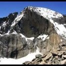
snowing at Alpine Visitor Center this afternoon with rain at Estes/Fort Collins
-

2025-2026 ENSO
Daniel Boone replied to 40/70 Benchmark's topic in Weather Forecasting and Discussion
That's one none of us want unless you like an average Florida like January. -
Well given this output, we just might need to upgrade the panic room. Damn that is so bad for the Western ski resorts. Mammoth may be bare ground all winter. I'll be begging for a reaping. Do me a rendition of being on the 105th Floor in the North Tower and goin down with the building on September 11 2001 while clinging to the outside trying to get some fresh air........ Sure I am terminally morbid about so many things lol.
-
Here’s another one, Don: Mysterious ‘warm blob’ re-emerges in Pacific Ocean, long-term impacts expected by: Mike Masco Posted: Sep 15, 2025 According to the National Oceanic and Atmospheric Administration, the North Pacific sea surface temperature hit 20°C (68°F) in August, which would put it as the highest on record. For perspective, the first time it reached 19°C was 11 years ago, with records dating back to 1854. This event marks the fourth-largest marine heat wave since 1982, spanning a vast region from north of Hawaii to the coasts of California and Alaska. From a meteorological view, this setup can be significant. The warm anomaly tends to build high-pressure ridges over the Pacific Northwest, which pushes the jet stream eastward, often unleashing colder Arctic air into the eastern U.S.. This developing pattern closely mirrors what happened in the summer, fall and winter of 2013–2014, which featured: A neutral-to-weak La Niña ENSO pattern Below-average hurricane activity in the Atlantic Massive cold outbreaks and snowfall across the Northeast That year, New York City recorded 57 inches of snow, Philadelphia saw 63 inches, and the following year, Boston shattered records with 110 inches. Is history repeating itself? The current oceanic and atmospheric setup strongly resembles the winter of 2013–2014, raising the possibility of another brutal season for the East Coast — especially with hurricane activity already trending below normal, just like it did back then. https://wgntv.com/news/mysterious-warm-blob-re-emerges-in-pacific-ocean-long-term-impacts-expected/
-

2025-2026 ENSO
Daniel Boone replied to 40/70 Benchmark's topic in Weather Forecasting and Discussion
Exactly. With the dual area's, that would favor back and forth of HP Centering of which would produce periodic +PNA. Other Drivers would have to spring it moreso one way or the other.


