All Activity
- Past hour
-
 actual payday loan lenders online: CashBridge - best acceptance payday loans
 -
https://northtrustpharmacy.shop/# canadian pharmacy meds reviews
-

2026 Atlantic Hurricane Season
Windspeed replied to Stormchaserchuck1's topic in Tropical Headquarters
The first wave the OP GFS had been persistently developing the past few days was lost on the most recent 00z run. No surprise, around 100-120 hrs, it gets mauled by 30-50 kt westerlies. The 2nd wave mentioned in the previous post hits the same wall around 200 hrs out. Something probably will hit a favorable pocket eventually, and perhaps the deep mind is seeing that, but the upper levels will have to chill out. Not sure how the AI models are handling those same modeled westerlies simulated on the GFS and ECMWF operationals at advanced hours. That being said, recent EURO runs have been flirting with the build of dominant 500 MB heights over the ECONUS and WATL around Labor Day. We'll see if one of the later AEWs can find its way under that ridge and a more favorable ULAC pocket amidst the upper level chaos. - Today
-
North Trust Pharmacy: thecanadianpharmacy - North Trust Pharmacy
-
online pharmacy [url=https://pharmtru.shop/#]no rx needed pharmacy[/url] overseas online pharmacy
-

2026-2027 Record-breaking El Nino
GaWx replied to Stormchaserchuck1's topic in Weather Forecasting and Discussion
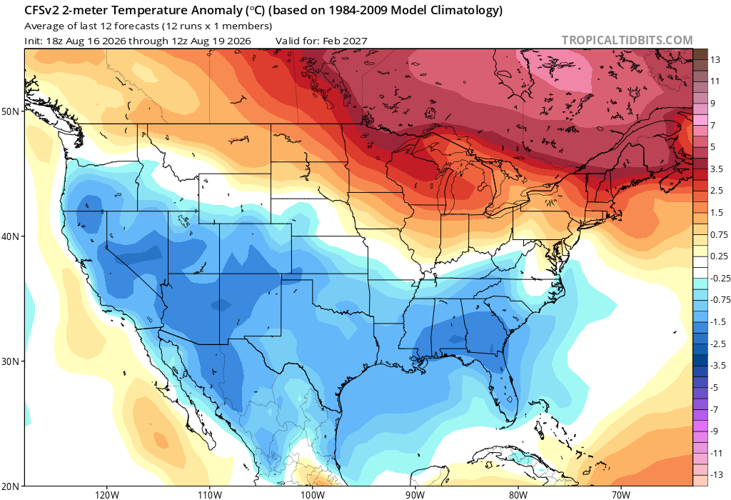
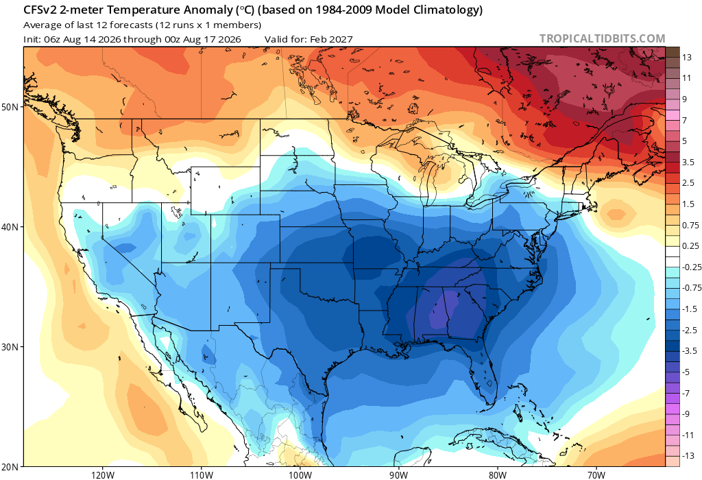
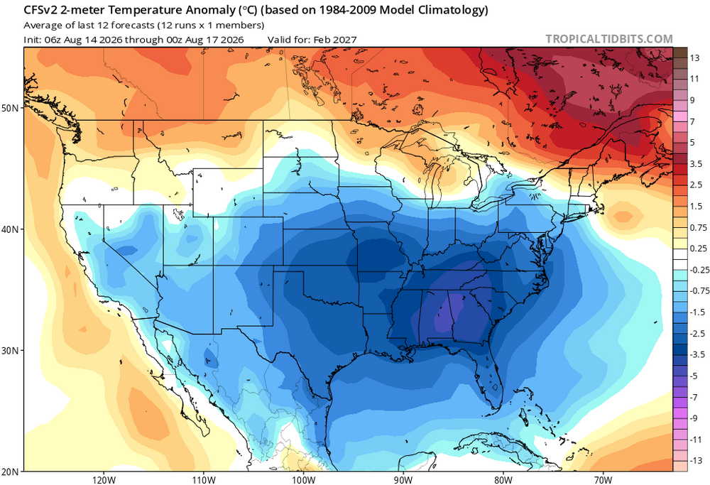
The latest few CFSv2 4 day means have reduced the Feb cold in the SE substantially: Compare that to how cold it was on the 4 day mean just 2.5 days prior: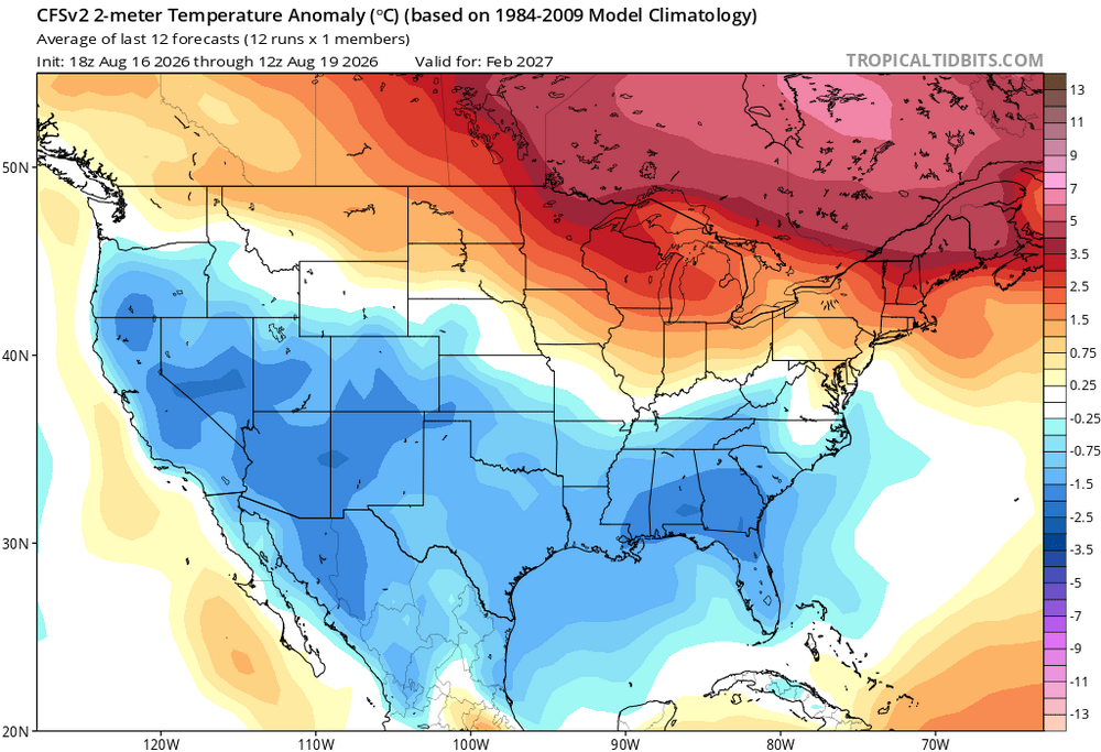
-

2026-2027 Record-breaking El Nino
raindancewx replied to Stormchaserchuck1's topic in Weather Forecasting and Discussion
Going to be very interesting to see if we get 'normal' El Nino conditions here. So far the Summer here has been about as hot as ever recorded, with near record low precipitation as well. 2023 was even drier in the Summer, but we're running hotter. Summer has been very close to 1953, 1958, 2023 as a blend, all the sort of drought plagued, -PDO, El Nino, very +AMO shit years locally. It's actually been very interesting - for the past month little batches of rain showers have formed late evening almost every night. But they are widely scattered and have only brought drizzle to the city most nights. A lot of the terrible monsoon years don't even have the showers form. But they typically perform best for rainfall late afternoon to about 8 pm. We've seen showers develop in the 8 pm to 2 am time frame and then sizzle out, which is unusual here for formation time. The Atlantic has really warmed up quite a bit relative to averages over the past 2-3 weeks. I think we will actually see a brief period of decent hurricane season activity in September. My hottest average temperature El Nino Summers are these winters: 1994, 2023, (2003 borderline El Nino), 1958, 2018, 1953, 2002. We tend to get fluky out-of-season heavy snow events following very hot and very dry Summers here. 1994-95 snowed a lot in April, 1953-54 in November, 2002-03 in March, 1958-59 in March, 2023-24 in November. Several of these also see good snow in the main winter too. My guess is the MJO will set up to favor bigger storms nationally in something like an Oct 15-->Nov 30-->Jan 15-->Mar 1-->Apr 15 fashion for major events given the local Summer data supports unusual concentration of heavy snow events in Nov/Mar/Apr so far, more than the winter. -
Everyone is saying shutout or HECS. I don't think the Winter will be like that. I can say pretty confidently that we will have snow periods, but maybe 3-12" type events. I don't see us blowing up a GOA low and -NAO, which are hecs patterns. We'll see.
-
Cialis without a doctor prescription: TadaHealth Rx - Cialis 20mg price in USA
-
Look at this: NWS in my neck of the woods mentions Nino - BUT I am not getting my hopes up. I am an excitable guy by nature, but I am also a realist. This is a record Nino that is extremely east-based. This means we will not get much rain in Austin from this Nino thru later 2027. But watch out Southeastern US and Mid Atlantic. This record Nino has got your name on it and it's got one hell of a roided up STJ. This Nino means bisnass. Get your arks ready in the DMV and the Southeast and Mid South. or move RIGHT NOW to the Mountains. This STJ means serious serious business and it will not spare and it will show no mercy and pull no punches. Some communities will get drowned by catastrophic flooding and it will last for a long time. Some neighborhoods in the Mid South, Southeast and Mid Atlantic will receive so many rounds of rain, that they WILL BE WRITTEN OFF. It's really too damned Bad I live too damn far west for this. I wanted to walk around and admire rising water levels while blasting Gen Z tracks, especially Playboi Carti, Kodak Black and Ken Carson. These songs and raps remind me of disasters in the 2020s. .LONG TERM... (Friday through next Wednesday) Issued at 123 PM CDT Wed Aug 19 2026 The 500mb ridge steadily migrates eastward and by Friday/Saturday, it will be centered over the Texas Panhandle. At the 700mb level, the thermal ridge will be centered directly over Texas, so strong subsidence and sunny skies should be the normal through the weekend. Heat advisories will continue this weekend and actual air temperatures may approach warning levels (105+) for the Austin metro this weekend. Trends will be monitored for a possible upgrade to Extreme Heat Warning, but for now, expect highs in the 99-104 range for most locations through Sunday. Unfortunately, despite a brief lull and advisory level temperatures Monday-Tuesday, ridging will be in even greater control by mid to late next week, and highs in the 100-106 range look like a good bet. At this distance, little relief is in sight through the end of August, but a pattern change may be in the works as El Nino continues to strengthen over the Equatorial Pacific, which may result in increased rain chances in early to mid- September.
-
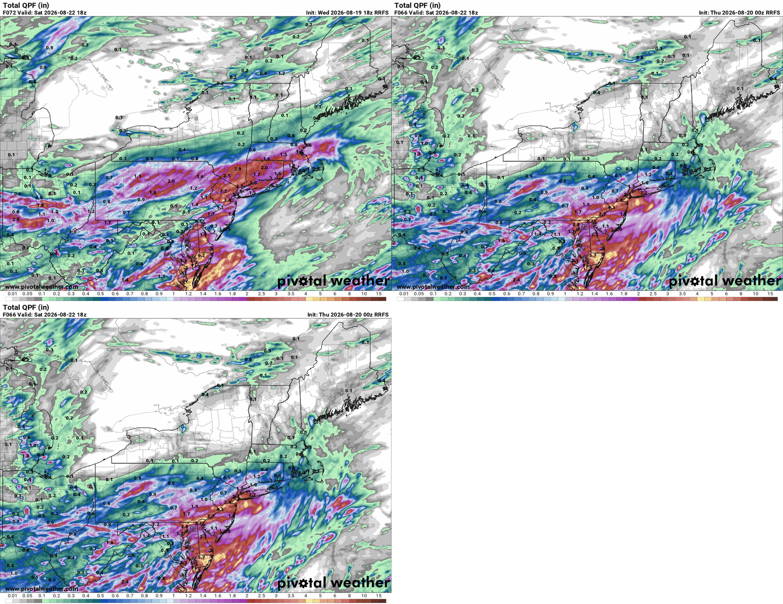
Yeah I've been watching the radar all evening and it's just crazy. I can't recall a time where a specific area had so much rain in such a short amount of time. It looks like there's a break soon but yet another wave back by ILX.
-
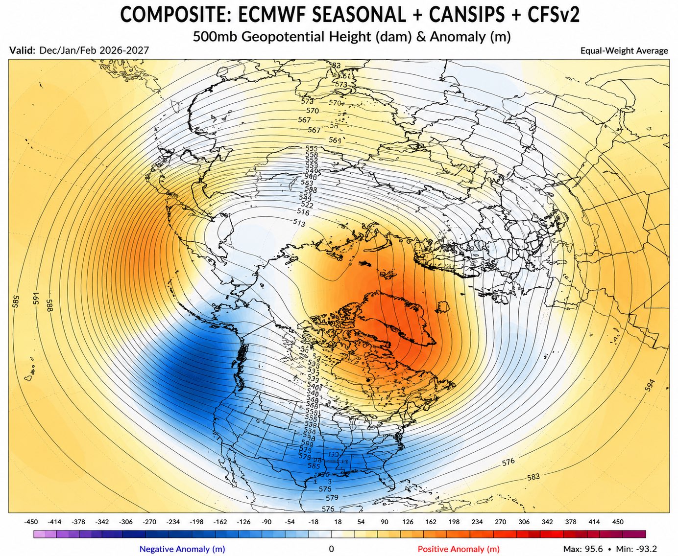
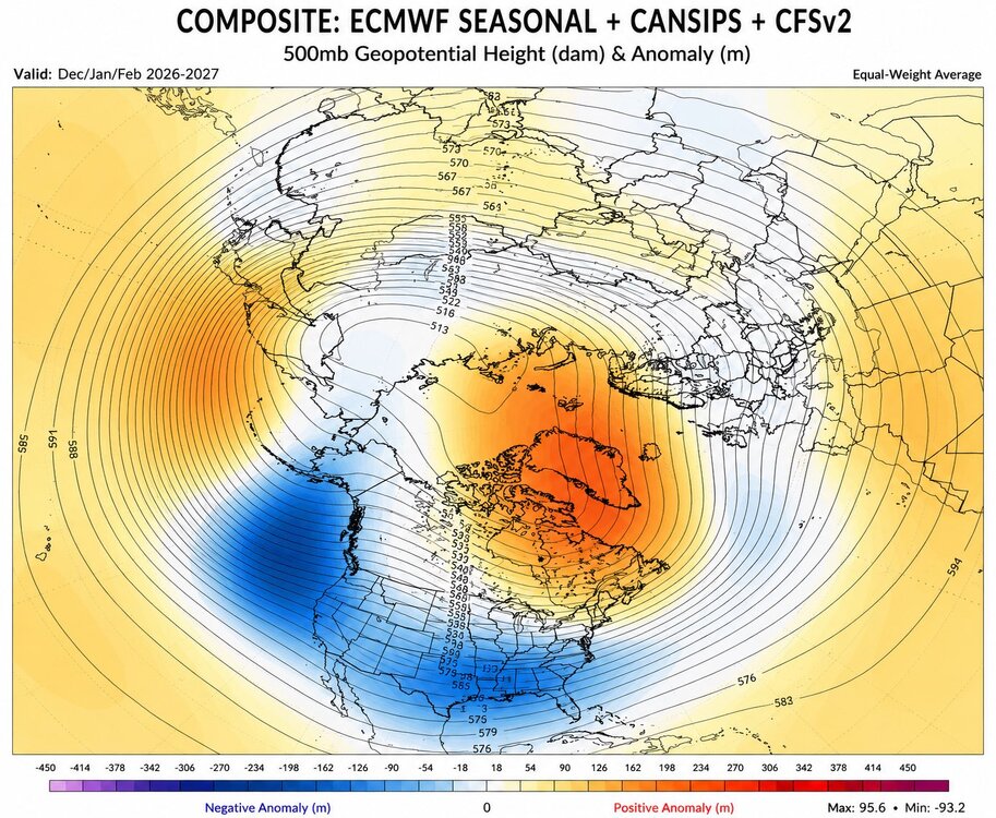
Nice composite
-
Yeah even today had more clouds than I thought it would. Just been a meh weather month, and this weekend doesn't look to change that. Our area is fine with rain and the reservoirs are good. Abnormally dry doesn't mean a drought.
-
I read somewhere that a high amount of Saharan sand can knock down the threat and there was a large amount being transported this year. Does this have any basis in fact?
-

Occasional Thoughts on Climate Change
LibertyBell replied to donsutherland1's topic in Climate Change
This is exactly why I stated we are approaching entropy. In that sense ACC is entirely normal because the entire universe is headed towards entropy. Also see my post in the El Nino thread about there being no ice on this planet for 85 percent of its history. -

Augdewst 2026: Summer's Last Stand
dendrite replied to Prismshine Productions's topic in New England
What a cave by rufus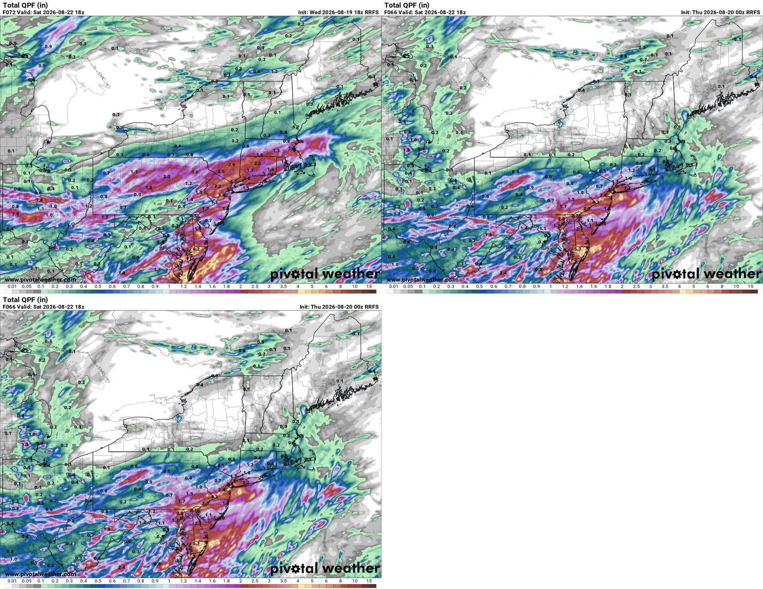
-
It's been raining for 6 hours straight again. This is getting stupid.
-
2026-2027 Record-breaking El Nino
LibertyBell replied to Stormchaserchuck1's topic in Weather Forecasting and Discussion
I dont know how many of you are aware of this but for 85% of this planet's history there was no ice anywhere on the planet. That being said yes the planet self regulates and as an example the Amazon even controls its own rainfall. The planet will be fine even either way the question is will humanity? Human beings are not the only creatures to alter the planet and ACC is nowhere close to the worst thing that's ever happened to this planet. Blue green algae aka phytobacteria altered the entire composition of the atmosphere and without them we wouldn't be here. The K-T event that ended the dinosaurs and 75% of all life on the planet was far worse than ACC is and happened in a much shorter time frame and the planet recovered just fine. As a matter of fact ACC can be thought of as the revenge of the dinosaurs as it may cause the climate to return to what it was like before the K-T event by literally burning their remains! -
I dont know how familiar you are with our climate but summers are supposed to be dry and moderate summer droughts are entirely normal. Alarmism based on color coded maps is unnecessary and unwarranted. Flooding is FAR worse than a moderate drought. Droughts normally end in the Fall anyway no need to spoil the summer even more.
-
http://northtrustpharmacy.com/# canadianpharmacy com
-

2026 Mid-Atlantic Severe Storm General Discussion
MillvilleWx replied to Kmlwx's topic in Mid Atlantic
The sad reality is, it's been a lot of bad luck for some and a lot of fortunate luck for others. This isn't a case where everyone has been skunked. Your area has been getting shafted while my parents down in Rehoboth has gotten hit multiple times, flush this summer. It's been a tough pill to swallow for many. Baltimore proper, especially east Baltimore has gotten trucked several times while the west side gets shafted. It's why I hate convective season around here. Need a synoptic scale gully washer to get everyone involved with good rain and some boomers.- 2,003 replies
-
- 1
-

-
- severe
- thunderstorms
- (and 7 more)
-

Occasional Thoughts on Climate Change
donsutherland1 replied to donsutherland1's topic in Climate Change
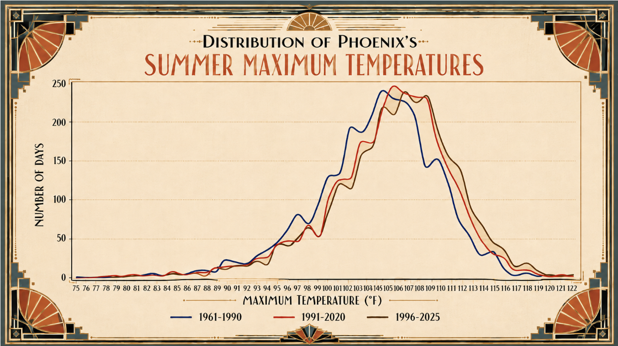
The distributions of Phoenix's warming summer high temperatures is shown below. Summer Mean High: 1961-1990: 104.3° 1991-2020: 105.4° 1996-2025: 105.9°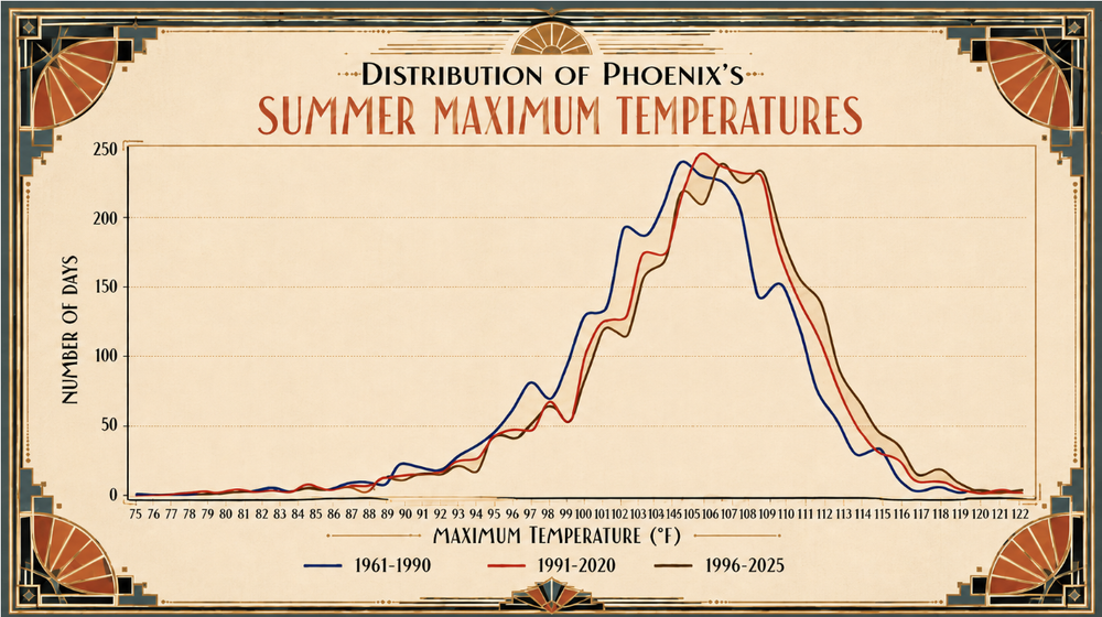
-
Same song and dance. And guess what? The hitting didn't show up again. It's pretty simple to see why this team will go nowhere. Some of the more un-clutch players I've seen. For every one time they succeed, they fail another 4. Sigh Where's football season?
-
They are aggressively mediocre
-
http://northtrustpharmacy.com/# rate canadian pharmacies