Greenwald
-
Posts
37 -
Joined
-
Last visited
About Greenwald

-
It looks like the widespread rain advertised for next weekend is quickly disappearing. 5"+ turned into 1.5"
-
Stack another .5" on for the ones that just went through. More coming for the weekend too.
-
"Particularly Delightful Day" Watch issued.. ENJOYMENT CHANCE...CONSIDERABLE
-
Yeah I've been watching the radar all evening and it's just crazy. I can't recall a time where a specific area had so much rain in such a short amount of time. It looks like there's a break soon but yet another wave back by ILX.
-
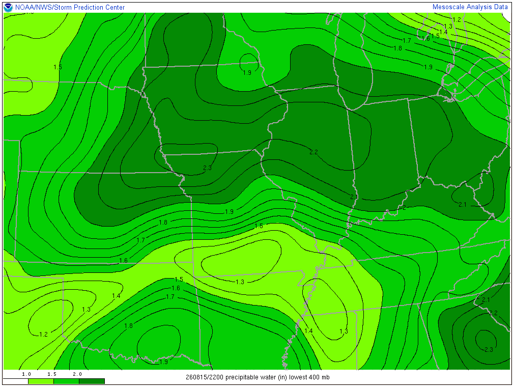
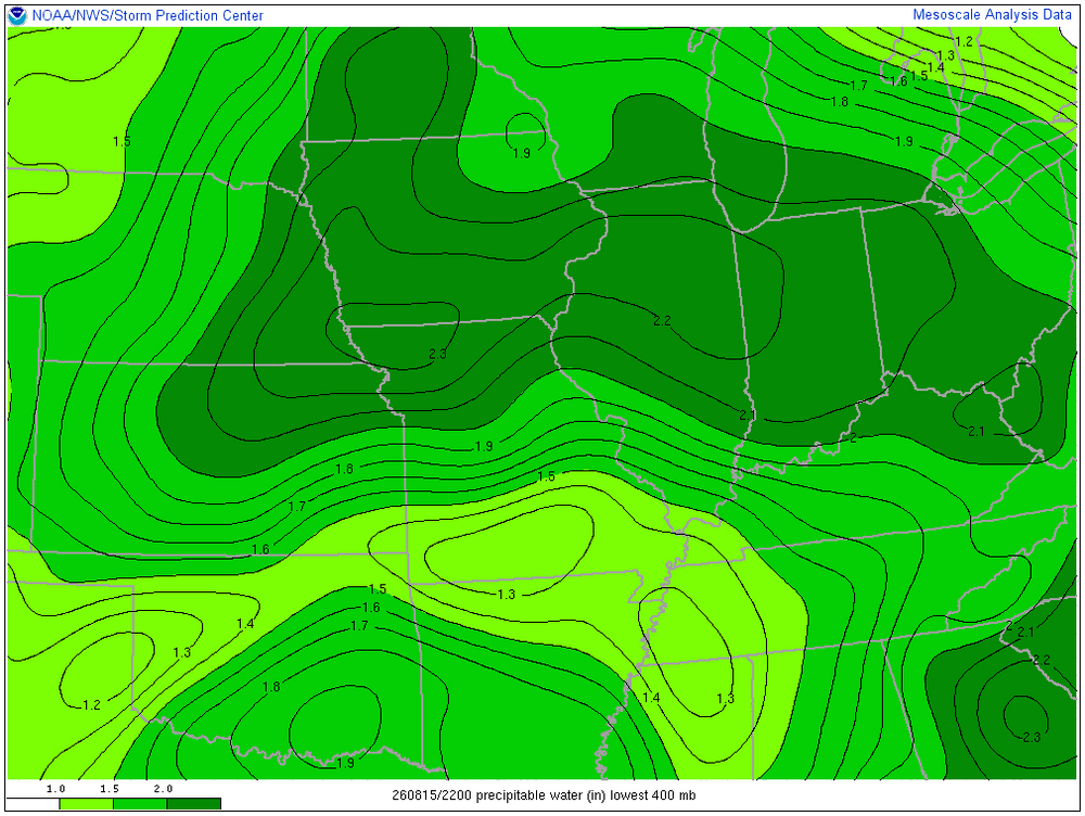
PWAT is about as high as it gets. No rain though, mowed today. Tomorrow should be the last day of this pattern. Signals are showing maybe a dry last 1/2 of August.
-
Yeah I woke up and thought what?? Big MCS over by Chicago and FFE down south. Chicago wave according to SPC should turn south but we'll see. Warned for 60 right now.
-
Yeah I would expect an EDS warning over a big tornado warning like that. Heavy rain here and maybe 55 mph wind thankfully. Lots of lightning.
-
I'm wondering about that and also in the 2:43 PM IWX AFD they mentioned signs of the boundry pushing south into central Indiana tomorrow.
-
Interesting discrepancy between the CSU and NWS on the area of severity. CSU seems to be leaning more south central IN / southern OH event. I guess we'll see what 00z offers.
-
Substantial tree damage reports coming out of Marion, IN according to police traffic. One structure with roof damage as well.
-
Had a quick five minute rain here then done. Looks like it's all south of me now. Nothing severe, classic July storm.
-
473K without electricity in Michigan alone. I mean I knew storms were forecast but wow..
-
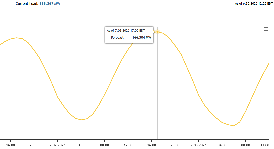
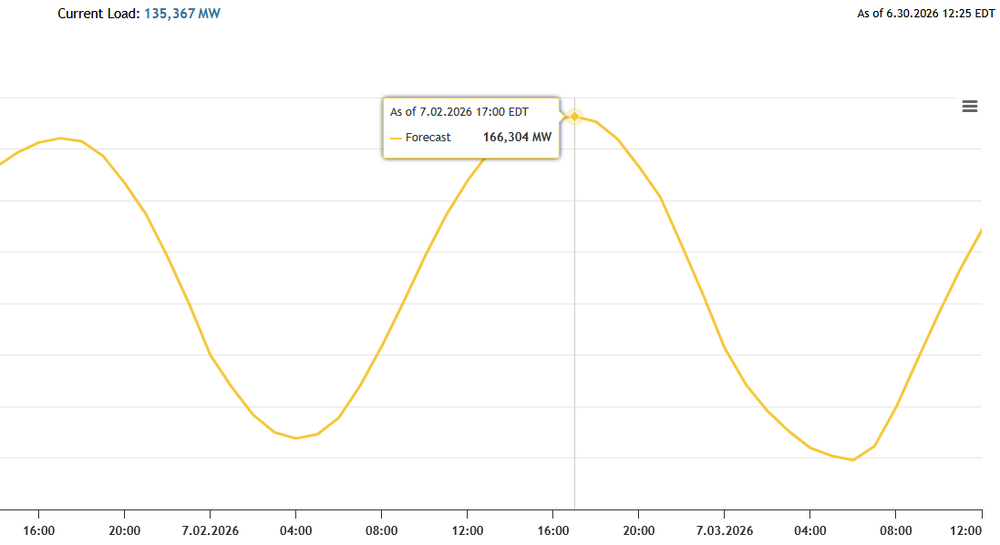
PJM is forecasting a record grid load on 7/2. Yesterday it was forecast to be 162, this morning they updated it to 166MW. The record I believe is 162 in 2006.
-
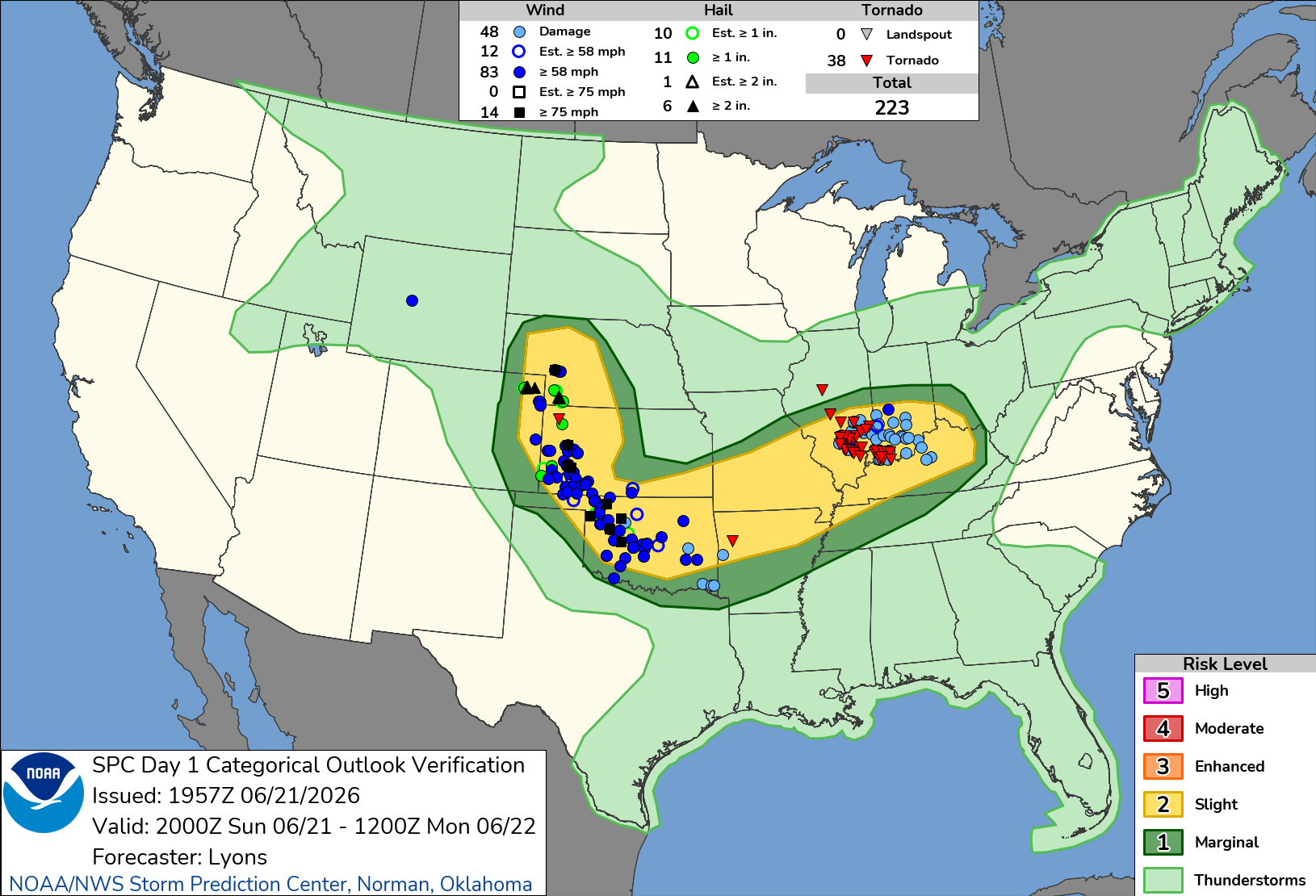
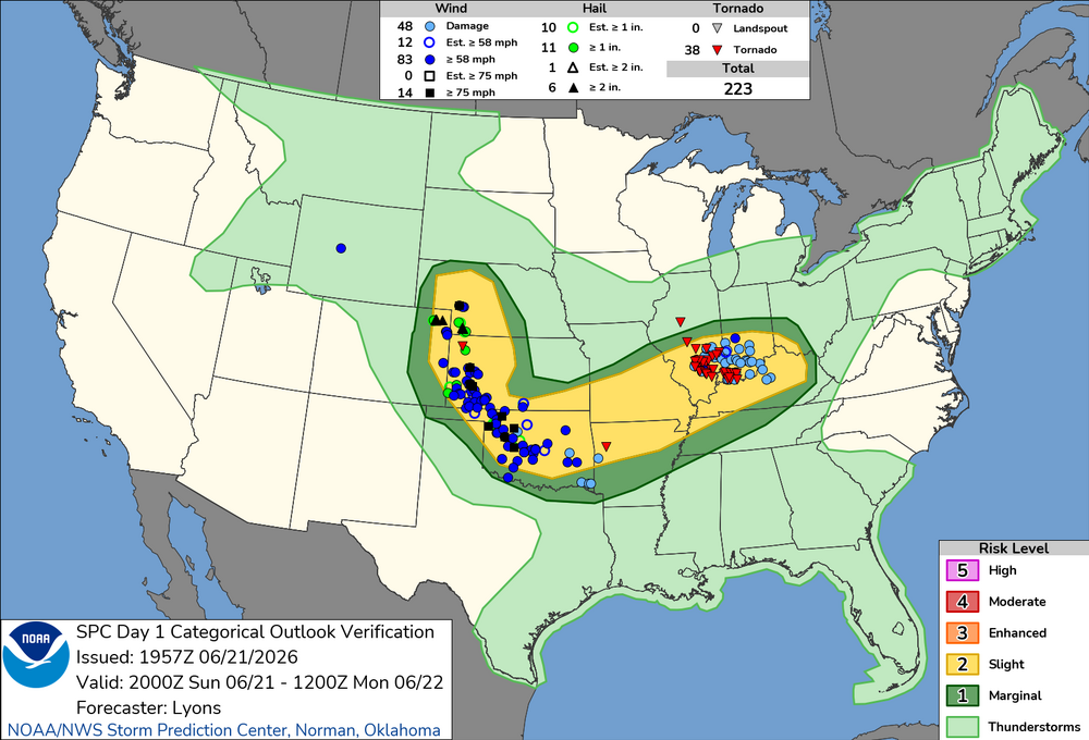
What a day.. I'm surprised they didn't go with moderate at some point. Even at 20z it was obvious something was up. Evansville fire and EMA were talking on the radio about watching Ryan Hall trying to figure out where the tornado was.
-
From the scanner it sounds like there's a lot of damage in the Evansville area and Warrick County. Took quite awhile to get a proper warning on that one too.