All Activity
- Past hour
-
 38° at SLK
 -

Central PA Summer 2026 Discussion/Obs Thread
Mount Joy Snowman replied to Voyager's topic in Upstate New York/Pennsylvania
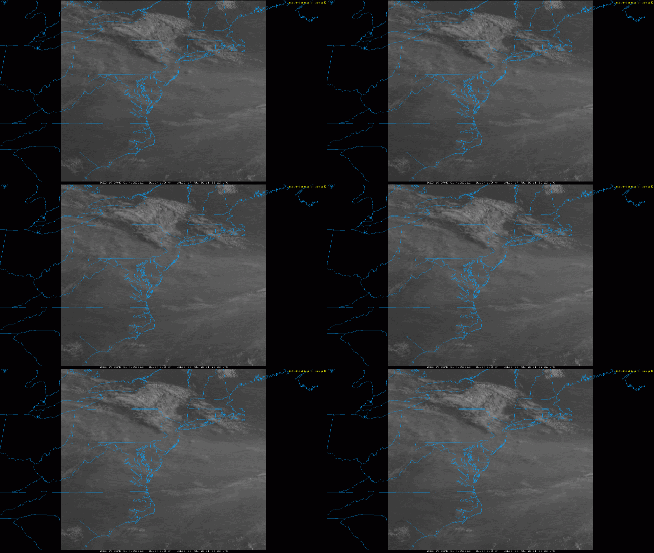
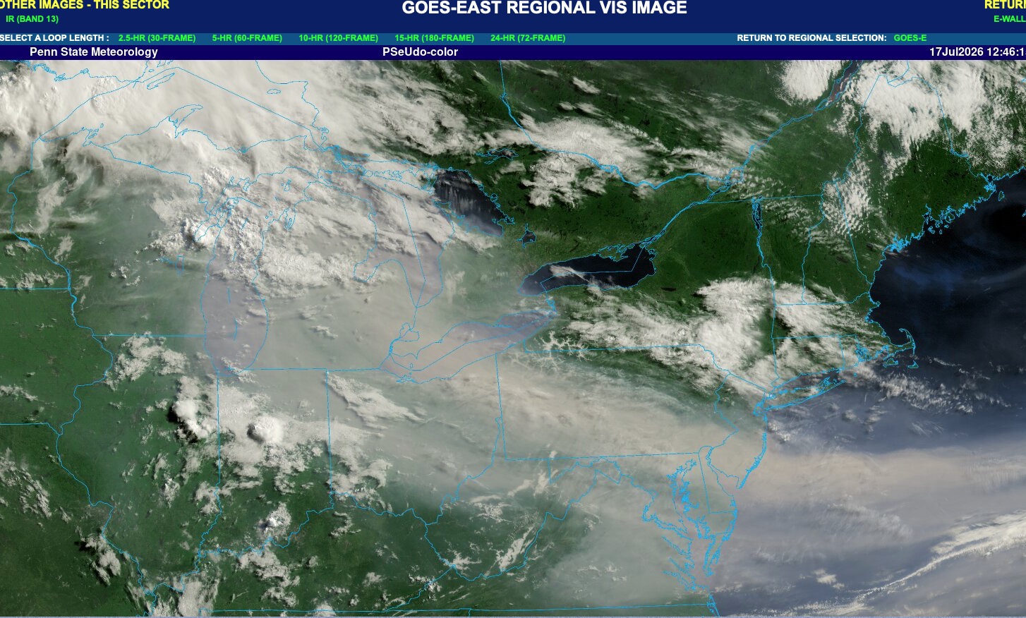
Low of 67 with thick smoke, which thankfully looks to clear out pretty quickly tomorrow afternoon. Hopefully we get some nice storms tomorrow and then Sunday looks beautiful. Harrisburg tied its max min record of 77 yesterday. National high of 121 at Stovepipe Wells, CA and low of 36 at Mt. Washington, NH. Carry on. -
The pool we belong to closed for the day. Dammit. I was gonna swim and then inhale water to flush my lungs out. We are a bunch of wimps
-
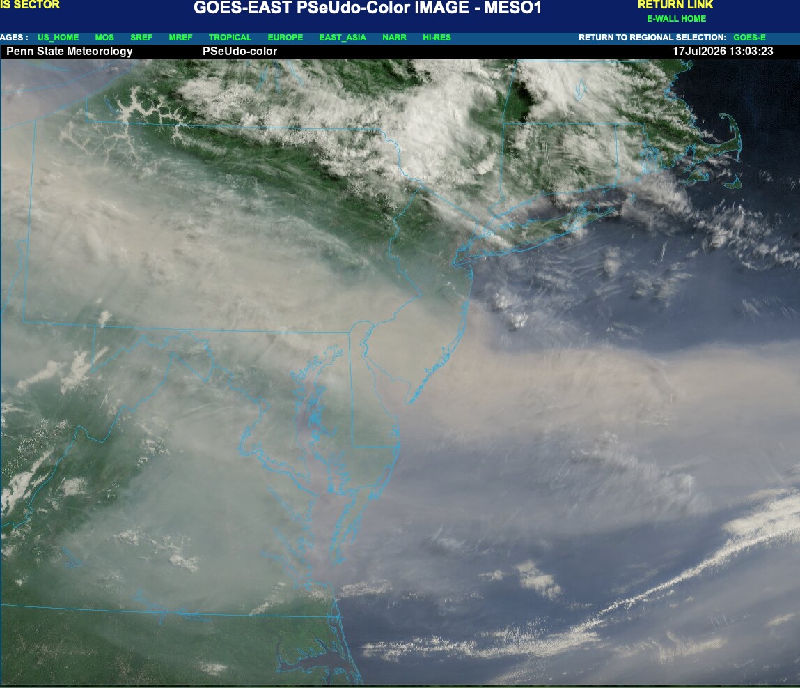
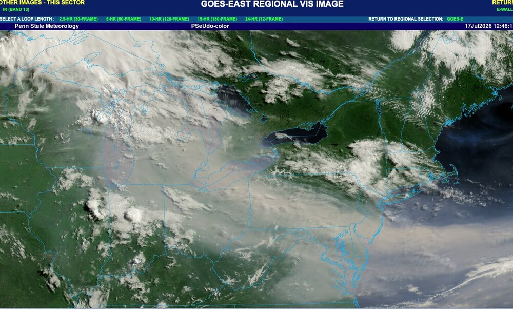
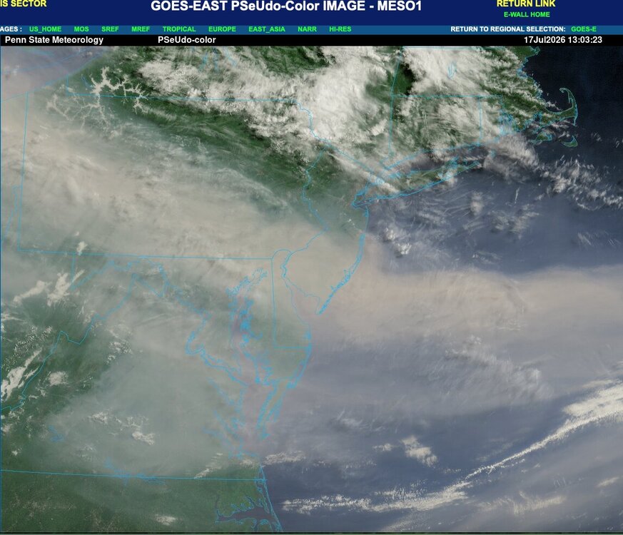
Yeah. Main smoke plume is shifting southward today. Actually fairly clear up here in NWNJ right now with only some haze to the south and clear blue skies to the NW.
-
They just cancelled
-

2026-2027 Super El Nino
GaWx replied to Stormchaserchuck1's topic in Weather Forecasting and Discussion
Sure enough, Darwin on July 16th exceeded 1018 mb for only the 2nd day since daily records started in 1991, a sign of El Niño. It reached 1018.25, which trailed only the 1018.35 of 21 years ago! https://www.longpaddock.qld.gov.au/soi/ -
High yesterday was 96. Supposed to be upper 90's again today. I am so over this heat. I can't remember a time when we had so many upper 90's for highs. Took our pup out for a walk this morning and it is already miserable out there. At 9 am it is 83/80, feels like 95. So miserable and I need to mow my yard.
-
 may fire one up after 12z
 -
I remember a tire smell here in 2023. Revolting out. Hope everyone can stay in as much as life permits.
-
The smoke is bad up there.
-
 Thread?
 -
Ha, or the Kingdome in Seattle back in the day. Was in Seattle in the mid-90s when they had A-Rod, J Buhner, Ken Griffey Jr, and Edgar Martinez and would hit multiple home runs a game. Every time they'd set off fireworks, and the smoke would start settling down with each consecutive homer. By the late innings you were praying for good opponent relief pitching.
-
I told you you didn't want anything to do with what was north of you. Hanging out in the mid to high 400's overnight. Looking for relief later today.
-
After avoiding the worst yesterday, we are in the thick of the smoke here. AQI over 400. Smells nasty.
-
Seems even worse this morning. The sun is no longer visible and visibility is low. Crazy stuff.
-
Still a little bit of low level smoke, but skies are much clearer overall. It's great seeing the sun again! HRRR brings some smoke back in later tonight with the sea breeze. Looks pretty clear by Sunday
-
NYC needs to pick up 2.77” by the end of July to have their first average to above precipitation month since May 2025. https://forecast.weather.gov/product.php?site=NWS&issuedby=NYC&product=CLM&format=CI&version=1&glossary=1&highlight=off Monthly Total Precipitation for NY CITY CENTRAL PARK, NY Click column heading to sort ascending, click again to sort descending. 2026 2.70 2.60 3.60 2.48 3.05 3.39 1.83 M M M M M 19.65 2025 0.61 2.60 5.52 3.25 6.58 2.46 4.03 2.21 2.76 4.08 2.09 3.38 39.57 2024 5.28 2.05 9.06 3.47 4.11 1.71 4.20 7.02 1.58 0.01 3.35 4.53 46.37
-
For as bad as the AQ is right now, if you are old like me this is nothing compared to going to a Caps game at the old Cap Center in the early 80s
-
Really a bummer. Ducks game is gonna be cancelled. Bought a bunch of tickets. Fireworks were supposed to be after.
-
.thumb.jpg.6a4895b2a43f87359e4e7d04a6fa0d14.jpg)
Central PA Summer 2026 Discussion/Obs Thread
Yardstickgozinya replied to Voyager's topic in Upstate New York/Pennsylvania
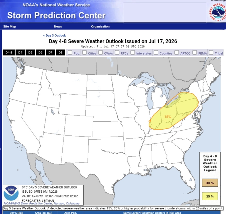
Tuesday Day 5 Days 4-6/Mon-Wed -- Great Lakes/Midwest to the Mid-Atlantic/Northeast... A shortwave upper trough initially over the Canadian Prairies and northern Plains will develop east/southeast across the Upper Midwest/Great Lakes on Monday, then the Ohio Valley and Mid-Atlantic vicinity on Tuesday. Meanwhile, another upper shortwave trough will develop across the Great Lakes to the Northeast/Mid-Atlantic on Wednesday. These features will support enhancement of mid/upper level flow as a surface low tracks across Ontario/Quebec and New England during this time. A trailing cold front will likewise progress east/southeast over this three day period, with a very moist and unstable airmass present ahead of the front. This overall pattern will likely bring multiple days of severe storm potential from the Upper Midwest/Great Lakes to portions of the Ohio Valley, Northeast and Mid-Atlantic vicinity Monday through Wednesday, necessitating severe probabilities. While these areas may shift some over the coming day as the timing of mesoscale features and influence of prior days convection becomes more clear, these general regions are most likely to see at least isolated to widely scattered damaging wind potential as the upper trough and surface cold front sweep across the area.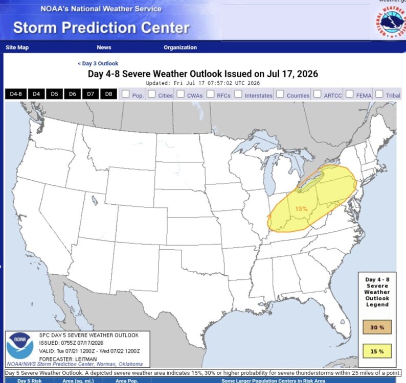
-
Really incredible smoke plume. Its made its way to the DC area. Readings similar to whats in the great lakes. And yeah no birds singing here either.
- Today
-
 They are setting records with relatively moderate strength ridging. When/if one of those 600dm+ ridges parks over this area they will blow those margins away.