All Activity
- Past hour
-

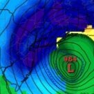
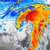
Possible coastal storm centered on Feb 1 2026.
WeatherGeek2025 replied to Typhoon Tip's topic in New England
whatever Euro AI shows today, I will go with that forecast! -

January 2026 Short/Medium Range Thread
Holston_River_Rambler replied to John1122's topic in Tennessee Valley
We got NAM'd! -
-
January 2026 Medium/Long Range Discussion
SomeguyfromTakomaPark replied to snowfan's topic in Mid Atlantic
I don’t see any reason to speak very definitively when you’re at approx 120 hours. People were very definitively saying our fail mode was suppression for the last storm not much beyond 120 hours. Things can and do change fast at this range. We’re still in the game. -
I will keep watching through tomorrow for any improvement. Realistically, this currently has an eastern shore bullseye potential but tracking is fun so I go with it. By the way, rescheduled my appointment from the 26th to the 22nd so lock in the 22nd for our blizzard!
-
.thumb.jpeg.406ecda2eec9e267302c22b9f128fe3c.jpeg)
Possible coastal storm centered on Feb 1 2026.
kazimirkai replied to Typhoon Tip's topic in New England
Interesting to see EPS and GEFS are trending in opposite directions. GEPS sits pretty happily in the middle -
Low was 9.3 at 7:30 am. Up to 14 currently. Going to go out and chip out some left over snow at the end of the drive in the street that the plow ran over. The older Ms. J in DC got another day of campus closed and zoom classes. The younger Ms. J in PA will be trucking across campus for classes as campus is open today. Told her welcome to school in the North. Told her my memory of walking to class at my school in NW Ohio and got into the building with my eye lashes frozen together due to the wind chill.
-
For those of us still locked up because of unplowed streets, fortunately Uber Toilet Paper delivery is on the job!
-
Winter 2025/26 Banter Thread
TheClimateChanger replied to Chicago Storm's topic in Lakes/Ohio Valley
That's the jackpot. You can get snow effect snow from any wind direction. -

Possible coastal storm centered on Feb 1 2026.
Ginx snewx replied to Typhoon Tip's topic in New England
Modeling struggles with depth of cold and Baroclinic processes. Putting a 518 abreast the gulf stream in SC is as rare as it gets. That stall is not real. -
Possible coastal storm centered on Feb 1 2026.
Go Kart Mozart replied to Typhoon Tip's topic in New England
Dig more west, or not so deep? I think we want closure closer to Norfolk rather than Myrtle Beach. Maybe digging west accomplishes the same thing? -

Winter 2025-2026 Offers Return to Normalcy
40/70 Benchmark replied to 40/70 Benchmark's topic in New England
I'd grade it today...def. not an A+ IMO because I was a bit too far NE with max zone....First Call was actually better on that. -
Winter 2025/26 Banter Thread
TheClimateChanger replied to Chicago Storm's topic in Lakes/Ohio Valley
Lol, I saw that and it makes zero sense. There is in fact snow cover over eastern Kentucky and West Virginia - that's typical upslope snow from there south into E TN/ W NC. The satellite imagery isn't blue there, because there's overcast skies. If anything, it looks like the snow cover is suppressing clouds. Maybe the differential heating is contributing to the cumulus buildup south of the snowpack, but that's not the same process as lake effect snow. The flurries on radar earlier are clearly from a weak "disturbance" that moved in from Arkansas. -

January 24-26: Miracle or Mirage OBS Thread!
nw baltimore wx replied to Jebman's topic in Mid Atlantic
Same! Pretty stiff and sharp’ish pain on one side, but doing some sit-ups and planks helps loosen mine up. -
Low of 1 Degree here at my House. -2 and Minus 3 reported in parts of the County.
-

The “I bring the mojo” Jan 30-Feb 1 potential winter storm
NorthHillsWx replied to lilj4425's topic in Southeastern States
A smart man would never extrapolate the end of the NAM -
Thanks for ctaching that JTGFS AI AIGFS: EURO AI AIFS:
-

The “I bring the mojo” Jan 30-Feb 1 potential winter storm
NorthHillsWx replied to lilj4425's topic in Southeastern States
NEVER EVER UTTER THESE WORDS -
We still doing this?
-

January 2026 Medium/Long Range Discussion
IUsedToHateCold replied to snowfan's topic in Mid Atlantic
I'm not out. Things could trend back the right way. I'd say if by end of day tomorrow it's considerably offshore it's time to turn out the lights. But if all we need is a 100-200 mile shift then we can get that as we approach the event. -

The “I bring the mojo” Jan 30-Feb 1 potential winter storm
BornAgain13 replied to lilj4425's topic in Southeastern States
Someone smarter than me can extrapolate the NAM. But it looked like it has potential at the end? -
Cape Cod and not a hair further west. Boston will get fringed.
-

Possible coastal storm centered on Feb 1 2026.
40/70 Benchmark replied to Typhoon Tip's topic in New England
Right, but he was agreeing with me, so that's why I replied. No biggie. -
Patience ATT / Takeaway it's a signal with agreement of models on all levels. To early to write off, trends yes with no definitive outcome. Won't get fooled again.


