All Activity
- Past hour
-
Few flurries here also
-
The models really want to tank the PNA after the 10th. I know Ray expected that….
-

Arctic Hounds Unleashed: Long Duration Late January Cold Snap
dendrite replied to WxWatcher007's topic in New England
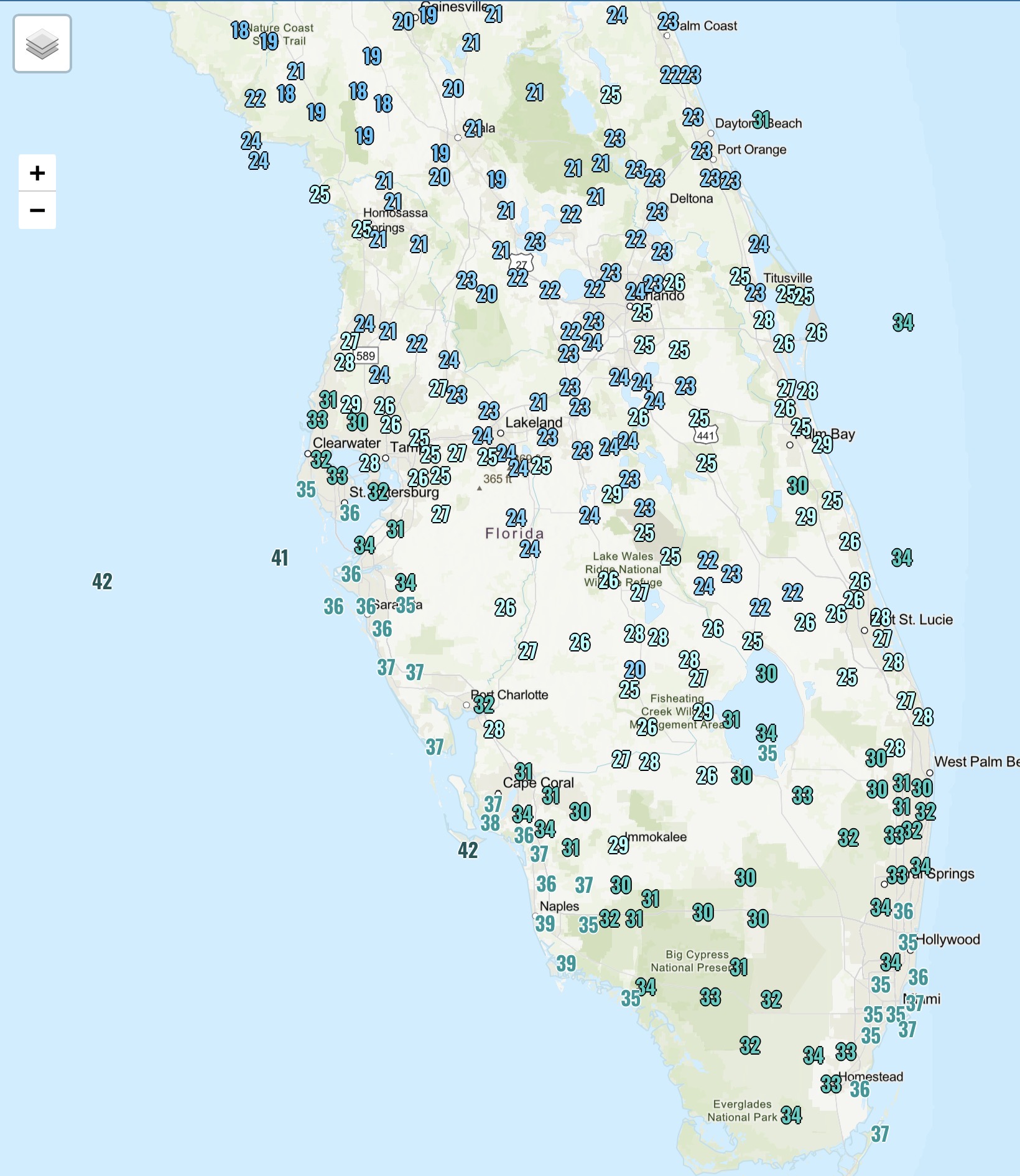
Congrats S FL. Goodbye oranges and iguanas.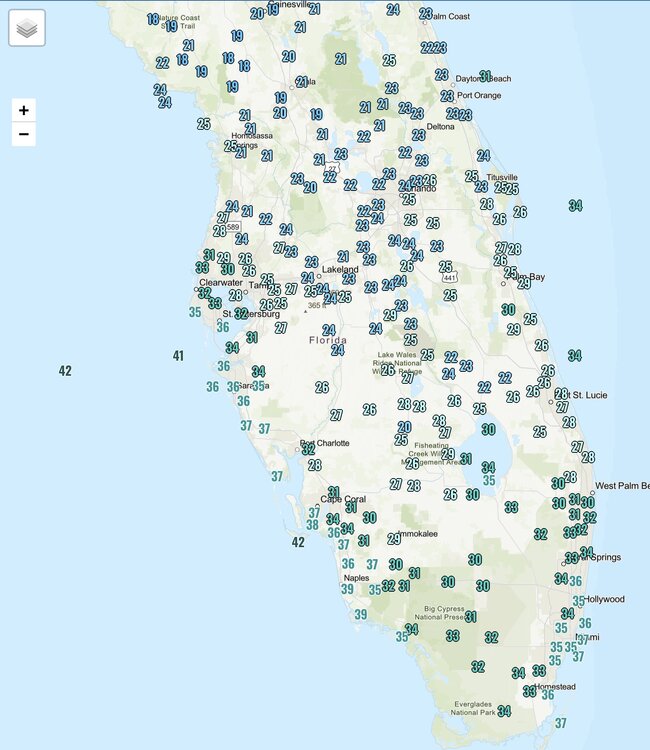
-

January 30th- Feb 1st ULL and coastal storm obs
senc30 replied to JoshM's topic in Southeastern States
Here is Jacksonville, I woke up to the windows at the house all half covered in an inch of snow from the wind blowing it so much during the night. Guess it's added insulation. -

February 2026 Medium/ Long Range Discussion: Buckle Up!
Heisy replied to Weather Will's topic in Mid Atlantic
After whatever happens next week I think we’re shutout until around mid month, 15th-end of the month should open back up opportunities. At least that’s how it’s looking currently. -

January 30th- Feb 1st ULL and coastal storm obs
olafminesaw replied to JoshM's topic in Southeastern States
Some in that Western max had over 20:1 ratios. GSO reported .4" liquid -
February 6 eighth does not look exciting but could give us a nice refresher. It appears to me that the next period of interest is around the 13th of 14th. My view is that at some point the dry pattern will break and it’ll probably start to get good around mid month and given the reversal stratosphere thing that might continue through a good part of March. What’s your take?
-
Buddy on the NC/SC border on the water has almost a foot
-
There is a meteorological term for that IMO. Internal variability within a longwave pattern. Stuff like wave spacing, shortwave interactions, etc. There's research out there that describes it in that way. I do believe chaos is even mentioned sometimes lol.
-

Possible coastal storm centered on Feb 1 2026.
Great Snow 1717 replied to Typhoon Tip's topic in New England
This "storm" is exactly why I never look at any of the models until within 48 hours of a storm potentially impacting the area... 87 pages and counting lol -

January 30th- Feb 1st ULL and coastal storm obs
WinstonSalemArlington replied to JoshM's topic in Southeastern States
-
Yawn for awhile. When are we supposed to buckle up?
-

January 30th- Feb 1st ULL and coastal storm obs
suzook replied to JoshM's topic in Southeastern States
Looks like it's still snowing in Myrtle Beach. WOW -
Flurries!
-

Possible coastal storm centered on Feb 1 2026.
CoastalWx replied to Typhoon Tip's topic in New England
Yeah this thing went east for sure. Light snow here. -

E PA/NJ/DE Winter 2025-26 Obs/Discussion
Birds~69 replied to LVblizzard's topic in Philadelphia Region
9F @ 7:15am -
Arctic Hounds Unleashed: Long Duration Late January Cold Snap
dendrite replied to WxWatcher007's topic in New England
-6.1 Tied for the coldest yet -
We ended up with about 3-4 here just east of downtown Raleigh. This was the FIFA snow prize for sure with this one but none the less it is better than a zero out by far. This storm was our shot at a 6+ event so we will not see that this year but so it goes. I do not think it is possible to get 2 big snow events in a season in this region so my guess is from here on out we will be tracking minor and/or mixed p events. Congrats to those that did get the big totals.
-

Arctic Hounds Unleashed: Long Duration Late January Cold Snap
alex replied to WxWatcher007's topic in New England
-18.4F here. First night without much flakeage -
A couple flakes falling.
-
Mostly cloudy. -1F
-

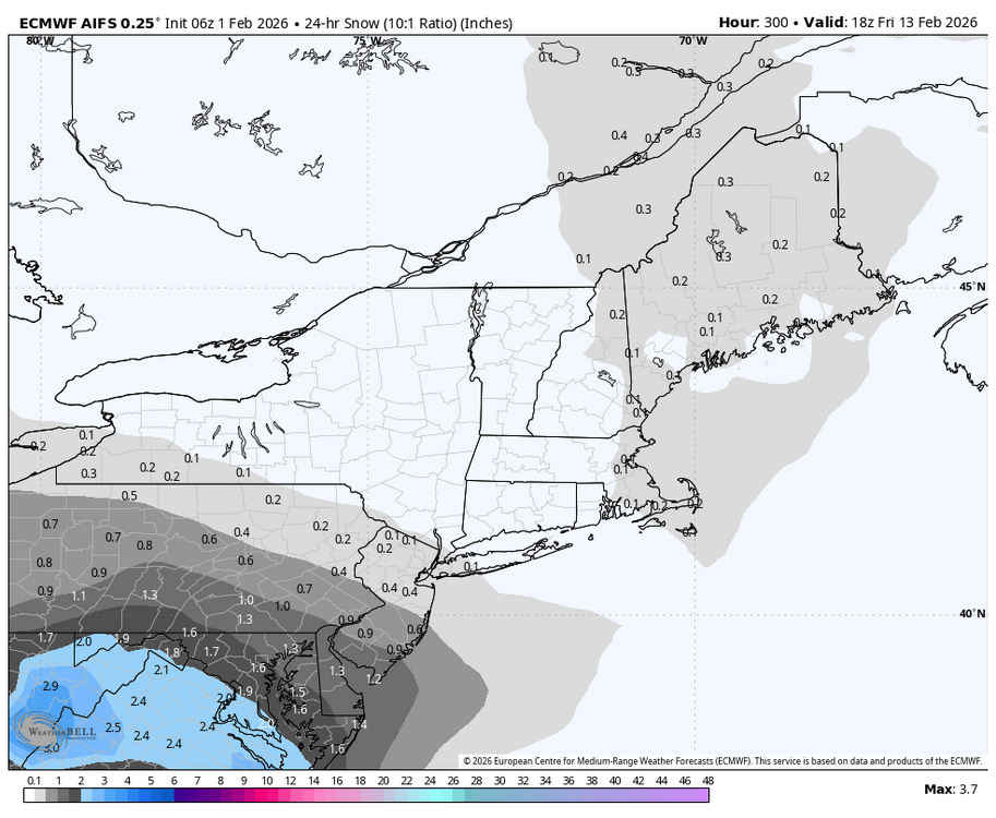
February 2026 Medium/ Long Range Discussion: Buckle Up!
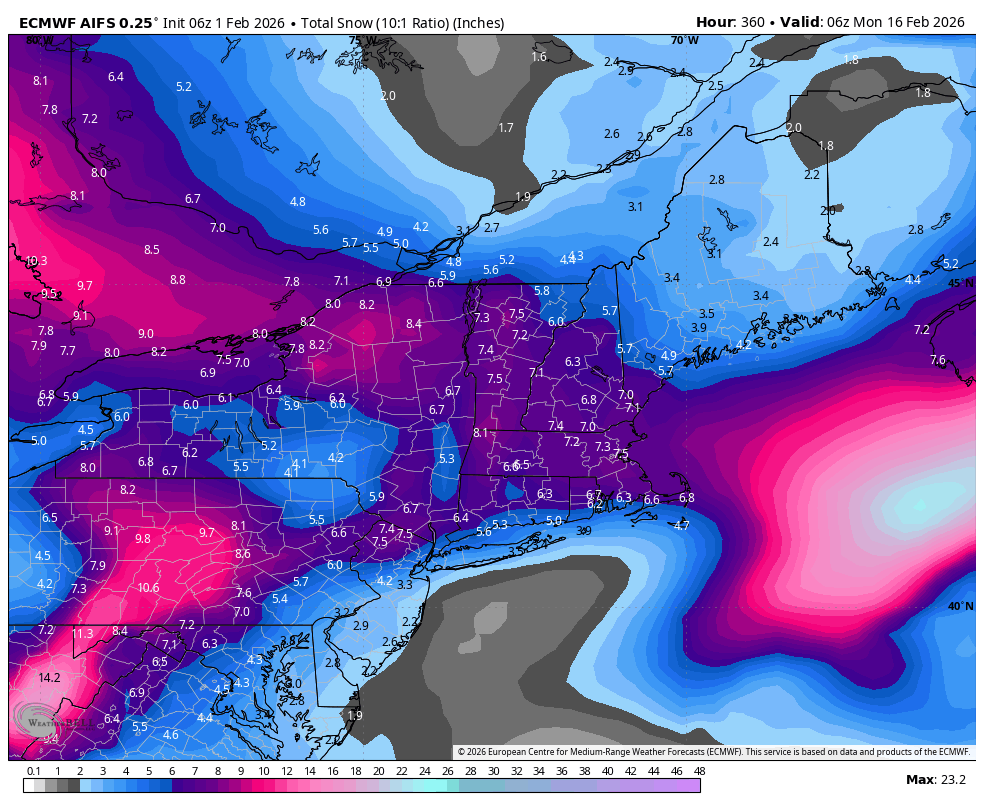
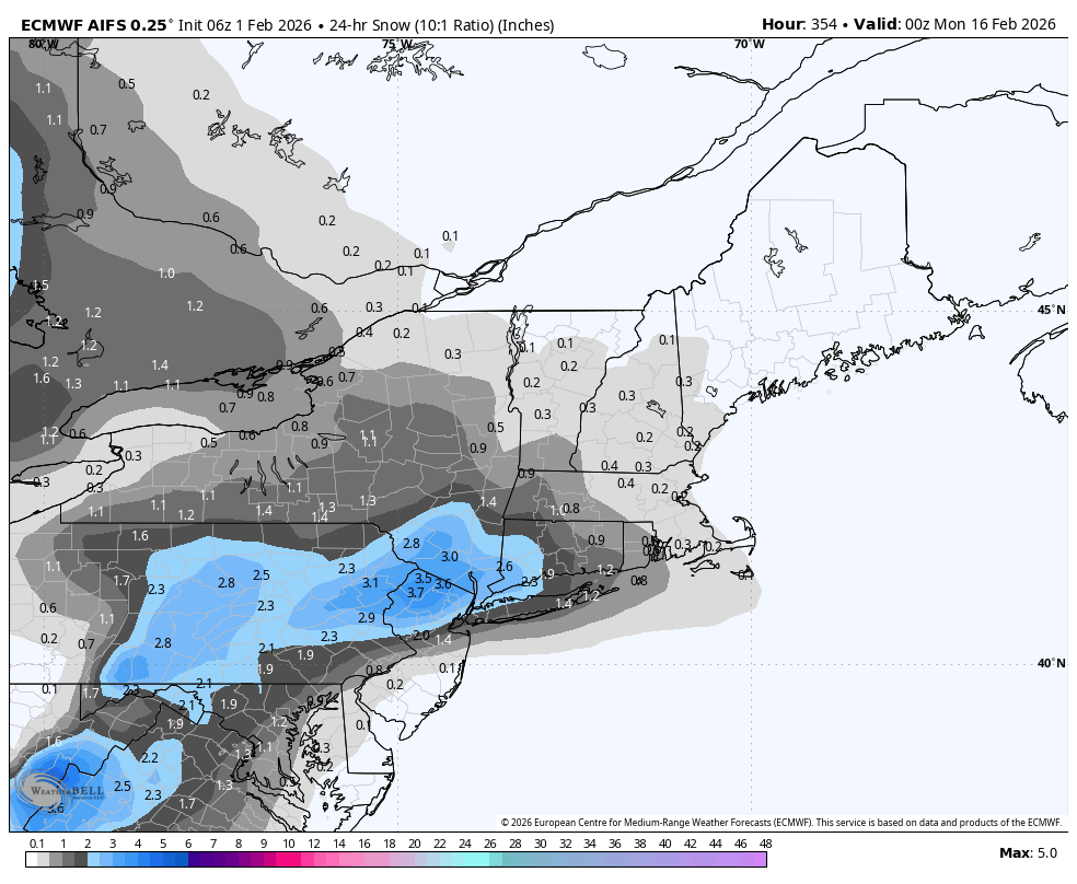
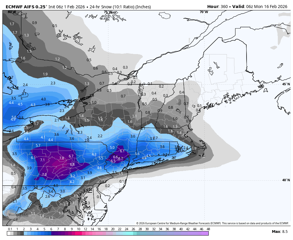
Blizzard of 93 replied to Weather Will's topic in Mid Atlantic
Here are some 6z Euro Ai 24 hr snapshots to get a better idea of potential windows.


-

January 30th- Feb 1st ULL and coastal storm obs
sakau2007 replied to JoshM's topic in Southeastern States
looks like somebody in eastern NC is gonna wind up with 30 inches. i saw a report from a few hours ago of 21.5” in New Bern, and it is still snowing there and will for a few more hours. crazy storm east of 95. -
February 2026 Medium/ Long Range Discussion: Buckle Up!
Blizzard of 93 replied to Weather Will's topic in Mid Atlantic
6z AI Euro looks active with chances with most of this snow taking place between day 11 & 15.
-
Felt like the right time to get out to Dutch Hill yesterday. I had been chomping at the bit to ski there; the zone has been closed for over a year by the NFS. It certainly didn’t disappoint. Snow was decent once you rolled off the ridge line, bottomless in most places. Almost wish I had my wider setup, but I managed no problem. It really is one the best places to tour near my house when conditions are right. Crowds are always minimal and people are very friendly. Met several first time uphillers yesterday in fact. .