All Activity
- Past hour
-
It’s the Washington wizards of weather. If you are a fan you keep watching because they add something and call it improved but it’s last in the league from 3 point range
-

First Legit Storm Potential of the Season Upon Us
SouthCoastMA replied to 40/70 Benchmark's topic in New England
im enjoying the AI vs OP battle to be honest. -
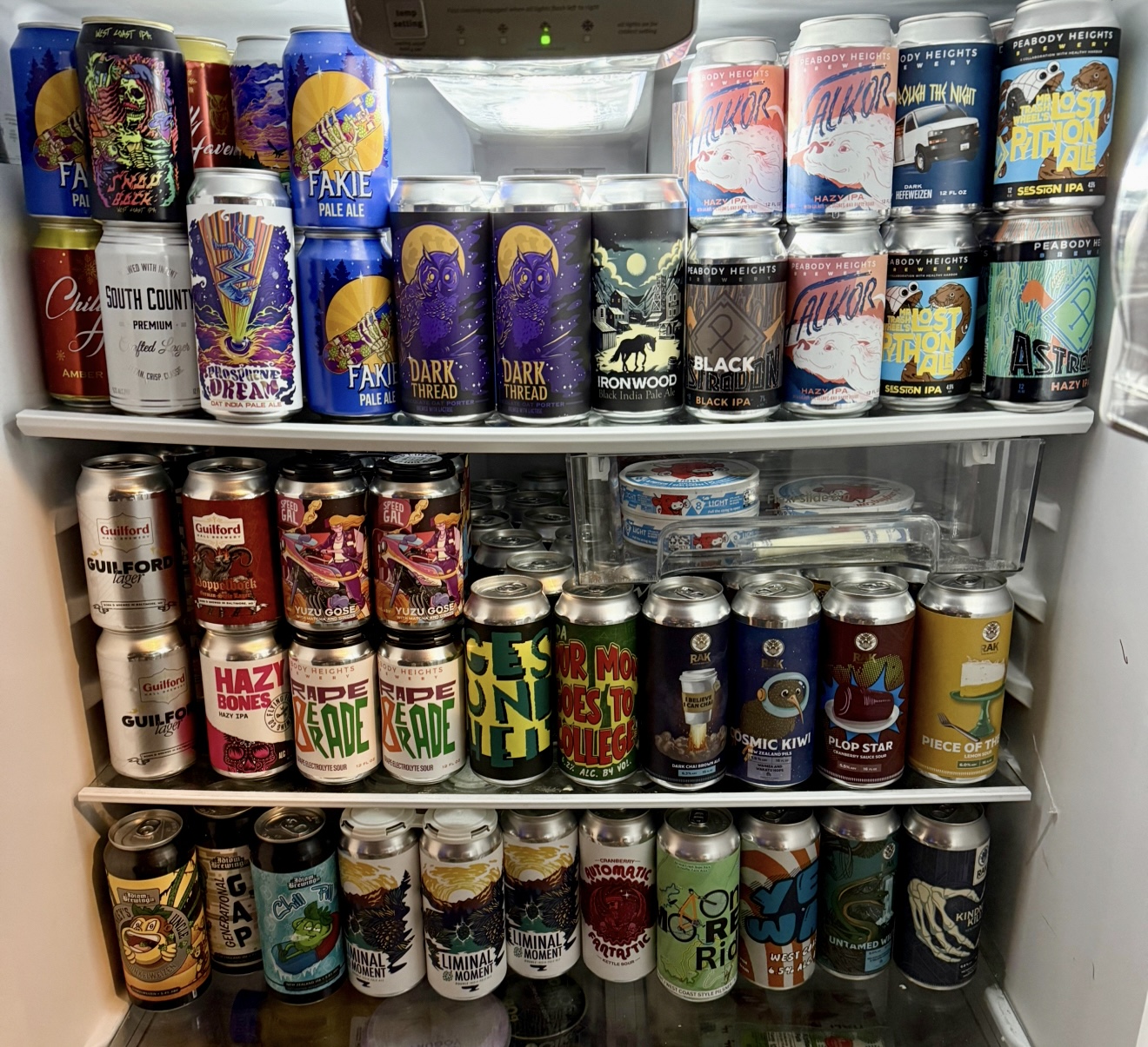
South County! I'm about 10 minutes away from their amazing brewery and restaurant.
-
Well…there’s that. .
-

Central PA Winter 25/26 Discussion and Obs
Mount Joy Snowman replied to MAG5035's topic in Upstate New York/Pennsylvania
They seem fairly split on the midnight action but either way I tend to think that opening batch may appear more as virga and serve to overcome the dry dews, setting the table for a quick morning slug. That's my thoughts anyway. Oh, and the only model that truly matters, that being the RAP (no sarcasm detected), shows a nice morning hit. #RapForTheWin -

First Legit Storm Potential of the Season Upon Us
TauntonBlizzard2013 replied to 40/70 Benchmark's topic in New England
No Ukie posts, I’m sure it blows -
Canadian has it as well about a day later
-

E PA/NJ/DE Winter 2025-26 Obs/Discussion
The Iceman replied to LVblizzard's topic in Philadelphia Region
GFS/CMC suite stubbornly hanging on to Sunday from 95 S and E. Would only be a c-2" but still... As I said before, I'm happy with any white. I think there's a solid chance at a c-2" tonight/tomorrow from 95 N and W too. Some years it just wants to snow... -

First Legit Storm Potential of the Season Upon Us
MegaMike replied to 40/70 Benchmark's topic in New England
12z GEFS consolidated a bit and is east of its 06z position. For now, I'm still ignoring AI.
-

First Legit Storm Potential of the Season Upon Us
40/70 Benchmark replied to 40/70 Benchmark's topic in New England
Great through 5 minutes. -
I find it a little funny how much we bash the gfs and then are hyper focused on every run 150+ hours out.
-

First Legit Storm Potential of the Season Upon Us
dendrite replied to 40/70 Benchmark's topic in New England
@ineedsnowHow did the srefs look? -
First Legit Storm Potential of the Season Upon Us
40/70 Benchmark replied to 40/70 Benchmark's topic in New England
They're hiding from the razor-sharp gradient and attendant Hadley Cell. -
Great question! Probably some Laughing Cow cheese.

-
Maybe it was Master of Disaster My memory isn't what it used to be in my youth
-
First Legit Storm Potential of the Season Upon Us
dendrite replied to 40/70 Benchmark's topic in New England
Sorry but I have dinosaur bones under the ground here. EXPLAIN THAT -
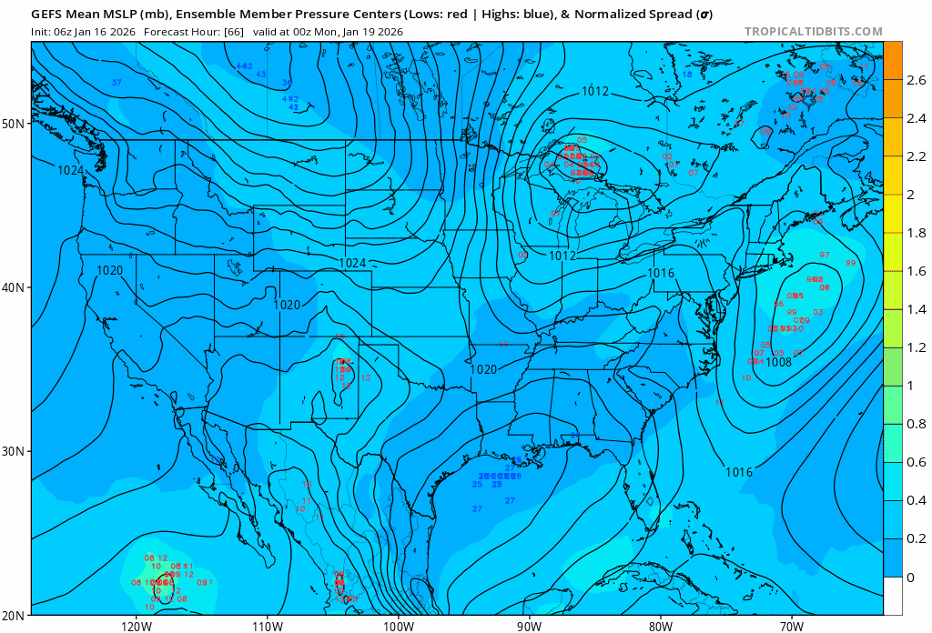
The 12z guidance has moved into strong agreement concerning the QPF for tomorrow's light precipitation event with only the UKMET and ECMWF left to initialize. The NAM is a notable dry outlier for New York City (0.01"). The RRFS A, the NAM's successor model, has 0.20" QPF. With the NAM doing NAM things in the face of strong agreement among the other guidance, the idea that New York City will see little or no precipitation is discounted. Snowfall amounts in New York City will still be limited: Readings will likely be above freezing for most or all of the event. Readings will generally range from 33°-34° during the event. QPF will be on the light side (probably 0.15"-0.25"). The 15z NBM has 0.20". Most of the 12z guidance is just under 0.20". Precipitation rates in the City will likely be less than 0.05" per hour except for a brief period. Measurable snow is likely in Central Park. There's strong agreement among the individual EPS members for this outcome. All of the 12z guidance, except for the NAM, shows measurable snow. All said, snow showers or a period of snow remains likely tomorrow. A coating to an inch of snow is likely in and around New York City. The distant northern and western suburbs could see 1"-2" of snow due to slightly higher QPF, precipitation rates, and slightly colder temperatures. Sunday still bears some watching, as uncertainty is somewhat greater than it is for tomorrow. The Canadian suite (GGEM-RGEM) continue to bring a light measurable snowfall to New York City and its adjacent suburbs. The earlier runs of the ECMWF keep the snows farther east. As the GGEM is consistently the #2 rated model, it's solution is plausible. There was very little support for accumulating snowfall in New York City among the 1/16 0z EPS members. Therefore, at least for now, a miss to the east still remains more likely than not. Under that baseline scenario, there would be some accumulating snow in eastern Long Island into southeastern New England. Snow flurries and/or snow showers would be possible farther west, including in the New York City area.
-
It’s waffling from run to run. I’m more interested in what’s getting tee’d up for next weekend. Looks like maybe some stj action?
-

First Legit Storm Potential of the Season Upon Us
weathafella replied to 40/70 Benchmark's topic in New England
I spent $1500 on a new snowblower based on earlier guidance. I’ve used it maybe 3-4 times total. -
First Legit Storm Potential of the Season Upon Us
40/70 Benchmark replied to 40/70 Benchmark's topic in New England
Don't forget that the Fossil Fuel is peer reviewed...there is literature on this so this is fact-sorry, it just is, and that is not debatable- -

First Legit Storm Potential of the Season Upon Us
CoastalWx replied to 40/70 Benchmark's topic in New England
Don’t forget Tobin Tuesdays where we look ahead at the next model fails for the upcoming week. -

First Legit Storm Potential of the Season Upon Us
Typhoon Tip replied to 40/70 Benchmark's topic in New England
y'all lookin to flog someone or something cuz now your pissed. but it's your buying in and/or allowing you're moods be yo yoed by this thing. probably should work on your dopa dependency with 'blue light' and web access to weather chart thing, ha -

January 2026 Short/Medium Range Thread
Holston_River_Rambler replied to John1122's topic in Tennessee Valley
-
Never start a storm thread again. Negative trends began the second we moved from the discussion thread.
-
yea thats not good. thats suppressive