All Activity
- Past hour
-
1/30-1/31 Lake Effect Snow Threat - SE WI, NE IL, and NW IN
mimillman replied to A-L-E-K's topic in Lakes/Ohio Valley
Looks like gonna crank in a bit -

February 2026 Medium/ Long Range Discussion: Buckle Up!
Heisy replied to Weather Will's topic in Mid Atlantic
Heh yea, but I would say that this event is a lot less complicated than others. -
The “I bring the mojo” Jan 30-Feb 1 potential winter storm
Orange county replied to lilj4425's topic in Southeastern States
I assumme some heavy banding occurs We will know where when it occurs.............. -

The “I bring the mojo” Jan 30-Feb 1 potential winter storm
JoshM replied to lilj4425's topic in Southeastern States
12z FV3 it’s nice for Western North Carolina. That upper level low just sits and pivots. -

The “I bring the mojo” Jan 30-Feb 1 potential winter storm
Solution Man replied to lilj4425's topic in Southeastern States
Thank you brother. Looking forward to riding this one out with you. -

2025-2026 Fall/Winter Mountain Thread
CheoahBald1 replied to Buckethead's topic in Southeastern States
So far this year I should say, feb is looking cold . -

1-30/2-1-26 Arctic Blast, ULL Snow Event
BlunderStorm replied to John1122's topic in Tennessee Valley
It's very much real per a friend in Clintwood and imby. Hope it works down toward yall quickly. @BuCoVaWx @Kentucky How's it looking?- 599 replies
-
- extreme cold
- snow
-
(and 1 more)
Tagged with:
-
TriadTom_wxm changed their profile photo
-

2025-2026 Fall/Winter Mountain Thread
CheoahBald1 replied to Buckethead's topic in Southeastern States
I’d bet it’s just noise, if the euro decreases amounts for us at 12z then I’d get concerned. Either way this is gonna be the best event all year imo . -

2025-2026 ENSO
40/70 Benchmark replied to 40/70 Benchmark's topic in Weather Forecasting and Discussion
Remember that post you made about how someone was going to be very wrong about the PV, which I followed up with a comment about how I've been schooling Webb? -
Arctic Hounds Unleashed: Long Duration Late January Cold Snap
ariof replied to WxWatcher007's topic in New England
8° at KBOS this morning, WC -11°. With the sun angle it didn't even feel that bad. (I think a lot of it is that we're kind of getting used to it.) Today is 6 days at BOS <30°. 9 is likely by Sunday, which would be tied for 11th longest. The record at or below 32° is 16 days. Neither the Euro or GFS has BOS breaking 32 through the end of the model, which if it verified would break that record by a lot. (Thanks goodness we got that storm last week or we'd have cold, mostly-brown conditions which would be miserable.) -

The “I bring the mojo” Jan 30-Feb 1 potential winter storm
SouthboundYank replied to lilj4425's topic in Southeastern States
I personally appreciate your continued inputs, comments and obs...please keep 'em coming, if you have the time. -

February 2026 Medium/ Long Range Discussion: Buckle Up!
stormtracker replied to Weather Will's topic in Mid Atlantic
Well you’re a met, I take what you say seriously. Imma track obviously. The Euro just spooked me. -

Winter cancelled/uncancelled banter 25/26
WeatherGeek2025 replied to Rjay's topic in New York City Metro
my cousin lives in Wilmington, NC they're supposed to get around 5-7 inches apparently -
MSP eeked out a low of -1 this morning. We’ve now had a low temperature at or below zero for 14 of the past 15 days.
-
The “I bring the mojo” Jan 30-Feb 1 potential winter storm
eyewall replied to lilj4425's topic in Southeastern States
It is hard to believe we are nearing the start of this event. May the odds be ever in our favor. I am ready to go mobile if I have to in order to get into the FGEN band if it decides to miss my area. -

The “I bring the mojo” Jan 30-Feb 1 potential winter storm
USCG RS replied to lilj4425's topic in Southeastern States
Praying for your wife This storm always has had the potential for banding. In this case, short range models will begin to pick up on this. In addition, where banding sets up will also allow for subsidence on each side, or the sinking of air. This causes drying which means that areas next to high totals could have much lower totals themselves. This is a common feature of very strong mid latitude storms and nearly impossible to predict. That withstanding, global models (with less resolution) will normally smooth out the QPF forecast, whereas short range models will attempt to showcase where these bands set up. This is because globals have a lower resolution and therefore the algorithm will not be able to as readily differentiate banding and this will smooth, or average, out the precipitation forecast over its grid (boxes of resolution, ie 12km, 3km resolution, etc etc). Short range models - or CAMS - have a higher resolution and will thus alter precipitation forecasts more, which is where you usually see the qpf (precip forecast) changing. -

The “I bring the mojo” Jan 30-Feb 1 potential winter storm
TriadTom_wxm replied to lilj4425's topic in Southeastern States
Keep the mojo mojoing. Battleground area bound to be around triangle with maybe a dream set up east of triangle. However, I could see battleground area shifting slightly more NW based on overnight changes in runs. Snow on top of the existing ice in Triad and then refreezing should be fun. Good luck and be safe everyone! -
1-30/2-1-26 Arctic Blast, ULL Snow Event
Jeff Co Vol replied to John1122's topic in Tennessee Valley
That's a great post, especially for those of us who are novices and lurk here to feed off the info from those of you who are much more knowledgeable. Thanks for taking the time to educate us!! It is greatly appreciated.- 599 replies
-
- 2
-

-

-
- extreme cold
- snow
-
(and 1 more)
Tagged with:
-
12z HRRR isn't as juiced. Looks decent still but is this just noise or a trend? I'm still riding with the Euro. Sent from my SM-G998U using Tapatalk
-
Richmond Metro/Hampton Roads Area Discussion
Sernest14 replied to RIC Airport's topic in Mid Atlantic
nam looks more east with the low similar to 0z -
Lotta local Mets going Stein
-
1/30-1/31 Lake Effect Snow Threat - SE WI, NE IL, and NW IN
Chicago916 replied to A-L-E-K's topic in Lakes/Ohio Valley
Already snowing here yet reflectivity not impressive -
The “I bring the mojo” Jan 30-Feb 1 potential winter storm
timnc910 replied to lilj4425's topic in Southeastern States
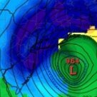
Can some one elaborate on what this is. Thanks in advance


.thumb.jpg.57c149abeb0612b554c5548d24586482.jpg)