All Activity
- Past hour
-
Wow. Woke up to a solid little dusting here. Cars and yard are covered in a thin layer of snow.
-
Sounds like you woke up on the wrong side of the cave.
-
35 degrees, snow flurries have ended.
-
I traveled to Elkins, WV too. I really enjoyed this region and the people. But you can't buy liquor on Sunday!
-
Currently 16 degrees and snow in Davis, WV. 7-Day Forecast 39.12N 79.46W
- Today
-
Ugly pattern for winter lovers. Big block north linking up with SE ridge again.
-
I went to Cannan Valley Resort, WV for a wedding. I traveled to a little hippy town called Davis, WV. I would love to live there. It's like a mini Austin, Texas in the middle of the mountains. I'm sure they got at least 4 inches of snow.
-
39 degrees and some on and off flurries.
-
31 here
-

11/8-11/10 First Snow and Lake Effect Event
Roger Smith replied to Geoboy645's topic in Lakes/Ohio Valley
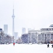
Would you say all of that 4" fell on Sunday, or if not, what portion fell on Monday? The only heavier snowfall for Nov 9th was 5.6" in 1921. That date also set a low maximum record for the date (30F). The snowfall record for Nov 10 for Toronto (downtown location) was 5.5" in 1898 and 7.0" fell Nov 9-10 1898 at that location. -
Snow flurries in Atlanta today It's just flurries but given the SOB (south of Baltimore) storm track that has persisted for most of the decade, it's still annoying nonetheless.
-
Flurries flying here, first 32 degree reading of the season. Good band in NE NC likely putting down at least a dusting. Now back to bed
-
30F Feels like 22F
-
The problem with Stratosphere warming is that they are common. The whole Stratosphere moves in one direction: stronger or weaker. 1/2 of the time it's warmer. 1/2 the time it's colder. Because of fluctuations, there are on average 1-2 top 30 percentile Stratosphere warmings per Winter. This one coming up doesn't look record breaking strong, it's looks pretty average as a SSW, actually. It would be weird to go to March without seeing one. Still, there is a lagged -NAO correlation that has a pretty high correlation coefficient. But at the current strength that is being modeled it's not a "change the whole Winter scenario".
-
You can add Wilmington, NC to that record earliest snow. Their previous record earliest was also 11/12/2013.
-
Greetings from the Champlain Valley (well, I’m in DC for work this week). 3.2” at the house in Charlotte this evening with multiple reports of 5+” Burlington and north. Nice to get the first measurable on the books.
-
Snow near Chapel Hill
-

11/8-11/10 First Snow and Lake Effect Event
Snowstorms replied to Geoboy645's topic in Lakes/Ohio Valley
4" from this storm in Toronto. From the pictures, looked like a nice snow globe. Congrats to some of the Chicago peeps! -
34.5F in Tenley - 37F at DCA
-

11/8-11/10 First Snow and Lake Effect Event
sbnwx85 replied to Geoboy645's topic in Lakes/Ohio Valley
Padded another inch on the day at home. Saw closer to 3” at work. -

2025-2026 Fall/Winter Mountain Thread
The Alchemist replied to Buckethead's topic in Southeastern States
Even had a burst of moderate snow down here in Saluda about 4 hours ago. Nice little car topper. Down to 25 now. Sent from my iPad using Tapatalk -
Had a car topper here in Saluda. Down to 25 currently. Sent from my iPad using Tapatalk
-
Central PA Fall Discussions and Obs
jm1220 replied to ChescoWx's topic in Upstate New York/Pennsylvania
That band looks quite impressive and nearly stationary. I remember once in I think 2007 when I was a PSU undergrad we had one of those Huron connected snow bands park overhead and dump 5" of fluff that was gone by the next day since it was in March. Otherwise lots of frustration with those being on the downslope side of the Allegheny Ridge. -

November 2025 general discussions and probable topic derailings ...
mreaves replied to Typhoon Tip's topic in New England
I ended up with 1.74” of rain between the start as snow and the end as snow. This was a good precip event for us. It didn’t rain so hard that it all ran off, the ground isn’t frozen and vegetation is dormant so it’s all going to the aquifer. Sitting on the board of my village water District made acutely aware of how dry we’ve been. -
Well see. 35.5 now and steady. CAA is often overdone on the island but we’ll see


