All Activity
- Past hour
-
84 is niiice
-
Snow gonna be faster coming in ..say 5 pm
-
-

Possible Record Breaking Cold + Snow Sunday 1/25 - Tuesday 1/27
weathermedic replied to TriPol's topic in New York City Metro
25 dropsondes reportedly dropped into the low off of Southern California for ingestion into the 0Z models -
 No. We are in Phase 6.
 -
Very good snow growth. Wintry appeal for sure.
-

Possible Record Breaking Cold + Snow Sunday 1/25 - Tuesday 1/27
Prue11 replied to TriPol's topic in New York City Metro
I’m not buying it either for my area but I think the mix line could make it up to southern Monmouth -

Possible Record Breaking Cold + Snow Sunday 1/25 - Tuesday 1/27
TriPol replied to TriPol's topic in New York City Metro
We are in phase 6 https://charts.ecmwf.int/products/mofc_multi_mjo_family_index?base_time=202601210000 -
If I had to bet I'd say the GFS will be a mix between its 18z run and the Euro's depiction
-
81..raking begins
-

Possible Record Breaking Cold + Snow Sunday 1/25 - Tuesday 1/27
SACRUS replied to TriPol's topic in New York City Metro
-

2025-2026 ENSO
PhiEaglesfan712 replied to 40/70 Benchmark's topic in Weather Forecasting and Discussion
How does this compare to the winter of 2014-15? -

Pittsburgh/Western PA WINTER ‘25/‘26
Mailman replied to Burghblizz's topic in Upstate New York/Pennsylvania
AIGFS seems to have delivered, also. -
given that it had us on the northern fringe not too long ago, I'm not sure we can crown it "the most accurate" (unless that is the ultimate outcome lol)
-

January 24-26: Miracle or Mirage Thread 2
NorthArlington101 replied to mappy's topic in Mid Atlantic
Fair… about identical but it’s on the edge at 90. No movement at 96
-

January 24-26: Miracle or Mirage Thread 2
midatlanticweather replied to mappy's topic in Mid Atlantic
I don't think 850 was our warm layer -
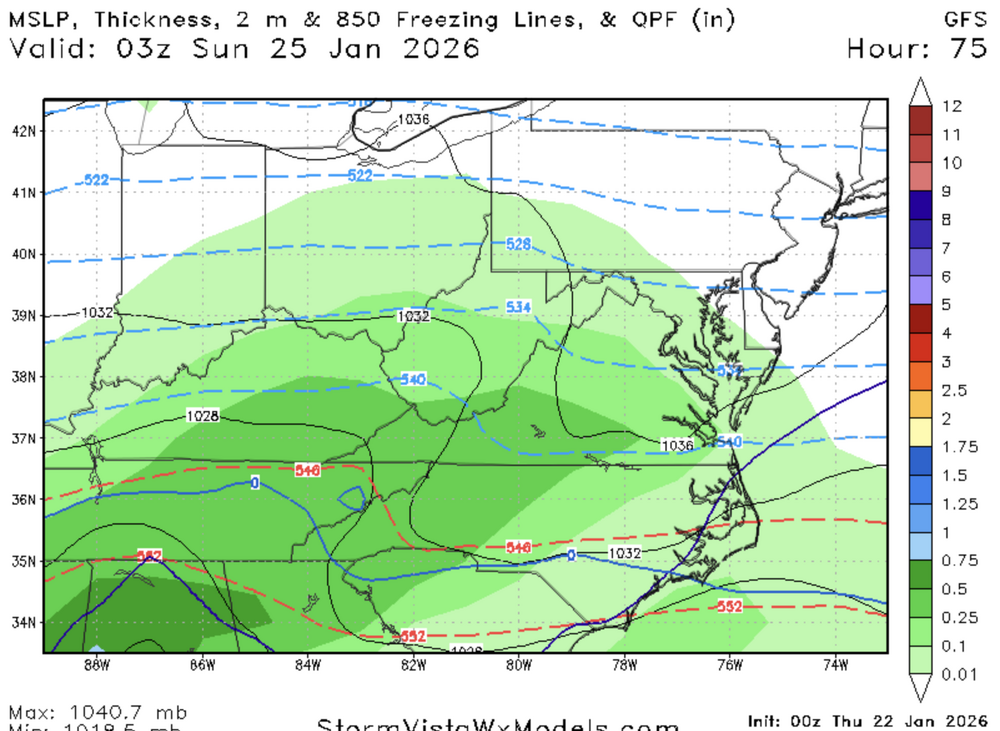
Yup.. at 60 there were already some significant changes. By 72 heights are screaming. You could also see Baja low starting to tilt neutrally here. I honestly haven’t even looked at surface yet because upper levels don’t lie.
-

Central PA Winter 25/26 Discussion and Obs
pasnownut replied to MAG5035's topic in Upstate New York/Pennsylvania
shouldnt they be called snowcane hunters in winter? -
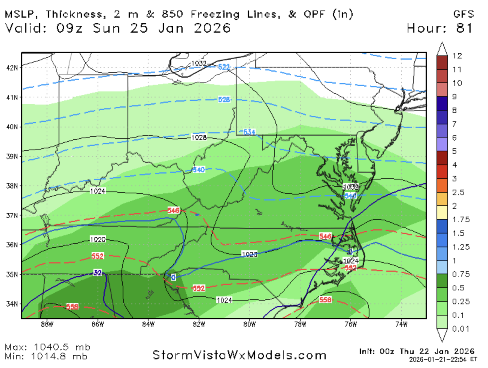
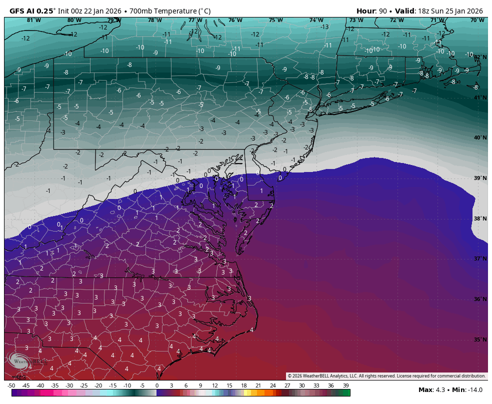
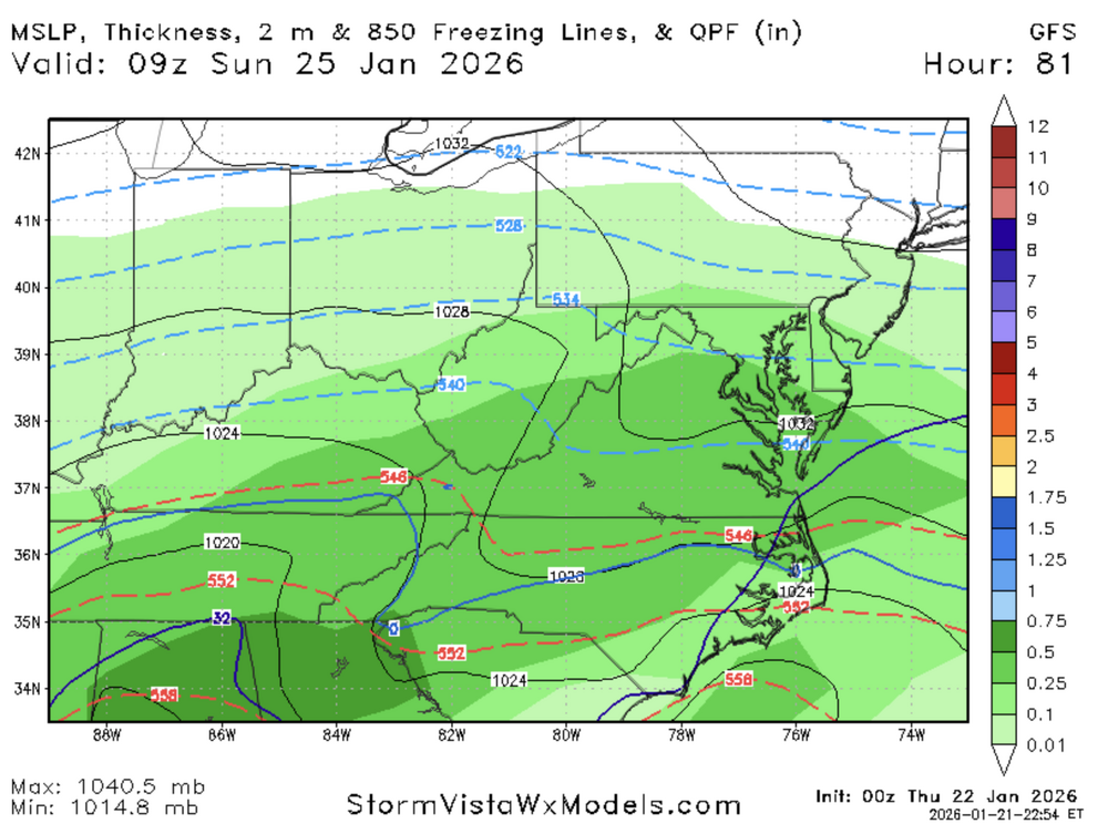
Looks like we lose 700 mb at 90
-
-
i mean it was the outlier south model. i figured it was coming north but lets see how much lol
-
How about 700mb?
-
sleetzille is the worst frozen marbles
-
Excited to decide whether GFS is the worst model of all time or the most accurate winner for this storm in about three minutes
-
Maybe and hour or two slower at 63...track looks similar for wave one.