All Activity
- Past hour
-

Hoisting the Sultan Signal: Heavy Rain Event July 5-7
kdxken replied to WxWatcher007's topic in New England
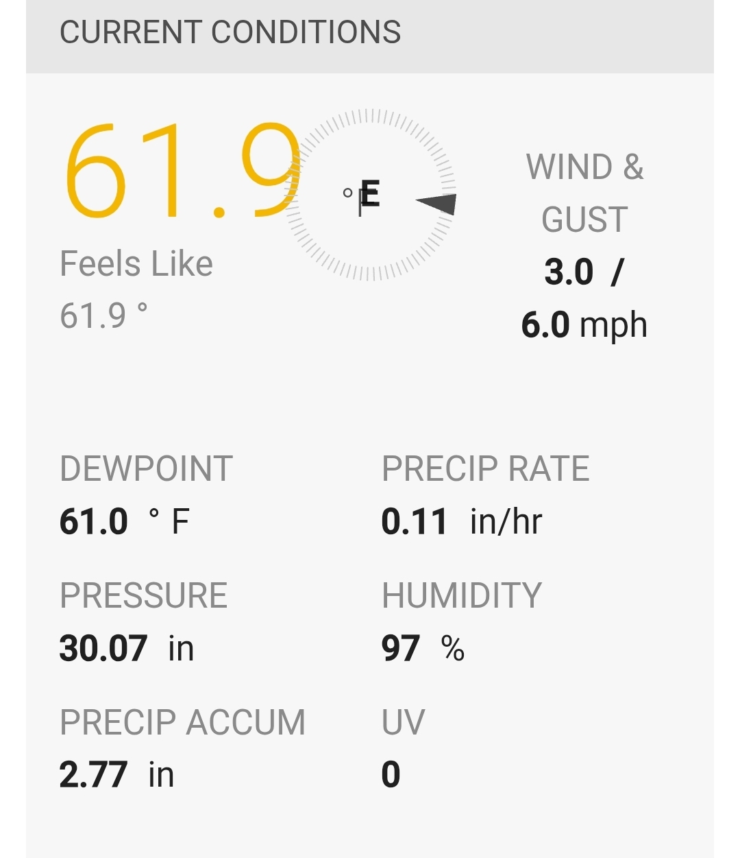
Still raining steadily.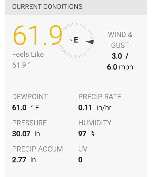
-
Hoisting the Sultan Signal: Heavy Rain Event July 5-7
kdxken replied to WxWatcher007's topic in New England
Total fail by Stein. Quirking and likable but not sure he's the best meteorologist. Gave up after a quarter inch overnight. Said we might get showers during the day but not nearly enough. Nearly 3 inches later.... -

2026-2027 Super El Nino
csnavywx replied to Stormchaserchuck1's topic in Weather Forecasting and Discussion
Early trade wind pattern in this event certainly looked like 72-73. Then tilted more towards 97-98. It's a souped up version of those older canonical events, imo, if superimposed on a warmer background state. Problem is I think the warm pool is coming even further east than '98 did (that event got to about 150W) and it will drag everything else into resonance with it, so makes a straight shot comparison more muddled. -
Yup same at the house. Had a high of 78 degrees then fell into the low to mid 70s mid to late afternoon. Beautiful weather.
-
So much for the drought
-

Hoisting the Sultan Signal: Heavy Rain Event July 5-7
WxWatcher007 replied to WxWatcher007's topic in New England
Cracked at least 2.0” storm total here. -

Hoisting the Sultan Signal: Heavy Rain Event July 5-7
512high replied to WxWatcher007's topic in New England
63 F/ looks like 1.08" for the final. -
That 1936 heatwave is a remarkable outlier. Will be interesting to see if it can be repeated again in the future, or spoiled by higher dews from modern agriculture.
-
High of 82, stayed cloudy most the day so we fell well short of the forecast high.
- Yesterday
-

Hoisting the Sultan Signal: Heavy Rain Event July 5-7
SouthCoastMA replied to WxWatcher007's topic in New England
2.02" -
We just can't get the rain down here. Same thing every day. Still a bit of a chance tonight I guess.
-

Hoisting the Sultan Signal: Heavy Rain Event July 5-7
Ginx snewx replied to WxWatcher007's topic in New England
Scooter Brett crushed lol must be winter with all the premature fails posts -
We will be tired of the blizzards.
-

Hoisting the Sultan Signal: Heavy Rain Event July 5-7
Baroclinic Zone replied to WxWatcher007's topic in New England
Yeah, it’s dumping here now. Under some 45-50 dBZ echoes -
Hoisting the Sultan Signal: Heavy Rain Event July 5-7
Baroclinic Zone replied to WxWatcher007's topic in New England
I have no idea how much here. Cocorahs this AM showed about 0.70” here. -
Nice storm ~7 miles away that refuses to move
-
Tomorrow will be somewhat milder with highs in the upper 70s. Thursday will see raadings return to the 80s and the Friday could see highs in the upper 80s. A few of the hot spots could approach or reach 90°. The weekend will turn somewhat cooler with highs mainly in the lower 80s. No excessive heat appears likely through mid-month. The ENSO Region 1+2 anomaly was +3.4°C and the Region 3.4 anomaly was +1.8°C for the week centered around July 1. For the past six weeks, the ENSO Region 1+2 anomaly has averaged +2.80°C and the ENSO Region 3.4 anomaly has averaged +1.52°C. The ongoing El Niño will continue to strengthen through the summer. The SOI is not available due to data feed issues. This could be an extended issue. The preliminary Arctic Oscillation (AO) was +1.023 today. Based on sensitivity analysis applied to the latest guidance, there is an implied near 61% probability that New York City will have a warmer than normal July (1991-2020 normal). July will likely finish with a mean temperature near 78.6° (1.1° above normal). Supplemental Information: The projected mean would be 2.1° above the 1981-2010 normal monthly value.
-

Hoisting the Sultan Signal: Heavy Rain Event July 5-7
Damage In Tolland replied to WxWatcher007's topic in New England
You guys up over 3”? Notice your buddy went M.I.A. -
@MN Transplant@nw baltimore wx Thanks for the bus suggestion guys. Will definitely look into it.
-

Hoisting the Sultan Signal: Heavy Rain Event July 5-7
CoastalWx replied to WxWatcher007's topic in New England
Dam windy now. Must be gusts 35+. Pillaging. -
Hoisting the Sultan Signal: Heavy Rain Event July 5-7
Baroclinic Zone replied to WxWatcher007's topic in New England
Soakahhh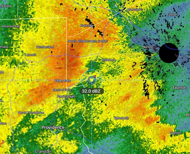
-

E PA/NJ/DE Summer 2026 Obs/Discussion
Psychguy replied to PhiEaglesfan712's topic in Philadelphia Region
It was a gorgeous day today... loved my morning walk in the mist/fog with the pup and my better half... loved that I was able to go for a run and not sweat 10 gallons, and am loving sitting on the porch listening to the birds and the kids playing outside (I could however do without the Mister Softee jingle in the background... but you can't have everything, I guess... :))) -

2026-2027 Super El Nino
Typhoon Tip replied to Stormchaserchuck1's topic in Weather Forecasting and Discussion
Super duper bust? Moderate ENSO might still be able to penetrate RONI -

Hoisting the Sultan Signal: Heavy Rain Event July 5-7
wxeyeNH replied to WxWatcher007's topic in New England
It was a beautiful day up here. Some smoke A fair amount of smoke looking out at the distant ridges. We are starting to dry out the surface. This past week has been dry other than about .10" on the 1rst. We did have a 5 minute sprinkle earlier today. I notice some drops covering about 1/3 of the deck surface at the height. Does that count as a T for the day? Enjoy your soak down in SNE. -

E PA/NJ/DE Summer 2026 Obs/Discussion
Hurricane Agnes replied to PhiEaglesfan712's topic in Philadelphia Region
Glad for the heat break today. Only made it to 75 for a high after a low of 65. Also managed to get 0.02" between 1am - 2 am (event total now 3.09"). Currently 73 with dp 68.