All Activity
- Past hour
-
Wow, that is surreal. Wonder what code that gets? Code orange here today and tomorrow.
-
Currently 92 here. Probably makes it to 95 then we’ll see how much smoke holds temp down.
-
 Definitely starting to brighten. Breeze is picking up too as dews drop. Love the smoke. Hopefully we get more days of this.
 -
Except for the band that just crossed LI and SW CT the smoke aloft is mostly thinner than yesterday so many places are warmer than this time on Tuesday. Also more favorable downslope. Yesterday the lack of surface heating kept winds down somewhat and even allowed LGA to stay more 210-230 most of the day.
-
I don’t care or see the big deal either way.
-
90/101
-
 Yeah, the additional clouds aren't helping, but man it's dark out.
 -
 Wow, it looks like 8:30 pm out there. There's a weird "solar eclipse" vibe about it where things don't quite seem right. The air definitely has a heaviness to it. I don't smell smoke, but my mouth kind of tastes weird. Was it mostly forest that burned up there, or did it hit a lot of manmade things that have who knows what in them?
 -
92 here right now.
-
I can smell the smoke but don't really see it yet
-
 Took 134 to the New Sharon Dunkin Donuts a few times this week. Hard to beat the views as far as a quick car ride is concerned. Taking the kids to hike Bald Mountain Preserve in Camden tomorrow morning. Usually it's Bald Mountain or Mt Blue in Weld, but I'm out of hiking shape and we are looking to try something a bit different outside of the Kennebec Highlands trails near us.
 -
Smoke starting to filter in here in Suffolk as well. Temp has “dipped” down to 90.
-
 Nice to see bluebird skies again. Smoke just to my south but blue to the north. The sun is back! Other than a few Cu the skies are clear! Unlike the smoke of a couple of years ago this smoke came on quick yesterday.
 -
Light smokey haze with a distinct smoke smell in jersey city
-
One can smell the smoke in the Bronx, as well, even as it's not as thick as that in Rhinebeck.
-
Not only Canada, the Boundary Waters area of northern MN has lightning-induced fires and they've closed the park for only the third time on record.
-
90 here 7 behind the hottest day Jul 1-4th so thinking we top out in the 97-99 range 100 south of the area.
-
 Those are great books especially the Early American series.
 -
 This isn’t the smoke I prefer to bathe myself in.
 -
Enough that you can blow a flat surface is see the ash blow away, and its visible falling too.
-
 Let the hair hang down out of the confines of the pony-o ..and wave it around and wash the hair in the smoke
 -
WPC increased rainfall total
-
 It is so thick here in Brattleboro that I can't even see the sun Sent from my SM-S176V using Tapatalk
 -

2026-2027 Super El Nino
GaWx replied to Stormchaserchuck1's topic in Weather Forecasting and Discussion
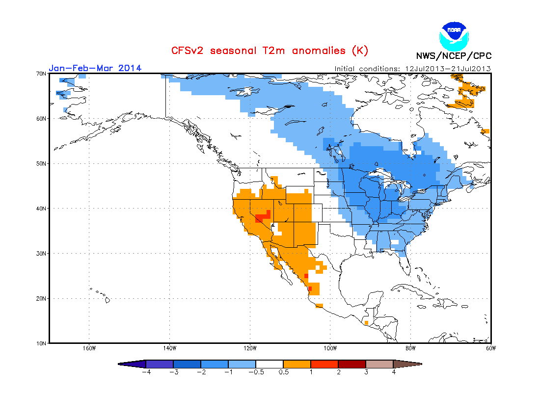
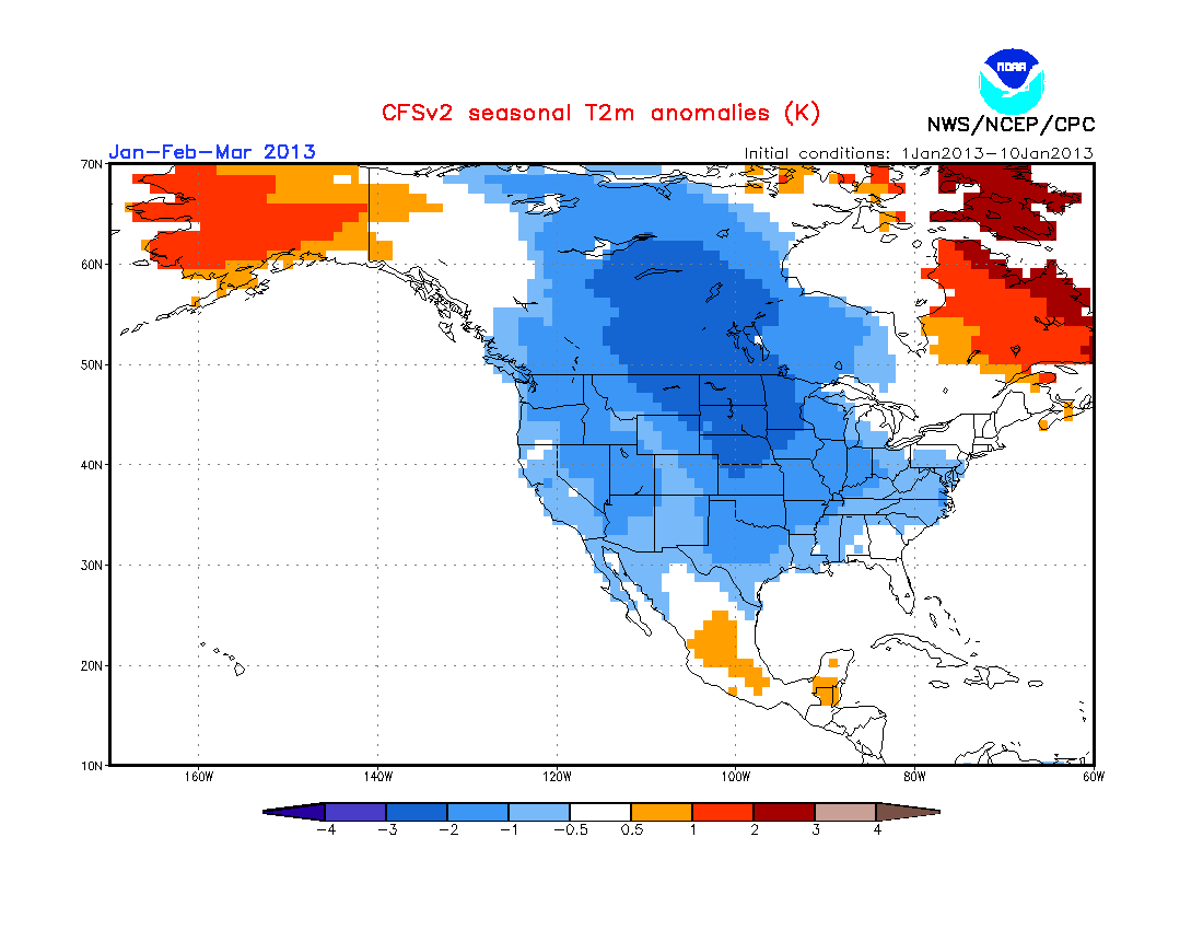
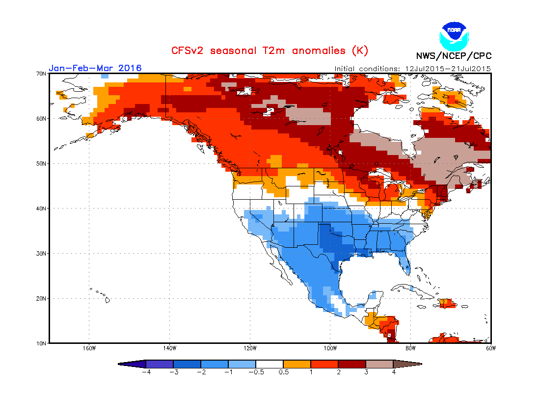
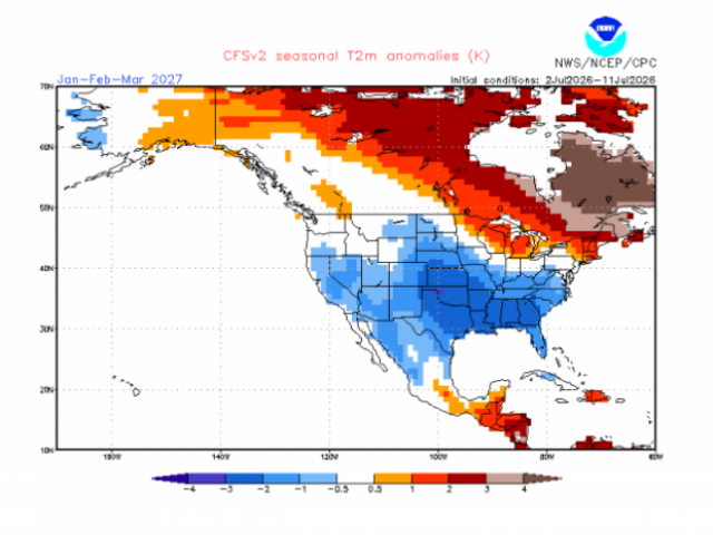
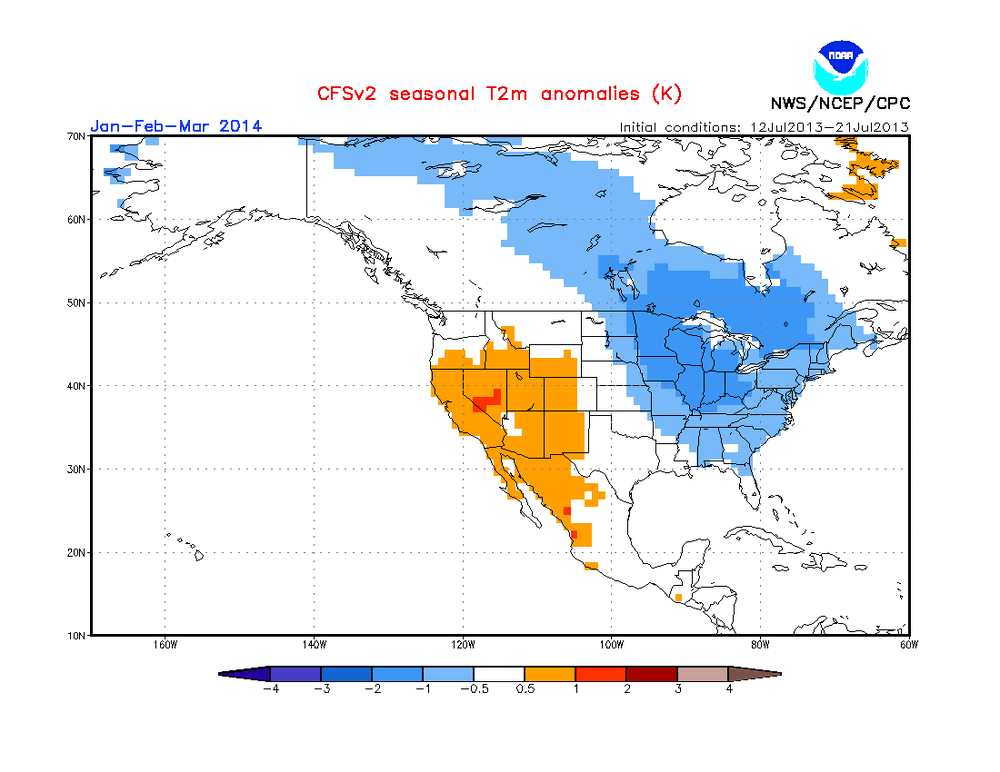
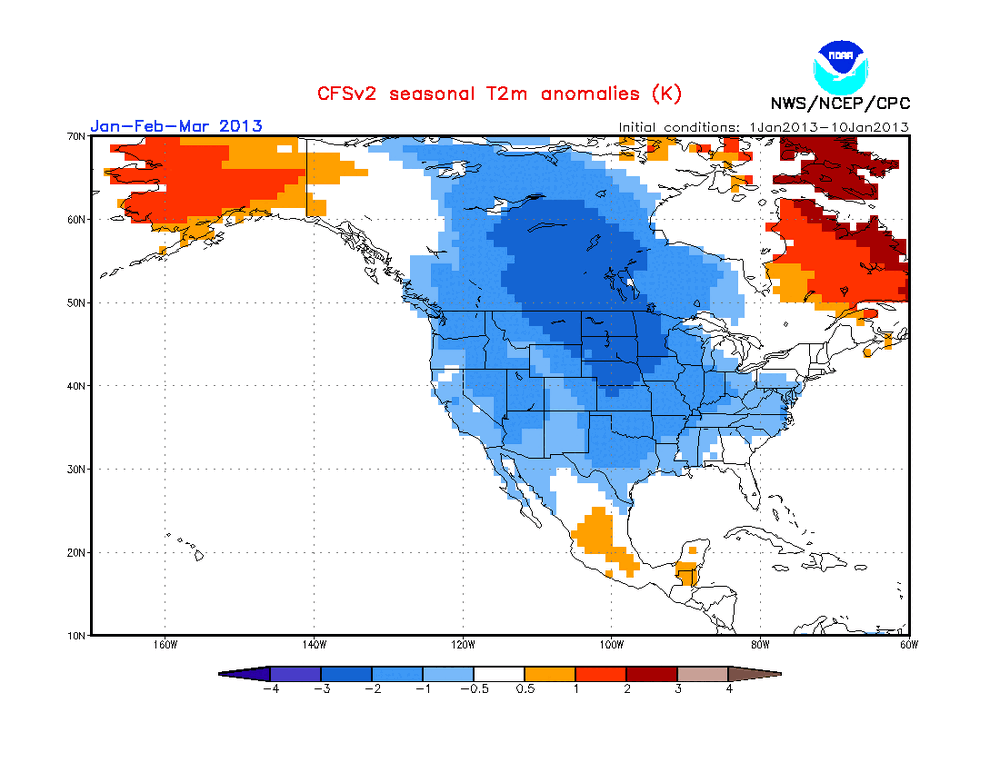
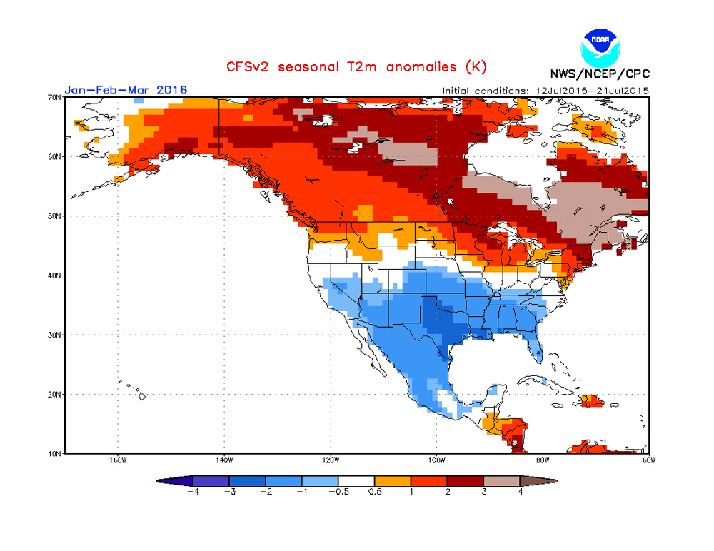
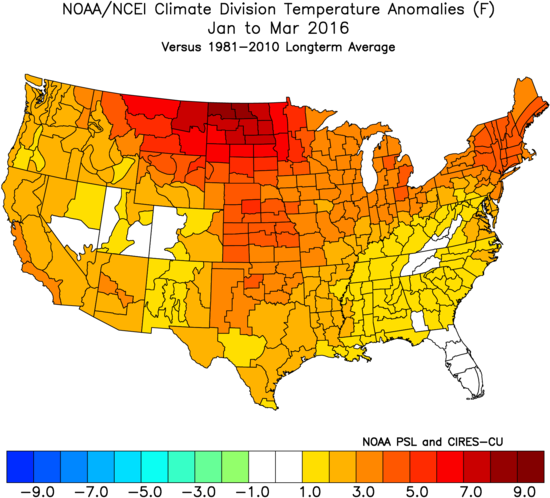
After researching this carefully, the following CFSv2 forecast map that JB posted for 2027 actually may not be the coldest population weighted CFSv2 JFM forecast overall for the U.S. on the site predicted in summer, which goes back to the progs for JFM of 2012: Regarding the following forecast, which was made in the summer of ‘13 for JFM of 2014, the U.S. overall may be colder than the above map on a population as opposed to geographically weighted basis because the most heavily populated NE to upper Midwest is significantly colder despite the warmer S: JB was specifically referring to pop. weighted this far out as he said: “ Population Weighted, CFSV2 with Coldest JFM in hits archive I went back thru all CFSV2 forecasts since 2012 on its site. This is the coldest JFM it has ever shown from this far out“ Now, regarding a JFM prog made at anytime of year, which JB wasn’t talking about, this one made in early Jan for 2013 appears to be the coldest of any I found on either a pop or geo wted basis: Interestingly, the aforementioned recent forecast for JFM 2027 is not that much colder than the following one also made in summer for JFM 2016 (which similarly followed a super Nino peak) as it has a fairly similar pattern (just not as cold): The above summer of ‘15 prog for JFM ‘16 ended up failing miserably for most of the country as this is what actually happened: This miserable failure, itself, doesn’t exactly bode well for those like me hoping the cold on the JB posted CFS for JFM ‘27 will verify well since we’re again going into a super-Nino.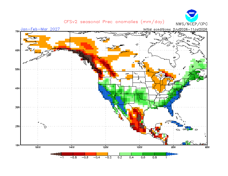
-
The sun is now completely obscured in the valley. I can taste the smoke in the air and the motion detector nightlight outside the brewery flicked on because it’s so dark right now. Killing a heat wave with smoke was not on my bingo card.