All Activity
- Past hour
-

E PA/NJ/DE Winter 2025-26 Obs/Discussion
Physicsteve replied to LVblizzard's topic in Philadelphia Region
Yeah, western snow shield seems more expansive than was modeled. Not mad about the location of low pressures for some coastal action.
-
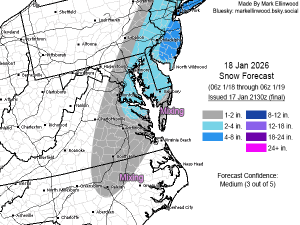
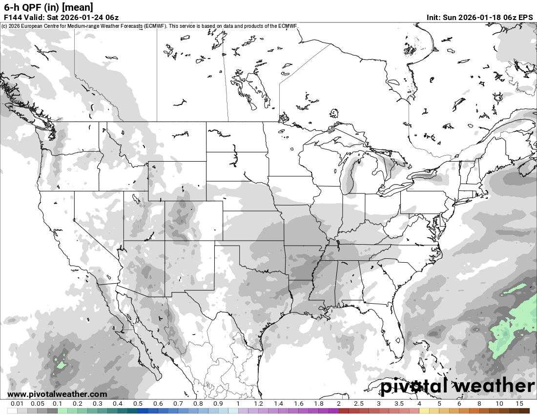
6z Eps at the end of the 144hr run looks "right" if you know what I mean. Lol Top is 6hr precip and bottom is 6hr snowfall.

.thumb.png.36c28dfed111c15da97f6b795556b6d3.png)
-
It’s been snowing at Forsyth, GA nearly 30 min. Patience is recommended in Macon area as it’s about to start there:Here are 7AM hourly readings:COLUMBUS LGT SNOW 31 29 92 NW9 30.16R VSB 3/4 WCI 23 6HR MIN TEMP: 31; 6HR MAX TEMP: 44; 6HR PCP: 0.04; MACON LGT RAIN 37 35 92 NW10 30.10R WCI 30 TC 3 6HR MIN TEMP: 37; 6HR MAX TEMP: 45; 6HR PCP: 0.13; ROBINS AFB RAIN 39 36 87 NW16 30.09R WCI 30 TC 4 CITY SKY/WX TMP DP RH WIND PRES REMARKS LAGRANGE* CLOUDY 34 14 44 NW9 30.14R WCI 26 TC 1 SYLVANIA* RAIN 42 42 100 N6 30.04R TC 6 MILLEDGEVILLE* LGT RAIN 39 37 93 NW14G20 30.08R FOG WCI 31
-

Winter 2025-26 Medium/Long Range Discussion
A-L-E-K replied to michsnowfreak's topic in Lakes/Ohio Valley
Zzzzz -

First Legit Storm Potential of the Season Upon Us
CoastalWx replied to 40/70 Benchmark's topic in New England
Well just stating like Will said too. Anyways good luck. Getting off for some time. -
(002).thumb.png.6e3d9d46bca5fe41aab7a74871dd8af8.png)
January 18th Back Door NW Trend Snow OBS Thread
ChescoWx replied to Mikeymac5306's topic in Philadelphia Region
As of 710am a new 1.0" of snow so far here in East Nantmeal - temperature at 28.5 degrees all surfaces re-covered.
-
First Legit Storm Potential of the Season Upon Us
CoastalWx replied to 40/70 Benchmark's topic in New England
Yeah I noticed that. Hence the pull back. -

Rise of the Machines: January 18-19 Winter Storm Obs Thread
SouthCoastMA replied to WxWatcher007's topic in New England
snow pellets here -

January 16-18th: Rolling the dice
Stormchaserchuck1 replied to SnowenOutThere's topic in Mid Atlantic
-

Rise of the Machines: January 18-19 Winter Storm Obs Thread
moneypitmike replied to WxWatcher007's topic in New England
If I had any furniture and a kitchen there, I'd be down at the new place for this......sitting here in PVD just isn't cutting it. -

First Legit Storm Potential of the Season Upon Us
Baroclinic Zone replied to 40/70 Benchmark's topic in New England
Donny Boys Obs -
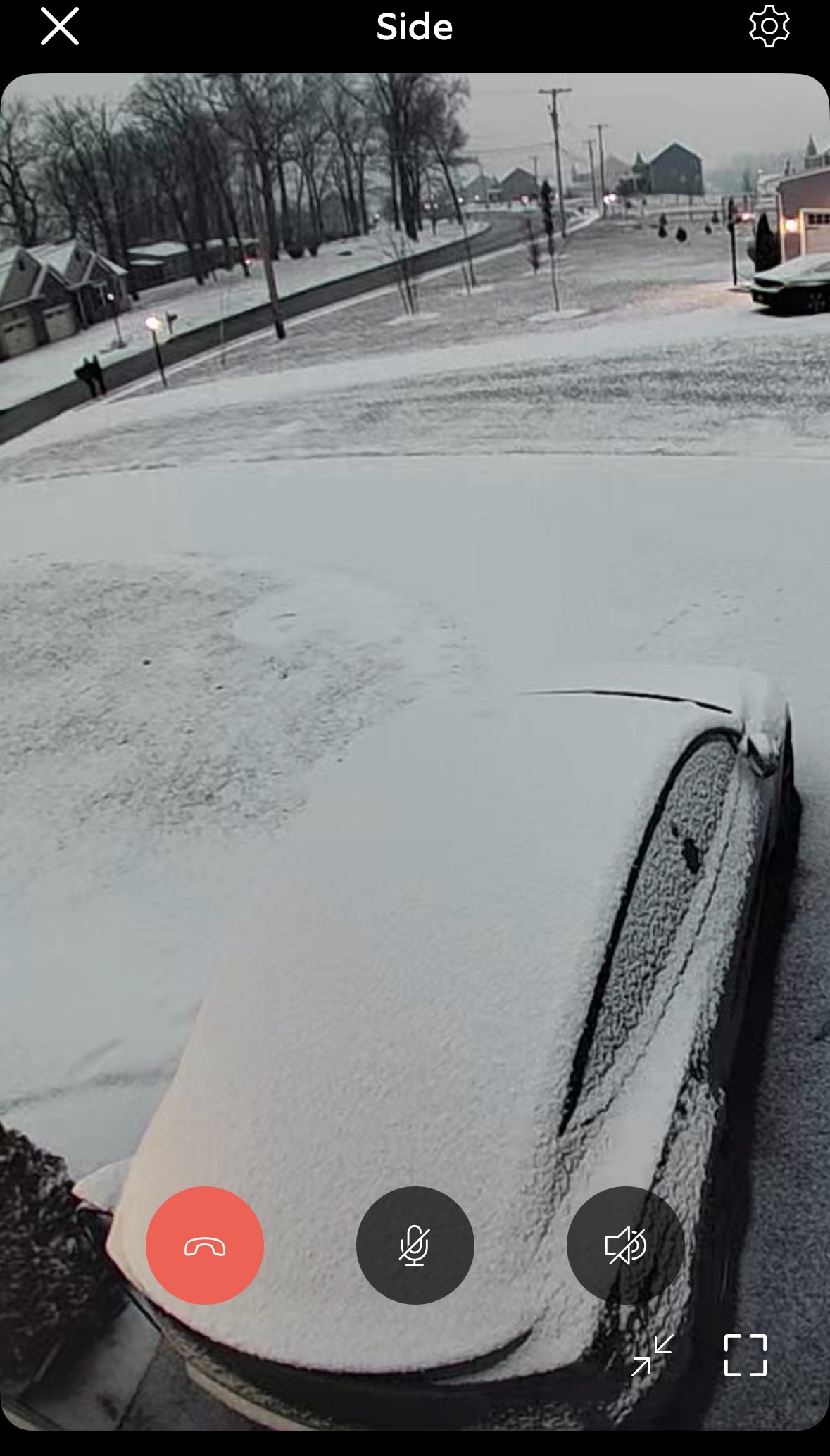
Woke up to a nice coating
-
First Legit Storm Potential of the Season Upon Us
Baroclinic Zone replied to 40/70 Benchmark's topic in New England
GWDLWOTR -

First Legit Storm Potential of the Season Upon Us
ORH_wxman replied to 40/70 Benchmark's topic in New England
I think I’d go 3-6/4-7 here. Don’t think the dynamics are there for lots of 6-8 type amounts. Maybe that changes, but subtle trend overnight of reducing the “curl” in the vort as it passes by. -

Storm potential January 17th-18th
Stormlover74 replied to WeatherGeek2025's topic in New York City Metro
Hoping for a little more but a 5 or 6 hour lull in the action will probably allow for some melting -

First Legit Storm Potential of the Season Upon Us
Damage In Tolland replied to 40/70 Benchmark's topic in New England
You too .See you on the other side after the pull back -

Central PA Winter 25/26 Discussion and Obs
canderson replied to MAG5035's topic in Upstate New York/Pennsylvania
Real nice surprise of 1.5-1.75” snow when I woke up. -
Light snow. Gorgeous out.
-

Central PA Winter 25/26 Discussion and Obs
Caveman replied to MAG5035's topic in Upstate New York/Pennsylvania
Nearly identical observations for the Saturday and Sunday light snow events from Valley Green, northern York County: Saturday: 1.5" of snow with a liquid eq. of 0.08" Sunday: 1.4" of snow with a liquid eq. of 0.07" Snow on snow is always kinda nice; NFL officials playing such a huge role in any and all games, well, not so much! -
Moderate snow 32° 4 miles west of Hunt Valley
-
This is hot off the press new:URGENT - WINTER WEATHER MESSAGE NATIONAL WEATHER SERVICE PEACHTREE CITY GA 713 AM EST SUN JAN 18 2026 GAZ089-090-181800- /O.UPG.KFFC.WW.Y.0001.000000T0000Z-260118T1800Z/ /O.EXA.KFFC.WS.W.0001.000000T0000Z-260118T1800Z/ MUSCOGEE-CHATTAHOOCHEE- INCLUDING THE CITIES OF COLUMBUS AND FORT BENNING 713 AM EST SUN JAN 18 2026 ..WINTER STORM WARNING IN EFFECT UNTIL 1 PM EST THIS AFTERNOON * WHAT...HEAVY SNOW. ADDITIONAL SNOW ACCUMULATIONS UP TO 1 TO 2 INCHES * WHERE...CHATTAHOOCHEE AND MUSCOGEE COUNTIES. * WHEN...UNTIL 1 PM EST THIS AFTERNOON. * IMPACTS...PLAN ON SLIPPERY ROAD CONDITIONS.
-
Rise of the Machines: January 18-19 Winter Storm Obs Thread
Baroclinic Zone replied to WxWatcher007's topic in New England
Snowing -
Rise of the Machines: January 18-19 Winter Storm Obs Thread
moneypitmike replied to WxWatcher007's topic in New England
Snowing lightly in PVD. Radar showing the band about to tickle Mattapoisett. Meanwhile, GYX even is calling for 4-6" up at Pit2 tonight. -
Was hoping the models would bring the PM snow more in line with my track, but looking more like now this will be lower-end/under my forecast in the DMV region. I wasn't really relying on this morning's activity to do much south of the MD/PA border, but would have liked to see at least a coating IMBY by now instead of rain/mix.
-
First Legit Storm Potential of the Season Upon Us
moneypitmike replied to 40/70 Benchmark's topic in New England
Snowing lightly in PVD. Radar showing the band about to tickle Mattapoisett. Meanwhile, GYX even is calling for 4-6" up at Pit2 tonight.

.png.985fecbc2bb3cf1ac87190ff76e86fc6.png)