All Activity
- Past hour
-

2025-2026 ENSO
40/70 Benchmark replied to 40/70 Benchmark's topic in Weather Forecasting and Discussion
The implication is that it will strengthen relatively rapidly if we are to have a reflection event in January, as believe that we will. I told everyone that this first one would not result in a reversal weeks ago. -
From the NWS OKX AFD: SHORT TERM /THURSDAY THROUGH FRIDAY NIGHT/... Key points * Winds of near 20 mph with gusts near 35 to 40 mph forecast for Thanksgiving. High temperatures Thanksgiving mainly low to mid 40s but wind chills stay in the 30s. * Winds of near 25 mph with gusts near 40 to 45 mph forecast for Friday. There is still some model indication of near 50 mph wind gusts being possible. High temperatures Friday mainly in the upper 30s to lower 40s with wind chills staying mostly in the 20s to lower 30s. The key points with the short term will be gusty winds and with the higher winds, cold temperatures as well as wind chills. No measurable precipitation is expected during the timeframe of Thanksgiving through Friday night. There could be a few light rain/snow showers with strong mid level vorticity maximum pushing across on Friday. A much colder airmass will be across the region during the short term.
-
I am not happy that the chances of me getting a tiny bit of snow will hinge on if the corn stalks in Iowa are too warm.
-
2025-2026 ENSO
40/70 Benchmark replied to 40/70 Benchmark's topic in Weather Forecasting and Discussion
I didn't say "strong" by Xmas, I said approaching climo....then then strong into January. That maps another slight weakening just prior to Xmas...nothing major. -
.thumb.jpg.ad3a2e31d30aff035044689b311a0540.jpg)
Nov 28-30th Post Turkey Day Wintry Potential
nvck replied to Chicago Storm's topic in Lakes/Ohio Valley
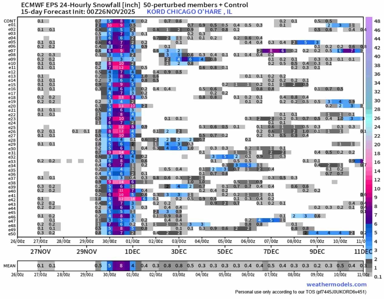
24hour snow at o'hare from the 00z eps. Trended up vs the prior day's 00z and 12z runs, no members w/ less than 3" now.
-
.66 total at my station.
-
The date that the chart shows a 2nd slight weakening is mid-month, so he was showing the mid month calls might be wrong (like half the posts here since Oct 1). It doesnt take a genius to say that the PV will eventually strengthen. A 2 year old can make that same statement, it isn't a bold call.
-
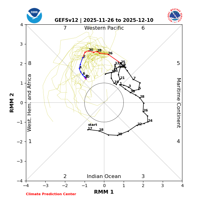
Im saying that the PV will not become strong. I expect cold most of this month with active conditions. Beating a dead horse ? Snowman, you have been wrong so far about this upcoming pattern along with others. I wouldn't be puffing your chest out if I was you. Why are you ignoring the MJO projection . PV will take another hit soon.
-
We’ve had accumulating snow right down to the beaches in less than ideal cold-Nov 2018 being the most recent example but numerous others. We really just don’t want the wind shifting to onshore.
-

December 2025 regional war/obs/disco thread
moneypitmike replied to Torch Tiger's topic in New England
I hate them. Even at my new place, there's more risk of them missing than not. Just think of James. -
GEFS, EPS, and GEPS members clustered where we'd want them I think, mostly offshore with the SLP. Hints of a weak primary up the Apps. The bulk of the precipitation along the coastal plain. Surface temperatures for low elevation coastal areas are marginal for snow and the real cold doesn't move in until the storm is departing. But that's a pretty good look overall for a 6 day forecast. The bar for me at this point of the season is a shovelable snowfall. I don't want to get carried away by 10:1 snow maps.
-
35mph gusts at like 4:30 woke me up this am, lots of stressed people on campus (we still have class today) who have to drive either north or to the west side of the state
-
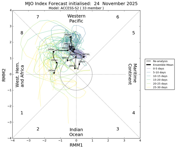
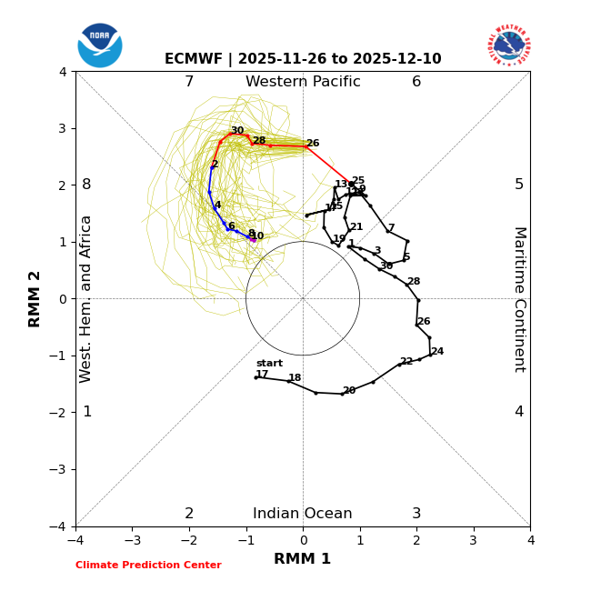
Today’s MJO through 12/10: tune in tomorrow to see what they’ll do 12/11-27:
-

November 2025 general discussions and probable topic derailings ...
dendrite replied to Typhoon Tip's topic in New England
Up to 43° but still wedged and in the pea soup. -
God, just thinking about it sends chills up my spine. The amount of storms is ungodly. The area/towns/counties i'm unfamiliar with + wild elevation changes... At this point i think i know every town and county from Ocean up to Ulster and east to Essex, MA, thats plenty for me.
-

December 2025 regional war/obs/disco thread
WxWatcher007 replied to Torch Tiger's topic in New England
Messenger shuffle ftw I want everyone to cash in this winter. Seriously. It’s been too long. -

November 2025 general discussions and probable topic derailings ...
Cold Miser replied to Typhoon Tip's topic in New England
Moose chillin' up near the ADK house. (pic taken by one of my cousins) Not sure why it's crappy like a 1970's Big Foot pic.
-
2025-2026 ENSO
40/70 Benchmark replied to 40/70 Benchmark's topic in Weather Forecasting and Discussion
Looks like a graphic pirated from that bafoon, Mark Margavage, who is trying to claim there will be a major SSW with a reversal around xmas. I can assure you, there will not. -

Nov 28-30th Post Turkey Day Wintry Potential
Baum replied to Chicago Storm's topic in Lakes/Ohio Valley
Just an FYI that was his call for the 1979 Chicago Blizzard. No lie. -

2025-2026 Fall/Winter Mountain Thread
Maggie Valley Steve replied to Buckethead's topic in Southeastern States
Someone could see a bit of NWFS this evening and overnight as a bit of moisture moves overhead. -

December 2025 regional war/obs/disco thread
WinterWolf replied to Torch Tiger's topic in New England
Here again, not fighting against anyone. I don’t like trolling. I don’t like misinfo from folks, or folks trying to agitate others. I come here for accurate info on what our weather may be…and that’s it. I have no agenda. just want to discuss the potential weather when it’s active. And I won’t burn out..I am on zero social media, so I just walk away from here if it irritates me too much. -

Nov 28-30th Post Turkey Day Wintry Potential
ChiTownSnow replied to Chicago Storm's topic in Lakes/Ohio Valley
Sounds right -

December 2025 regional war/obs/disco thread
mahk_webstah replied to Torch Tiger's topic in New England
No. You should do it. Because then when it trends south and east so many will be happy. -
Imby/Columbia: 0.32” overnight. 1.52” November to date.
-
The long range looks meh to me. Not a torch anymore but no slam dunk pattern that is primed for southern snow either.