All Activity
- Past hour
-
October 29 2004: Exceptionally muggy conditions for October are felt over much of the state. Dew points surged into the middle to upper 60's over central and southern Minnesota. Ladybugs are extremely active. 1955: Early snow hits the Twin Cities, accumulating to 2.2 inches. 1905: Several inches of snowfall accumulate in south central Minnesota. Snow totals included 7 inches at Fairmont, 6 inches at Farmington, 4.5 inches at Montevideo, 4 inches at Faribault, and 3 inches at New London. For Thursday, October 29, 2026 1917 - The temperature at Denver, CO, dipped to zero, and at Soda Butte, WY, the mercury plunged to 33 degrees below zero, a U.S. record for the month of October. (David Ludlum) 1942 - A tornado struck the town of Berryville in northwest Arkansas killing 20 persons and causing half a million dollars damage. (David Ludlum) 1956 - A violent tornado, or series of tornadoes, moved along a path more than 100 miles in length from south of North Platte NE into Rock County NE. It was an unusually late occurence so far north and west in the U.S. for such a storm. (The Weather Channel) 1987 - Severe thunderstorms in Arizona produced wind gusts to 86 mph at the Glendale Airport near Phoenix, baseball size hail and 70 mph winds at Wickenburg, and up to an inch of rain in fifteen minutes in Yavapai County and northwest Maricopa County. Arizona Public Service alone reported 2.5 million dollars damage from the storms. (The National Weather Summary) (Storm Data) 1988 - Wintry weather prevailed in the Upper Midwest. South Bend, IN, equalled their record for October with a morning low of 23 degrees. International Falls MN reported a record low of 11 degrees in the morning, then dipped down to 8 degrees above zero late in the evening. (The National Weather Summary) 1989 - Thunderstorms developing along a cold front produced severe weather in Oklahoma and north central Texas during the late afternoon and evening hours. Thunderstorms in Oklahoma produced weak tornadoes near Snyder and Davidson, and produced hail two inches in diameter at Altus. Large hail damaged 60 to 80 percent of the cotton crop in Tillman County OK. Nine cities in the northeastern U.S. reported record high temperatures for the date as readings warmed into the 70s. For Marquette MI it marked their fifth straight day of record warmth. Arctic cold invaded the western U.S. Lows of 7 degrees at Alamosa CO and 9 degrees at Elko NV were records for the date. (The National Weather Summary) 2011 - New York City received one inch of snow, the earliest they had received that much snow since records began. It was also only the fourth times since the Civil War snow had fallen in New York City in October. The storm also left over three million people without power including 62% of the customers of Connecticut Light and Power. Observances: 29 Thu National Oatmeal Day 29 Thu World Psoriasis Day 29 Thu World Stroke Day 29 Thu National Cat Day 29 Thu Internet Day 29 Thu National Hermit Day 29 Thu National Internet Day 29 Thu National Martina Day
-
we can only hope.
-
From what I've gleaned from here, ENSO since 1950 had 3 very strong Ninos - 82-83, 97-98 and 15-16. That last was the least snowy of 28 winters here. One of the oddest phenomenon in the 1998 storm occurred in the MWN area. The mountain observations included their highest January temp during the storm (since beaten IIRC), and Gorham had mainly cold rain. In between at 1500-2500 ft asl, trees were destroyed by ice. Another weirdness was observed in West Gardner, where the telephone cable had a line of discrete icicles. Falling trees and breaking poles caused the cable to twist, first pointing the vertical-formed 4-5" icicles toward about 8 o'clock, then after another inch formed, twisting it to about 10:30, producing a long parade of hockey-stick icicles pointing at the sky.
-
Lol….when I read that a couple days ago, I thought the same. Which was that’s pretty close to normal. Of course he was implying that his temps he mentioned were way above average, which they were not.
-
another week of dry weather looks likely-very un Nino like
-
Those are like June lows up there in Tolland.
-
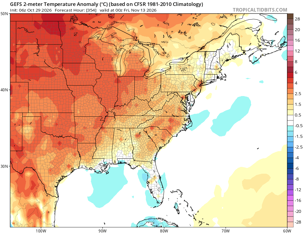
So many camp fires in the Catoctins it is hard to see with the smoke. But most of the next 5-7 days in the 70's? Time for some chilly weather and a front to clear out the smog.
-
Unless there’s another can kick I’m expecting a wet season. But I’m skeptical of a big snow.
-

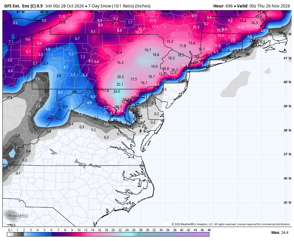
Winter 2026-2027 Digital Snow Thread
NorthArlington101 replied to SnowenOutThere's topic in Mid Atlantic
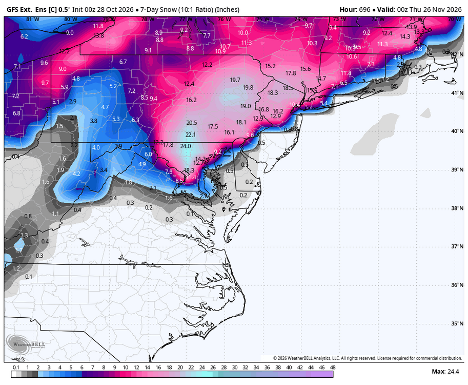
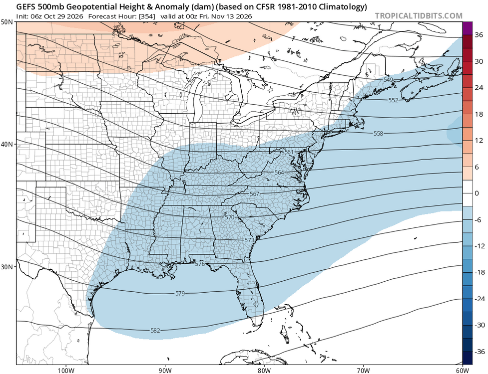
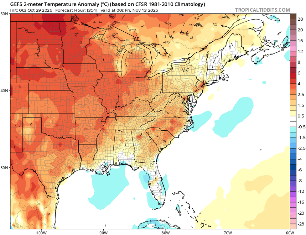
Hour 696... now we're starting to get there!! -
 https://fronteracaredirect.shop/# legitimate mexican pharmacy online
-
This weeks drought monitor showed significant worsening of the drought in central and eastern NC. I can say looking at lake and pond levels it is as dry as it got during the summer, though with the time of year impacts are less. The creek through my farm has been reduced to a trickle and several ponds are almost dry. We need rain badly and big rain
-
He is a snake oil salesman, so many times has it not even worked out at all.
-
WB extended GEFS, dreaming of a white Thanksgiving.
-
Getting pretty close to peak in central MD I think. Probably next week for MBY?
-
Fog as thick as pea soup this morning.
-
Some frost on the roofs…but that was it..38 driving into work.
-
Well no one can complain about not having a fall this year.
-
Things to get used to this winter :
-
Beautiful morning today. Woke up early at 7am to study for my test at 9:30 and I'm glad I was able to catch the sunrise over Charlottesville. Had enough low level moisture to get some pretty scattering of the light and the fall colors are probably near their peak. Turned in my climatology literature review of Mid-Atlantic snowstorms relation to the PNA and NAO (which I'll post eventually in here) last night and can't wait to get this test done. I think I'll wake up and try to get some pictures of sunrise tomorrow. I won't miss the 7am darkness once daylight saving time starts in a couple days but I will miss seeing the sun rise.
-
Same. I think there's potential for some really exciting weather. Not just possibly big snow events. Big wind events, big rain events, crazy temperature swings. All fun stuff.
-
I feel better about getting snow if the models are showing rain 5 days out.
-
47 when i.walked out this morning.. felt warm compared to what its been
- Today
-
Looks like the San Diego weather continues well into next week.
-
CWG’s forecast is what you get if you assume a 2/3rds chance of a near shutout and 1/3 rd chance of a HECS. But that’s not possible in the real world so they end up with a number that I don’t think is particularly likely on its own.
-
I feel optimistic about this winter.