All Activity
- Past hour
-
Is this the first of these new extreme cold warnings for the metros? My guess is last wind chill warnings might have been January 2018?
-
Flurries here in Smithsburg
-

Friday February 6 FROPA / WINDEX small event
Ginx snewx replied to HoarfrostHubb's topic in New England
.png.3ac2ad7ad86bbe7d068411151c682ba3.png)
-

Friday February 6 FROPA / WINDEX small event
Great Snow 1717 replied to HoarfrostHubb's topic in New England
Don't worry the Billerica crews will soon arrive... -
February 6 1994: The national low is at Tower, dropping down to -41. For Friday, February 6, 2026 1807 - It was the famous "Cold Friday" in the Midwest and South. The temperature did not rise above zero in Ohio and Kentucky. (David Ludlum) 1978 - A massive nor'easter buried the cities of the northeastern U.S. Storm totals included 18 inches at New York City, 16 inches at Philadelphia, and 14 inches at Baltimore. The Boston MA area received 25 to 30 inches in "The Great New England Blizzard" and the mayor outlawed travel in the city for an entire week. (David Ludlum) 1987 - Brownsville, TX, was deluged with seven inches of rain in just two hours, and flooding in some parts of the city was worse than that caused by Hurricane Beulah in 1967. (The National Weather Summary) (Storm Data) 1988 - Arctic cold invaded the south central and eastern U.S. Sixteen cities reported new record low temperatures for the date. Squalls in the Great Lakes Region produced a foot of snow at Arcade NY in three hours. (The National Weather Summary) (Storm Data) 1989 - Forty-one cities in the western U.S. reported new record low temperatures for the date. Lows of -30 degrees at Ely NV and -33 degrees at Richfield UT were all-time records. Morning lows of 31 degrees at San Francisco CA and -15 degrees at Reno NV were records for February. Logan Canyon UT was the cold spot in the nation with a low of 54 degrees below zero, and Craig CO hit 51 degrees below zero. (The National Weather Summary) 1990 - A second cold front brought more heavy snow to the high elevations of Oregon, with 12 inches reported at Sunset Summit. Ten inches of snow blanketed Crater Lake and Mount Bachelor. Heavy snow also blanketed northeastern Nevada and parts of Washington State. In Nevada, up to a foot of snow was reported between Spring Creek and Lamoille. Stevens Pass WA received 14 inches of snow in 24 hours. (The National Weather Summary) (Storm Data) 2010 - On February 5-6, a severe nor'easter, commonly referred to as Snowmageddon, impacted the east coast from North Carolina to New York. Some snowfall amounts include; 32.9 inches at Washington Dulles International Airport; 28.5 inches at the Philadelphia International Airport; 21.1 inches at the Pittsburgh International Airport; 18.2 in Atlantic City; Trace in Central Park. Just for reference to the 1807 low max being below zero, current low max records for early Feb are in the mid teens, with single digits across the N parts of OH.
-
I feel like we’d need more than 2-5 degrees F above normal for a thaw… that would still keep most of New England below freezing I would think?
-
Definitely a good shot at breaking through, moisture movement more north to south and entering through Ashe County and not getting shredded as much as it would trying to come in from TN.
-

Friday February 6 FROPA / WINDEX small event
RUNNAWAYICEBERG replied to HoarfrostHubb's topic in New England
Gfs looks bullish from Meth town to PVD -
Friday February 6 FROPA / WINDEX small event
Ginx snewx replied to HoarfrostHubb's topic in New England
Hmm GFS just jacked -
This would really suck. OL coach Stoutland not returning, Lane will retire very soon now this w/Dickerson?....and quite a surprise/shock. Birds OL could go to one of the worst real quick. They didn't play well last season but now they could flat out suck...

-
URGENT - WEATHER MESSAGE National Weather Service Baltimore MD/Washington DC 929 AM EST Fri Feb 6 2026 DCZ001-MDZ013-014-018-504-VAZ053-054-501-505-506-526-527-070000- /O.UPG.KLWX.CW.Y.0011.260207T0900Z-260208T1500Z/ /O.EXA.KLWX.EC.W.0004.260207T0900Z-260208T1500Z/ /O.CON.KLWX.HW.W.0001.260207T0900Z-260208T0000Z/ District of Columbia-Prince Georges-Anne Arundel-Calvert-Central and Southeast Montgomery-Fairfax-Arlington/Falls Church/Alexandria-Northern Fauquier-Western Loudoun-Eastern Loudoun-Northwest Prince William-Central and Southeast Prince William/Manassas/Manassas Park- 929 AM EST Fri Feb 6 2026 ...EXTREME COLD WARNING IN EFFECT FROM 4 AM SATURDAY TO 10 AM EST SUNDAY... ...HIGH WIND WARNING REMAINS IN EFFECT FROM 4 AM TO 7 PM EST SATURDAY... * WHAT...For the Extreme Cold Warning, dangerously cold wind chills around or lower than 10 degrees below zero expected. For the High Wind Warning, northwest winds 20 to 30 mph with gusts up to 60 mph expected. * WHERE...Portions of DC, central and southern Maryland, and northern Virginia. * WHEN...For the Extreme Cold Warning, from 4 AM Saturday to 10 AM EST Sunday. For the High Wind Warning, from 4 AM to 7 PM EST Saturday. * IMPACTS...Damaging winds will blow down trees and power lines. Widespread power outages are expected. Travel will be difficult, especially for high profile vehicles. The cold wind chills as low as 10 below zero could result in hypothermia if precautions are not taken. Frostbite and hypothermia will occur if unprotected skin is exposed to these temperatures. * ADDITIONAL DETAILS...Wind chills are expected to remain below zero for at least 24 hours beginning Saturday morning and continuing through late Sunday morning. Being outdoors for a prolonged period of time will be life-threatening.
-
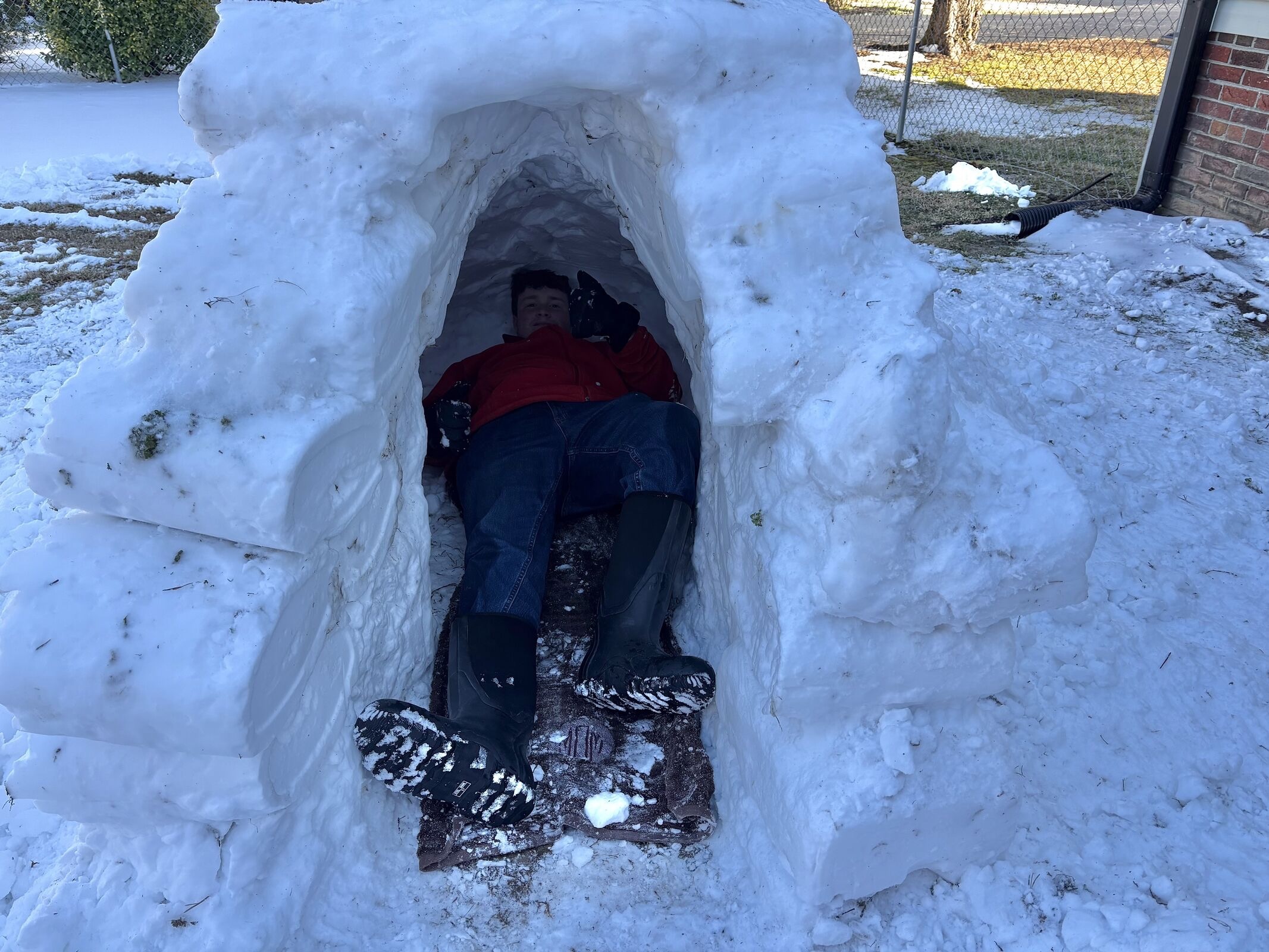
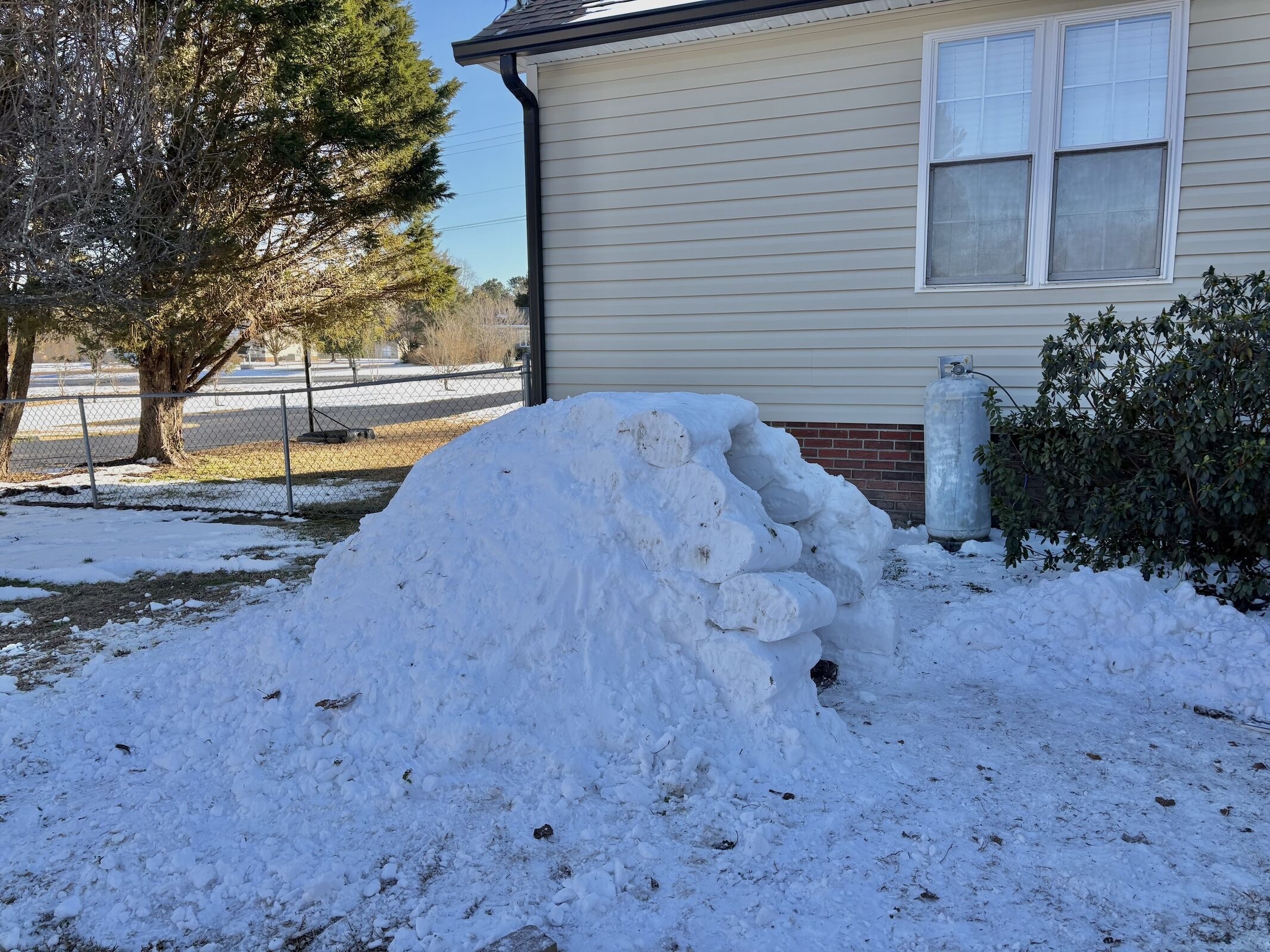
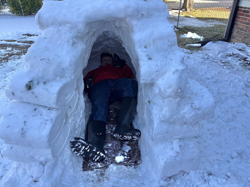
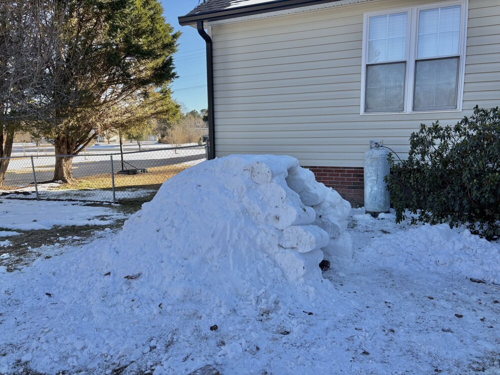
We’ve had a couple “thawing” days here in Clayton now but I’m still hanging on to my shade piles, and better yet my small iglooI I managed to build.
-
Extreme Cold Warnings expanded
-
There were some bad spots on roads this morning. Saw two wrecks on Highway 16 due to black ice. I was amazed at how fast people were travelling with temps in the low 20s and "wet looking roadways." Crazy how common sense to slow down doesn't register with everyone.
-
Frederick County schools also!
-
Friday February 6 FROPA / WINDEX small event
Great Snow 1717 replied to HoarfrostHubb's topic in New England
My job?? I think not !...I am sure the Billerica HWD would love to hear from you..lol... -

Friday February 6 FROPA / WINDEX small event
ma blizzard replied to HoarfrostHubb's topic in New England
GFS ramping QPF up a bit .. verbatim solid advisory central / east MA, RI, NE CT and borderline warning just north of Boston -
WCPS just called the same.
-

Is we back? February discussion thread
40/70 Benchmark replied to mahk_webstah's topic in New England
I'm just saying, regardless of ENSO and independent of any CC related factors (I'm not disputing your supported ideology), the STJ is always going to factor into some degree, every seasons. I mean...look at 1995-1996...that predated CC....but again, I'm not disputing CC or the role that it plays. -
 OKX soundings had -25C and -26C at 925 for 2/4/23 12z and 2/14/16 12z respectively. Mins at Central Park were +3 and -1. LGA was +5 and +1. MOS has mins of +7 with this right now.
 -
@Ian posted a link to this Google doc on Bluesky. Hopefully a sign they're leaving the Post soon: Stay up to date with the team behind Capital Weather Gang: https://docs.google.com/forms/d/e/1FAIpQLSdm3NDIifn5oyaiA4MOlrst7jvXDBM8z_da6vuouaWGUmH0IA/viewform
-
Looking west towards the Catoctin Mts. from Carroll County. They're vanishing into some kind of haze as the radar lights up to my west. Wonder if there's a burst of snow with this activity?
-
lol - the Wiz were like, oh shit we have a team now (not there yet though) and they went and beat the best team in the East pretty comfortably.
-

February 2026 OBS & Discussion
Freezing Drizzle replied to Stormlover74's topic in New York City Metro
Thanks, guys. I know Erie is very shallow, I was just surprised at the degree versus the other lakes. -

Friday February 6 FROPA / WINDEX small event
Torch Tiger replied to HoarfrostHubb's topic in New England
thay sounds like your job, since everyone else is always wrong no matter how correct