All Activity
- Past hour
-

2026 Atlantic Hurricane Season
NorthHillsWx replied to Stormchaserchuck1's topic in Tropical Headquarters
As we are now in October and with absolutely nothing showing in any modeling, I am folding. For the first time this year I think the odds of not getting a hurricane exceed the odds of seeing a hurricane in the Atlantic basin. I'm going 60/40 odds (no hurricane/hurricane) at this point with only a CAG system as the realistic most likely chance to break the streak. Unbelievable -
Kind of surprised SPC doesn't have general thunder extending into the Northeast tomorrow
-
Radar looking like we may get trained on today. Ready 2 drown.
-
I know Ai was.
-
Has any one looked at the visible GOES-East this morning?
-
Wasn't the EuroAi and Eps combo the winning team over the weekend?
-
6z Eps
.thumb.png.5039d0d91a1009193ba0e58d42aea1e7.png)
-
I'm hesitant but I think I'll go with the Vikings. Miami is so bad and they lost their best player for the season.
-
October 1 1999: One of the earliest significant snowfalls in Minnesota history falls in a narrow track across southern Minnesota. Reported snowfall totals include 4.0 inches in Montgomery (Le Sueur County) and Northfield (Rice County), 3.8 inches in Springfield (Brown County), 3.0 inches in Vesta (Redwood county), and 2.8 inches in Mankato (Blue Earth County). 1989: High temperatures across central and southern Minnesota reach the 80's. Later in the day, a cold front would come through and drop the mercury to the 40's. For Thursday, October 1, 2026 1752 - The second severe hurricane in two weeks hit the Carolinas. The Onslow County Courthouse was destroyed along with all its records, and Beacon Island disappeared. (David Ludlum) 1893 - The second great hurricane of the 1893 season hit the Mississippi Delta Region drowning more than 1000 persons. (David Ludlum) 1987 - A blast of cold arctic air hit the north central U.S. An afternoon thunderstorm slickened the streets of Duluth MN with hail and snow, and later in the afternoon, strong northerly winds reached 70 mph. Unseasonably warm weather continued in the Pacific northwest. Afternoon highs of 90 degrees at Olympia WA, 92 degrees at Portland OR, and 89 degrees at Seattle WA, were records for the month of October. For Seattle WA it marked the twenty- first daily record high for the year, a record total in itself. (The National Weather Summary) 1988 - Afternoon and evening thunderstorms produced severe weather across central Oklahoma and the eastern half of Texas. Thunderstorms in Texas produced softball size hail northwest of Nocona, and baseball size hail at Troy and Park Springs. (The National Weather Summary) (Storm Data) 1989 - Thunderstorms produced severe weather in the southeastern U.S. through the daytime and evening hours. Severe thunderstorms spawned eleven tornadoes, with seven of those tornadoes in Georgia. A tornado southwest of Moultrie, GA, killed two persons and injured a dozen others. Tornadoes also injured one person north of Graceville, FL, and two persons at Bartow, GA. (Storm Data) (The National Weather Summary) Observances: 1 Thu International Coffee Day 1 Thu National Homemade Cookies Day 1 Thu National Fire Pup Day 1 Thu Urticaria day 1 Thu International Day of Older Persons 1 Thu National Hair Day 1 Thu World Vegetarian Day 1 Thu Breast Cancer Awareness Month 1 Thu International Music Day 1 Thu Balloons Around the World Day 1 Thu CD Player Day 1 Thu Model T Day 1 Thu National Black Dog Day 1 Thu National Lace Day 1 Thu National Raccoon Day 1 Thu Filipino American History Month
-
Raining in leominster
-
I’m not switching over until after Christmas Eve. Then it’s official.
-
Near-record highs today and tomorrow look to be replaced with actual fall next week. I hope these are the last 90's of the year, there is a good chance they are
-
100%. Great post, and info. Appreciate the explanations.
-

Central PA Autumn 2026
TheDreamTraveler replied to canderson's topic in Upstate New York/Pennsylvania
This record breaking super el nino is definitely going to throw a wrench into forecasts I think but I am thinking it'll be AN as well for most of the winter. Still though all it takes is the perfect setup at the right time to completely smash us like what happened in January 2016 following the last super el nino. But I do wonder just how lucky we got with that storm since it basically didn't snow the rest of the winter besides that one storm. -
HRRR hardly shows anything in same time period
-
most of the precip from the Euro is Friday night and Saturday smh. Its been very aggressive with Saturday
-
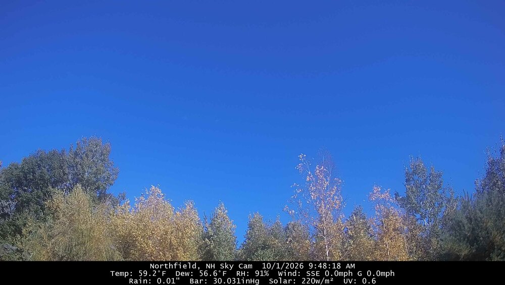
Enjoying it while it lasts
-
Back to avg wx with frost/freeze warnings out for tomorrow morning.
-

Occasional Thoughts on Climate Change
Typhoon Tip replied to donsutherland1's topic in Climate Change
https://phys.org/news/2026-09-science-strategy-transparency-anthropocene.html Mm .. honestly? There's no honesty there. Naivety perhaps, if someone believes it's just procedural contention. All that stuff about procedure mishandling, or turning phrases like "...Compromised evaluation" leading to "internal ethics report investigating these violations,.." strikes me as 'obsticularity' - i.e., blocking agenda. No, there's internal strife surrounding acceptance that human activity is causing climate change - that's what this is. And someone or group therein has some reason to block the labeling when it's perfectly valid. According to a quick conversation with AI ... "What is the reticence and/or outright resistance toward codifying a geological epoch as the "Anthropocene" ?" "The resistance is not mainly to the claim that humans are transforming Earth. There is broad agreement on that. The dispute is over whether those changes satisfy the technical rules for a formal geological epoch, and whether a single boundary can represent such a complex, uneven process. In March 2024, the International Union of Geological Sciences approved the rejection of the proposed Anthropocene Epoch. The proposal would have placed its beginning around 1952, using plutonium fallout from nuclear-weapons testing in sediments at Crawford Lake, Ontario, as the “golden spike”—a precisely defined physical marker for a boundary in the geological time scale. The Anthropocene therefore remains widely used, but not as an official epoch." Yeaaa, riiight. The problem I have with all that is for having suffered long years in observing the follies and vicissitudes human kind. What this smacks pretty egregiously like is no different than lawyers getting a murderer off "on a technicality" - a fundamental flaw in the execution of Law in our free society is that procedure should somehow circumvent culpability. So, the shimmering righteousness of human morality takes over and it is then used divisively. Whenever the implications of legislation is unappealing, ... most importantly, patently true, strategy is often redrawn to attack method. But it doesn't change the facts. Admitting human activity has led to climate change is a pacification device to turn down the heat while a stall can perpetuate. The hold outs for not label it as such and why? Dubious. There's probably something like "moles" (not per se but for lack of better word) up and down the ranks of the brain trust and "Universium" that may even have to answer to society during "back door conversations". Perhaps reticence in labeling it Anthropocene has more to do elsewhere - something powerful has something to lose. Perhaps I'm being too expressively cynical. Maybe. But given what's transpired in the last 150 years ... to mention, now more than ever is an exposing world that simply cannot conceal itself any longer like it used to, does anyone above a brick's intelligence believe that anything is or really ever was adjudicated with impartiality? Alright? so at least cautionary cynicism is required going forward. -
ray-nee
-
yeah. warm and rainy
-

E PA/NJ/DE Autumn 2026 Obs/Discussion
Birds~69 replied to PhiEaglesfan712's topic in Philadelphia Region
Lose tonight and it will be the shortest Red October on record... 66F/DP 64/Cloudy -
Records: Highs: EWR: 85 (1986) NYC: 88 (1927) LGA: 87 (1950) JFK: 85 (1986) Lows; EWR: 35 (1947) * very cold fall that year 1947 NYC: 36 (1947) LGA: 39 (1947) JFK: 41 (1992) Historical: 1752 - The second severe hurricane in two weeks hit the Carolinas. The Onslow County Courthouse was destroyed along with all its records, and Beacon Island disappeared. (David Ludlum) 1844: Through the 7th, a major hurricane swept over Jamaica, Cuba and Nassau and the Bahamas. According to early hurricane researcher William Redfield, the storm "exhibited an amount of injury and destruction such as is rarely known in the annals of commerce." 158 vessels were wrecked and 2,546 houses were destroyed along the- Cuban coast. (Ref. Wilson Wx. History) 1890: The weather service is first identified as a civilian agency when Congress, at the request of President Benjamin Harrison, passes an act transferring the Signal Service’s meteorological responsibilities to the newly-created U.S. Weather Bureau in the Department of Agriculture. 1893 - The second great hurricane of the 1893 season hit the Mississippi Delta Region drowning more than 1000 persons. (David Ludlum) 1893: On this day, the village of Caminadaville, Louisiana, was destroyed by a massive hurricane. Caminadaville was a vibrant fishing community in the late 19th century, located on Cheniere Caminada, adjacent to Grand Isle in coastal Jefferson Parish in Louisiana. It took five days for the news of this devastating hurricane to reach New Orleans. 1938: Grannis and Okay, Arkansas set an all-time high-temperature record for October for Arkansas with 105 degrees. 1954: On October 1st Boston, Massachusetts had a minimum temperature of 69 °F the warmest low temperature. This is also the highest minimum on Boston's records for October. (Ref. NOAA Boston Weather Events) 1958: NASA officially begins operations on October 1st, 1958. 1976: A ridge of high pressure brought record highs to parts of the Midwest. Locations reporting their warmest October temperatures included: Hatfield, WI: 94°, Preston, MN: 92° (also latest occurrence of 90 in a year), Neillsville, WI: 92°, Caledonia, MN: 91°, and Jump River, WI: 87°. Other daily record highs included: La Crosse, WI: 92°, Des Moines, IA: 92°, Kansas City, MO: 92°, Madison, WI: 90 °F. (Ref. Wilson Wx. History) 1977: While an F3 tornado traveled less than one-mile through Montfort Heights or the greater Cincinnati area, it destroyed 12 homes and damaged 15 others. There were 17 injuries. 1986: Heavy rainfall totals produced saturated soil conditions across parts of Oklahoma beginning the previous day. Conditions worsened across the area when more torrential rain fell during the first four days of October. Rainfall amounts of 6 to 10 inches were common, while 15 to 20 inch amounts were reported over north-central Oklahoma. The excessive rainfall caused most major rivers in the state to flood, requiring the evacuation of about 30,000 people from 25 towns. The floods destroyed 509 homes, damaged 3,957 others, and washed out many roads and bridges, including two bridges on I-35. (Ref. Wilson Wx. History) 1987 - A blast of cold arctic air hit the north central U.S. An afternoon thunderstorm slickened the streets of Duluth MN with hail and snow, and later in the afternoon, strong northerly winds reached 70 mph. Unseasonably warm weather continued in the Pacific northwest. Afternoon highs of 90 degrees at Olympia WA, 92 degrees at Portland OR, and 89 degrees at Seattle WA, were records for the month of October. For Seattle WA it marked the twenty- first daily record high for the year, a record total in itself. (The National Weather Summary) 1988 - Afternoon and evening thunderstorms produced severe weather across central Oklahoma and the eastern half of Texas. Thunderstorms in Texas produced softball size hail northwest of Nocona, and baseball size hail at Troy and Park Springs. (The National Weather Summary) (Storm Data) 1989 - Thunderstorms produced severe weather in the southeastern U.S. through the daytime and evening hours. Severe thunderstorms spawned eleven tornadoes, with seven of those tornadoes in Georgia. A tornado southwest of Moultrie, GA, killed two persons and injured a dozen others. Tornadoes also injured one person north of Graceville, FL, and two persons at Bartow, GA. (Storm Data) (The National Weather Summary) 1992: A strong 588 decameter heat ridge extended from the Plains to the West Coast bringing record highs. Areas reporting their warmest October temperatures included: Sheridan, WY: 92° and Billings, MT: 90°-Tied. (Ref. Wilson - Additional Temperatures Listed On This Link) 1994: Lightning hit a bow-and-arrow deer hunter, knocking him down from his 15 feet high stand near Prosperity, PA. He survived, but experienced second degree burns along with blurred vision. (Ref. Weather Guide Calendar with Phenomenal Weather Events 2011 Accord Pub. 2010, USA) 1998: Heavy rain fell across the Liberal area in Kansas for 24 hours with the heaviest rain falling during the morning and afternoon hours. Five to eight inches were reported with one unofficial report indicating 10 inches. Streets were flooded that had never flooded before. A local disaster was declared. (Ref. Wilson Wx. History) 1999: A strong cold front with a Canadian blast and moisture combined to bring snow to parts of the upper Midwest. Caledonia, MN with 2 inches and La Crosse, WI with 0.3 of an inch had their earliest measurable snowfall. (Ref. Wilson Wx. History) 2006: An extended heat ridge brought record highs to parts of the Plains. Wichita, KS recorded their hottest October day ever with 97°. Other daily record highs included: Dodge City, KS: 96°-Tied, Lincoln, NE: 94°, Kansas City, MO: 94° and Sioux City, IA: 91°-Tied. (Ref. Wilson Wx. History
-
67 / 64 cloudy. Warm next 48 hours with mid 70s - upper 70s today with the clouds, Warmest for a while tomorrow with mid 80s and perhaps a stray 90 in the hot spots with enough sun. Weekend split nice Saturday cooler / cloudy showers Sunday. Overall near normal 10/5 - 10/10 with a bit back and forth. Beyond there overall warmer.
-
DLH Sept mean of 59.5 is t16th warmest of 85 unique temps (PWS near old wx bureau site was 60.9). 55.8 is the midpoint temp. 3.45" of precip is 66th wettest of 142 unique amounts. 3.32" is the midpoint amount. TH co-op Sept mean of 58.7 is t22nd warmest of 71 unique temps. Midpoint temp is 57.0. 2.97" of precip is t68th wettest of 119 unique amounts. 3.30" is the midpoint amount. DLH & TH ended with a warmer Sept with near avg precip. Here's the difference from old wx bureau-PWS (downtown area)/DLH arpt 9/48 62.8/60.2 9/49 54.6/52.9 9/50 56.4/54.8 9/51 51.4/51.0 9/52 55.9/56.1 9/53 54.9/54.9 9/54 54.1/53.4 9/55 55.6/54.6 9/56 51.0/50.6 9/57 53.0/52.5 9/58 55.7/55.5 9/59 56.2/54.9 **** 9/23 62.0/61.9 9/24 65.3/64.3 * 9/26 60.9/59.5



.png.188021931e6029587c3ba0f8b75c696c.png)