All Activity
- Past hour
-

Hoisting the Sultan Signal: Heavy Rain Event July 5-7
Damage In Tolland replied to WxWatcher007's topic in New England
Look at that R++ headed at Taunton . Kid gonna end up 3-4” inches and 3-4 wives all at once . -

Hoisting the Sultan Signal: Heavy Rain Event July 5-7
Snowedin replied to WxWatcher007's topic in New England
Almost looks like your classic mid winter deform band setting up in the usual areas while the system slowly pulls away. But yeah, we’re catching up big time this afternoon in eastern mass. Finally getting the goodies! -
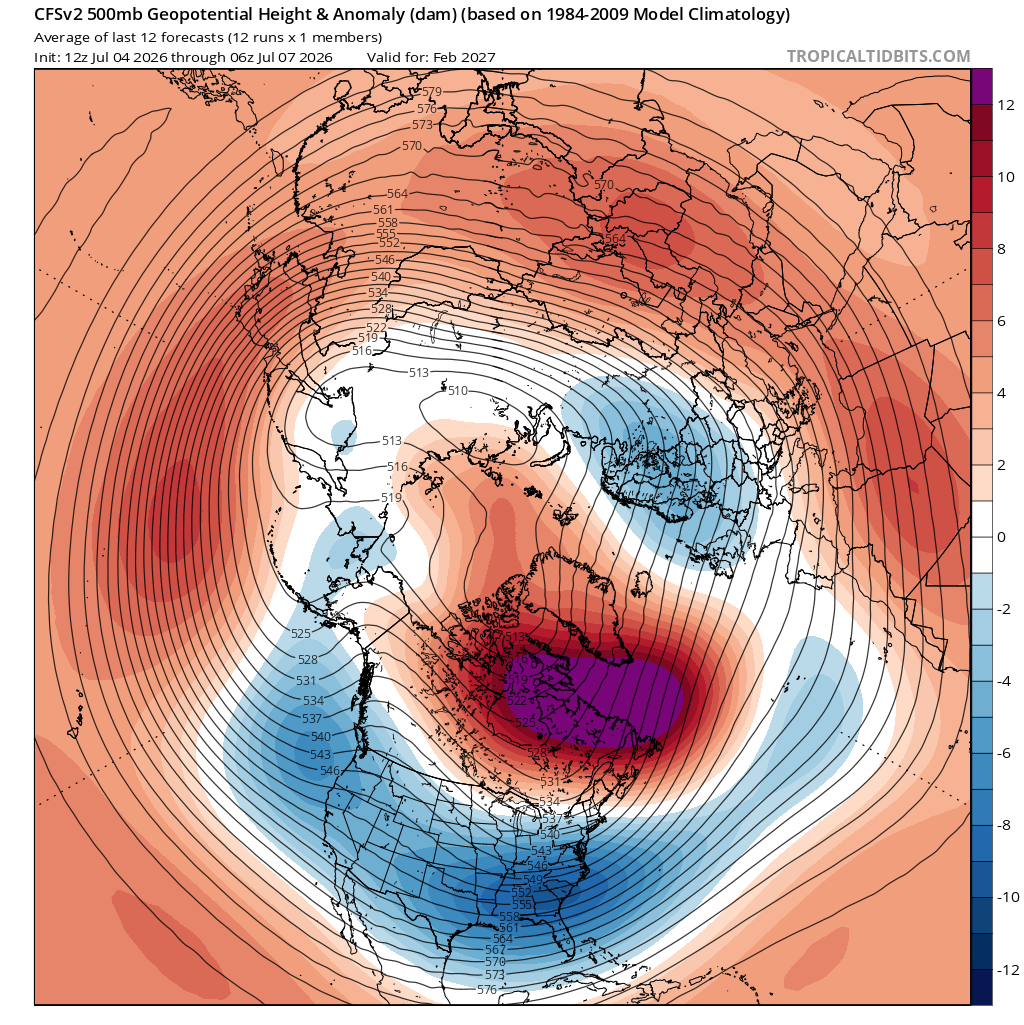
If we can't snow with that look it's time to Cloe the blinds for good
-

Hoisting the Sultan Signal: Heavy Rain Event July 5-7
kdxken replied to WxWatcher007's topic in New England
Make that two and a half. Another half in just the last hour. -
This definitely looks Giga
-
Well, we got Mega at least
-

Hoisting the Sultan Signal: Heavy Rain Event July 5-7
CoastalWx replied to WxWatcher007's topic in New England
Pillaging rains and winds. One thing that worked out, were the dynamics. Enough moisture transport and even deformation to help wring out precip from processes helping with efficient droplet production. I’ve seen that fail so I definitely underestimated that! -
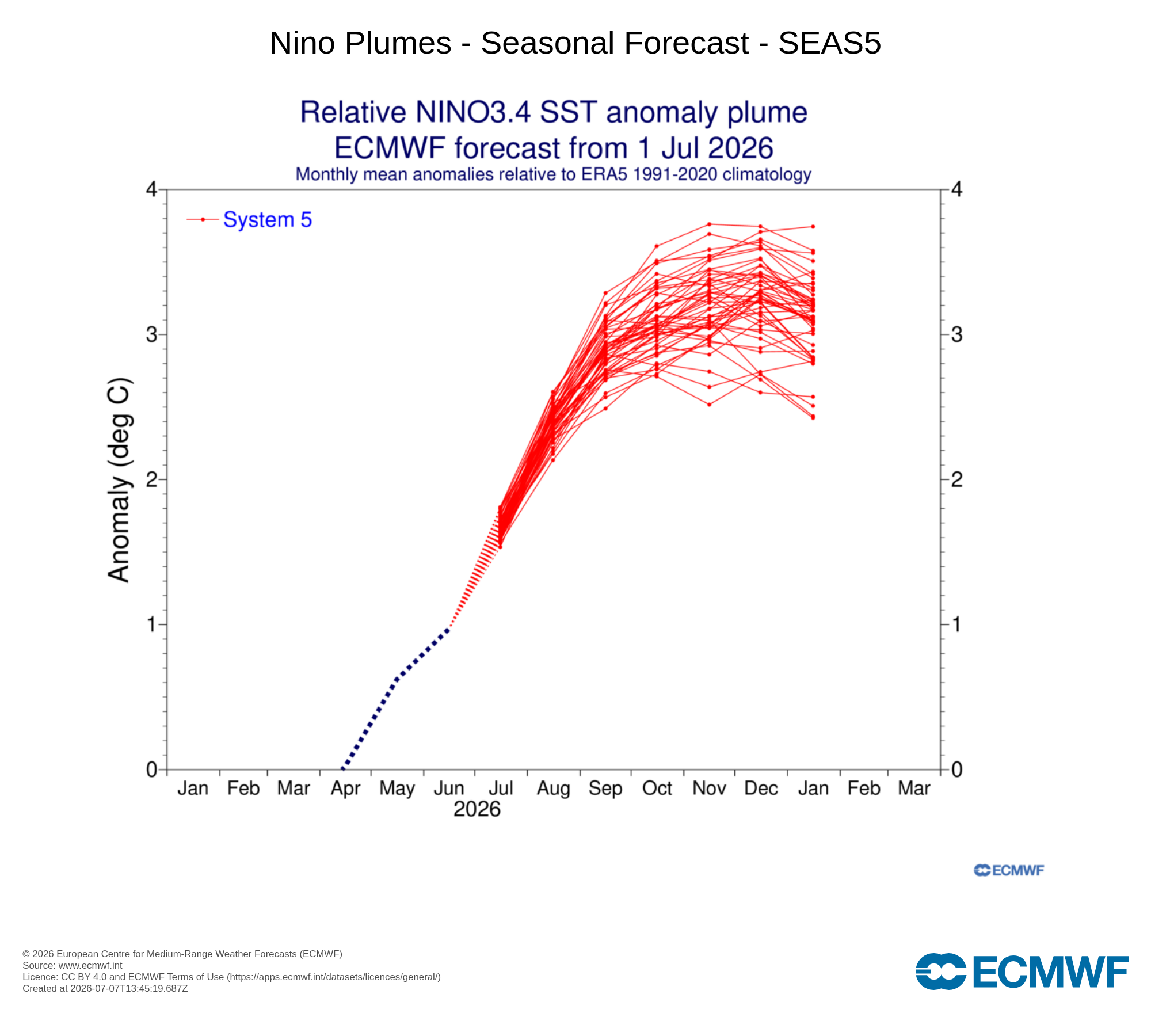
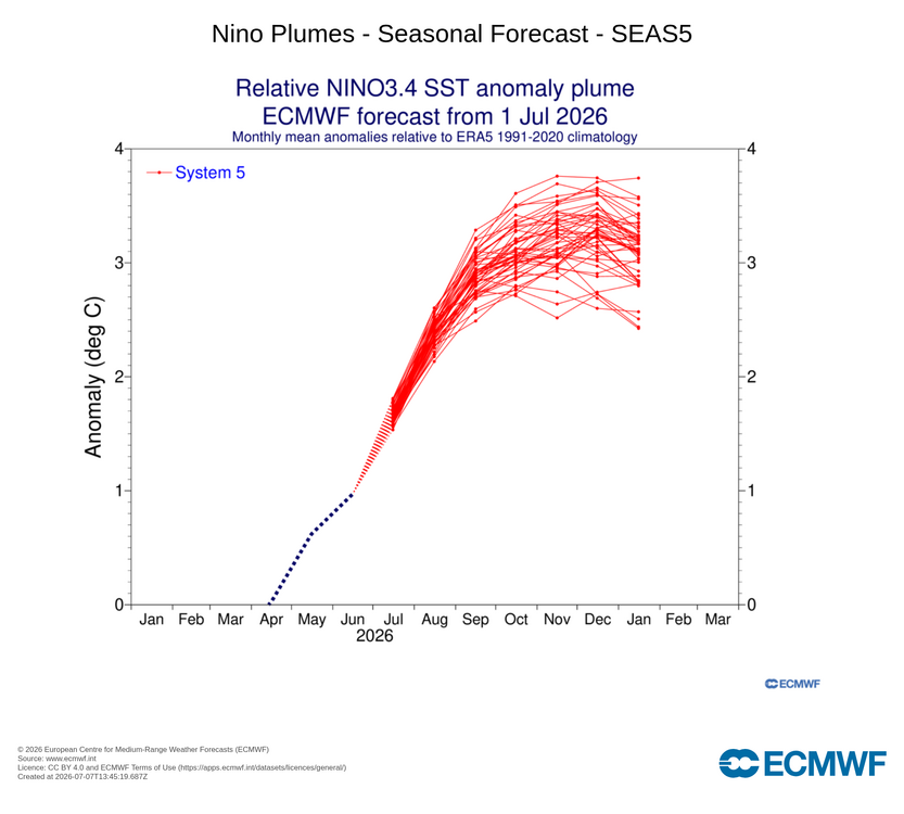
Fox weather says MONSTER Nino on the way
-
Hoisting the Sultan Signal: Heavy Rain Event July 5-7
bristolri_wx replied to WxWatcher007's topic in New England
If this storm teaches anyone anything it’s you shouldn’t say a forecast has busted until the storm is actually done. Models were all over the place on QPF, and yes they also had some outrageous amounts that may have not ended up occurring, but it was always showing a 2.5 day event, and different phases or chapters. Areas of rain have been pulsing, regenerating, and dying out for the entire duration of this storm. It also shows how much room for improvement there needs to be for modeling to nail down with better accuracy for these types of weather events. But the common sense forecast didn’t waiver much. There will be some larger numbers reported once things wind down, and the widespread 1-2” with 3-5” isolated spots will not be too far off what was being forecasted in the mid-range. -

Hoisting the Sultan Signal: Heavy Rain Event July 5-7
Typhoon Tip replied to WxWatcher007's topic in New England
mm not really. Snark aside ... I posted the monthly means every month of this last winter. We were always the coldest or proximal to the coldest region during the 3rd warmest winter on record. Oh, but look out! It'll be the warmest nights ever -
Love to see it
-
Got a nice 1/3" today. Needed that bad.
-
Taunton well up over 2”!
-
We had some drizzle and mist earlier but skies are brightening-today felt like October with temps stuck in the mid 60's
-
Nice n warm aftrn. 80 with 69 dew. Last night's rain helped with that.
-
 @Typhoon Tip Will love this https://www.the-independent.com/life-style/cold-blob-atlantic-ocean-amoc-current-climate-change-b3009895.html
 - Today
-

Hoisting the Sultan Signal: Heavy Rain Event July 5-7
tamarack replied to WxWatcher007's topic in New England
Mostly cloudy 70s here, not a drop since June 28. Water table is fine (5.53" in June) but the upper 6" is pretty dry. -

Hoisting the Sultan Signal: Heavy Rain Event July 5-7
powderfreak replied to WxWatcher007's topic in New England
But only in summer, not in winter. -
Hoisting the Sultan Signal: Heavy Rain Event July 5-7
Typhoon Tip replied to WxWatcher007's topic in New England
It's a bit uncanny too because of the Meteorology going on over this "cold" air. It's 582 heights with 570 dm hydrostats... We've been 96 F on those parametrics before. There's something peculiar about this area of the planet Earth. It's always, always, always, at least excuse imagined, the coldest it can possibly be relative to anything allowed. -
Additional .11 so far 1.22 for the event
-
Nice little rain falling. 4th day in a row with some rain. .09 today so far. 1.90 for month.
-
Drizzle here
-
Well, It's Raining Again
-
Socked in here all day. Even some mist / drizzle at times earlier. Temperature never got out of the 60's. High on the day 69.
-
Looks like yet another dry day here. Some rain would be nice. I don't see any sign of that any time soon. I don't count thunderstorms. They only hit Glen Burnie and Frederick lol