All Activity
- Past hour
-
Glad we could break 94/75 with no rain. God does SNE suck.
-
As warm/hot as it has been past couple of days, no records here. High yesterday before storms rolled in was 90.1 degrees, record is 92 from 1984. Got 0.14" from the storm, every drop counts!
-
Who cares
-
Scored .24" last evening in a T-Shower. Better than nothing I suppose. Air has better "feel" to it this morning. The humidity yesterday was foul. Cleaner air mass in place with deep blue skies. Still no Canadian smoke this season, that's a plus.
-
Departures through Jun 12th EWR: +5.2 JFK: +4.8 LGA: +4.4 NYC: +3.8
-
Records: Highs: EWR: 99 (2017) NYC: 96 (1961) LGA: 101 (2017) JFK: 95 (1983) Lows: EWR: 51 (1982) NYC: 51 (1953) LGA: 51 (1982) JFK: 51 (1980) Historical: 1586: (23 June current calendar) Roanoke Colony, North Carolina: First European report of waterspout off US coast by Ralph Lane, a member of Sir Francis Drake's fleet: "There were great spouts at the seas as though heaven and earth would have met." (Ref. WxDoctor) 1889 - Forest fires in northern Wisconsin and northeast Minnesota were in the process of destroying millions of dollars of board feet of timber. (David Ludlum) 1907 - The temperature at Tamarack, CA, dipped to 2 degrees above zero, the lowest reading of record for June for the U.S. The high that day was 30 degrees. Tamarack received 42 inches of snow between the 10th and the 13th. On the 13th the snow depth was 130 inches. (The Weather Channel) 1955: Water from the Spring Mountains swept down on Las Vegas, NV after a violent thunderstorm of rain and hail, virtually isolating the City, flooding hundreds of homes and stores and causing an untold amount in property damage. Residents of the Twin Lakes Subdivision reported that a four-foot wall of water came down from the slope of Mt. Charleston. Hardest hit was the Brentwood Park Tract, where large stocks of lumber, stacked for construction on new homes, were washed away by the flood, and littered the Municipal Golf Course and Twin Lakes Subdivision. (Ref. Wilson Wx. History) 1956: Boston, Massachusetts recorded peak gust of 84 mph gusts during a thunderstorm. (Ref. NOAA Boston Weather Events) 1967: Three separate lines of thunderstorms developed and raced across eastern South Dakota. The storms dumped up to 5 inches of rain and hail the size of golf balls was common. Winds gusted to 71 mph in the Aberdeen area resulting in some damage. Crop damage was 100% in some areas in the northeast due to the relentless hail and flooding rains. (Ref. Wilson Wx. History) 1968: A violent F5 tornado killed 9 people at Tracy, MN. Over 110 homes were destroyed, while a steel I-beam was reportedly carried for 2 miles on a piece of roof. Two farms hit by this tornado were also hit by a violent F4 tornado on 6/24/1924.(Ref. Wilson Wx. History) 1969: 10 inches of snow fell in Deerfield, SD as an unusual late season storm covered parts of South Dakota, Wyoming, Montana and Nebraska. Five inches of snow was measured at Great Falls, MT. The low temperature at Billings, MT fell to 32°, their latest freeze on record. The temperature also fell to 32° the previous day; both tying a record low for the month of June. (Ref. Wilson Wx. History) 1973: Dust devils are not tornadoes, but they can still lift heavy objects. At Jennison, MI, a dust devil picked up a rug, stepladder, and a patio umbrella. It also lifted a 350-lb concrete patio table and dropped it 3 feet away (in several pieces after the landing). (Ref. Weather Guide Calendar with Phenomenal Weather Events 2011 Accord Pub. 2010, USA) 1976: A deadly tornado moved across parts of the southwestern Chicago, IL suburbs killing two people and injuring 23 others. The tornado, with winds over 200 mph moved from Lemont to Downers Grove causing $13 million dollars in damage when 89 homes were destroyed and another 90 were damaged. The tornado passed over the Argonne National Laboratory, peeling part of a roof off the building housing a nuclear reactor. The tornadoes movement was rather erratic moving southeast the north and finally turning northwest. (Ref. Wilson Wx. History) 1984 - Severe thunderstorms struck Denver deluging the city with five inches of rain, and leaving up to six feet of water in some places. Softball size hail smashed windshields and ripped through metal cars. Snow plows had to be called out. (The Weather Channel) 1987 - Fifteen cities in the north central U.S. reported record high temperatures for the date, including International Falls, MN, with a reading of 92 degrees. Mason City IA and Waterloo IA reported record highs of 100 degrees. Thunderstorms in the northeastern U.S. produced golf ball size hail around Hamilton Square NJ, along with high winds which tore the roof off a hospital causing a million dollars damage. Averill Park NY was deluged with 1.64 inches of rain in fifteen minutes. (Storm Data) (The National Weather Summary) 1988 - Afternoon thunderstorms produced severe weather in the Southern and Central Plains Region. Forrest NM was deluged with 5.5 inches of rain in ninety minutes. Temperatures soared into the 90s across much of the eastern half of the nation, including New England. Northern Illinois reported a record twenty straight days of dry weather. (The National Weather Summary) 1989 - Thunderstorms produced severe weather from the Southern Plains Region to the Carolinas during the day and night, and continued to drench parts of Texas and Oklahoma with heavy rain. Oklahoma City reported 13.41 inches of rain for the first thirteen days of the month, and Fort Worth TX reported 29.56 inches for the year, a total more than 13 inches above normal. Severe drought continued to rage across South Texas. (The National Weather Summary) 1991: Lightning struck a tree at the U.S. Open Golf Tournament being held at Chaska, MN. One spectator was killed, and six others were injured. (Ref. Wilson Wx. History) 1993: Four inches of rain fell in one hour on Lenox, IA as the Great Mississippi Flood of 1993 was beginning. (Ref. Wilson Wx. History) 1994: A series of violent thunderstorms roared across parts of western and central New York. The thunderstorm winds downed trees and power lines. A tornado touched down in the town of Freedom. Damage was intermittent along the mile long path, with only tree damage for the first 3/4 mile. Over its last quarter mile the tornado destroyed a 25 x 25 foot garage. The tornado then struck the Pleasantview Mobile Home Park. A roof which was blown off one mobile home penetrated the wall of another home about 200 feet away. Two other mobile homes were lifted and moved off their foundations. The thunderstorms dropped between two and four inches of rain which produced flash flooding. One hundred basements were flooded in Jamestown. Damage from flash flooding was extensive in Allegany State Park in Cattaraugus County. Two recreational bridges collapsed and other major bridges were undermined. Beaches were damaged extensively and roads were washed out. In one instance, the blacktop from one road was carried over 20 feet. (Ref. Wilson Wx. History) 2002: As thunderstorms roared through Ponca City, OK with lots of large hail and wall clouds, lightning caused a fire at a Conoco refinery. The news immediately sent gasoline futures higher by 50 points. The refinery was back on line quickly, but gasoline prices rose a few extra cents in time for the Fourth of July Holiday. (Ref. Wilson Wx. History) 2005: Low pressure, the remnants of Hurricane Arlene, moved northeast across the Great Lakes. The bands of showers and thunderstorms produced damage across parts of the Niagara Frontier and Finger Lakes. Heavy rains produced flash flooding in Livingston County, an area which received heavy rains on several consecutive days. The strong winds downed trees and limbs in Le Roy, Stafford, Mendon, Livonia, Lockport, Kendall, and Clarkson. (Ref. Wilson Wx. History)
-
75 / 59 much drier today. wonderful day on tap warm / dry and sunny upper 80s - low 90s making it a heatwave for some. Tomorrow warm/ and potentially stormy later in the evening and overnight as the front comes through, pending on clouds mid 80s to low 90s. Cooler Mon - Wed then a brief surge of dew points and temp Thu (next shot at 90) before next front comes through. The period 6/19 - 6/24 trough generally into the Midwest / northeast looks overall near normal to slightly above and features storm chances. Beyond there and through the close of the month near to above normal with next heat chance as we move into next month.
-
Just based on feel, being out and about in Manhattan there was no was it was a run of the mil around 90 degree day. It had to be mid to upper 90s out. The Park was especially lagging yday considering we haven't had alot of heavy rain lately. It doesnt make sense that even the heliport downtown was running ahead of the Park and their sensor is sitting on a pier sticking out into the East River, just about to open into Upper NY Bay.
-
-
Got down to 74 for the low before started warming up. Sun already baking!
-

2026-2027 Super El Nino
csnavywx replied to Stormchaserchuck1's topic in Weather Forecasting and Discussion
It's possible. I'm kind of leaning that way this time since we're likely to get a fully coupled and canonical ('97-like) full warm pool discharge and it will take some time for that to recover. -

Junorch obs and discussion 2026
Damage In Tolland replied to Damage In Tolland's topic in New England
Let’s tear as much down as possible! - Today
-
Thursday could be an interesting day in these parts.
-
Yeah, the tree growth over the equipment since the 90s when the trees are leafed out from the spring into late fall has been creating an artificial high temperature cooling there. I can remember when the station was out in the open and often had warmer highs than LGA and sometimes Newark. More record highs today around the area. RECORD EVENT REPORT NATIONAL WEATHER SERVICE NEW YORK, NY 252 AM EDT SAT JUN 13 2026 ...RECORD DAILY HIGH TEMPERATURE SET AT LAGUARDIA NY... THE HIGH TEMPERATURE REACHED 98 DEGREES FRIDAY, JUNE 12 AT LAGUARDIA AIRPORT. THIS BREAKS THE OLD RECORD OF 96 DEGREES, SET IN 2017. RECORDS FOR THE LAGUARDIA NY AREA GO BACK TO 1939. RECORD EVENT REPORT NATIONAL WEATHER SERVICE NEW YORK, NY 252 AM EDT SAT JUN 13 2026 ...RECORD DAILY HIGH TEMPERATURE, HIGH MINIMUM TEMPERATURE SET AT ISLIP NY... THE HIGH TEMPERATURE REACHED 94 DEGREES FRIDAY, JUNE 12 AT ISLIP MACARTHUR AIRPORT. THIS BREAKS THE OLD RECORD OF 91 DEGREES, SET IN 2017. THE LOW TEMPERATURE WAS ONLY 72 DEGREES FRIDAY, JUNE 12 AT ISLIP MACARTHUR AIRPORT. THIS BREAKS THE OLD RECORD HIGH MINIMUM OF 70 DEGREES, SET IN 1973. RECORDS FOR THE ISLIP NY AREA GO BACK TO 1963. RECORD EVENT REPORT NATIONAL WEATHER SERVICE MOUNT HOLLY NJ 530 PM EDT FRI JUN 12 2026 ...RECORD HIGH TEMPERATURE BROKEN IN PHILADELPHIA PA... A HIGH TEMPERATURE OF 98 DEGREES WAS RECORDED AT THE PHILADELPHIA INTERNATIONAL AIRPORT IN PHILADELPHIA PA TODAY. THIS BREAKS THE OLD RECORD HIGH FOR TODAY OF 95 DEGREES PREVIOUSLY SET IN 1947 AND 2015. RECORDS FOR THE PHILADELPHIA PA AREA DATE BACK TO 1872. RECORD EVENT REPORT NATIONAL WEATHER SERVICE NEW YORK, NY 438 PM EDT FRI JUN 12 2026 ...RECORD DAILY HIGH TEMPERATURE SET AT KENNEDY NY... THE HIGH TEMPERATURE REACHED 95 DEGREES TODAY AT JOHN F. KENNEDY INTERNATIONAL AIRPORT. THIS BREAKS THE OLD RECORD OF 92 DEGREES, SET IN 2017. RECORDS FOR THE KENNEDY NY AREA GO BACK TO 1948. RECORD HIGH TEMPERATURE BROKEN AT ATLANTIC CITY AIRPORT NJ... A HIGH TEMPERATURE OF 96 DEGREES WAS RECORDED AT THE ATLANTIC CITY INTERNATIONAL AIRPORT NEAR ATLANTIC CITY NJ TODAY. THIS BREAKS THE OLD RECORD HIGH FOR TODAY OF 94 DEGREES PREVIOUSLY SET IN 2017. RECORDS FOR THE ATLANTIC CITY AIRPORT NJ AREA DATE BACK TO 1943. RECORD EVENT REPORT NATIONAL WEATHER SERVICE MOUNT HOLLY NJ 528 PM EDT FRI JUN 12 2026 ...RECORD HIGH TEMPERATURE TIED IN TRENTON NJ... A HIGH TEMPERATURE OF 94 DEGREES WAS RECORDED AT THE TRENTON-MERCER AIRPORT NEAR TRENTON NJ TODAY. THIS TIES THE RECORD HIGH FOR TODAY PREVIOUSLY SET IN 1933. Data for June 12, 2026 through June 12, 2026 Click column heading to sort ascending, click again to sort descending. NY LAGUARDIA AIRPORT WBAN 98 NJ TETERBORO AIRPORT COOP 97 NJ HARRISON COOP 97 NJ NEWARK LIBERTY INTL AP WBAN 96 NJ TETERBORO AIRPORT WBAN 95 CT NORWICH PUBLIC UTILITY PLANT COOP 95 NY ISLIP-LI MACARTHUR AP WBAN 94 NY SHRUB OAK COOP 93 NY CENTERPORT COOP 93 NY FARMINGDALE REPUBLIC AP WBAN 93 NY PORT JERVIS COOP 93 NJ CALDWELL ESSEX COUNTY AP WBAN 93 NY SHIRLEY BROOKHAVEN AIRPORT WBAN 93 NY BAITING HOLLOW COOP 93 NJ CHARLOTTEBURG RESERVOIR COOP 92 CT MERIDEN MARKHAM MUNICIPAL AP WBAN 92 NY SYOSSET COOP 92 NY ST. JAMES COOP 92 NY UPTON COOP - NWSFO NEW YORK COOP 92 CT IGOR I SIKORSKY MEMORIAL AIRPORT WBAN 91 NY WESTCHESTER CO AP WBAN 91 CT GUILFORD COOP 91 NY RIVERHEAD RESEARCH FARM COOP 91 NY MONTGOMERY ORANGE COUNTY AP WBAN 90 NY NY CITY CENTRAL PARK WBAN 90 NY ORIENT POINT STATE PARK COOP 90 Data for June 11, 2026 through June 11, 2026 Click column heading to sort ascending, click again to sort descending. NJ NEWARK LIBERTY INTL AP WBAN 97 NJ TETERBORO AIRPORT WBAN 97 NY LAGUARDIA AIRPORT WBAN 96 NY JFK INTERNATIONAL AIRPORT WBAN 95 NJ CALDWELL ESSEX COUNTY AP WBAN 94 NY PORT AUTH DOWNTN MANHATTAN WALL ST HEL ICAO 93 NY MONTGOMERY ORANGE COUNTY AP WBAN 93 NY FARMINGDALE REPUBLIC AP WBAN 93 CT MERIDEN MARKHAM MUNICIPAL AP WBAN 93 NY WESTCHESTER CO AP WBAN 92 NY ISLIP-LI MACARTHUR AP WBAN 92 NY RIVERHEAD RESEARCH FARM COOP 92 NY SHIRLEY BROOKHAVEN AIRPORT WBAN 92 NY NY CITY CENTRAL PARK WBAN 91
-

Central PA Summer 2026 Discussion/Obs Thread
pawatch replied to Voyager's topic in Upstate New York/Pennsylvania
57 degrees for the low this morning. Blue bird sky. -
The Hamden F4 is my earliest memory. We’re due!
-
Closest Cocorahs station to my location showing on 2.15” of rain since May 1st. Arid.
-
Lol 71/61 here.
-
Think that was the best I’ve ever seen any usmnt play
-
62.0/56 Refreshing morning.
-

Central PA Summer 2026 Discussion/Obs Thread
mahantango#1 replied to Voyager's topic in Upstate New York/Pennsylvania
US National Weather Service State College PA Favorites · · 530 AM Saturday June 13th, 2026: Enjoy today with lots of sun and lower humidity than in recent days. There is potential for more strong to severe storms on Sunday, mainly during the afternoon into the evening. The main threat will be strong winds and heavy downpours. -
Central PA Summer 2026 Discussion/Obs Thread
mahantango#1 replied to Voyager's topic in Upstate New York/Pennsylvania
-
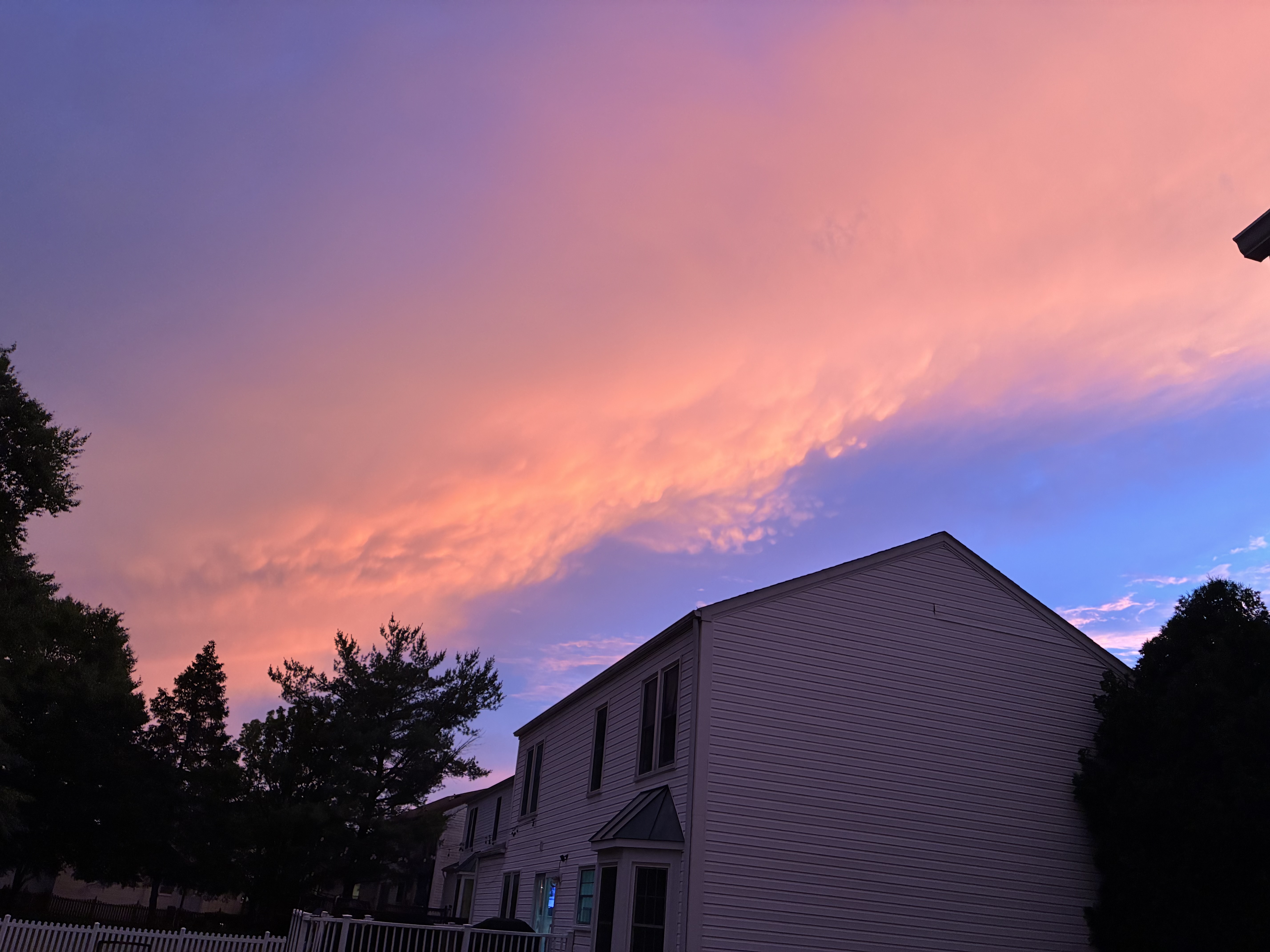
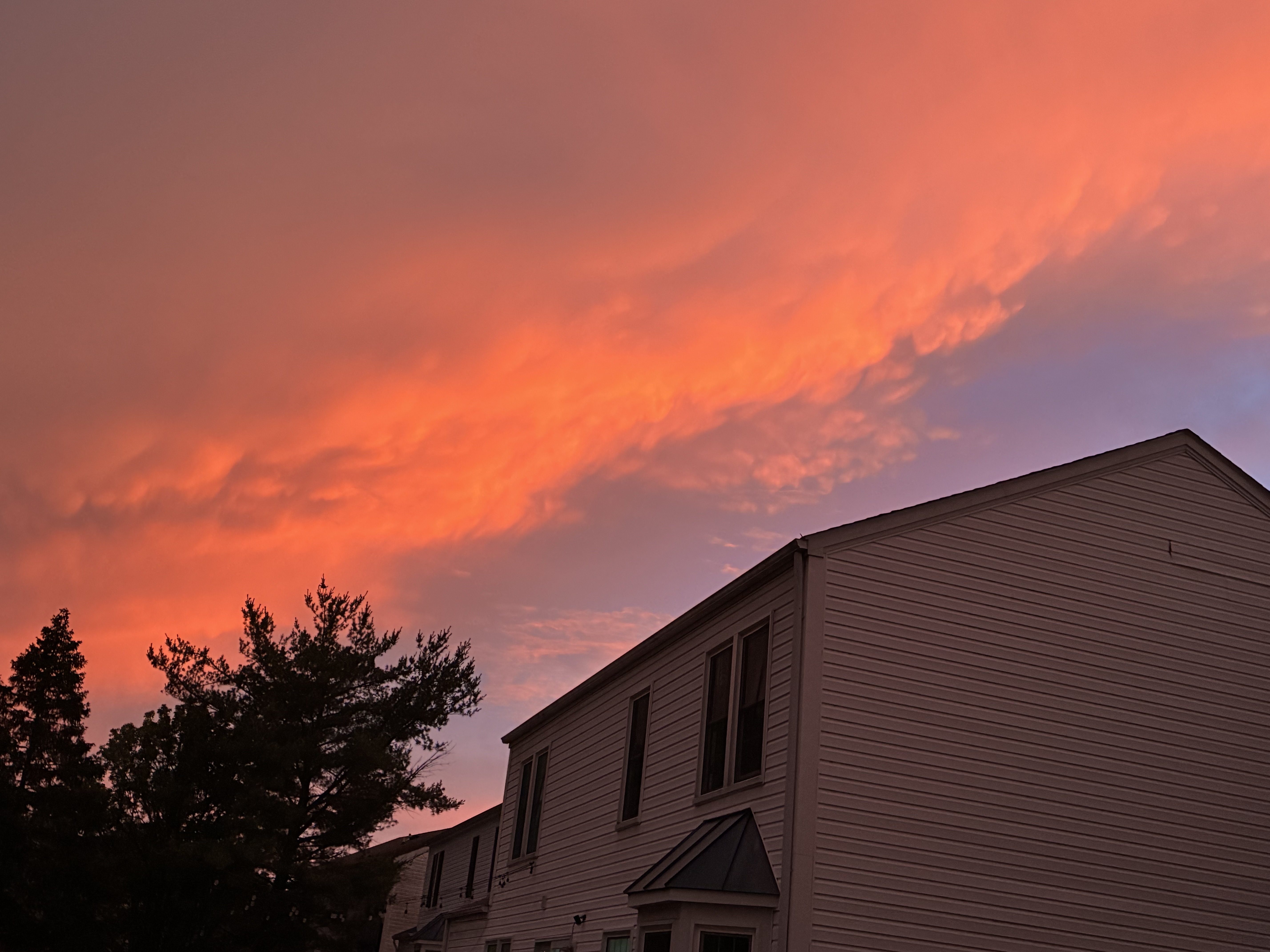
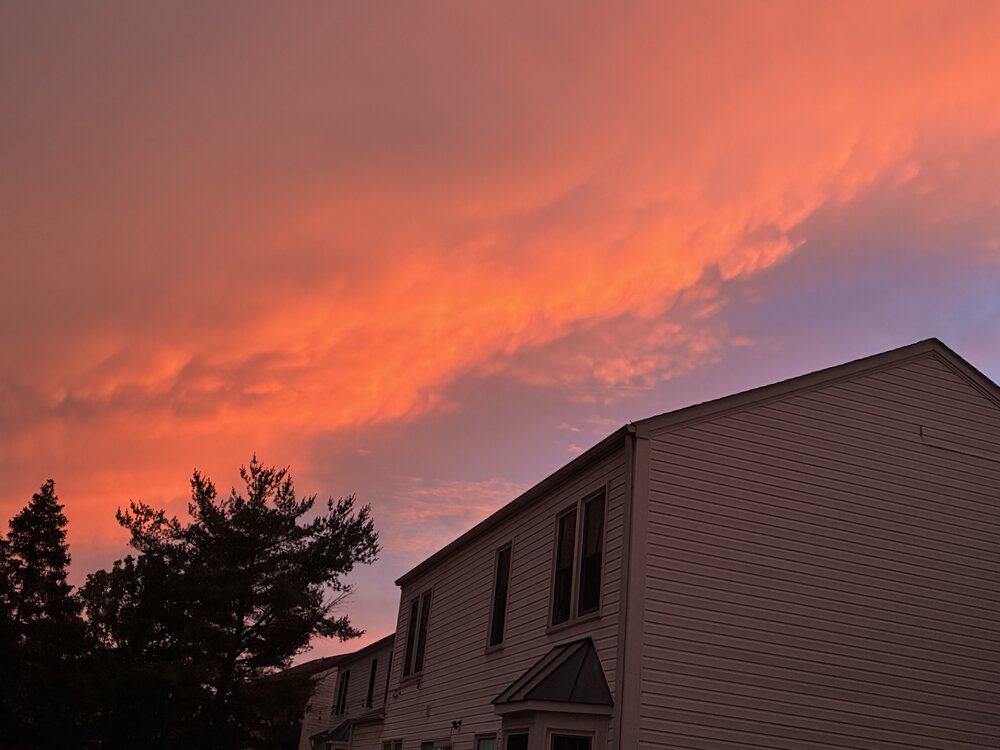
One more from Friday sunset

-
Photos from sunset Friday in Columbia

-
Central PA Summer 2026 Discussion/Obs Thread
mahantango#1 replied to Voyager's topic in Upstate New York/Pennsylvania
.CLIMATE... The high temperature on Friday at Harrisburg reached 94 degrees. This broke the old record of 92 degrees, last set in 2017.