All Activity
- Past hour
-
.40, was muggy this morning around 8am, not anymore.
-
And it makes intuitive sense that more Siberian snow creates a contrast with the warm W PAC near Japan and enhances the Pacific jet. The warm mid latitudes may be altering the Hadley Cell which some have pointed out. So to me it makes sense how these factors work together to ruin our pattern where I live for snow. I don’t like it but the planet and its feedbacks don’t care what I want. Guess I can buy a cabin in ME for the winter where there are still plenty of very snowy winters left to look forward to.
-
Small line of showers, seemingly right along the front. Winds have really picked up.
-

2025-2026 ENSO
TheClimateChanger replied to 40/70 Benchmark's topic in Weather Forecasting and Discussion
Increased Siberian snow cover is, in part, a consequence of a warming Arctic: Enhanced Arctic moisture transport toward Siberia in autumn revealed by tagged moisture transport model experiment | npj Climate and Atmospheric Science -

Central PA Fall Discussions and Obs
Jns2183 replied to ChescoWx's topic in Upstate New York/Pennsylvania
It ripped way harder and was way windier than expected. I'm just happy October is well on its way to normal rain Sent from my SM-G970U1 using Tapatalk -
Still raining here but back edge coming-about a half inch-I'll take it.
-

Central PA Fall Discussions and Obs
Itstrainingtime replied to ChescoWx's topic in Upstate New York/Pennsylvania
Man, a lot of you got over 1" more of rain than I did. Impressive totals from Harrisburg north. -
Central PA Fall Discussions and Obs
Itstrainingtime replied to ChescoWx's topic in Upstate New York/Pennsylvania
Haha! All I know is when she was over at our place this past weekend she told my wife and I she was going to Marysville on Wednesday and Thursday this week. I yelled "Blizz!" in response. -
Upper teens n 20's for lows this morning. A crisp AM across my area, n others. Radiational cooling really blew the forecast. Much cooler than cast. Another cold one tomorrow AM with freeze warnings out again. Frost/Freeze adv will probably be done after this as growing season is over here now.
-
Yep. My grass under the trees is brown. 0.18 now. Won’t do much at all
-

Spooky Season (October Disco Thread)
tamarack replied to Prismshine Productions's topic in New England
1995-96 was by far (29" ahead of #2) our snowiest winter of 13 at Gardiner, though the thaws left SDDs in 5th place. Five straight months began with cold and snow, finished with mild and wet. Cherrypicking the dates illustrates the contrasts. The top line shows the data for Dec 1-21, Jan 1-16, Feb 1-19, Mar 1-11 and April 1/14 - total of 81 days. Lower line combines the remainders of those months, 71 total days. Avg max Avg min Depart. Precip Snow SN/day 26.4 9.1 -6.4 11.56" 127.4" 1.57" 44.1 24.2 +4.8 14.58 9.2 0.13" -
I let mine run this morning, as scheduled. Glad I did, so far only 0.17”
-
Unless the whole world does something and is in total agreement, there is zero solve for cc. Live your life how you see fit.
-

Spooky Season (October Disco Thread)
TauntonBlizzard2013 replied to Prismshine Productions's topic in New England
0.51 -

Spooky Season (October Disco Thread)
eyewall replied to Prismshine Productions's topic in New England
No filters just some basic processing in Lightroom but the colors were really vibrant then. -
Need a vei 7 for that to happen
-
.70" nice event.
-

Spooky Season (October Disco Thread)
SJonesWX replied to Prismshine Productions's topic in New England
<0.25" here -
I think looking at precipitation only is insufficient to determine dryness without also considering the impact of elevated temperatures on the hydrological cycle. Ground and surface waters may tell a different story. We can see for instance Lake Champlain is teetering on the edge of its all-time record low level. We can see from this September 4th article, the all-time low level is 92.4' set in 1908. Source: Lake Champlain approaching record low levels | WAMC We can see in recent days, the lake has dropped to within about 7" of that record, although it has recovered a bit today in response to recent rains.
-
Rain picking up here
-
Spooky Season (October Disco Thread)
tamarack replied to Prismshine Productions's topic in New England
We lived in Gardiner then, 9 miles south from AUG. Oct. 6, 1995: 51/45, 2.33". Tiny shower about 8 last evening 0.01", almost mocking. Dumped precisely 1.00" from the Stratus this morning and radar suggests a final total near 1.5". -

Spooky Season (October Disco Thread)
moneypitmike replied to Prismshine Productions's topic in New England
59 off the overnight low of 65. -
E PA/NJ/DE Autumn 2025 Obs/Discussion
Bluescat1 replied to PhiEaglesfan712's topic in Philadelphia Region
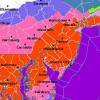
Did anyone see the radar this morning? The frontal rain was moving from west to east, but a line of storms was moving from north to south. -

Central PA Fall Discussions and Obs
sauss06 replied to ChescoWx's topic in Upstate New York/Pennsylvania
details, so we can crash -

Spooky Season (October Disco Thread)
WxWatcher007 replied to Prismshine Productions's topic in New England
Not as good this year for sure. Pictures still don’t do it justice though. This is the SLK/Lake Placid area.


