All Activity
- Past hour
-

December 2025 regional war/obs/disco thread
moneypitmike replied to Torch Tiger's topic in New England
Canceling Sunday or the winter? -

December 2025 Short/Medium Range Forecast Thread
Carvers Gap replied to John1122's topic in Tennessee Valley
For kicks and giggles, take a look at the blizzard warning posted for West VA. -
Pattern favors DC to VA area
-

December 2025 regional war/obs/disco thread
40/70 Benchmark replied to Torch Tiger's topic in New England
Jesus, it's brutal in here....give it until 12z tomorrow before cancelling. We have an uber-fast flow with two tiny parcels of energy from the arctic phasing while diving SE at break-neck speeds...won't be resolved until late week. -
Super mega deathtron frost with freezing fog this am
-
December 2025 Short/Medium Range Forecast Thread
Carvers Gap replied to John1122's topic in Tennessee Valley
Just looking at yesterday’s Euro weeklies which have been the source of much gnashing of teeth and have the worst possible of all the outcomes. Warms up Christmas and is back to this current colder pattern by mid Jan. Wash, rinse, repeat. Actually, temps return to seasonal abruptly during the second week of Jan. Seasonal during that time frame will get the job done. -
6Z euro looks good for Baltimore
-
29/23, hoping that light precip just to my west makes it in here as frozen. 50s on Christmas Eve and a cold rain on Christmas Day, a true holiday of yore being projected at this point.
-
Yep the annual Xmas week torch. You can set a clock to it.
-
Fields looking about cooked but we will see what daylight brings. Biggest tragedy, these 24-hour cheap shots. Mama Said https://youtu.be/yMGWQKn9Ers?si=de4RPur-3z1MyG5f
-
34 and rain snow mix so far this morning. Roads just slushy.
-

2025-2026 Fall/Winter Mountain Thread
Buckethead replied to Buckethead's topic in Southeastern States
26 with flurries and fog in the Cane River Valley right now. That's interesting considering it's partly cloudy. Sent from my Pixel 10 Pro using Tapatalk -
Unless we get the 4” in Central Park the stats for La Niña show mark the difference between the good and bad Nina outcomes, have to think this one would follow that trend. Central Park had 3.1” last Dec I believe and still ended way below average for snow.
-
Same. Parking lot puddles and bare ground rearing its head again. Second half of December torch. December 2013 played out kind of similar too. Fingers crossed January and February are epic.
-

E PA/NJ/DE Winter 2025-26 Obs/Discussion
penndotguy replied to LVblizzard's topic in Philadelphia Region
Another WWA out here in Berks, yes let’s go, starting out as the Winter of Yore. -
Yeah, we can't leave December without at least an inch or two of snow. Cold and snowless Decembers are the absolute worst. 2022-23 is a very good example. I can't remember a time when a cold and low snow December produced a great rest of the winter season.
-
I have to think there’s something here with how cold it’s been. It’ll probably be the minor 1-2” clipper but something to cover the ground at least which we got last Dec. But like you said who knows.
-
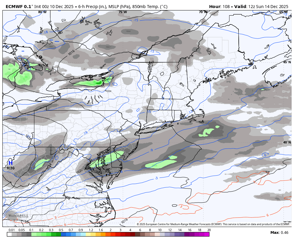
Two decent runs from the GFS for the possible lowlands event on Sunday. It gives the lowlands south of Baltimore 2-3/2-4. It would be nice to score again before the pattern flips to who knows what.
-
December 2025 Short/Medium Range Forecast Thread
Carvers Gap replied to John1122's topic in Tennessee Valley
From what I can tell on the 6z GFS, the warmth rolls in and the warmth rolls out w/ each cold front. The warmth in the medium/LR is originating from a chinook. Whether that is MJO related, feel free to debate. However, as we have seen with other warmups, the warmth on deterministic models is being eroded into shorter timeframes as it gets closer. At one point, medium range modeling had the Dec 14th system moderated to a minor cold front passage. As is, we likely see very cold wind chills with this and temps in the lower teens and upper single digits in portions of NE TN. The mountains will be below zero. Just using the 6z GFS which looks reasonable. Temps warm on Dec18th and 19th before another cool front arrives. Then temps warm from Dec 21-24, before the GFS slams the door on it. The danger w/ this Dec 20th front is that modeling could be too weak. The 0z CMC has what looks to be an anafront line up in the Plains during that time. A trend I have noticed w/ modeling is that cold fronts are modeled as pretty vigorous at range. Then, they are moderated...then w/ about 7-10 days to go...the are much colder yet again. Just combing through ensembles this AM...the 0z GEFS erases the aforementioned chinook warmth by Dec 26. The 6z GEFS is still rolling. The 0z CFSv2 basically repeated the current pattern through the entire run. It has a strong cold shot to end December and begin January. More on that later if 6z and 12z support that run. The trend we have been seeing for weeks is modeling which moderates temps of warmth which roll through. TRI is -5.4F for the month so far. -
All ensembles have a very mild pattern coming up
-
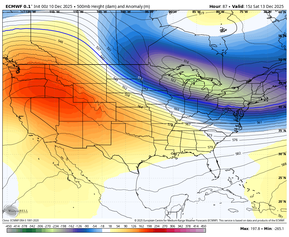
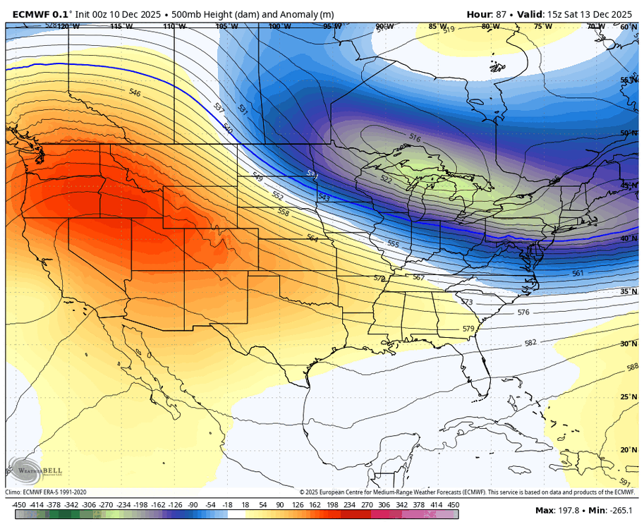
this is literally all it takes. slightly more lean westward with the TPV lobe -> higher downstream heights -> more buckling

-

Pittsburgh/Western PA WINTER ‘25/‘26
RitualOfTheTrout replied to Burghblizz's topic in Upstate New York/Pennsylvania
Yeah it was a long shot. Still may see a few mangled flakes but nothing interesting. At least the morning commute won't be a disaster. I think we all knew at some point in December this would flip, that's Nina climo to some degree and patterns break down in general. Question is what happens afterwards into January. Shame we couldn't keep the cold around one more week and instead it gets gross just in time for Christmas. -

December 2025 regional war/obs/disco thread
brooklynwx99 replied to Torch Tiger's topic in New England
this is literally all it takes. slightly more lean westward with the TPV lobe -> higher downstream heights -> more buckling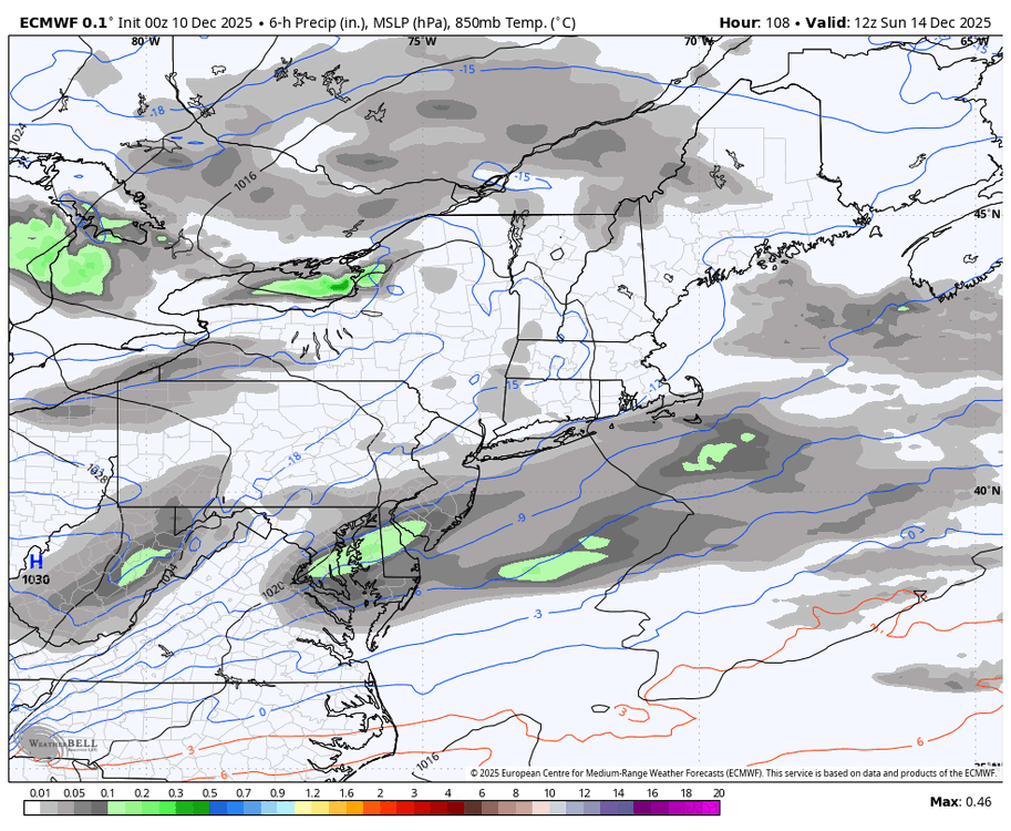

-
If the solution ends up verifying pretty close to the AI models, that would definitely be a big win for them. They’ve been way steadier than the regular OP runs.
-
hard to believe how cold its been and, yet we get rain later today here