All Activity
- Past hour
-
In the olden days, that’s exactly where you’d want the GFS at this stage.
-
@MANDA has noted this for the past week. The cold load in AK/Yukon and the Northwest territory is impressive.
-

January 2026 Short/Medium Range Thread
Weatheriscool replied to John1122's topic in Tennessee Valley
That's funny but true -
Wait have people been treating the GFS/Euro OP play by plays for a storm over a week out as actual forecasting? I thought we were all doing it as a fun bit of entertainment/learning opportunity. Everybody here should know that the OPs are effectively useless 7+ days out and only become moderately (still defer to ens) from 7-5 days out before taking over within 4 days of the storm.
-

Rise of the Machines: January 18-19 Winter Storm Obs Thread
VivaManchVegas replied to WxWatcher007's topic in New England
Here we go...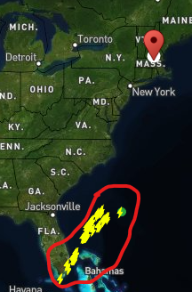
-

Storm potential January 17th-18th
NorthShoreWx replied to WeatherGeek2025's topic in New York City Metro
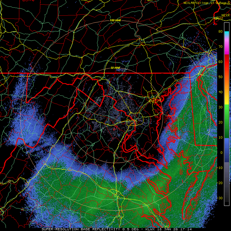
It's snowing lightly here, but you'd think it was much heavier based on the visibility. Very cool vibe with the light snow and fog and everything plastered with snow. 32.7⁰, Today's snowfall so far 1.1". NWS forecast looks good, but there could be a little extra excitement this evening as the column cools a little more. -

Storm potential January 17th-18th
binbisso replied to WeatherGeek2025's topic in New York City Metro
Steady snow back after a 1hr or so lull. No echoes on radar. Its obviously not picking up precipitation well. 1.5" today. 3.5" 2 day total and 14.5" ytd. Should be a fun afternoon evening -
The Canadian is reminiscent of some of the east to west maulers I remember from being a kid in the 80s……. It’s a winter lover’s dream with……Snow on snow with back to back systems with less than 24 hours between them.
-
not in 94 it didn't, or 96. never know.
-
Better for gooning over the fantasy snow maps maybe
-

Rise of the Machines: January 18-19 Winter Storm Obs Thread
Sey-Mour Snow replied to WxWatcher007's topic in New England
Funny looks much better than I imagined it would for this time, the lull was well forecasted , it will pick back up in the next few hours and spread NE as we watch a playoff snow game . -

Rise of the Machines: January 18-19 Winter Storm Obs Thread
Mj-pvd replied to WxWatcher007's topic in New England
Going to the pats game gonna be fun with the flakes -
Lol love the cut off there in Central Alabama and Georgia on the GFS.
-

Pittsburgh/Western PA WINTER ‘25/‘26
colonel717 replied to Burghblizz's topic in Upstate New York/Pennsylvania
Of course it was being laughed at for that but that wasn't the only big storm it was showing as it did on another runs. But it was as if because it showed that "stupid" storm all the others were laughed at and thrown out too since there wasn't agreement from EURO. Then last night EURO threw one out that was somewhat similar to what GFS was showing on few of it's runs. So maybe a "stupid" storm isn't as far fetched. I certainly do not want a 6 ft storm as ROTT discussed the dangers with that large a storm, but give me a"stupid" 12-24 one. -
For those that know, the Ragu programmatic ad at the bottom of Pivotalweather will be the death of me.
-
NOVA/DC snow hole in full effect. What else is new?
-

Rise of the Machines: January 18-19 Winter Storm Obs Thread
Spanks45 replied to WxWatcher007's topic in New England
Just went for a hike, snow coming down nicely again....everything I shoveled is already covered up again -
A week out?
-

Rise of the Machines: January 18-19 Winter Storm Obs Thread
WinterWolf replied to WxWatcher007's topic in New England
Definitely some nice wintry appeal. -
Rise of the Machines: January 18-19 Winter Storm Obs Thread
Sey-Mour Snow replied to WxWatcher007's topic in New England
It’s awesome out, steady tiny flakes , low ceilings with fog above the tree lines -

Rise of the Machines: January 18-19 Winter Storm Obs Thread
Franklin0529 replied to WxWatcher007's topic in New England
Thanks for the motivation -

January 2026 regional war/obs/disco thread
SnoSki14 replied to Baroclinic Zone's topic in New England
I genuinely think the pattern is pretty loaded for a large overrunning Miller A/B type storm in late Jan. And it's showing up in spurts across op runs. With today's event the AI models had the best handle several days out so definitely keep an eye on what they show. -

Rise of the Machines: January 18-19 Winter Storm Obs Thread
QuietCorner replied to WxWatcher007's topic in New England
We have maybe 1" here, 34 degrees with some rain mixed in with the flakes that are currently falling. -

Storm potential January 17th-18th
winterwx21 replied to WeatherGeek2025's topic in New York City Metro
Nice that it filled in even earlier than this. Radar continues to blossom with echoes to our southwest. Turning out that there wasn't even much of a break between rounds. -

Rise of the Machines: January 18-19 Winter Storm Obs Thread
Hoth replied to WxWatcher007's topic in New England
Sort of happening now.


