All Activity
- Past hour
-
oops my bad, wait until Prismshine sees the ECWMF clowns
-

2025-2026 ENSO
PhiEaglesfan712 replied to 40/70 Benchmark's topic in Weather Forecasting and Discussion
The further south, it is more noticeable earlier. For example, Charlotte hasn't seen a 10-inch snow season since 2003-04, or even an above average snow season since 2013-14. -
wow, didn't even see this before I posted.
-
Sun's out, guns out. 72°
-
Sun and guns Up to 70°
-
I don’t know why you would hope for that. 100F heat WITH an onshore flow would likely be a mass casualty heat event with the humidity.
-
83/70 here with juicy southeast winds. Dry air should mix in in a few hours and temps will skyrocket up above 95.
-
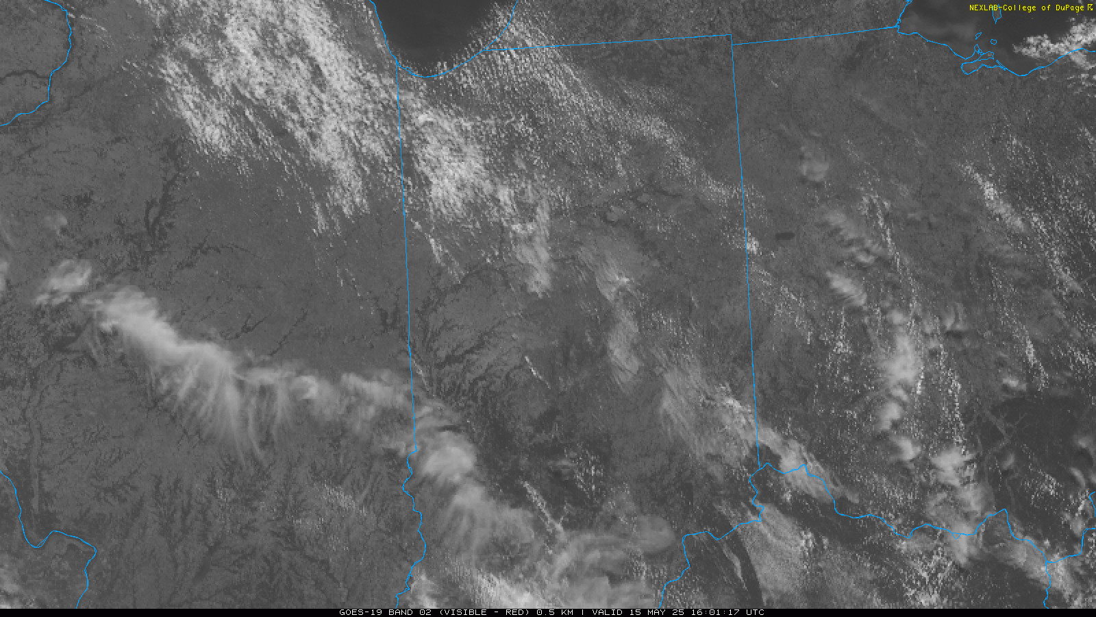
 Satellite as of 12:05. Good pockets of CU developing. 15Z HRRR has pretty significant cell right over Chicago metro. Could be a very costly hail storm if that happens.
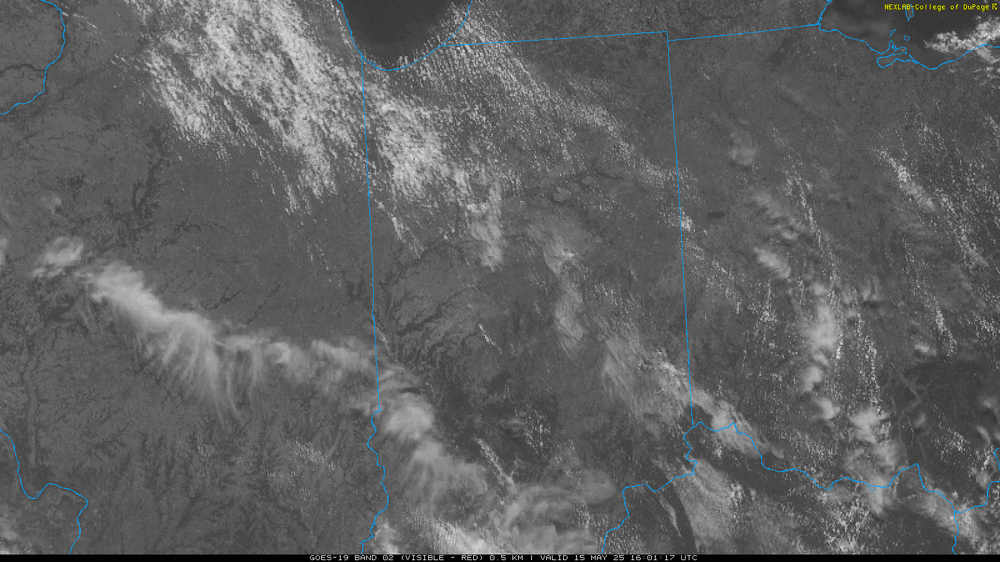
-
 If temperatures are held down a few degrees from the HRRR soundings (which the current clouds over southern Wisconsin might help with) we could be in business. However 12Z CAMs trended to a messier mode around here. Only the RRFS still maintains more spaced out cells.
 -

Occasional Thoughts on Climate Change
LibertyBell replied to donsutherland1's topic in Climate Change
It was still a very hot summer though as it set the NYC record for 90 degree days and that three day stretch of 100+ was extremely memorable. I lived through that 10 day heatwave in NYC and I haven't felt so much heat before or since then. -
12z NAM Nest soundings suggest nastiness tomorrow evening into nighttime
- 516 replies
-
- 1
-

-
- severe
- thunderstorms
- (and 2 more)
-
that is what i thought too
-
I browse every so often, but as stated a while back, thought it a good time to "get to work", as things were slow and in truth thought it a good time for a break in addtion to my usual sprint/summer board break. I'll stop in ever so often. Sounds like your getting answers to your health riddles. Fingers crossed for you pal. TTFN
-
Only managed 1 day at or above 90 in the Twin Cities during this stretch.
-

Central PA Spring 2025
Mount Joy Snowman replied to canderson's topic in Upstate New York/Pennsylvania
Yes. Perfection. A little breezy but that should help it feel nice. -
 Miss on round one. Guidance nailed the hard turn to the north as the decaying line approached the metro.
 -

Occasional Thoughts on Climate Change
TheClimateChanger replied to donsutherland1's topic in Climate Change
Here is New Brunswick, NJ versus Newark for July 1993. New Brunswick was 0.6F above the 1991-2020 normal [measured with standard MMTS] versus Newark 4.3F above 1991-2020 normal [with HO-83]. Certainly seems highly suspect to me. One note - there appears to be a 1-day offset for the New Brunswick data, as the observation must have been taken the following morning and ascribed to that day [even though the maximum would have occurred the prior afternoon]. -
Today has a sneaky thunderstorm day feel and look to it.
-
Hopefully with your projected 3C of warming, JFK and EWR will see 100 degree temps a few times every summer even with onshore flow. Do you think a time will come when we could hit 100 degrees even on a southerly wind?
-
There are places in Florida near the coast that see 100 degree temps-- see Jacksonville.
-
Occasional Thoughts on Climate Change
LibertyBell replied to donsutherland1's topic in Climate Change
Do you think the 1993 Newark numbers might be cooked? Take a look at their 90, 95 and 100 degree numbers. On most lists 1993, 2010 and 2022 are the three hottest summers there, I lived through 1993 it was the first time I was forced to use air conditioning, it was unbearably hot. -
Occasional Thoughts on Climate Change
LibertyBell replied to donsutherland1's topic in Climate Change
Yes, this is why I always say we should define normal as within one standard deviation, rather than a single *average* number. Don't get me started on that, TCC and I both hate that word *average* lol. -
More STEIN incoming...
-
Very similar to why south Florida doesn’t see the type of 100 degree heat you see in Texas. We are years from seeing a Florida climate here but the halmarks are starting.
-
Occasional Thoughts on Climate Change
TheClimateChanger replied to donsutherland1's topic in Climate Change
I also wouldn't put much stock into the 1986-1995 era, which shows tons of big heat. The HO-83 had a significant warm bias. See: Inside the HO83 Hygrothermometer « Climate Audit Here is comparative data from Lincoln, NE, for 1991 & 1992, comparing readings from the HO-83 versus a newly installed ASOS. There was only 1 day where the HO-83 max was lower than the ASOS. On one date, it was 7 degrees warmer! We have to remember our ability to measure temperature today is better than at any point in history. As almost any bias results in a warmer temperature [except for poor calibration, which could go either way, and shading, which introduces a cool bias], this naturally makes it more difficult to reach these lofty readings with regularity. Shading is probably a bigger issue today. I know NYC doesn't comply with setbacks and I see trees around a lot of sites.