
All Activity
- Past hour
-
The disturbance on the models that develop down south in the long range might have a chance.
-
thanks captain obvious
-
latest 90 on record.
-
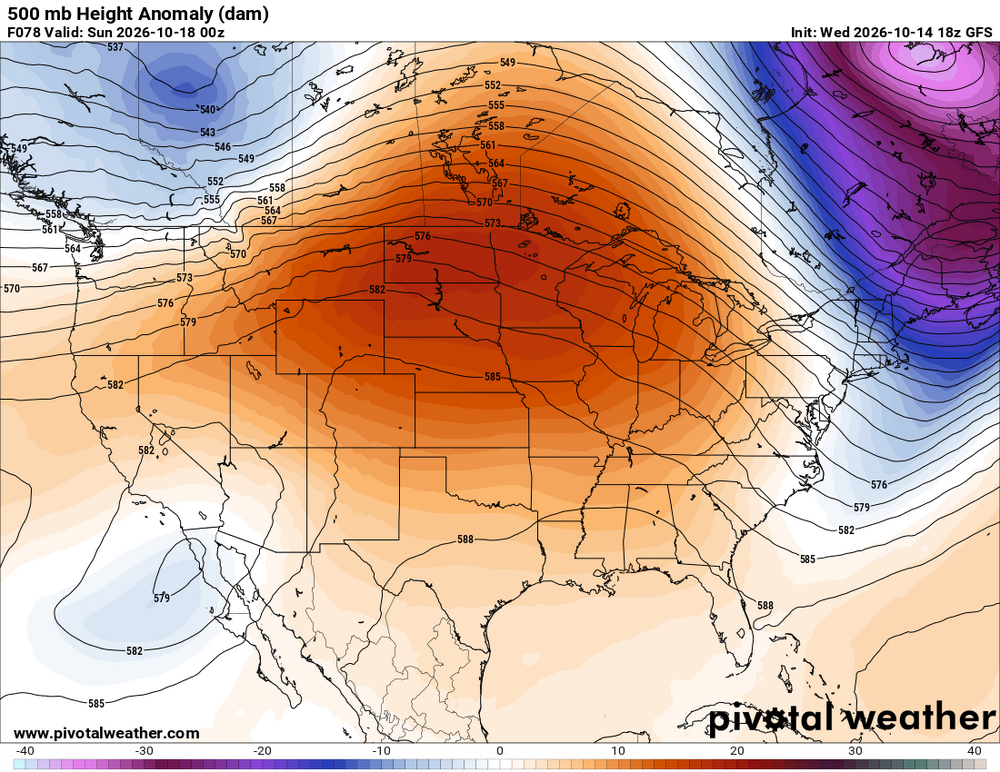
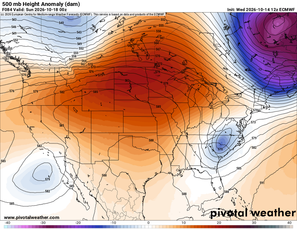
Oh yeah, crazy differences for ~4 days out. Bodes well for winter tracking!
-
Some people here need to consider moving to the deep south...
-
Hit 90 down in DC today
-
 Negative PDO is the opposite of what they have. It's not a cooler north pacific. Where they have a Low pressure is really a High pressure.
 -
Yeah the cold and freezes literally vanished . Started noticing it Monday . Just a slight BN day now
-
I don't know why you've taken on the stance that everything is normal with the El Nino and H. Hemisphere pattern. It clearly is not. We have not seen more than 4 consecutive N. Pacific low days since the El Nino began in April. Oct-Nov.. -0.38 max Dec.. -0.32 max To say that too much on the correlations and then post QBO correlation is ridiculous! I know the QBO is not anything different from random. It's not a practical surface level indicator perhaps beyond the AO effects.
-

Central PA Autumn 2026
Itstrainingtime replied to canderson's topic in Upstate New York/Pennsylvania
I went to ALCS games in Baltimore on weekday afternoons in 1979 and 1983. I miss afternoon postseason baseball. -

2026 C and E Pacific tropical activity
SnowenOutThere replied to GaWx's topic in Tropical Headquarters
Currently it has one of the weirdest look's I've seen a hurricane take on. -
-

Mountain West Discussion
mayjawintastawm replied to mayjawintastawm's topic in Central/Western States
Same here, super frustrating especially given the ongoing drought. Looks like the NAM won. Wraparound is a hoax, just like it always is. Maybe we should hope for a bone-dry forecast and then celebrate when we get a flood or a blizzard. -
Game 5 in 1988 was the last time an LCS game started that early.
-
Nice to make a beach day out of today. Made it up to 81. Water still warm enough for a swim too
-
89 for the hi imby. BS.
-

2026-2027 Fall/Winter Mountain Thread
Met1985 replied to BlueRidgeFolklore's topic in Southeastern States
Dang that does suck. -
It will be in lower 50s outside elevations.
-
a high of 86 here
- Today
-
DCA recorded a high of 90 degrees today, October 14th -- the latest in a calendar year 90+ reading in DC history. The previous record was October 11th, which was set way back in 1919.
-
Looks like 88 BWI, 89 IAD, 90 DCA. All records
-
89 was the high here
-
Wind this afternoon was pretty sweet
-

Fall 2026 Medium/Long Range Pattern Thread
Carvers Gap replied to John1122's topic in Tennessee Valley
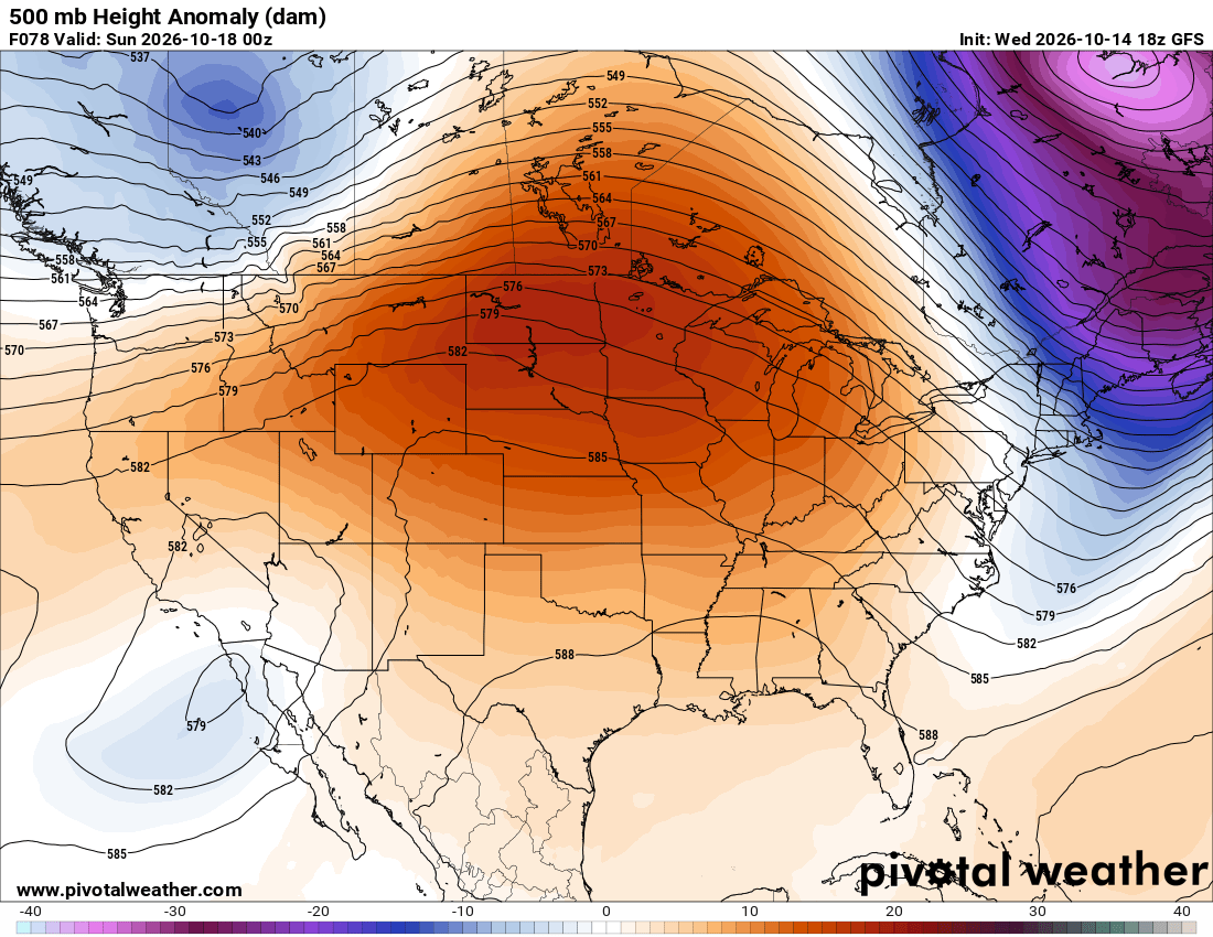
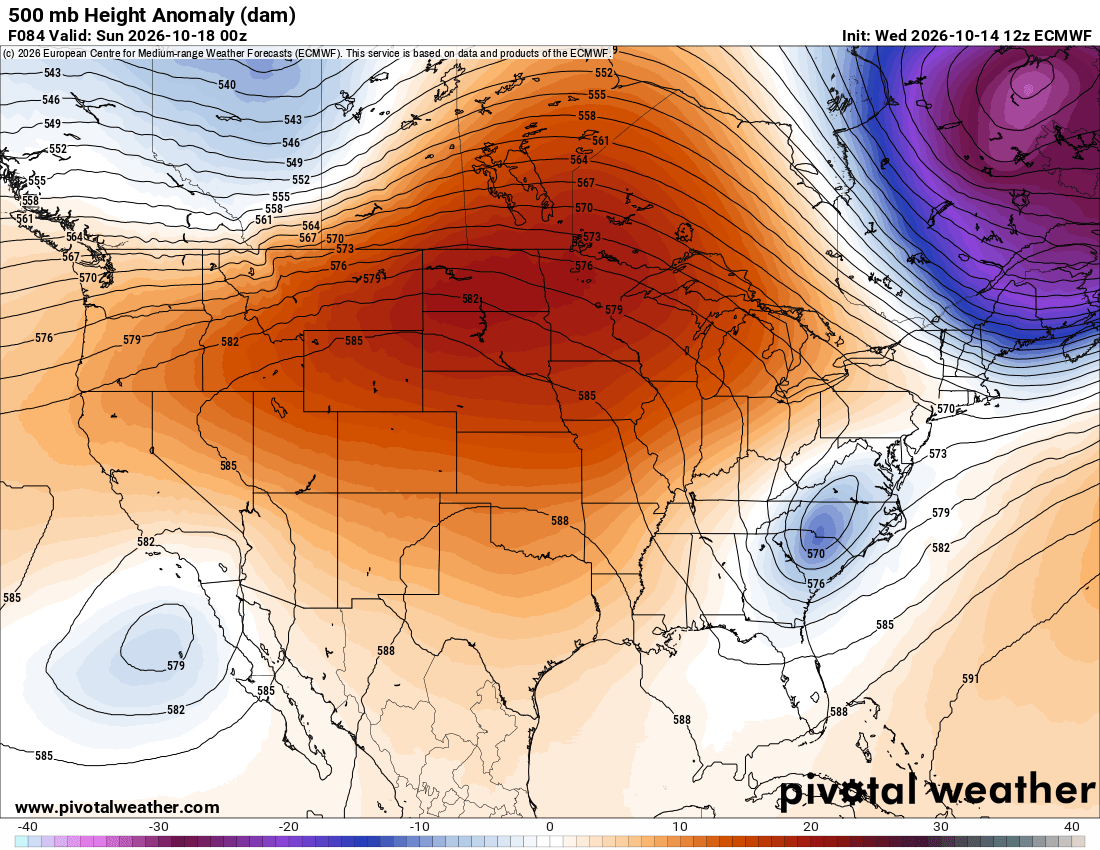
It should also be noted that at this time of the year, LR ext modeling can be extremely untrustworthy. It can flip on a dime. I thought the tropical system might shake things up(and it still yet might have done that), but the return of the heat ridge is at hand. Let's see if something can knock it down for more than 4-5 days at a time. The Euro Weeklies ext control can sometimes pick up pattern changes. It has extreme blocking in the week 4 range, but not crazy cold temps to go with that blocking. Snowpack in Canada may be well behind normal. This might be a winter where winter arrives mid-late.











.thumb.jpeg.f5c6ba9d911ec96b3b124f8606aee58e.jpeg)






