All Activity
- Past hour
-
PWAT’s are 1.6 to 1.8” with ample moisture on a SW flow.
-
Hi, I’m the guy it took 2 hours to notice the COD radar hadn’t updated in 6 hours
-
Ignoring the obvious accidental doxing .. lol but would be cool to see the users mapped out in our region
-
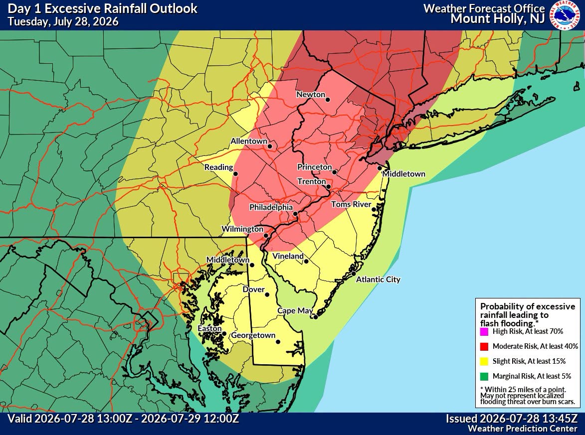
This is a convective event so there will be winners and losers. I had 2.29” yesterday under that stationary storm in less than an hour. The storms today should be moving but there will be training. Someone is going to see a ridiculous total. Bullseye area looks to be along the I-287 corridor from Morristown up into the LHV.
-
Light rain here with blue skies to the west
-
 Radar lighting up a bit around here
 -
it's like lousy winters when the cold is pushed back and back....
-
 It’s a very humid pattern from today onwards. Not many 90’s thru early Augdewst.. but daily dews to enjoy
 -
 I'm staying conservative here in the valley. Thinking more like 1.5-2" which is fine.
 -
.thumb.gif.f92b16c631a1d15d405ed77b33f0710d.gif) weaklies. lol what a dummy
weaklies. lol what a dummy -
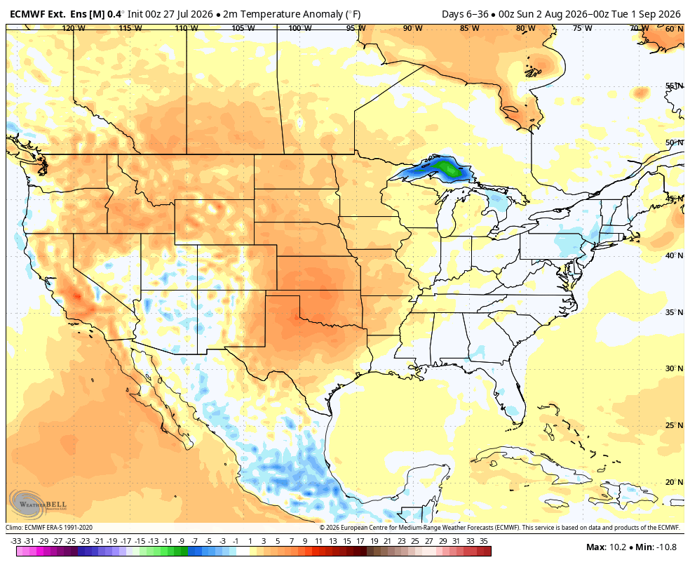
 I was hopeful we could sneak in another period of very hot temperatures into the region towards the end of the first week of August but not so confident on that anymore. Seems like the more favorable look is now pushed out into the second week. And when you have to start chasing dates...never usually a good thing, especially when working downhill from peak climo.
 -

2026 Mid-Atlantic Severe Storm General Discussion
SolidIcewx replied to Kmlwx's topic in Mid Atlantic
Looks like the clouds are breaking up a bit to the west -
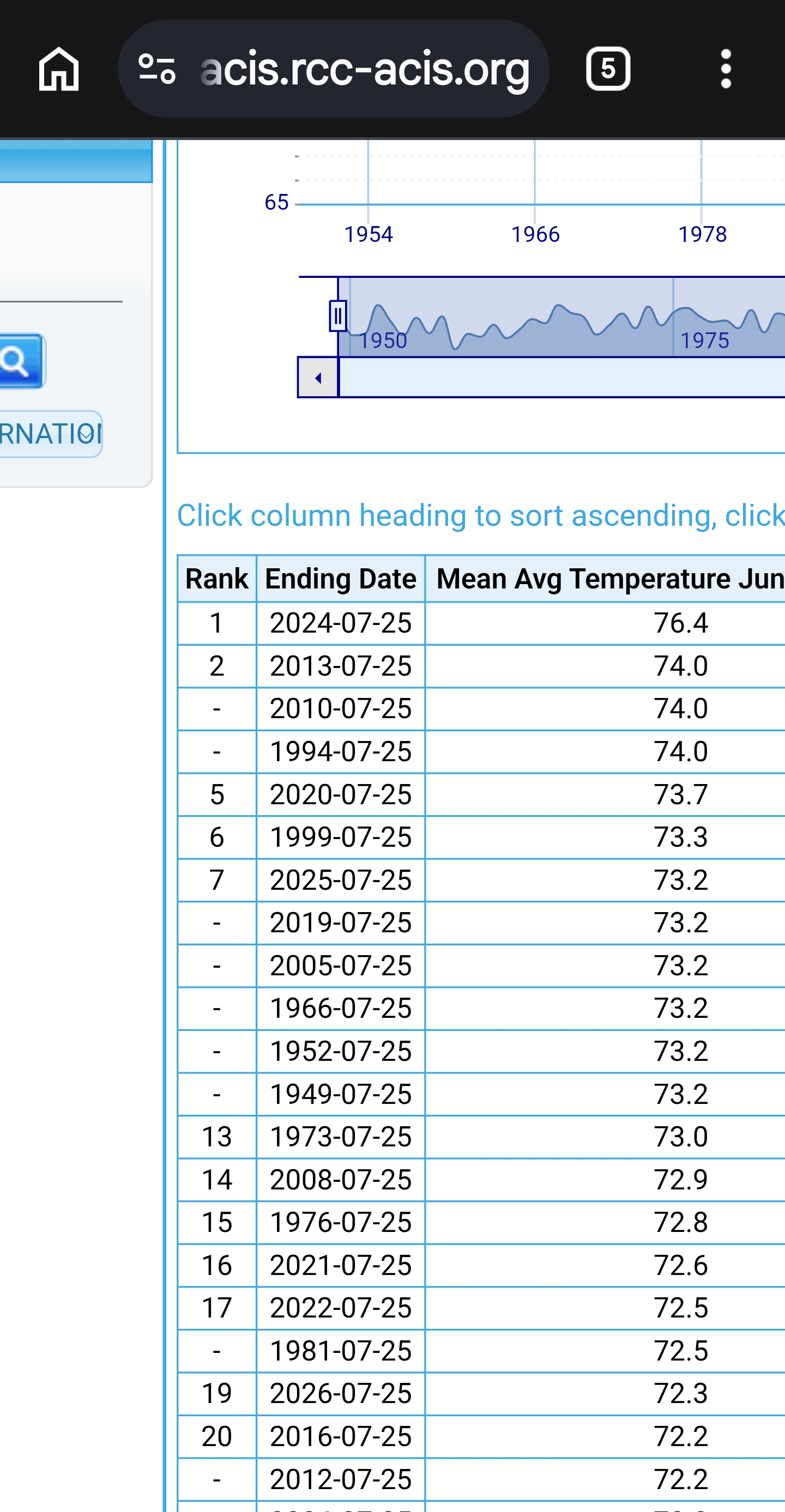
 So much for the HHH hottest summer ever Top5! Weeklies BDL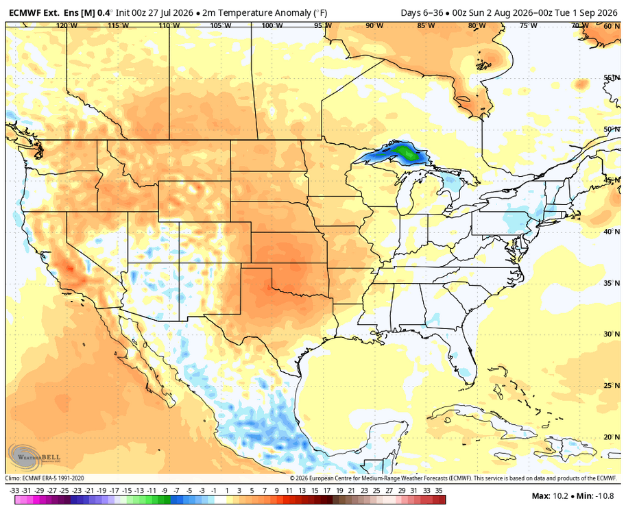
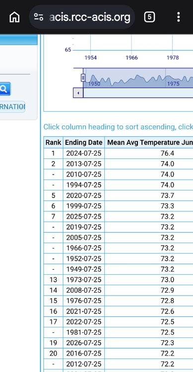
-
This event feels easier to forecast than last Tuesday since energy is more consolidated and its also arriving later and not during the AM.
-
a bit of personal news. Will be moving to the Twin Cities in August, been busy with all that entails so haven't been able to be on the board much but hoping to be on here again after the move!
-
Not so sure about that Some of the maps being posted around makes it seem like Noah needs to make another appearance from heaven Great to be getting some of these setups lately. Giving people much needed rain without the concern for significant flooding issues. I know there was the flooding within SW CT last week but these events are perfect to tackle the deficit without cause for major concern
-
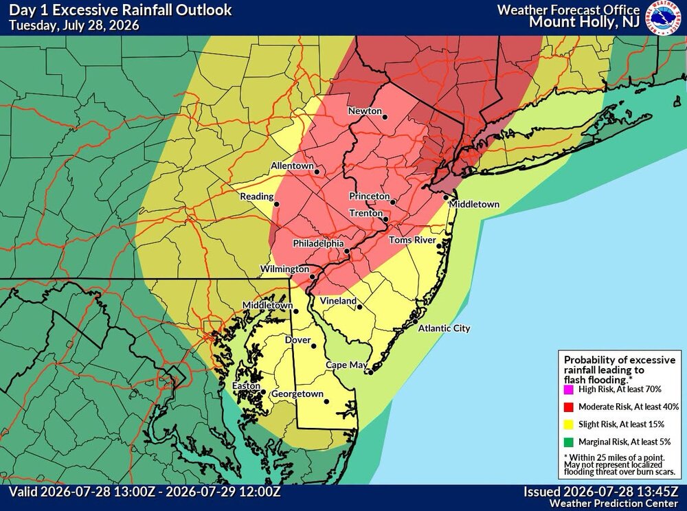
The latest
-
There is still a quite a bit of uncertainty in how the whole thing evolves for sure. I mean if you look at the latest NAM's, there is actually some potential we get enough drying and maybe even some breaks of sun tomorrow (especially in CT) that we could pop isolated thunderstorms with potential for localized damaging wind gust or even a brief tornado. I was thinking the greatest max would be west of here...Hudson into NJ but its possible you may see the max zone be something like northeast CT into northeast MA and southern NH and then a few local maxes elsewhere.
-
 Sounds about right. Don't think anyone is calling for 4" region-wide. There'll be some jackpots for sure.
 -
Recent guidance targeting northern NJ for heaviest rainfall: https://x.com/BhatiaKieran/status/2082103580756971568
-
It's early.
-
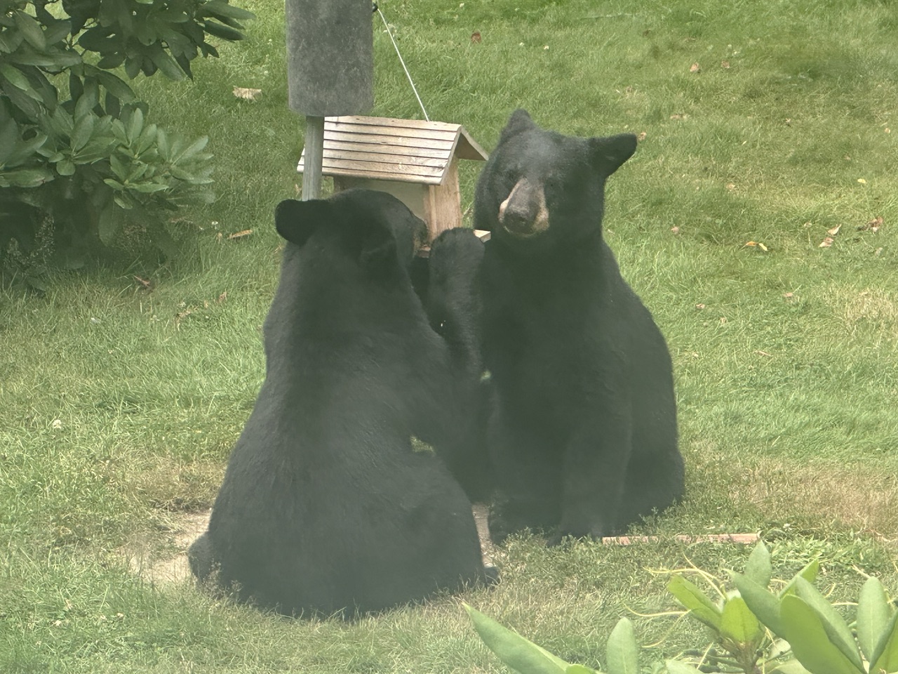
It took 20 years here, but we finally got some VT bears


-
 Also, doesn’t seem to be diving as much SE as I would have thought, more NE?
 -
That being said...satellite doesn't look as bad as I thought it would a few hours ago
-
Yeah I am seeing that too. We may be cooked here.