All Activity
- Past hour
-

2026-2027 Record-breaking El Nino
bluewave replied to Stormchaserchuck1's topic in Weather Forecasting and Discussion
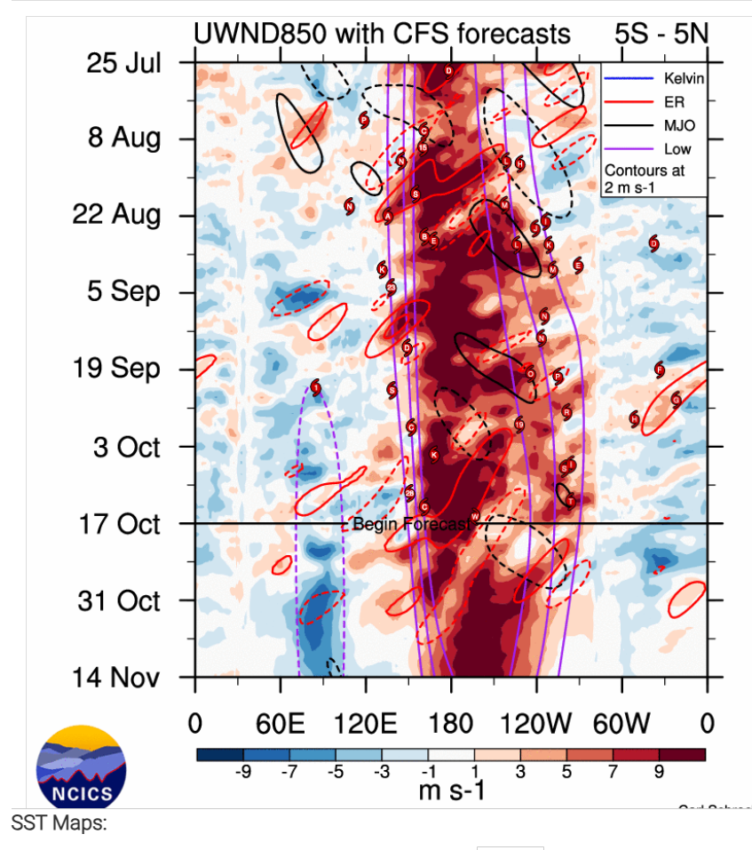
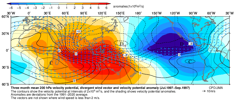
The forcing has had more of an eastward lean than 1997 did so far. Notice especially how much stronger the forcing was during the Southern Hemisphere winter closer to the West Coast of South America. Also the extension of the forcing into the SW CONUS has been stronger early on than 1997.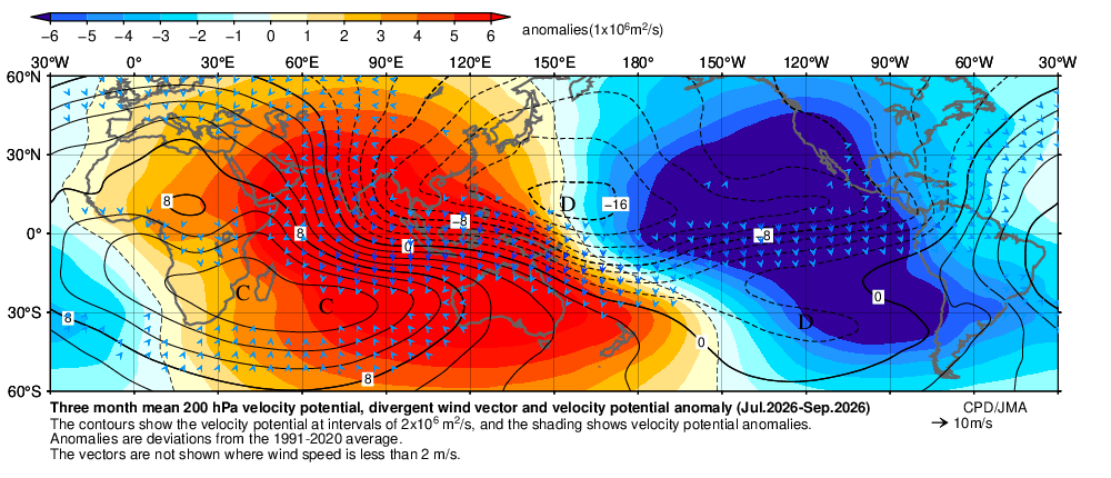
-

2026-2027 Record-breaking El Nino
Terpeast replied to Stormchaserchuck1's topic in Weather Forecasting and Discussion
While I think Webb was cherry picking those 2 dates, I’m in the camp where we will see at least one +10 month for a good swath of this country/continent east of the rockies. For selfish reasons of course, I’m rooting for that month to be December, because that makes it more likely we will see a more temperate month relative to climo in either Jan or Feb, or perhaps both. -
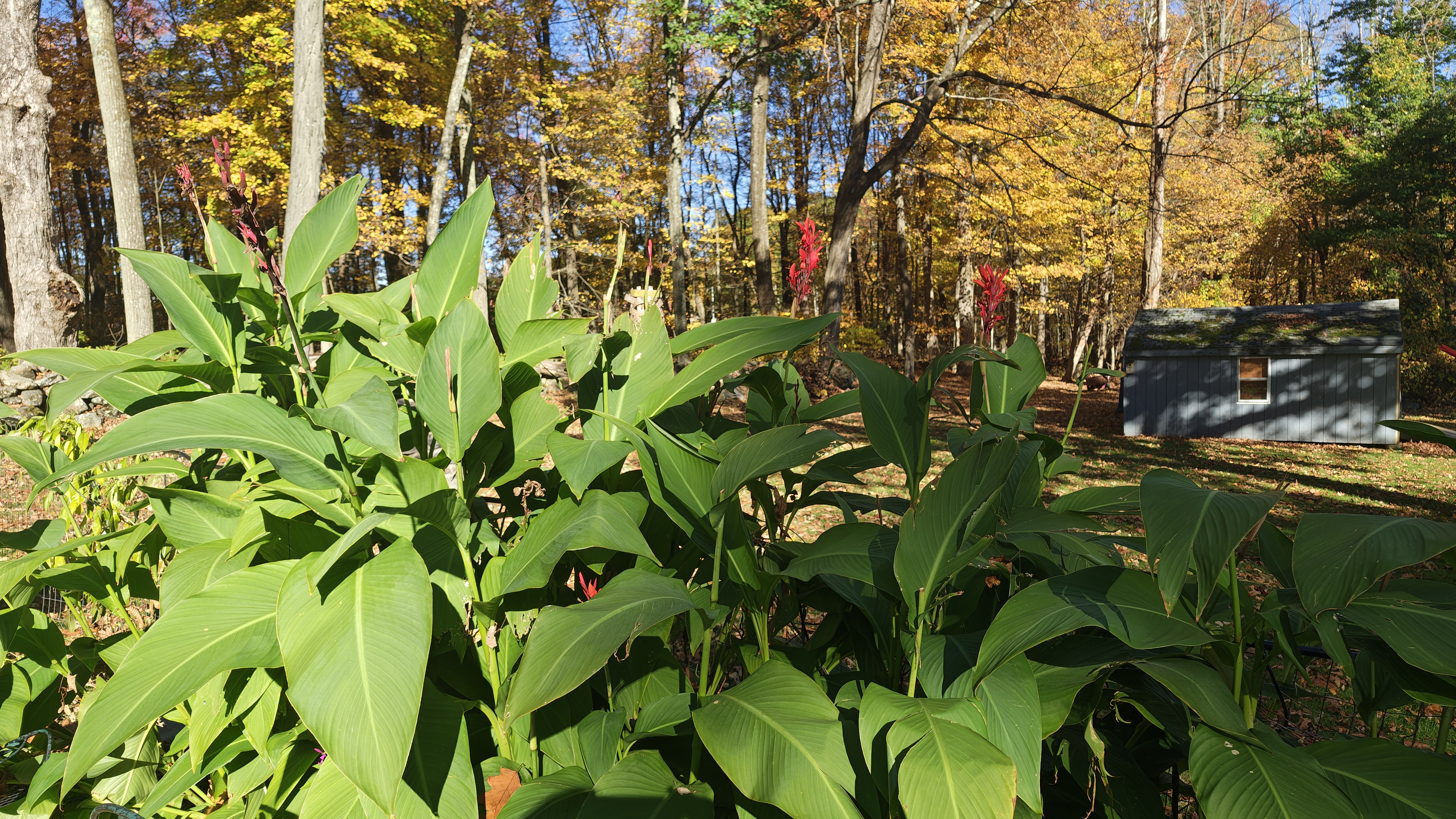
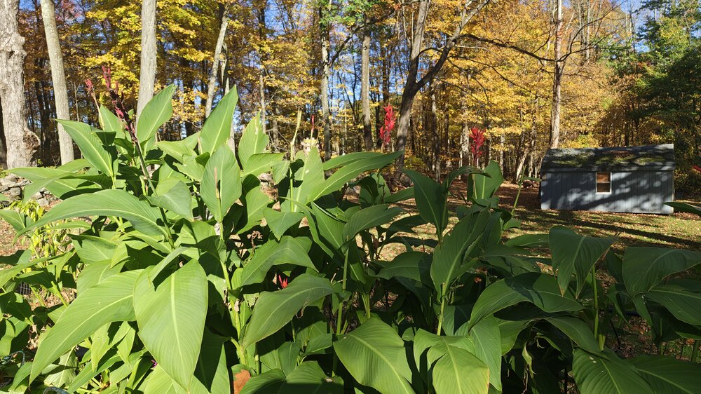
Growing season survives in my hood, I love the microclimate we got here.
-

2026-2027 Record-breaking El Nino
Keith Central PA replied to Stormchaserchuck1's topic in Weather Forecasting and Discussion
Many people here are throwing around December 2015..talk about extreme.+5 December is warm enough, which I could see, but +12?. It would have to be very dry with many days in the 60's, but with this el nino who knows?.I think we'll get a good idea how warm in mid ,late November. -
I have no idea. For some reason when we have an actual #, I feel like we shouldn't round. If I have 1.6" of snow, it stays at 1.6". Its probably just a me thing I think it bothers me most with 90° days. If I dont see my temp starting with a 9, I didnt hit 90 haha.
-
Yes, when rounding numbers one goes down in that case. I track my readings consistently with traditional NWS reporting methods. Perhaps that is changing?
-
-
30 today back home, cold in Louisville also .
-
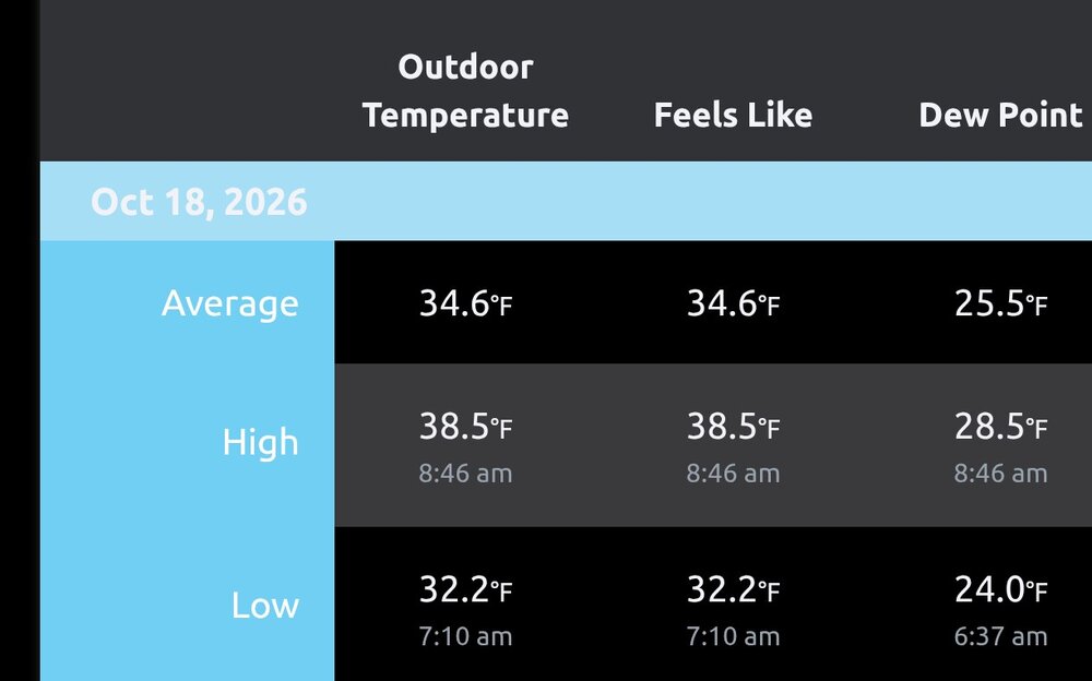
A toasty 40.1 Sunday morning on the east side of Columbia.
-
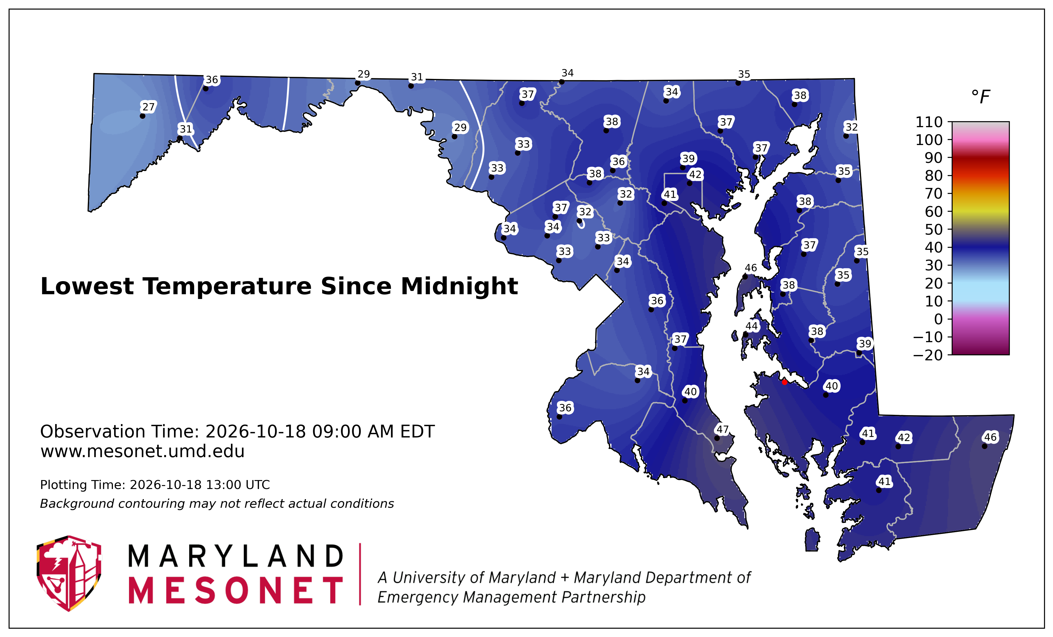
29.2 for a low this morning. Saw a couple 26's around Lafayette and Blairstown.
-
If it was 29.4, would you round to 29? Just wondering. I feel like with temps we have a real # and no need to ever round.
-
Looks like here and ORH and Scooter area only ones still growing
-
Bottomed out at 31.1 just before sunrise in Mt Airy Sent from my SM-S911U using Tapatalk
-
28.9° lowest here, looking forward to a stretch of yard-work weather, could really use some good rains though
-
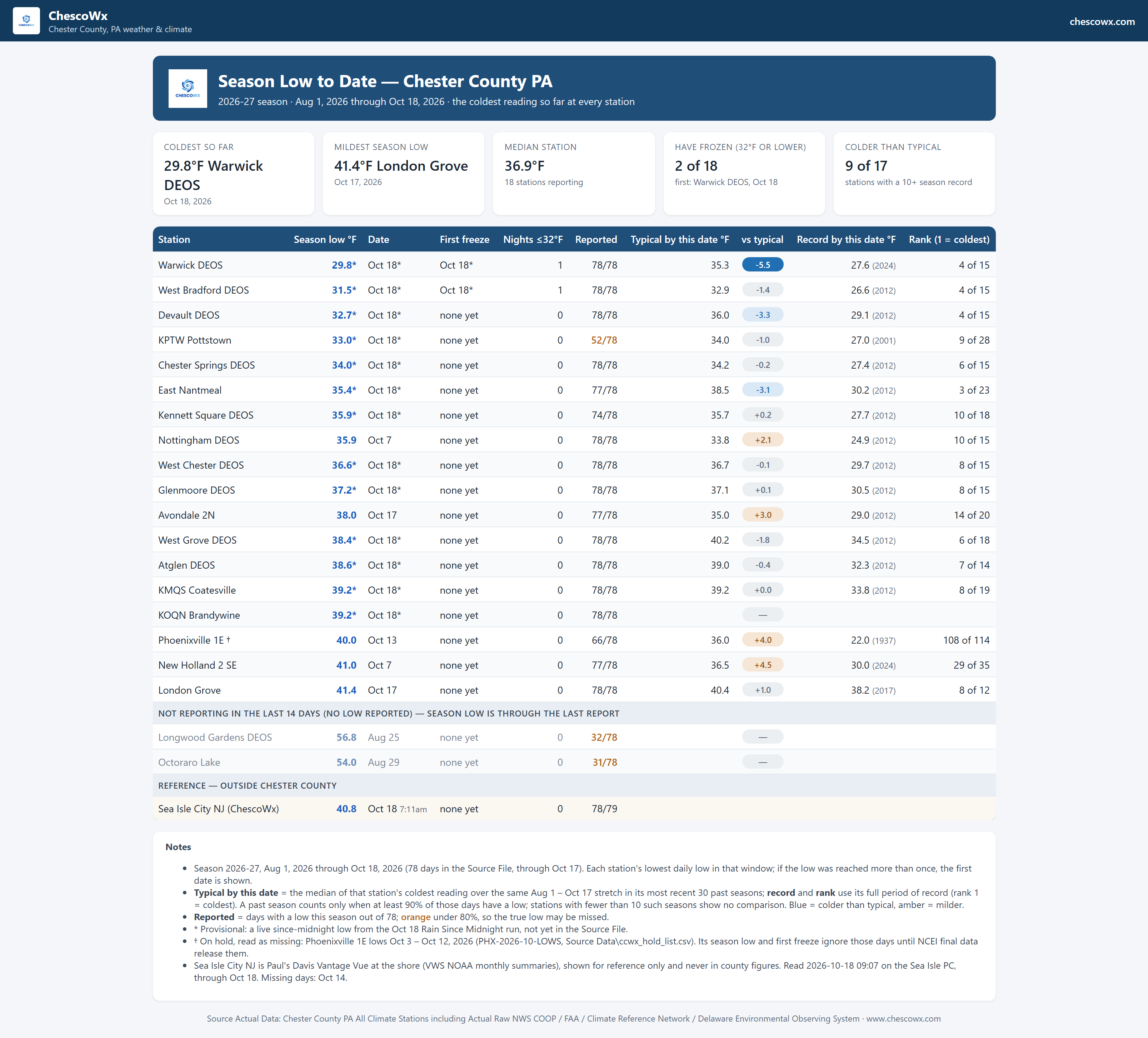
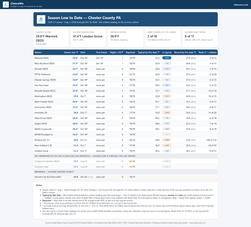
We saw 2 stations across the Chesco area record their first freeze. Below is some season lows to date history through today.
-
(002).thumb.png.6e3d9d46bca5fe41aab7a74871dd8af8.png)
E PA/NJ/DE Autumn 2026 Obs/Discussion
ChescoWx replied to PhiEaglesfan712's topic in Philadelphia Region
We saw 2 stations across the Chesco area record their first freeze. Below is some season lows to date history through today.
-
AWT
-
October 18 1950: Record high temperatures are set across the area as highs reached the mid to upper 80s. Minneapolis and Farmington saw highs of 87 degrees Fahrenheit, while Albert Lea reached 86 degrees. 1916: A blizzard impacts Minnesota. A sharp temperature drop begins as well; Hallock drops from the 60s to 2 above by the 20th. For Sunday, October 18, 2026 1906 - A hurricane struck South Florida drowning 124 persons stranded in the Florida Keys. (David Ludlum) 1910 - Northeasterly winds as high as 70 mph (from a hurricane moving northward up the Florida peninsula) carried water out of Tampa Bay and the Hillsboro River. The water level lowered to nine feet below mean low water. Forty ships were grounded. (The Weather Channel) 1930 - A big early season lake effect snowburst on the lee shores of Lake Erie and Lake Ontario produced 47 inches at Governeur NY and 48 inches just south of Buffalo. (David Ludlum) 1987 - Thunderstorms in northeastern Texas produced golf ball size hail at Atlanta, along with wind gusts to 86 mph, and four inches of rain. Damage from the storm was estimated at more than a million dollars. Sunny and mild weather continued across much of the rest of the nation. (The National Weather Summary) (Storm Data) 1988 - Eight cities in the southwestern U.S. reported record high temperatures for the date, including Red Bluff CA with a reading of 96 degrees. (The National Weather Summary) 1989 - Unseasonably cold air began to invade the central and eastern U.S. Light snow fell across northern Maine, and snow was also reported in the Great Lakes Region, including the Chicago area. Bismarck ND was the cold spot in the nation with a low of 9 degrees above zero. Five cities in Florida reported record high readings for the date, as temperatures warmed above 80 degrees. Miami FL reported a record high of 90 degrees. (The National Weather Summary) 2005 - With the formation of Hurricane Wilma, the 2005 Atlantic hurricane season tied the record for the most named storms for any season (21 storms in 1933), and also tied the record for the most hurricanes in a single season (12 in 1969). Wilma peaked at category-5 intensity on the 19th, with a minimum central pressure falling to 882 millibars (26.05 inches of mercury), the lowest pressure ever recorded in the Atlantic Basin. Wilma also became the most rapidly-intensifying storm on record, with a maximum-sustained surface wind speed increase of 105 mph in a 24-hour period. Observances: 18 Sun National Chocolate Cupcake Day 18 Sun Alaska Day 18 Sun National No Beard Day 18 Sun World Okapi Day 18 Sun National Alaska Day 18 Sun National Mashed Potato Day 18 Sun National Prayer Day 18 Sun National Speak Up for Victims of Sexual Abuse Day 18 Sun National Sunday Day 18 Sun Ride To Work Day 18 Sun World Menopause Day
- Today
-
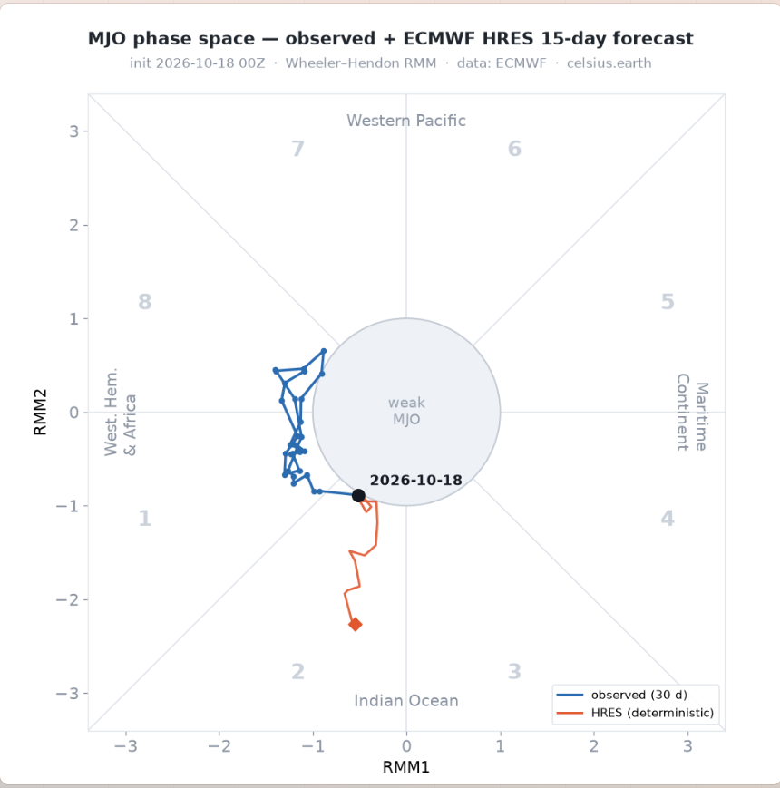
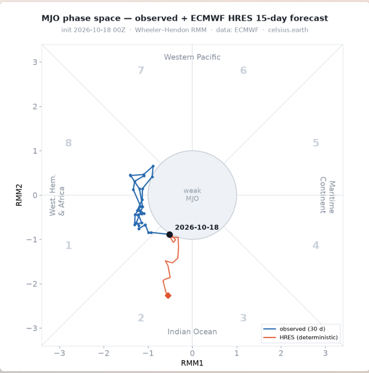
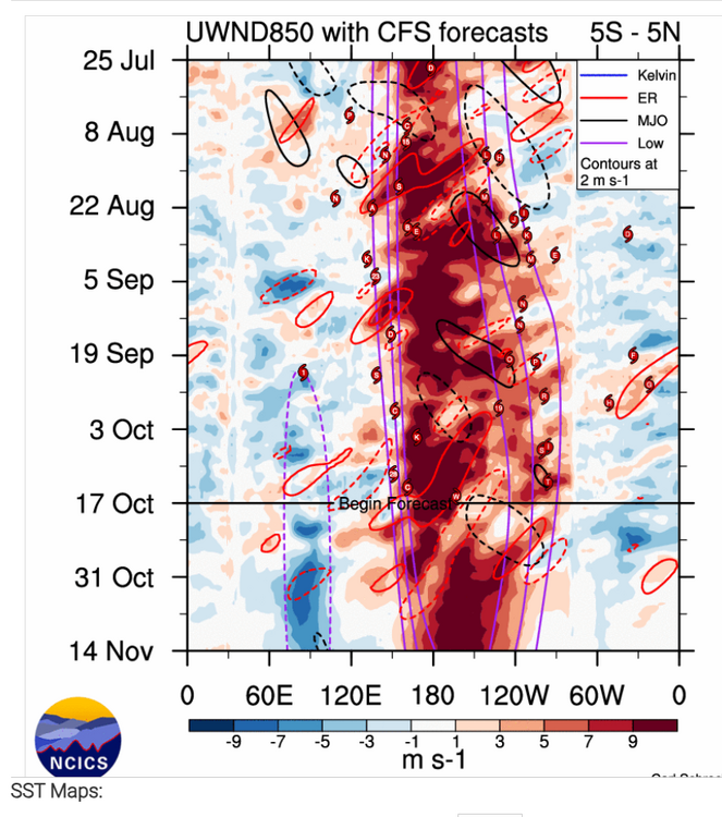
Euro has been fairly consistent the last several day of strenghtening the MJO into the IO,CFS is going into the Maritime but seemingly could just be interference via Rossby Wave,hard to go against the Euro IMO as consistent its been the last several days
-
Low of 40°.
-
I'm moving to the snowiest spot east of the rocky mountains. Barn Corner NY. I'll be at about 1600' elevation on the Tug Hill starting Dec 1. I'm super pumped. I lived up in Carroll County on Parrs Ridge for a couple winters. I was all pumped for a better climo. Still sucked lol
-
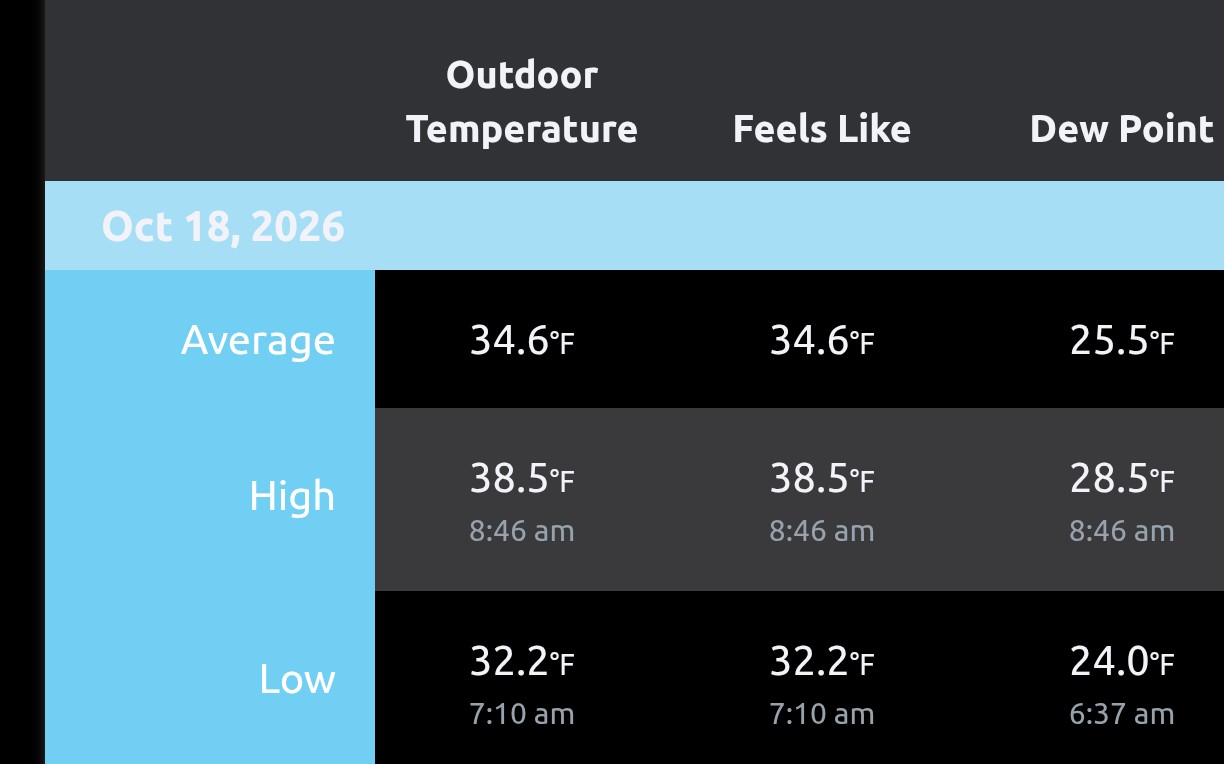
32.7 for the low. Colder than I thought it would get. House is at 59F.
-
34 & frost for me.
-
30° (29.6°) for the low here.