All Activity
- Past hour
-
It would be very difficult in this much warmer climate for a 09-10 repeat during an El Niño. First, we get more Southeast Ridge link ups with the -NAOs during the 2020s. So New England wouldn’t have to worry about -NAO suppression and confluence like they had in 09-10. The STJ riding too far north would be more of a risk for mixed precipitation from Philly to Boston. Since a stronger Southeast Ridge or Western Atlantic Ridge would probably mean plenty of cold rain from DC to Philly.
-
Strong winds crossing over from westchester county to rockland. Felt like i was on a plane with turbulence driving across the TZ Bridge.
-
Sounds miserable lol. I was definitely expecting a lot more weather than we received. Tornado watch, flood watch, wind advisory. I got a garden verity thunderstorm and a few showers overnight. Oh well. Bring on summer. Let's get it over with.
-
0.82"
-
1.58 in the bucket last night putting me over 8 inches for May..now 8.20 PLEASE MAKE IT STOP
-
1.62 " last 24 hours.
-
Let them eat !
-
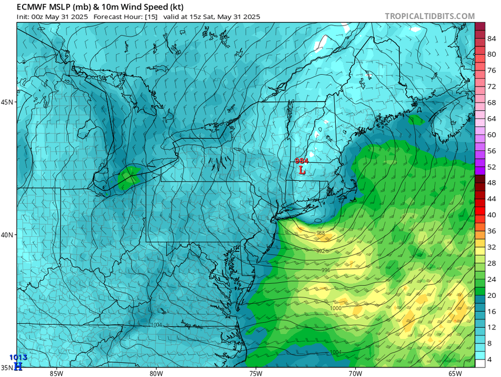
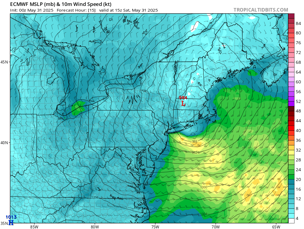
While this doesn’t meet the formal definition, this has some sting jet-like features. Very strong W to NW winds next few hours behind the system with the steepening low level lapse rates. So some spots could gust past 50mph next several hours as models have been underestimating the wind gusts here this year.
-
Nasty rain and wind storm going on out my way.
-
This could be for the long haul huh
-
Pretty wild overnight, especially for the time of year. 0.96" for the event and 10.12" for the month. Temp in the upper 40s throughout with strong winds gusting to 54 mph.
-
1.32"
-
The damn tent caterpillars are all over the south side of Fishers Island. I was going out of my way to squash them with my car.

-
Jeez, how is next weekend looking.............
-
Even more so out on the island. It’s getting to that time of year though. Really was just a warm frontal passage. Wrap around should mostly dry out before pivoting through
-
DCA gusted to 49mph overnight. 0.66” here takes me to 8.40” on the month. Just a shade behind 2014 and 2018.
-
Much less rain in central and western Loudoun. Fields all closed. Zero effort
-
Maybe we can pop the sun out to dry things off and the kid can play outside.
-
LOL should have kept my tee time.
-
You smoked too many of your cannabis plants, thereby shifting your consciousness to an alternate reality where Eastcoast NPZ now gets hammered with every storm system, while SoMD gets shafted.
- Today
-
Will be interested in knowing statistically what summer (JJA) month will see the greatest departure from normal. I saw Don's post on +1 summer. Not sure this is substantial but one of these months might show up larger departure.
-
Not that it can't happen, either. Hurricane Agnes in 1972 comes to mind...
-
TROPICAL: Personal opinion is to follow the Tropical portion of AM WX... just too early to get excited. I dont see any clear GEFS/EPS signal for an event GMEX-FL coast yet.
-
It flew north too fast to drop anything significant for the coast.
-
.41" since 4am/ 60F


.thumb.JPG.418e8a9a2902ae687ec35ff4bc0e038e.JPG)


