All Activity
- Past hour
-
Yeah it a show on Apple TV. I really like it.
-
Yeah it a show on Apple TV. I really like it.
-
Hopefully causes flare ups in the metro. I like the look and placement of the boundary
-
euro moved to the GFS p big around this time frame, shifting axis west and death ridging CA looks like a potentially extended period of seasonably comfortable temps for most of us
-
Doubt it. Radar estimates running a bit hot. 3.64" in Somerset. Just relentless.
-
I'm in my mail truck I'm not walking in this
-
 meh just a little warm
 -

Central PA Summer 2026 Discussion/Obs Thread
Jns2183 replied to Voyager's topic in Upstate New York/Pennsylvania
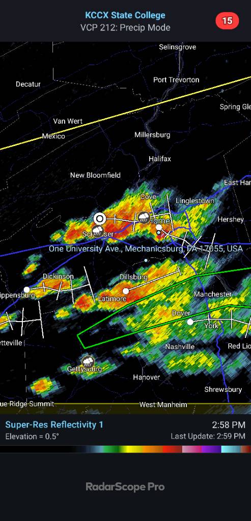
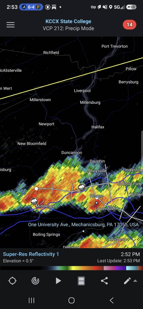
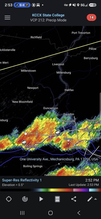
About to be some major convergence of cells Sent from my SM-S731U using Tapatalk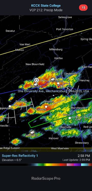
-
Central PA Summer 2026 Discussion/Obs Thread
Jns2183 replied to Voyager's topic in Upstate New York/Pennsylvania
Laid out outflow boundary and orgraphic lift did rest for new cell development Sent from my SM-S731U using Tapatalk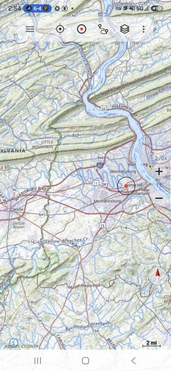
-
C'mon little outflow boundary
-
It’s gonna rain
-
did summer peak last summer?
-

Central PA Summer 2026 Discussion/Obs Thread
Superstorm replied to Voyager's topic in Upstate New York/Pennsylvania
Flash flood warnings going up . -
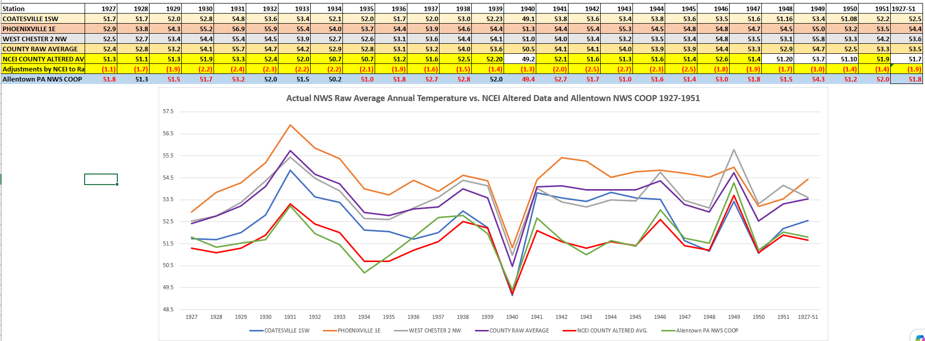
(002).thumb.png.6e3d9d46bca5fe41aab7a74871dd8af8.png) Revisiting that old topic that no one seems to be able to answer - not the why they did it - but how exactly or where exactly did NCEI look for their control COOP or analog station to support their chilling adjustments of the historical raw data for Chester County PA. Again we focus on the 25 year period of greatest adjustments to the raw data from 1927-1951. I think I may have found the station they use as the adjusted NCEI data is very close to this station. However, one big problem is this station sits a couple counties and 30 plus miles north of Chester County. I looked to the NWS COOP Allentown PA site which was the Allentown Gas COOP site. This station was the primary Allentown climate station prior to ABE. Of note NCEI chose to chill Chester County to actually lower than Allentown PA in 20 of these 25 years! Keep in mind again in 20 of 25 years there is no actual NWS COOP site in the county that was as cool as the post hoc NCEI County averages. So overall NCEI believes that Chester County is colder than Allentown....
Revisiting that old topic that no one seems to be able to answer - not the why they did it - but how exactly or where exactly did NCEI look for their control COOP or analog station to support their chilling adjustments of the historical raw data for Chester County PA. Again we focus on the 25 year period of greatest adjustments to the raw data from 1927-1951. I think I may have found the station they use as the adjusted NCEI data is very close to this station. However, one big problem is this station sits a couple counties and 30 plus miles north of Chester County. I looked to the NWS COOP Allentown PA site which was the Allentown Gas COOP site. This station was the primary Allentown climate station prior to ABE. Of note NCEI chose to chill Chester County to actually lower than Allentown PA in 20 of these 25 years! Keep in mind again in 20 of 25 years there is no actual NWS COOP site in the county that was as cool as the post hoc NCEI County averages. So overall NCEI believes that Chester County is colder than Allentown....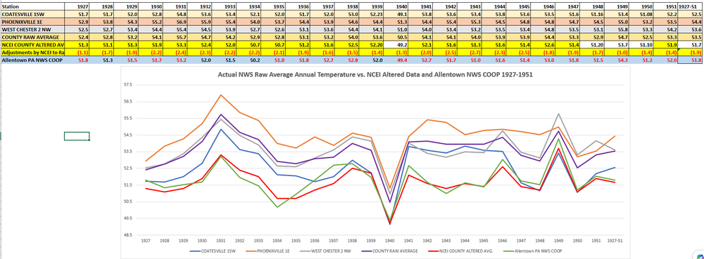
-

2026 Mid-Atlantic Severe Storm General Discussion
BlizzardNole replied to Kmlwx's topic in Mid Atlantic
Those purples on radar over Germantown look rough. Might be some trees down there -
Nice and dark to my south. No rain here but with strong gusts of wind you feel the cold air from it all.
-
I'm getting clocked by this rain.
-
Central PA Summer 2026 Discussion/Obs Thread
Superstorm replied to Voyager's topic in Upstate New York/Pennsylvania
Lancaster city about to get pounded . -

E PA/NJ/DE Summer 2026 Obs/Discussion
BBasile replied to PhiEaglesfan712's topic in Philadelphia Region
Time lapse of the flooding thunderstorm that scraped by me to the NW. The clouds were so low they were skimming the ground. Only caught a piece of the storm here. Picked up 0.39". -
A flood watch is perfectly adequate. Flash floods occur very quickly, and generally happen in specific locales- low lying areas(esp near rivers), densely populated urbanized areas, etc. Given the localized nature of developing storms that may produce flash flooding, and the specific areas that are susceptible to it, it is difficult to put a 'broad' flash flood watch in effect. Thus flash flood warnings are issued in these localized areas when a storm capable of producing such is imminent.
-
1 inch here and down to light rain, but another round is going to be moving in.
-
Looks like rain is increasing in intensity and coverage over the extreme south shores of Brooklyn, Queens and Nassau
-
.thumb.jpg.6a4895b2a43f87359e4e7d04a6fa0d14.jpg)
Central PA Summer 2026 Discussion/Obs Thread
Yardstickgozinya replied to Voyager's topic in Upstate New York/Pennsylvania
The furthest northeast tip of York Co did not get hit we just got missed here earlier, but there's a few more small cells popping up around me now. -

2026 Mid-Atlantic Severe Storm General Discussion
SnowenOutThere replied to Kmlwx's topic in Mid Atlantic
There’s now a well defined hook on radar. -
Story of the summer lol. I'm out doing an after work hike in Crownsville. I've had a couple showers pop up right overhead. Hopefully is goes nuts and floods us out. I just need some sort of exciting weather.