All Activity
- Past hour
-
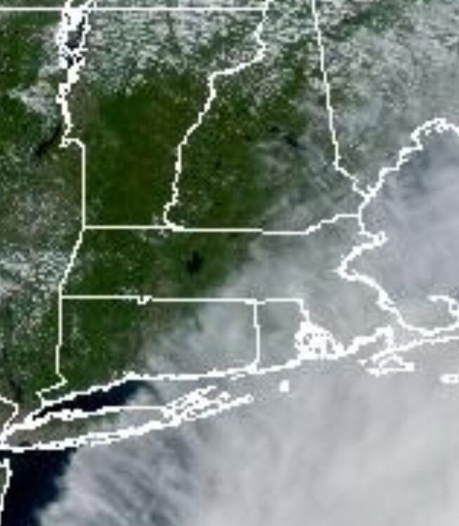
Middle of MDR moving WNW to W as a strengthening TD early next week underneath a stout high:
-

September 2025 OBS-Discussion centered NYC subforum
steve392 replied to wdrag's topic in New York City Metro
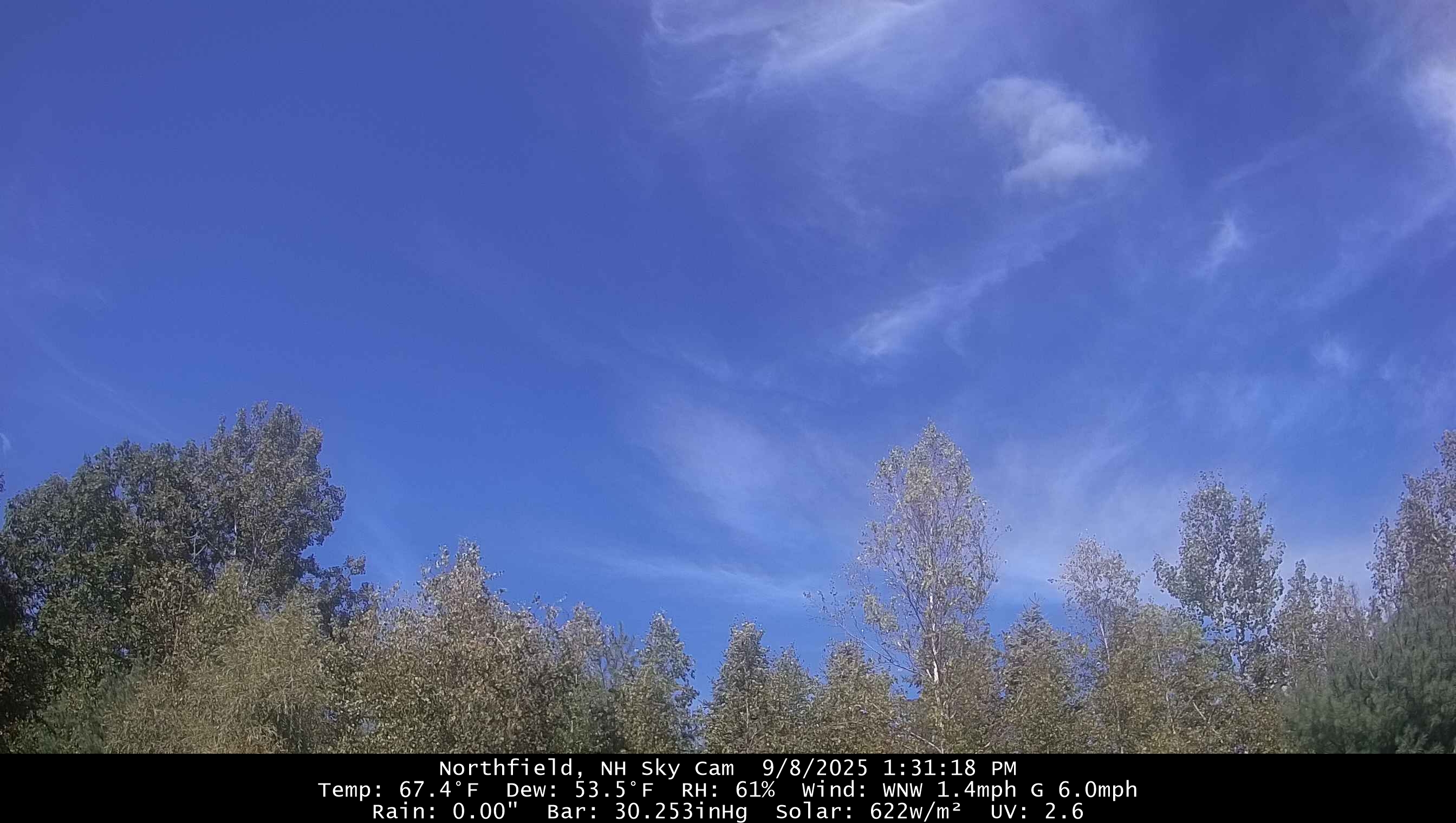
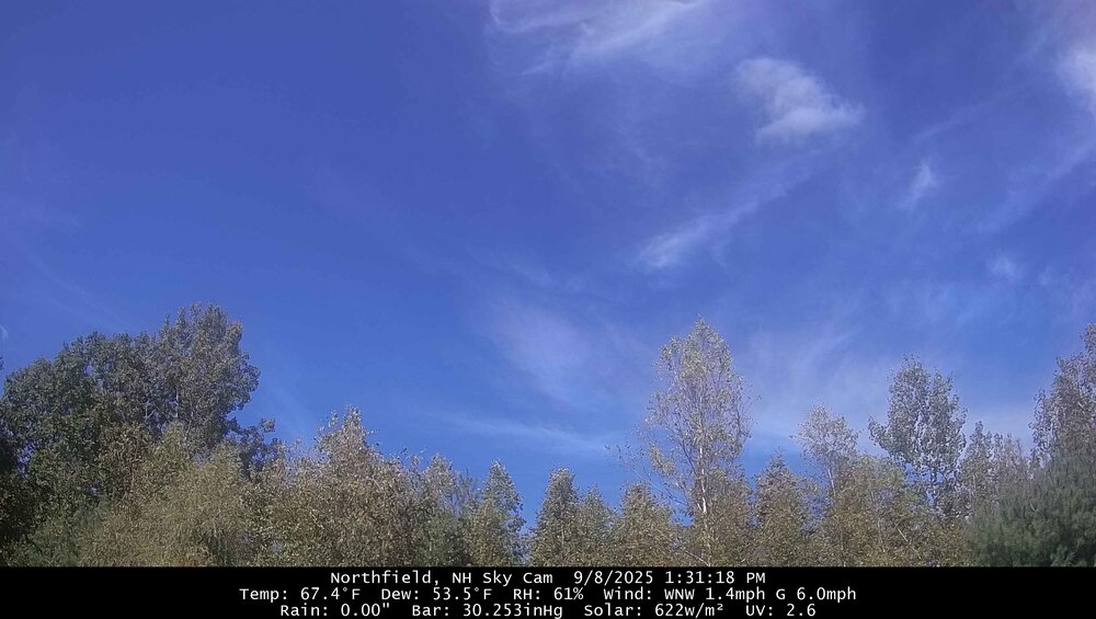
Shorts and hoodie weather! -

2025 Atlantic Hurricane Season
BarryStantonGBP replied to BarryStantonGBP's topic in Tropical Headquarters
Where’s this at lazza -
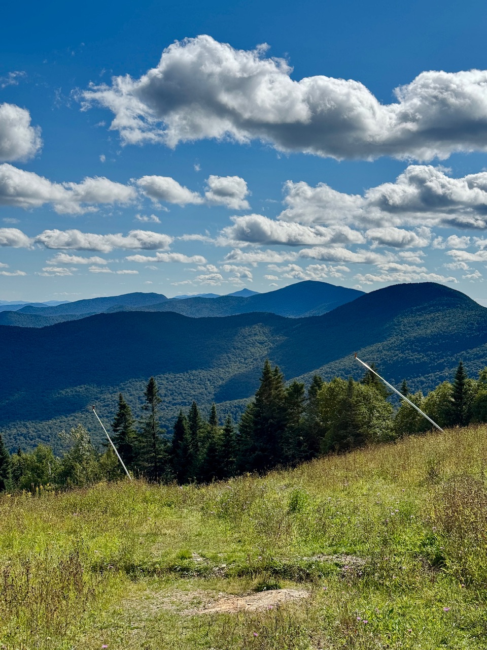
Cold pool Cu dotting the landscape up here. But what a beauty.

-

September 2025 OBS-Discussion centered NYC subforum
nycwinter replied to wdrag's topic in New York City Metro
perfect hoodie day where you can go outside even in bright sunshine and feel cool. -
As a general rule with La Niña winters, if there’s below average snow in November and December, they end up being dud winters. Yes, there are exceptions, but for the most part, November and December set the tone for the rest of winter with a La Niña
-
September 2025 OBS-Discussion centered NYC subforum
steve392 replied to wdrag's topic in New York City Metro
What kind of winter did that year have? -
I can’t think of any Nina season in my life growing up on LI that was any good without at least one decent Dec event. 2017-18 had the 1/4 blizzard that counted as our early event.
-
Low at SBN was 41 but I had 39 on my thermometer at home.
-
The coastal plain will celebrate with December holiday Luau’s. As always ….

-

September 2025 OBS-Discussion centered NYC subforum
PhiEaglesfan712 replied to wdrag's topic in New York City Metro
1988 was one that turned cold really quickly. The summer, particularly from June to the first half/two-thirds of August, was then a warmest on record. Then at the end of August, it just turned cold, and never really looked back. October 1988 was one of the coldest on record, and in some spots, beat out the cold standard of October 1976: Come to think of it, the warm west makes this look like the October version of February (or JFM) 2015.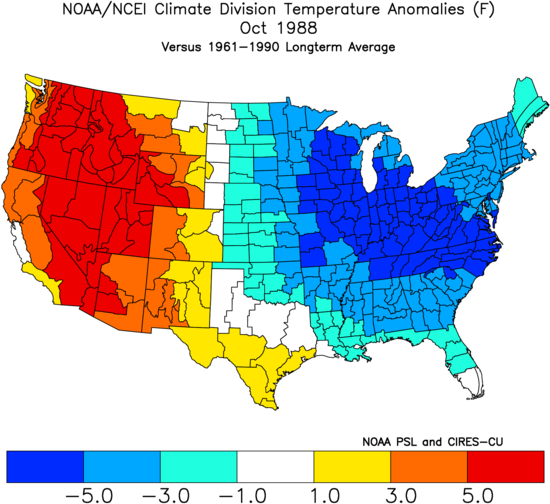
-

2025 Atlantic Hurricane Season
olafminesaw replied to BarryStantonGBP's topic in Tropical Headquarters
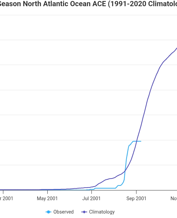
Back below average ACE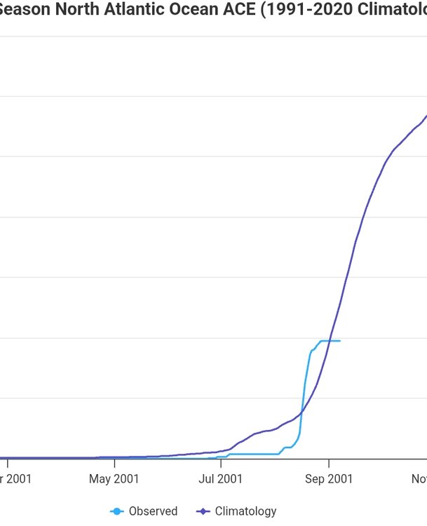
- Today
-
Found this research study (The Elevation-Dependence of Snowfall in the Appalachian Ridge and Valley Region of Northeastern Pennsylvania) examining the impacts on elevation dependence snowfall and the types of conditions that influence events to either be low in snowfall range with elevation or high. Definitely found it to be an interesting read and I'm sure the mets (and @psuhoffman) would enjoy it too. Here is the link (http://nwafiles.nwas.org/jom/articles/2017/2017-JOM8/2017-JOM8.pdf), also if any met would like to chime in I remember a particularly elevation dependent snowfall in late November last year and wonder how those conditions line up with the studies findings.
-

September 2025 OBS-Discussion centered NYC subforum
FPizz replied to wdrag's topic in New York City Metro
https://www.weather.gov/asos/CurrentEvents.html Though I'm told from Tony Gigi when I asked about the qc process, that they only qc the instruments, not the environment around them. Hence I guess why NYC is determined to be fine, since all the instruments are in correct working order. -
West is best.
-
38.7 here this morning.
-
42 here this morning!
-
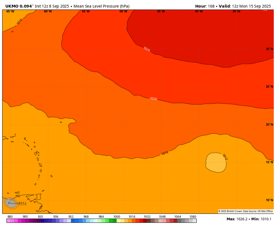
NEW TROPICAL CYCLONE FORECAST TO DEVELOP AFTER 150 HOURS FORECAST POSITION AT T+150 : 13.9N 32.5W LEAD CENTRAL MAXIMUM WIND VERIFYING TIME TIME POSITION PRESSURE (MB) SPEED (KNOTS) -------------- ---- -------- ------------- ------------- 0000UTC 15.09.2025 156 15.0N 33.7W 1012 27 1200UTC 15.09.2025 168 15.1N 37.9W 1010 33
-

September 2025 OBS-Discussion centered NYC subforum
wdrag replied to wdrag's topic in New York City Metro
ASOS new temp sensors? I'm out of touch... LINK for info? Thanks, Walt -
Water was coming in through our doorknobs. I had never seen that before.
-
Two decades later and the US is gleefully dismantling the Federal disaster and weather enterprise. ¯\_(ツ)_/¯
-
Bottom line, even though there wasn’t a ridiculous amount of arctic sea ice loss this spring/summer/early met fall, our starting point at the beginning of melt season was so low, we are still finishing at record low levels this year. God knows how many years it will take, when/if we get back to normal. Whether the arctic sea ice loss is related to SSTs or solar or both is anyone’s guess
-
Heaviest rain I ever experienced. It actually hurt to be out in it even in proper gear Sent from my SM-G970U1 using Tapatalk
-
gwdlt
-

E PA/NJ/DE Autumn 2025 Obs/Discussion
RedSky replied to PhiEaglesfan712's topic in Philadelphia Region
2.30" for September continuing the odd trend of predominately very dry yet high rain totals


.thumb.png.4150b06c63a21f61052e47a612bf1818.png)