All Activity
- Past hour
-

2025-2026 ENSO
brooklynwx99 replied to 40/70 Benchmark's topic in Weather Forecasting and Discussion
i earnestly believe that some of what's been occurring for the last few years is regression to the mean that 20 year stretch was insane... NYC averaged 34" of snow from 2002-03 to 2020-21. that was not going to last -
For the statewide averages, I expect Pennsylvania to check in around 67.9F for the month of August, and West Virginia around 70.0F, both of which are around 50th coldest August of record (since 1895). Meteorological summer should finish around 70.5F for Pennsylvania and 72.5F for West Virginia. That would finish up as 14th warmest for the State of Pennsylvania (since 1895) and tied for 7th warmest for West Virginia (since 1895), with 1901, 1949 & 1952. If anything, I think this projection might be slightly low for August but should be within about 0.1F of the final summer tally IMO, as I would have to be more than 0.3F off for August to be more than 0.1F off for the summer as a whole. Although the statewide numbers are so crowded that even a tenth of a degree can swing things a few places as evidenced by all the multi-year ties.
-
I’m getting ready for severe. Those cells popping in ASH area are strengthening and are immediately preceded by a period of limited clouds, during peak ISR. Primed.
-
Today is the 20th anniversary of Katrina’s landfall along the Gulf Coast. I was a young tropical weenie during the 2005 season and I could not believe the devastation in New Orleans and along the Alabama and Mississippi coast. The human tragedy is beyond words. Feel free to share your stories and reflections here.
-
After a generally hot and humid summer, August is closing out on significantly cooler than normal. August mean should drop around 0.9F with the last 3 days factored in, with the 3-month summer average dropping around 0.3F (0.9F/3). Looking at some long-term "threaded" climate sites, PIT should finish around 73.9F, which would drop us from a 3-way tie for 11th (1877, 1880) to a 2-way tie for 16th place in the threaded record (1878). At Wheeling, summer should finish around 73.4F, dropping from a 2-way tie for 5th (2010), down to 8th place. Note - lengthy gap here from the mid 50s to late 90s... not a whole lot of hot summers in that stretch but at least a couple are missing that can be seen in the PIT and MGW threads (e.g., 1991 & 1995). Morgantown should finish around 73.9F, dropping from 7th place to a 3-way tie for 11th place (2005, 1991).
-
I'm still under 1/2 of an inch for the entire month.
-
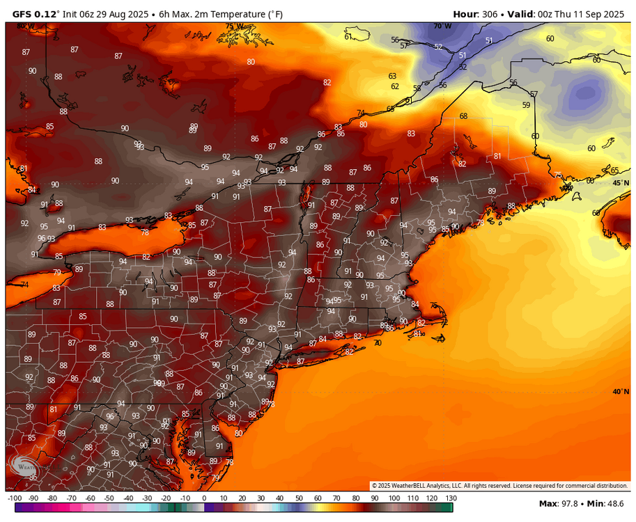
both the gfs and euro ensembles have a high in the low 60s for next Friday here in mt pleasant. Should feel great after a couple days of 80s
-
Firing now…NH/ME border and MHT. Last shot here is probably those showers near EEN.
-
Barely anything here, couple hundredths. We bone dry
-
Mostly “have nots” today with regard to beneficial rain. Barely a five minute shower here.
-
Warwick RI https://www.facebook.com/share/r/1CRzVfE32N/
-
We paid for it with that insane heat wave during most of June! I like the temperatures and all, but having a peak of like 5% chance of rain for the next week is a serious snooze fest. I'm going camping mid-September and it would be nice to have some variable weather, or maybe a thunderstorm once or twice, etc. I know it's a ways out, but that's starting to feel very unlikely lol.
-
kdxken started following August 2025 Summer Thread
-
-
Had another brief downpour around 7:45 this morning, but now the new showers keep forming just to my north east. Steined. 71/62
- Today
-
Mid to long range discussion- 2025
WinstonSalemArlington replied to wncsnow's topic in Southeastern States
The Triad -
I have the shades half closed. It’ll probably start blowing up once it gets east of the MRV.
-
With rain chances officially done for the month, we will finish August with 4 days of measurable rainfall at PIT (and one of them had just 0.01”). This ties 1976 for 2nd fewest rainy days in August. There were 3 in 1881.
-
We always find ways to avoid getting snowstorms in the 2020s. It's like nature is overcorrecting massively for the snowy 2000s-2010s. I really think no matter what kinda 500 mb pattern we get we aren't gonna get a >30" winter for the next few years.
-
About a third of an inch this morning at home. Looks like some convection building now in the Champlain Valley.
-
fortunes are being made
-
I wonder if Boston to Providence will have training storms for the next several hours. Seems to be forming and reforming in the same general area
-
Sorry but I totally disagree. There is a reason why Nino and Nina events are measured/defined by what happens in region 3.4 regardless of what 1+2 or 4 or 3 do. I consider last winter to be a weak La Niña. A late-bloomer weak Nina maybe but a weak Nina nonetheless. I know Ray @40/70 Benchmark does too


.thumb.jpg.ad3a2e31d30aff035044689b311a0540.jpg)


.thumb.png.4150b06c63a21f61052e47a612bf1818.png)


