All Activity
- Past hour
-

Augdewst 2026: Summer's Last Stand
Snowedin replied to Prismshine Productions's topic in New England
Yeah we need moisture very badly. This is no good for lawns, gardens and those of us with flaky skin. I’m rooting for any tropical systems to move in this direction in the coming weeks! -
Poured on me in Aruba today. Cant escape the damn rain.
-
Augdewst 2026: Summer's Last Stand
Snowedin replied to Prismshine Productions's topic in New England
See y’all again Christmas Eve! -

2026 Mid-Atlantic Severe Storm General Discussion
midatlanticweather replied to Kmlwx's topic in Mid Atlantic
This storm popped up in Purcellville is dumping rain!! Man! Lots of water being rung out. -

Augdewst 2026: Summer's Last Stand
Damage In Tolland replied to Prismshine Productions's topic in New England
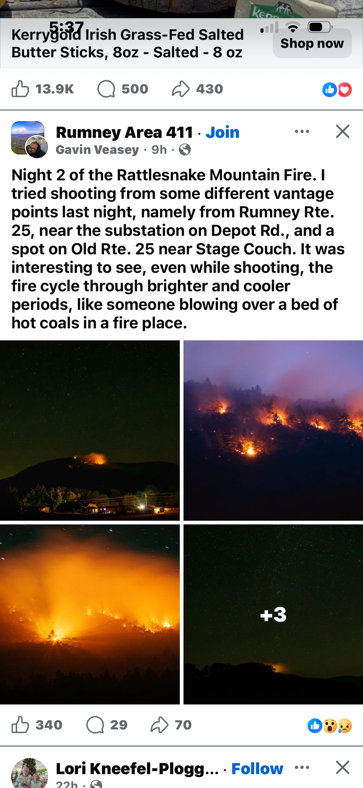
New Hampshire is on fire . Stein taking over again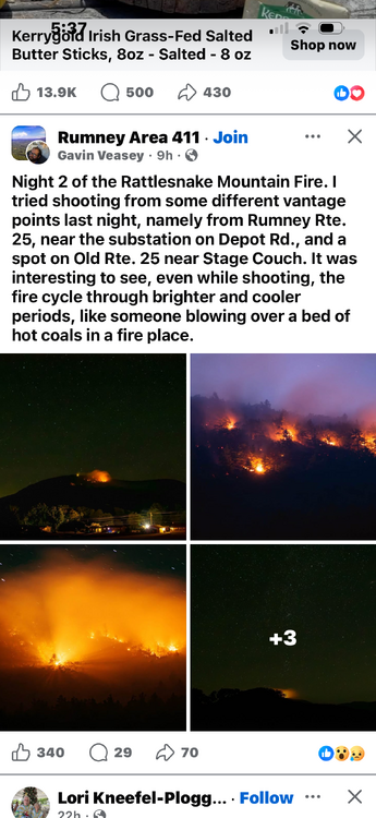
-
Looking at that line die a little in the middle gives me Stephens City vibes
-
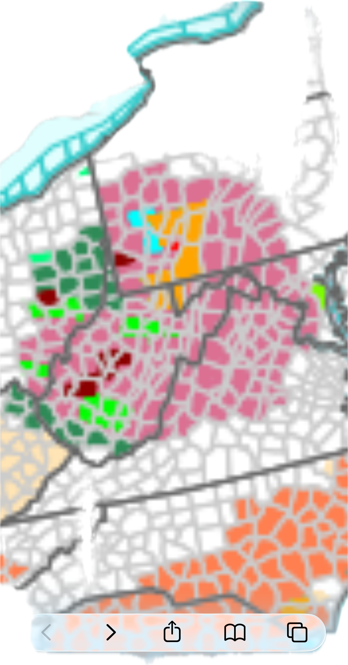
Flood Watch National Weather Service Baltimore MD/Washington DC 522 PM EDT Sun Aug 16 2026 DCZ001-MDZ013-016-504-VAZ053>057-506-526-527-170530- /O.EXB.KLWX.FA.A.0015.260816T2300Z-260817T0700Z/ /00000.0.ER.000000T0000Z.000000T0000Z.000000T0000Z.OO/ District of Columbia-Prince Georges-Charles-Central and Southeast Montgomery-Fairfax-Arlington/Falls Church/Alexandria-Stafford- Spotsylvania-King George-Eastern Loudoun-Northwest Prince William- Central and Southeast Prince William/Manassas/Manassas Park- 522 PM EDT Sun Aug 16 2026 ...FLOOD WATCH IN EFFECT UNTIL 3 AM EDT MONDAY... * WHAT...Flash flooding caused by excessive rainfall continues to be possible. * WHERE...The District of Columbia, portions of Maryland, including the following areas, Central and Southeast Montgomery, Charles and Prince Georges, and Virginia, including the following areas, Arlington/Falls Church/Alexandria, Central and Southeast Prince William/Manassas/Manassas Park, Eastern Loudoun, Fairfax, King George, Northwest Prince William, Spotsylvania and Stafford. * WHEN...Until 3 AM EDT Monday. * IMPACTS...Excessive runoff may result in flooding of rivers, creeks, streams, and other low-lying and flood-prone locations. * ADDITIONAL DETAILS... - Multiple rounds of showers and thunderstorms are expected to move through the Watch area this evening through the first half of the night. A widespread 1 to 2 inches of rain is expected, with localized totals of 2 to 4 inches where training or backbuilding occurs. Some instances of flooding are expected to occur, especially in urban areas that receive multiple rounds of storms. - Please visit www.weather.gov/safety/flood for flood safety and preparedness information PRECAUTIONARY/PREPAREDNESS ACTIONS... You should monitor later forecasts and be prepared to take action should Flash Flood Warnings be issued.
-
Man did my area get cut down. Forecast went from 0.5 to 0.75 for today and tonight to just 0.25 to 0.5 for tonight after nothing today. Oh well I guess the all day thick overcast killed it
-
No rain in 15 days here
-

2026 Mid-Atlantic Severe Storm General Discussion
mitchnick replied to Kmlwx's topic in Mid Atlantic
Mts seem to be beating the line up a bit.- 1,954 replies
-
- 2
-

-

-
- severe
- thunderstorms
- (and 7 more)
-
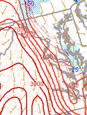
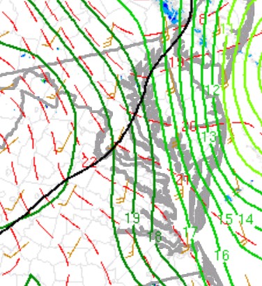
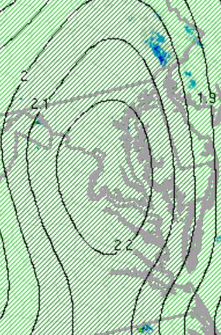
That sharp CAPE gradient (attached) the modeled show ydy has verified well. Notice IAD has 74 Td and HEF 76 Td but DCA 69. 925 mb Td gradient evident as well (also attached). No PWAT gradient though, bull's-eye 2.2+ centered right over DC metro! The cells forming ahead of the line, have to watch those when they cross this gradient as storm boundary interaction is often key for svr/tor. Also, if the gust front fans out well ahead of the line, how will that affect the Td and CAPE gradient? Bodily push it E? Bow echo often ride parallel to boundaries, but slamming into it perpendicularly? I don't know.
- 1,954 replies
-
- 3
-

-
-
- severe
- thunderstorms
- (and 7 more)
-
Stayed in the upper 60's all day w/ some drizzle and fog from time to time. Seasonal weather this week with the possibility of a sneaky cool night Wednesday. Point is already 45.
-
That question has been tossed around for weeks over in the main El Niño thread. I think we in the MA have started to see it with increased precip over the last month, but there's no evidence of it yet on a larger scale. Rest assured, it's coming...for better or worse.
-
Mostly in the southern hemipshere, STJ down there is insane. We’re not quite there yet in the NH but should couple better in the next few months as it cools.
-
Some small storms beginning to fire ahead of the line
-
Might see a few quick weak spin ups as the line interacts with the retreating WF
-

2026 Mid-Atlantic Severe Storm General Discussion
Eskimo Joe replied to Kmlwx's topic in Mid Atlantic
This line is booking east. Latest warnings from Sterling have movement at 50 mph. -
Finally! It has been nice to see green and not brown. Yep I at .62” as of now.
-
Wow, RRFS not as good for CAD? Given its 3 km resolution (same as NAM Nest) and the RRFS has 65 vertical layers compared to the NAMs 60, that seems odd. Lowest RRFS layer is 8 m "to better capture surface and planetary boundary layer (PBL) dynamics."
- 1,954 replies
-
- 1
-
-
- severe
- thunderstorms
- (and 7 more)
-
Well, since you posted it @yoda, that gives me an excuse to comment! And it is not merely a rant, it is food for thought. It is a bit odd b/c there is a SVR out now for the county, which was highly likely to begin w/. The SPS are typically reserved for non-svr storms for heavy rain and LTG risk. Also, whether the CG lightning is frequent or not is or should be irrelevant. The risk is still there regardless. So it is superfluous wording really. And "frequent" definition for lightning is questionable as it pertains to wx IMHO. In a METAR, lightning is considered frequent 1 to 6 flashes per min. Is 1-2 per min really "frequent?" And "continuous" is more than 6 flashes per minute. That not what "continuous" really means by its actual definition. It can and does get far more than 6 flashes per min (200 per min at times) enough in many parts of the county often enough that it can clearly be quantified better. How things are said/worded and their context are important. It is what IDSS is all about.
- 1,954 replies
-
- 1
-
-
- severe
- thunderstorms
- (and 7 more)
-

2026 Mid-Atlantic Severe Storm General Discussion
wxmeddler replied to Kmlwx's topic in Mid Atlantic
The SPC is creating a new Mesoanalysis based on a HRRR DA system. There was a recent SLS presentation about it. No idea! I asked about this specifically in a Q/A... and they provided a written answer! "The NAM is known to perform well for cold-air damming events. A comprehensive assessment of the RRFS’s ability to capture cold air damming events has not been conducted. However, subjective assessments indicate that it likely does not perform as well as the NAM for this phenomenon. This is a development priority for future releases."- 1,954 replies
-
- 1
-
-
- severe
- thunderstorms
- (and 7 more)
- Today
-

Central PA Summer 2026 Discussion/Obs Thread
Itstrainingtime replied to Voyager's topic in Upstate New York/Pennsylvania
I dunno - that is one vicious line moving through western PA. TOR warned as well. It should weaken some I would think but it's hard to believe we don't get some rain at the very least from it. -
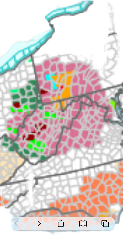
Severe thunderstorm watch until 11 for western and central areas:
-
- 1,954 replies
-
- 1
-
-
- severe
- thunderstorms
- (and 7 more)
-
Severe Thunderstorm Watch up until 11pm URGENT - IMMEDIATE BROADCAST REQUESTED Severe Thunderstorm Watch Number 588 NWS Storm Prediction Center Norman OK 435 PM EDT Sun Aug 16 2026 The NWS Storm Prediction Center has issued a * Severe Thunderstorm Watch for portions of District Of Columbia Maryland Central Pennsylvania Virginia Eastern West Virginia Coastal Waters * Effective this Sunday afternoon and evening from 435 PM until 1100 PM EDT. * Primary threats include... Scattered damaging wind gusts to 65 mph likely A tornado or two possible SUMMARY...Multiple organized clusters of storms will likely cross the mountains and generally persist east-southeastward into the region, as the downstream air mass near/east of the mountains destabilizes in the wake of early morning storms and cloud cover. Damaging winds are the most common severe hazard expected, but some tornado potential may exist as well, particularly near an effective warm front. The severe thunderstorm watch area is approximately along and 65 statute miles east and west of a line from 40 miles east northeast of Altoona PA to 50 miles south southwest of Staunton VA. For a complete depiction of the watch see the associated watch outline update (WOUS64 KWNS WOU8).