All Activity
- Past hour
-
Breezy and chilly here 52, dry air winning the battle for now
-
It does seem like an error, have to check back to see if it changes.
-
small consolation perhaps but in looking over the qpf from various products this has a real chance at either maxing or being prolific enough right where there is lingering deficits/ongoing drought monitoring up in ne ma/se nh
-
haha I think what hes saying is its the same as wanting 50s and rain in January. Most would say its depressing
-
We're miserable at primary lows headed towards Lake Erie.
-
Looks like another delayed-denied underachiever. After this first wimpy batch moves through, it's mostly hit or miss scattered showers through tomorrow. 0.21"
-
Well, this one is a complete bust.
-
No clue what happened here other than hail and wind,i thought some of the cells should have been tor warned sooner and a couple that should have been warned that wasnt,but thats just me.I know there was some large hail over 2" in Franklin and other places as well,we just got wind here,i didnt see no hail.I thought Morristown was suppose to do our weather here basically,sure they were busy also.
-
rain mow rain mow come on man enough its just may and i am tired of mowing already
-
47 at present with a nice breeze making it feel even nicer. Enjoy folks!
-
Since when does preferred weather make you sick in the head? I think its sick in the head to spend winter in a tropical climate, but I dont take to insults
- Today
-
0.32 from this morning’s rain drizzle /55
-
0.32”. Latest HRRR gives us about 0.30” later, but the NAM Nest is more like 0.1”-0.2”. Both develop showers tomorrow afternoon.
-
Just something I noticed in the point and click. No WAY can this be correct..Thunderstorms with cold temps and an easterly wind? That’s rubbish, no? Thursday Showers and possibly a thunderstorm before 3pm, then showers between 3pm and 5pm, then showers and possibly a thunderstorm after 5pm. Some of the storms could produce heavy rainfall. Patchy fog. High near 51. Northeast wind 11 to 15 mph, with gusts as high as 31 mph. Chance of precipitation is 100%. New rainfall amounts between a half and three quarters of an inch possible.
-
A bit breezy , damp and actually a little bit chilly outside right now...
-
Sort of hard to believe that we don't have confidence at least in "trends" of temperature more than 10 days out in the year 2025. Then again, I'm surprised at a lot of things in 2025...
-
I thought this was your favorite weather? You and Metfan should be skipping through the puddles
-
0.19 More than I anticipated looking at radar earlier... At least it keeps the ground moist and helps keep things nice and green/growing , with no legit heat in sight....
-
what a miserable cold rainy morning it is cold enough to wear a winter coat..
-
I know most folks on here don't like the wx pattern, but as for me, it's just normal fare up my way. 0.30" of rn yesterday. 1.48" for the month. 3.30" is the May avg, and the wx pattern looks fairly dry for me for the rest of the month. Frost adv for tomorrow a.m. across NE MN into N WI & U.P. MI.
-
If loop below it really exemplifies... really is about as bad a synoptic predicament as possible without a comet impact on Earth ... https://weather.cod.edu/satrad/
-
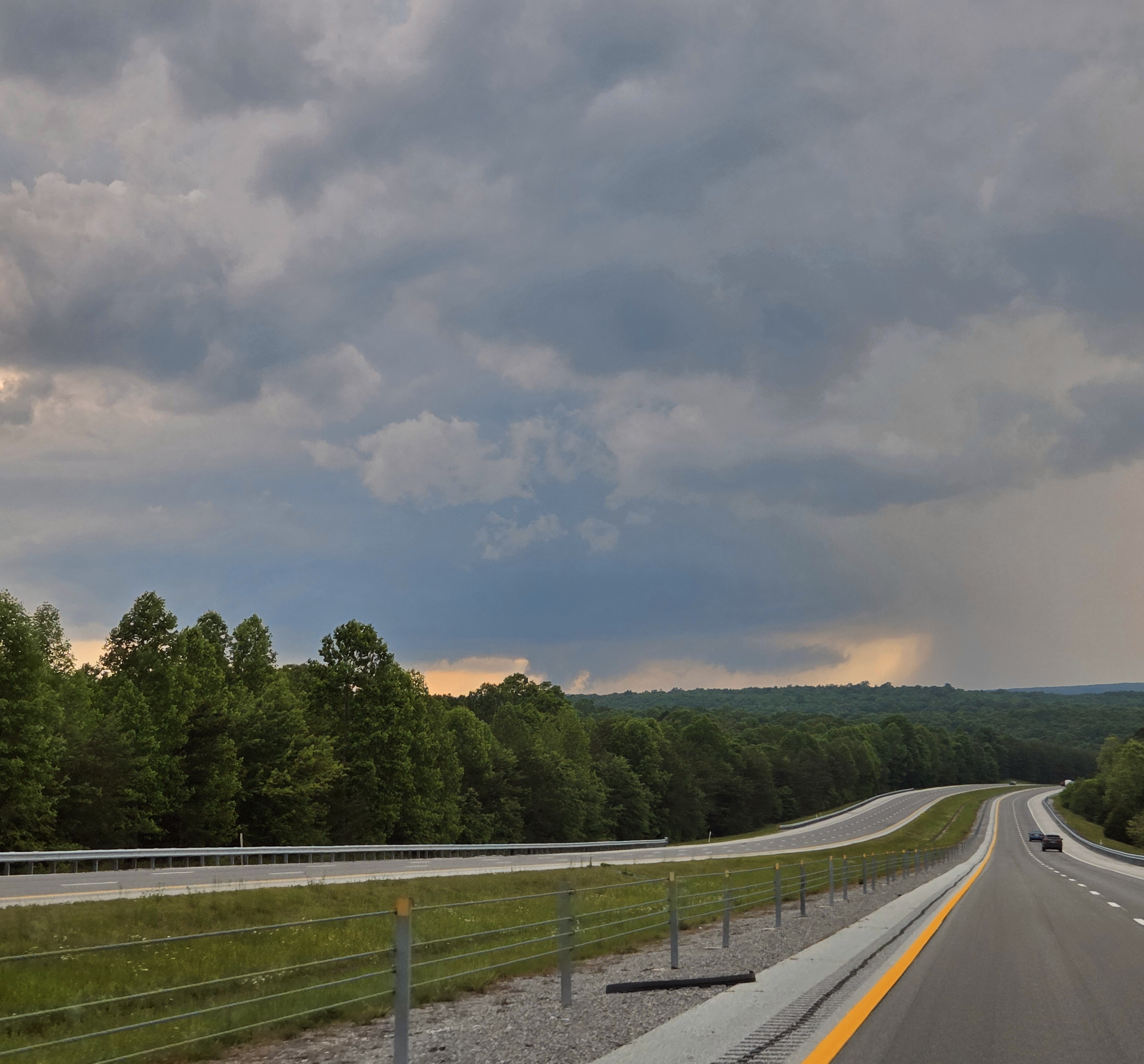
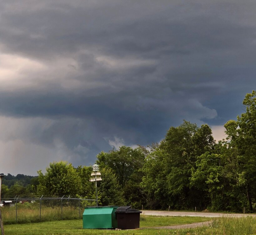
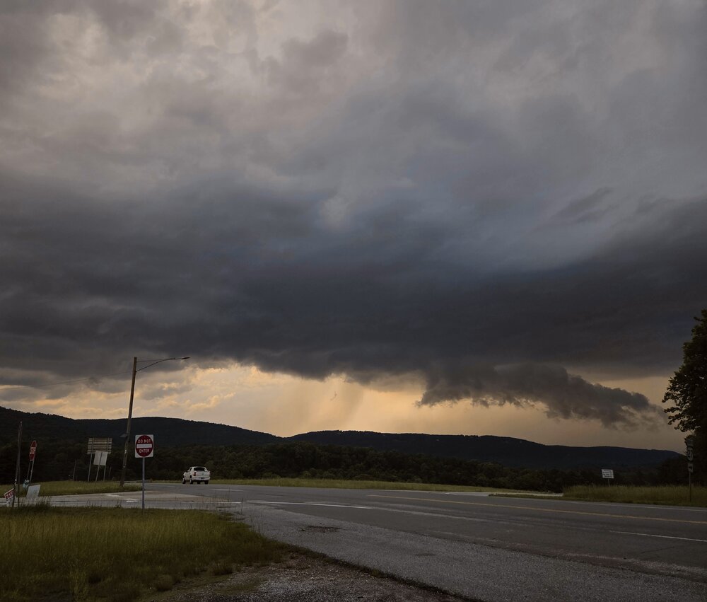
Unfortunately lots of scattered but significant damage is reported in North Alamba. James Spann posted. Also saw text reports from EMs. Sad deal more like an April event. Haven't heard much from the Nashville 'burbs. Meanwhile sups split Chattanooga so we lucked out here. I was unable to truly chase on Tuesday due to work requirements. However during a lull between the Cherokee, AL / Pickwick Reservoir tornado and evening trouble I was able to get out locally. A severe warned cell (actually the Cherokee cell hours later) tracked from Monteagle, to Dunlap, to Soddy Daisy all Tennessee. I-24 is a no-fly zone for me at rush hour, so no Monteagle, but I was able to track it from Dunlap to Soddy just north of Chattanooga. It was between 6-7 pm EDT before the Madison, AL and Huntsville stuff got really ugly. Here are my low-lights. While the first is arguably structure out of the spotter's guide, less crisp but good for East Tenn... the rest is scuddy crap. Oh well! At least I got out of the house. So while the Cherokee cell stopped producing tornadoes, it retained supercell characteristics for several hours. I believe it was on the intersection of the outflow boundary and a prefrontal trough. Evening cells were associated more with the main surface trough - enhanced by the same outflow boundary.

-
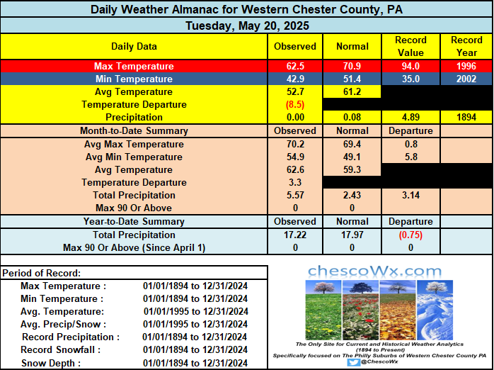
An ugly couple of unseasonably chilly and wet days ahead of us. Both today and tomorrow will feature rain and temps not too far from the low 50's....tomorrow some higher spots may actually struggle to escape the 40's! We should see around a half inch of rain today and about the same tomorrow. We start to dry out a bit by Friday PM and we start The Memorial Day weekend with sunny skies but with a continued unseasonable chill in the air. Temperatures look to remain below normal for at least the next week.
-

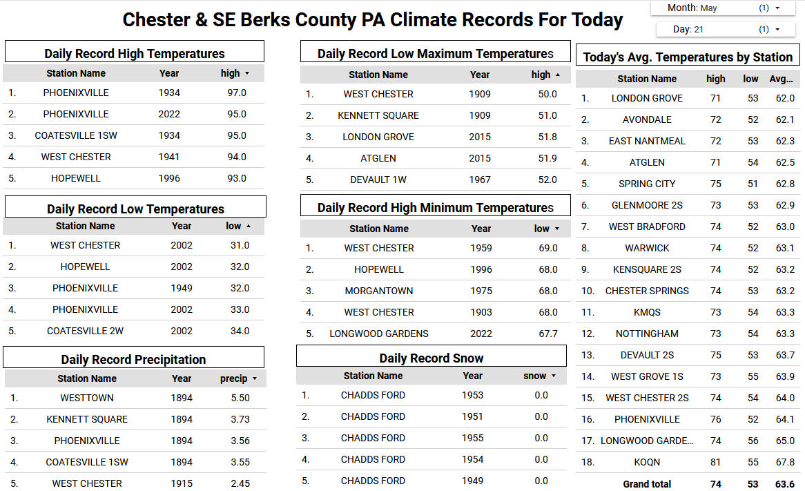
E PA/NJ/DE Spring 2025 Obs/Discussion
ChescoWx replied to PhiEaglesfan712's topic in Philadelphia Region
An ugly couple of unseasonably chilly and wet days ahead of us. Both today and tomorrow will feature rain and temps not too far from the low 50's....tomorrow some higher spots may actually struggle to escape the 40's! We should see around a half inch of rain today and about the same tomorrow. We start to dry out a bit by Friday PM and we start The Memorial Day weekend with sunny skies but with a continued unseasonable chill in the air. Temperatures look to remain below normal for at least the next week.