All Activity
- Past hour
-

2026 C and E Pacific tropical activity
LongBeachSurfFreak replied to GaWx's topic in Tropical Headquarters
Kauai is really going to luck out here. This could easily rival Iniki if it were slightly further east on the recurve . -

2026 Mid-Atlantic Severe Storm General Discussion
adelphi_sky replied to Kmlwx's topic in Mid Atlantic
Looks like I'll be sitting this one out. Southern PG and Alexandria look to have a good shot. -
 mexican rx: online drugs order or order meds from mexico
 -
Yep today was great right from 9 am onwards.
-
It was absolutely awesome at 9 am when I went outside perfect weather for a walk.
-

2026 Mid-Atlantic Severe Storm General Discussion
Eskimo Joe replied to Kmlwx's topic in Mid Atlantic
Ping pong ball sized hail report just NW of Orange. -
Always great to give the cactuses some water.
-

2026-2027 Record-breaking El Nino
GaWx replied to Stormchaserchuck1's topic in Weather Forecasting and Discussion
1. My post started with “Consistent with OISST, the August relative ERSST anomaly for Nino 3.4 just came out”. Thus it should be understood by anyone following along that the entire post is talking about “relative” anomalies. 2. My entire post is addressing anomalies, not absolutes. You’re using an absolute in your example. 3. Relative anomalies are now official for NOAA and BoM at the least. 4. The outdated traditional way of determining anomalies is currently inflated ~0.5C due to GW. 4. August of 2026 was very warm, but it wasn’t the warmest relative anomaly on record as Aug of 1997 was 0.18 warmer. 5. The main point of my post is that the models had way too rapid warming in 3.4 from July to August. It warmed only 0.34C per ERSST, which prevented a record high relative 3.4 for Aug. -

2026-2027 Record-breaking El Nino
frontranger8 replied to Stormchaserchuck1's topic in Weather Forecasting and Discussion
You're missing the main point. Wasn't about absolute temps, but instead warming relative to forecasts. -
Looks like .56" from that storm. Flush hit. .9" since last night.
-
Just wait til the soil gets hypersaturated! Then you'll get to see something!
-

Fall 2026 Medium/Long Range Pattern Thread
Carvers Gap replied to John1122's topic in Tennessee Valley
Even TRI has been scorching hot. Our real feels have only been 3-4 degrees cooler than you all at times. Boiling hot. Jeff, let's hope the Weeklies today were dealing with feedback. Super torch and prolonged. -
I remember them building 68. I remember hearing the dynamite blast in Artemas.
-
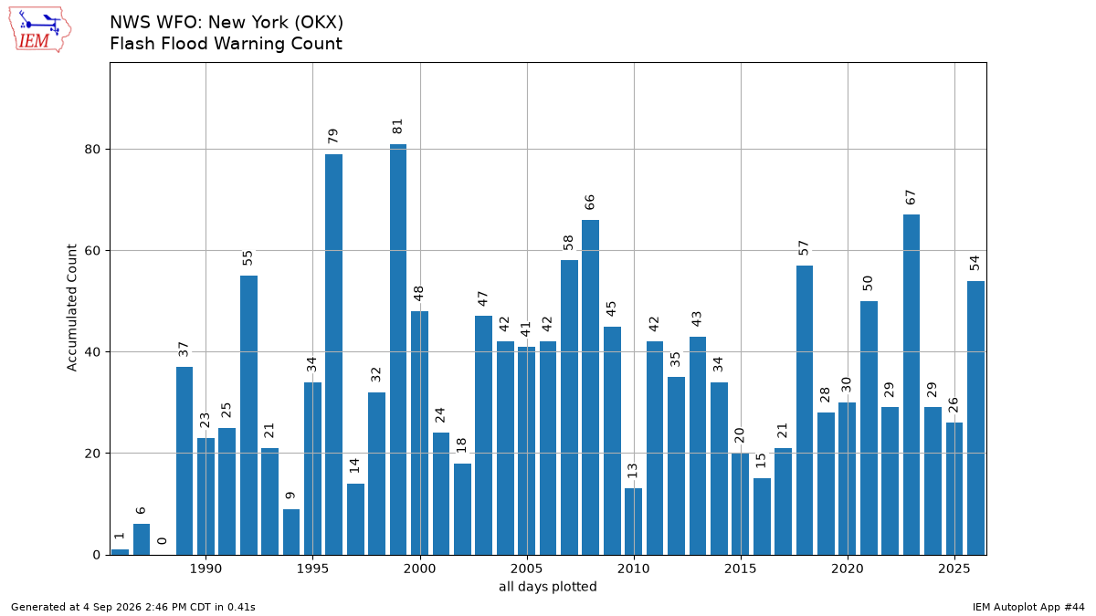
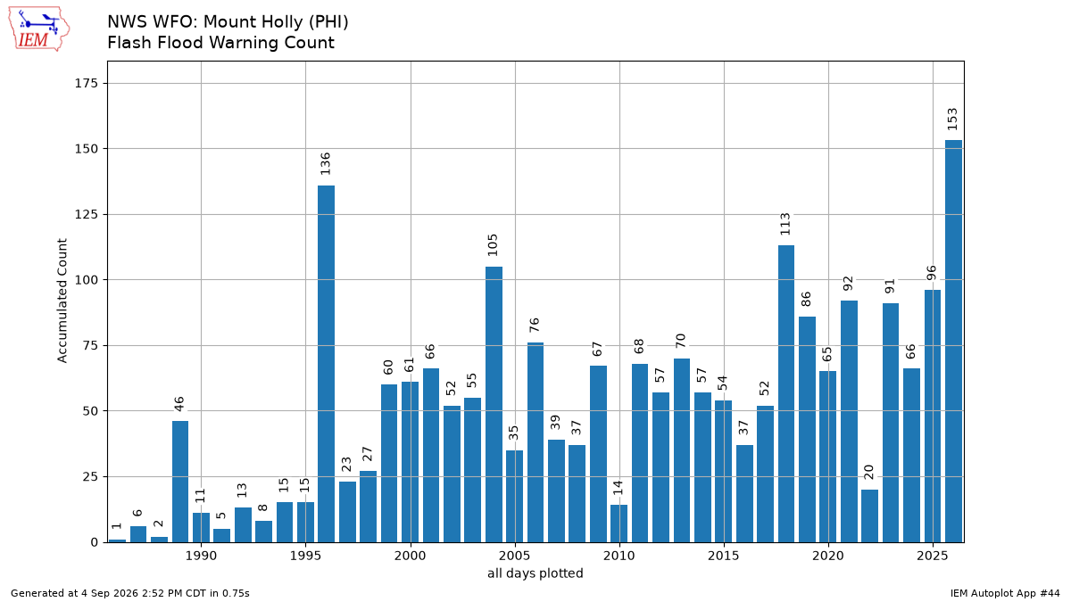
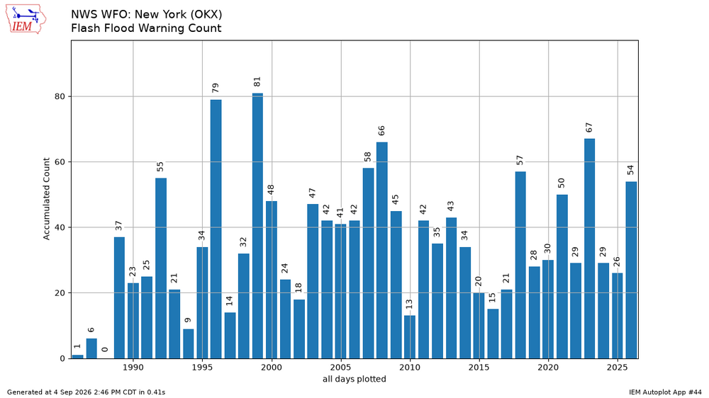
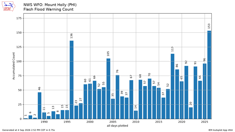
Looks like the OKX forecast zones moved up to 8th place so far for annual flash flood warnings while the PHI zones are in 1st place. https://mesonet.agron.iastate.edu/plotting/auto/?_wait=no&q=44&plot=bar&opt=wfo&station=OKX&state=CT&fema=7&limit=no&c=single&phenomena=FF&significance=W&syear=1986&eyear=2026&s=jan1&_r=t&dpi=100&_fmt=png
-
Congrats on the rains, DMV! Welcome to a Record Nino Autumn! You are all in perfect position for this! The Plume is coming straight at you! It's a massively East-Based Nino and you are right in the middle of it! Enjoy all those rains! There's a hell of a lot more where those came from! Look out for a Roided-up STJ!
-
.thumb.gif.f92b16c631a1d15d405ed77b33f0710d.gif)
Monday, August 31 - Thursday, September 3, 2026 Convective Episodes
Torch Tiger replied to weatherwiz's topic in New England
Yeah hopefully some with the annual Holiday screamer -
Some cool weather new for Maryland/DC folks. Montgomery County is developing an extension to the statewide mesonet with a focus on suburban and urban tripod stations. This will be known as the Montgomery County Micronet, with at least four (4) additional stations coming online this autumn. The first site just went online this past week. @wxmeddler and I rushed this site to completion as the MCS dove south from PA and we got it online maybe 10 min before the storms came in. When all is said and done, we'll have stations about ever five to seven miles in Montgomery County.
-
http://mapplemed.shop/# certified canadian international pharmacy
-
Dimed my way to another 0.34 with this batch up to 1.47" for the week and hopefully counting
-
Drove that stretch a lot, in all kinds of bad weather, before I-68 was there. Rt 40/48 was a thrill ride crossing those hills, especially in thick fog or blowing snow. Glad you and the truck made it safely.
-
Not as much severe here-but lots of flooding events. 7/4 was our big severe day in CT
-
This season might be a total loss. No canes yet and I don't see any potential in the foreseeable future.
-

2026 Mid-Atlantic Severe Storm General Discussion
AmericanWxFreak replied to Kmlwx's topic in Mid Atlantic
One hell of a supercell heading towards Orange. . -
NJ, Oklahoma'ed, while Long Island, Long Island'ed
-
Thankfully, yes, 2 storms in 15 hours. Feels so good. This was the windiest storm of the year. Pretty intense 15 minutes. Best of all, the timing killed the afternoon heat!