All Activity
- Past hour
-

January 25-26 Winter Storm Potential
Ralph Wiggum replied to Ralph Wiggum's topic in Philadelphia Region
100% outlier. I mentioned earlier today, the gfs will cling to an outlier solution right up to and even during the start of an event at times. It's a stubborn s.o.b. but dont fall for it. -
18z Euro out to hr24 LFG!!!
-
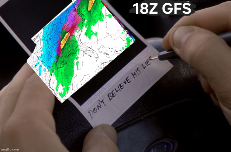
How I am feeling about the trends on the 18z GFS:
-
Ok. LWX has me getting 5 to 9 inches Saturday night and 3 to 7 on Sunday.. so that's 8-16 total. I love the sound of that but seems kinda high considering some of the models. I'm wondering if LWX is leaning on the GFS
-
Agree. What was it that Jeff said. Click bait.
-
Did Ai run yet ?
-
.thumb.png.4150b06c63a21f61052e47a612bf1818.png)
“Cory’s in LA! Let’s MECS!” Jan. 24-26 Disco
HIPPYVALLEY replied to TheSnowman's topic in New England
Do you think WNE can at least hold some mood snows through Monday? I know out here it’s the initial WAA thump that does most of the damage. -

Possible Record Breaking Cold + Snow Sunday 1/25 - Tuesday 1/27
jm1220 replied to TriPol's topic in New York City Metro
Oh I agree. -

January 25-26 Winter Storm Potential
Hurricane Agnes replied to Ralph Wiggum's topic in Philadelphia Region
That's the next Thursday storm I think (vs this weekend)! Trying to get through this one! -
Euro's a runnin
-
When all else fails phone Orlando
-
Okay that’s enough yall. The mass reactions speak for themselves
-
This last storm of about 6" was the most my almost 7 yr old has seen in one storm. Don't think he can fathom some of the numbers we are possibly looking at for this weekend.
-

January 25-26 Winter Storm Potential
Roger Smith replied to Ralph Wiggum's topic in Philadelphia Region
Some parts of ePA could see 18-24 inches, question being how far north of PHL would that most likely verify? I am thinking Allentown towards Catskills of se NY is the sweet spot for this storm. I am taking a consensus but relying on GFS to be closest to verifying. You'll notice in 18z GFS there is promising evolution off the coast of a faster deepening low that tries to push back northwest before being pulled around closer to Long Island. That would likely result in strong banding of snow overnight Sunday into Monday. There will be mixing issues somewhere between PHL and SBY, I hope it doesn't mix anywhere in PA but it probably will briefly near the end of the storm most likely, by then the bulk of precip will have moved past, -
Those are some interesting ranges: 1-7. Way to narrow it down. Sent from my Pixel 10 Pro XL using Tapatalk
-
The sun sets and it’s -6 with a WC of -31. Tundra vibes

-

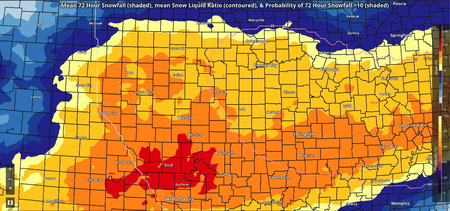
MO/KS/AR/OK 2025-2026 Winter Discussion
rockchalk83 replied to stormdragonwx's topic in Central/Western States
This is the 19z 72-hour mean snowfall off the National Blend of Models. There has been a bump up of this as we've gone through the day. The red area is snow totals of 18-22 inches, orange is 12-18.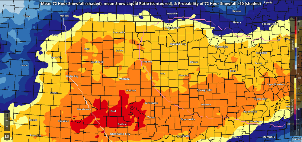
-
But like... a glacier?
-
U must be a riot at parties
-
It's hard to argue with the logic though.
-

January 24-26: Miracle or Mirage JV/Banter Thread!
RDM replied to SnowenOutThere's topic in Mid Atlantic
Now THAT was funny. Just about spit out my beer. Great post.... and likely very accurate. Not sure who that 300 dude is but he needs to read more and post less - as in never. -
“Cory’s in LA! Let’s MECS!” Jan. 24-26 Disco
HIPPYVALLEY replied to TheSnowman's topic in New England
Our time has come. -
You are a legend! Hats off to you sir or ma’am
-
288hr map has 2.3"sleet in Philly
-
Sheesh. They are updating frequently today!


.thumb.jpg.9707d4addca3d84715ae3d888c5c10d6.jpg)