All Activity
- Past hour
-
84/68
-
well, in the end the timing improved, but the track still lead to a doa situation. the convection across the southern plains the night before ended up further south, leading to a further south track of the potent mcv.
-
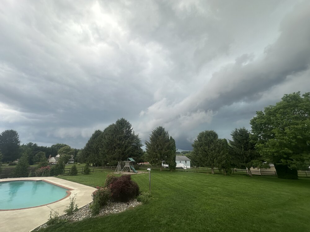
Picked up 0.6" in about 12 minutes with that cell that passed over me. Nothing severe, just torrential rain and a bit of a breeze with some rumbles of thunder.
-
BULLETIN - IMMEDIATE BROADCAST REQUESTED Severe Thunderstorm Warning National Weather Service Baltimore MD/Washington DC 351 PM EDT Thu Jun 19 2025 The National Weather Service in Sterling Virginia has issued a * Severe Thunderstorm Warning for... The District of Columbia... Southeastern Howard County in central Maryland... Southern Montgomery County in central Maryland... Central Prince Georges County in central Maryland... West central Anne Arundel County in central Maryland... Southeastern Loudoun County in northern Virginia... The City of Falls Church in northern Virginia... Fairfax County in northern Virginia... The City of Manassas Park in northern Virginia... East central Prince William County in northern Virginia... The northeastern City of Manassas in northern Virginia... The City of Fairfax in northern Virginia... Arlington County in northern Virginia... The City of Alexandria in northern Virginia... * Until 445 PM EDT. * At 351 PM EDT, severe thunderstorms were located along a line extending from Broadlands to 7 miles west of Dale City, moving northeast at 50 mph. HAZARD...70 mph wind gusts. SOURCE...Radar indicated. IMPACT...Damaging winds will cause some trees and large branches to fall. This could injure those outdoors, as well as damage homes and vehicles. Roadways may become blocked by downed trees. Localized power outages are possible. Unsecured light objects may become projectiles. * Locations impacted include... Arlington, Alexandria, Columbia, Centreville, Dale City, Rockville, Bethesda, Gaithersburg, Reston, Bowie, Annandale, Clinton, Olney, Springfield, College Park, South Riding, Fort Washington, Herndon, Greenbelt, and Fairfax. PRECAUTIONARY/PREPAREDNESS ACTIONS... This is a DANGEROUS SITUATION. SEEK SHELTER NOW inside a sturdy structure and stay away from windows! Damaging wind, and continuous cloud to ground lightning are occurring with these storms. Move indoors immediately. Lightning is one of nature`s leading killers. Remember, if you can hear thunder, you are close enough to be struck by lightning. Torrential rainfall is occurring with these storms, and may lead to flash flooding. Do not drive your vehicle through flooded roadways. && LAT...LON 3926 7679 3877 7674 3864 7746 3905 7751 TIME...MOT...LOC 1951Z 242DEG 41KT 3900 7750 3864 7749 THUNDERSTORM DAMAGE THREAT...CONSIDERABLE HAIL THREAT...RADAR INDICATED MAX HAIL SIZE...<.75 IN WIND THREAT...OBSERVED MAX WIND GUST...70 MPH
-
it's super frustrating when the 18z HRRR and the 3km initialize totally off. We already had cells in SNE at hr00 and by hour 1 both could already be tossed. It's like radar data didn't make it in.
-
Temp down to 70 at home - already up to .54" of rain and a top wind gust of 40 at the airpark down the road.
-
Pouring in basking ridge at the office; very loud cracks of thunder.
-
57kts IAD
- 1,118 replies
-
- 4
-

-
- severe
- thunderstorms
- (and 2 more)
-
eh screw it...just going to go home. nothing else looks like it is popping and the stuff going on is coming down
-
I forget the name of the place but right below the police station in camp hill there a store that specializes in whole natural baby foods. They have the best raw milk period. The cream line is halfway up the jug if you can get there in time to get the best jugs. You have to sign up to get it and it's Deliver to the store every Wednesday.
-
We’ll see what the stuff out in western PA does, but it’s having a hard time developing into anything. I’m not holding my breath… First round was lame…just some rain and a couple rumbles of thunder.
-
Wait, you live in Oceanside and you WANT a cat 3 to hit like 10-15 miles west of where you live??
-
Not a bad idea, but traffic may be miserable getting there lol
-
Bring it! honestly, the dp is 75 here now, how much worse can it be?
-
Yesterday qualifies as a serial derecho.
-
93 Nashua, NH /dewpoint dropped from 73 to 70...............swamp ass
-
About to get it hit
- 1,118 replies
-
- 4
-
-
- severe
- thunderstorms
- (and 2 more)
-
Drive up to the top of Castle Craig in Meriden. The round stone observation tower of native trap rock was built by local stone masons in 1900. It stands on East Peak with an elevation of 976 feet. The tower is 32 feet in height and 58 feet in circumference
-
Be very careful with raw milk . Healthy cows produce milk much higher in Saturated fats. I only drink raw milk But only a few cups a week now because it almost Single handedly sent my cholesterol through the fkn roof.
-
Initial wind was serious but now just dumping rain
-
Yeah. This is something.
-
Chris would you have said this before 2013-14 and 2014-15 too? One thing about climate change, it means more extremes, more droughts more rain and snow, and more extreme temperatures (maybe more likely in winter than summer.)
-
Little kink in the line near Brambleton, maybe
- 1,118 replies
-
- 1
-
-
- severe
- thunderstorms
- (and 2 more)
-
Probably going to go hang in North Branford for a bit in the field next to police station. It's a nice open spot. But that still may be just a bit too much into marine influence. Maybe I'll do Wallingford.
-
Yep, today is ideal, the sun isn't being blocked by clouds, but the white billowing cumulus clouds to the north do look pretty.


.thumb.jpg.6a4895b2a43f87359e4e7d04a6fa0d14.jpg)