All Activity
- Past hour
-
.4 so far which is what I got out of the last event a couple of weeks ago, but hopefully this is just a start. Good luck to everyone looking for rain.
-
Hottest day of year. 96.6 here, blew out the forecast of 91. Outflow just rolled through. Praying the storms behind it keep popping
-
Early plantings covered.
-
I'm glad we're going to get much-needed rain Saturday into Sunday morning. At least Monday doesn't look too bad. We'll have to see how long the rain lingers on Sunday -- some models move it out in time for late day and evening for people that want to cook outside. That's uncertain right now, but of course the one thing that is certain is Saturday is shot.
-

2026-2027 Strong/Super El Nino
LakePaste25 replied to Stormchaserchuck1's topic in Weather Forecasting and Discussion
Yup. To eradicate that W pac warm pool (which is what we want), we will need to maximize on this potential. -

2026 Atlantic Hurricane Season
Stormchaserchuck1 replied to Stormchaserchuck1's topic in Tropical Headquarters
NOAA predicts below-normal 2026 Atlantic hurricane season | National Oceanic and Atmospheric Administration -
Down at Wolf Trap. Pouring waiting to be let into our seats. The law is full.
-
I dunno. Supposed to clear here too and full sun tomorrow. Satellite begs to differ
-
1.25” since 7am today 0.73” before 7am and yesterday
-
MAV with 29° for MVL.
-
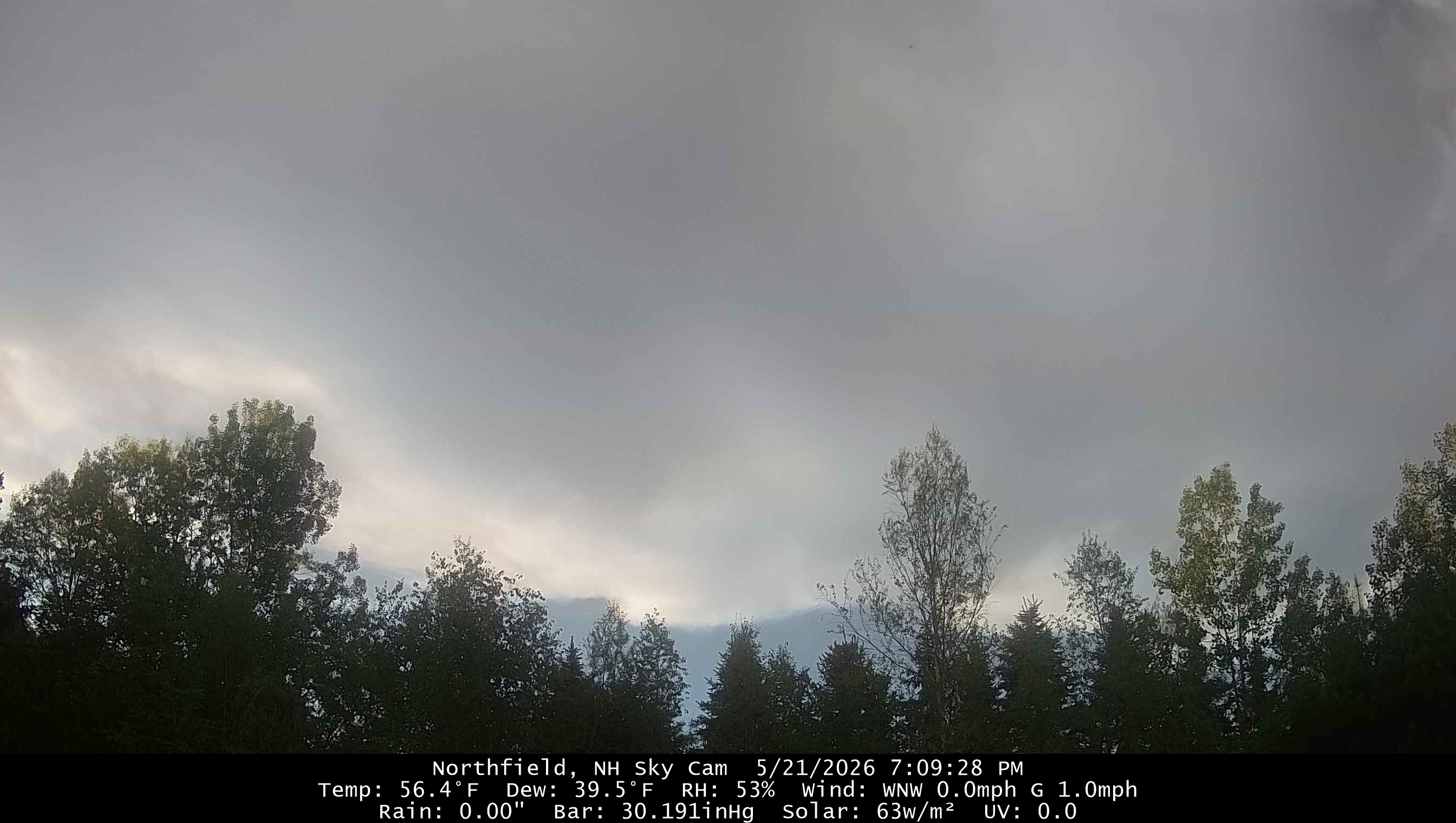
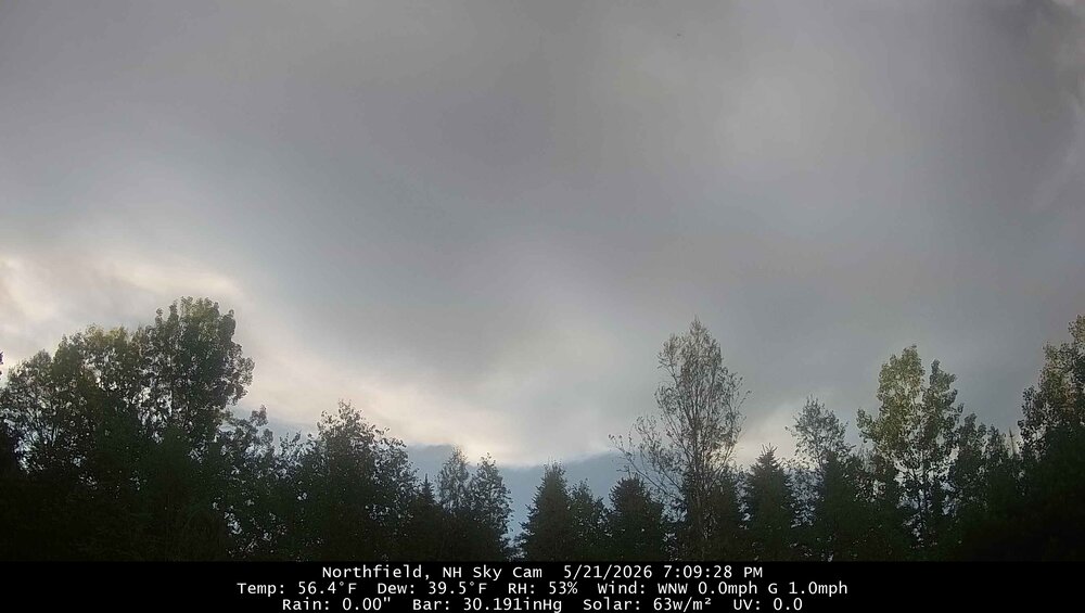
Clouds all day, but of course the clear skies will creep in overnight.
-
This storm has a tornado warning now
-
Dews in the 20s with clear skies are not giving me a lot of hope up here. Wind is staying up though, so hopefully the bottom doesn’t fall out. Could see us around freezing by morning though.
-
0.32” so far today 0.80” yesterday Greenspring Valley
- Today
-
Rain on the way, maybe.
-
Looks like the rain is finally going to hit mby but not a drop all day.
-
Through end of the month. Gotta love it.
-
Who wants to bet south wake county gets nothing?
-
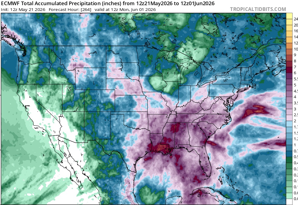
Cooler air has now returned to the region. Tomorrow will be variably cloudy and cool with highs topping out in the lower and middle 60s across the region. Rain will develop on Saturday and continue into Sunday. A general 0.50"-1.50" rainfall is likely. The temperature will likely remain in the 50s all day on Saturday and struggle to reach the lower 60s on Sunday. The mercury will likely return to the lower 70s on Monday. The ENSO Region 1+2 anomaly was +1.8°C and the Region 3.4 anomaly was +0.9°C for the week centered around May 13. For the past six weeks, the ENSO Region 1+2 anomaly has averaged +1.63°C and the ENSO Region 3.4 anomaly has averaged +0.70°C. El Niño conditions are now in place. The ongoing El Niño will continue to strengthen through the summer. The SOI was -15.07 yesterday. The preliminary Arctic Oscillation (AO) was +0.108 today. Based on sensitivity analysis applied to the latest guidance, there is an implied near 66% probability that New York City will have a warmer than normal May (1991-2020 normal). May will likely finish with a mean temperature near 63.8° (0.6° above normal). Supplemental Information: The projected mean would be 1.3° above the 1981-2010 normal monthly value.
-
95 at 4:46pm. I still say 50% chance of .50" of rain.
-
Hopefully this helps the wildfire in Chapell Hill. Tons of smoke on Wake today.
-
Sad to see. NASCAR driver Kyle Busch died at the age of 41.
-
Finally breaking the back on the drought. It's been straight crunchy dust down here for months. Had a sporty storm roll through a couple hours ago with some gully washing and gusts near 40mph. Picked up 1.3" in under an hour and now round 2 is rolling through. Could be close to 2" by morning. This is awesome
- 571 replies
-
- 10
-

-
45 and rain for us!
-
That slug in CVA moving towards DC looks nice