
All Activity
- Past hour
-
I'm not convinced this is the end of Dolly. There's still a pretty clear center of rotation visible on satellite and it looks like it's gaining in latitude much faster than forecasted. If the circulation goes north of the islands, which it seems that it might, then I think game is on once it makes it closer to the Bahamas. The big factor will be whether the weak LLC stays intact, which it probably wouldn't if it went over the islands, whereas it could if it goes north of them...
-
lot of wet records this summer/monthly
-

Augdewst 2026: Summer's Last Stand
WxWatcher007 replied to Prismshine Productions's topic in New England
Been a minute since we’ve had something to really talk about, but of course, ‘17-‘25 (added 2025 because of the behemoth that was Melissa) was a pace we couldn’t sustain much longer. -
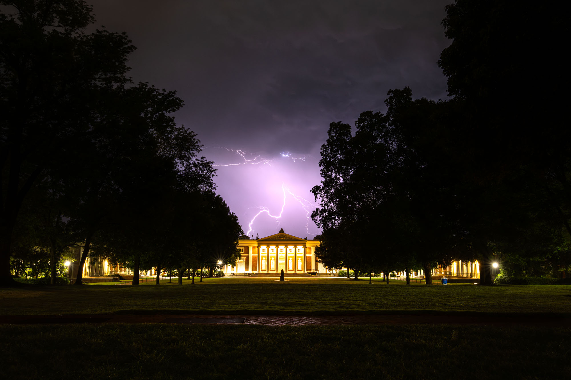
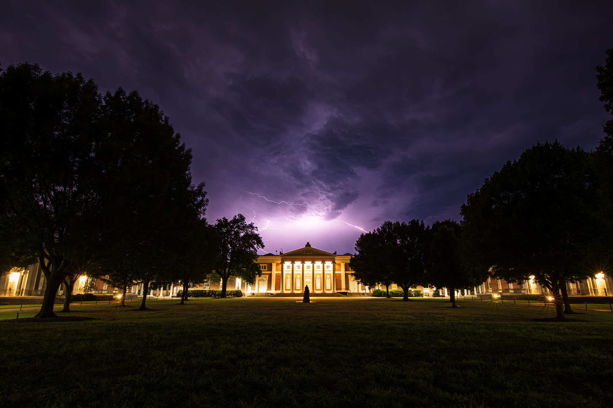
Super cool! Way to take advantage of UVA’s status as supercell alley these days. I’ve been feinding for good lightning this summer and have been annoyed - clearly I need to visit Cville. Hope you are ready to cheer us on vs. NC State tomorrow!! Big game.
-

Central PA Summer 2026 Discussion/Obs Thread
canderson replied to Voyager's topic in Upstate New York/Pennsylvania
CTP has no rain mention in my grid until next Tuesday night. -
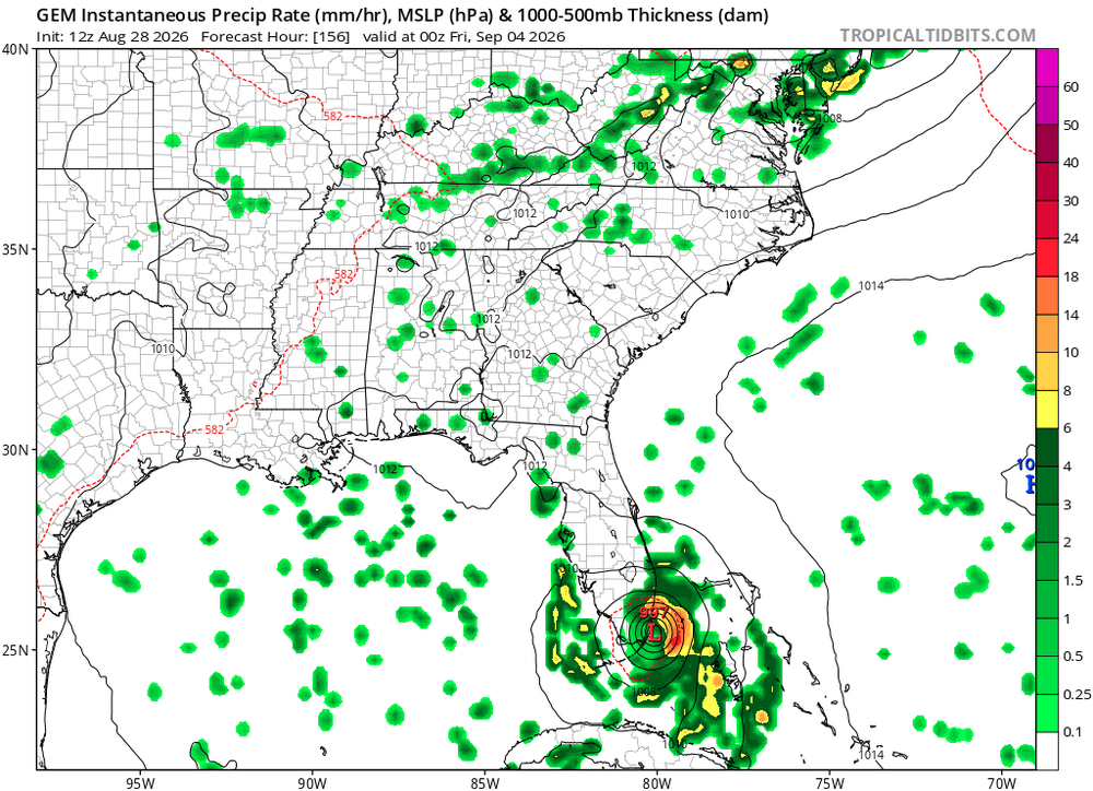
I can’t post the maps because they’re too large for the space allowed here, but comparing today’s 12Z UKMET 120 hour map with the 168 hour map of the 12Z UK of 48 hours ago using Pivotal shows they’re very similar with regard to both with a somewhat healthy Dolly (1007 mb/well organized vs 999 mb on the run from 48 hours ago) recurving and the preliminary low back to being just a weak (1012ish) low that’s not designated a TC and headed toward NE FL.
-

Augdewst 2026: Summer's Last Stand
40/70 Benchmark replied to Prismshine Productions's topic in New England
My past post on the tropics was a post-mortem on Hurricane Milton on October 10th, 2024. https://easternmassweather.blogspot.com/2024/10/hurricane-milton-verification-devil-is.html All you need to know. -
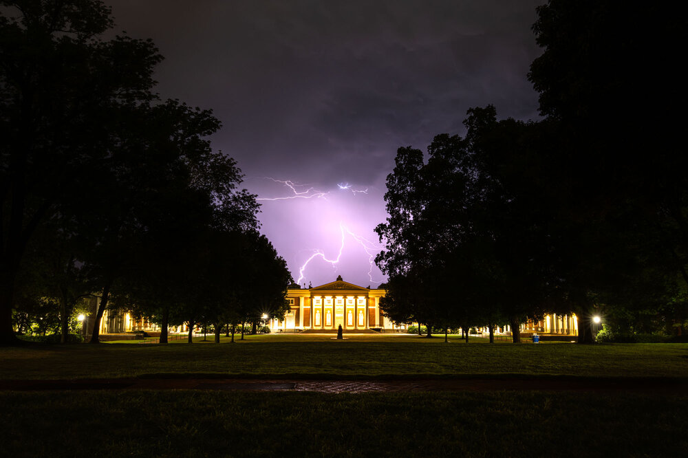
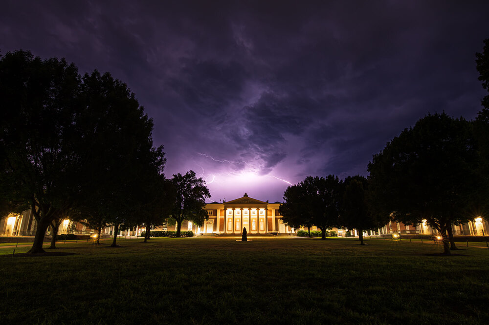
@NorthArlington101Turns out UVA liked them too as I'm now a post on their Instagram. https://www.instagram.com/p/DclqopRDcKi/?utm_source=ig_web_copy_link&igsi=MzRlODBiNWFlZA%3D%3D

-
 Here is a good post about it: MedGuide USA. Good luck!
 -
Looking at them both, which was painful...I agree that 2015 was worse from a synopitc standpoint at H5...2023 was bad, but December 2015 was as bad as it gets.
-
Will finish August with 4.08" unless we get some more on Sunday. Not 2 shabby.
-
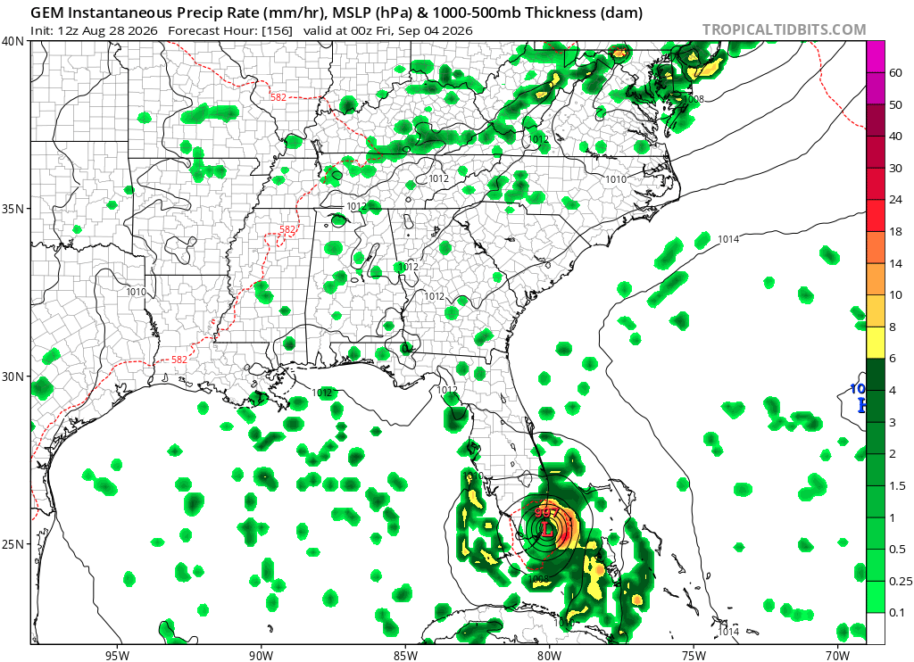
Cmc is still consistent with a south Florida hit.
-
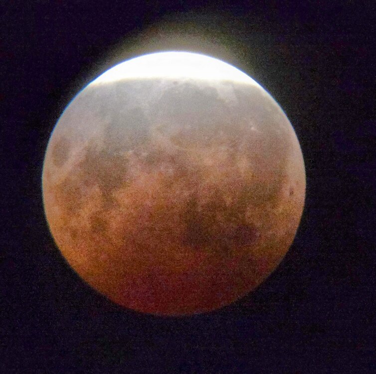
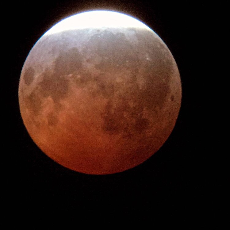
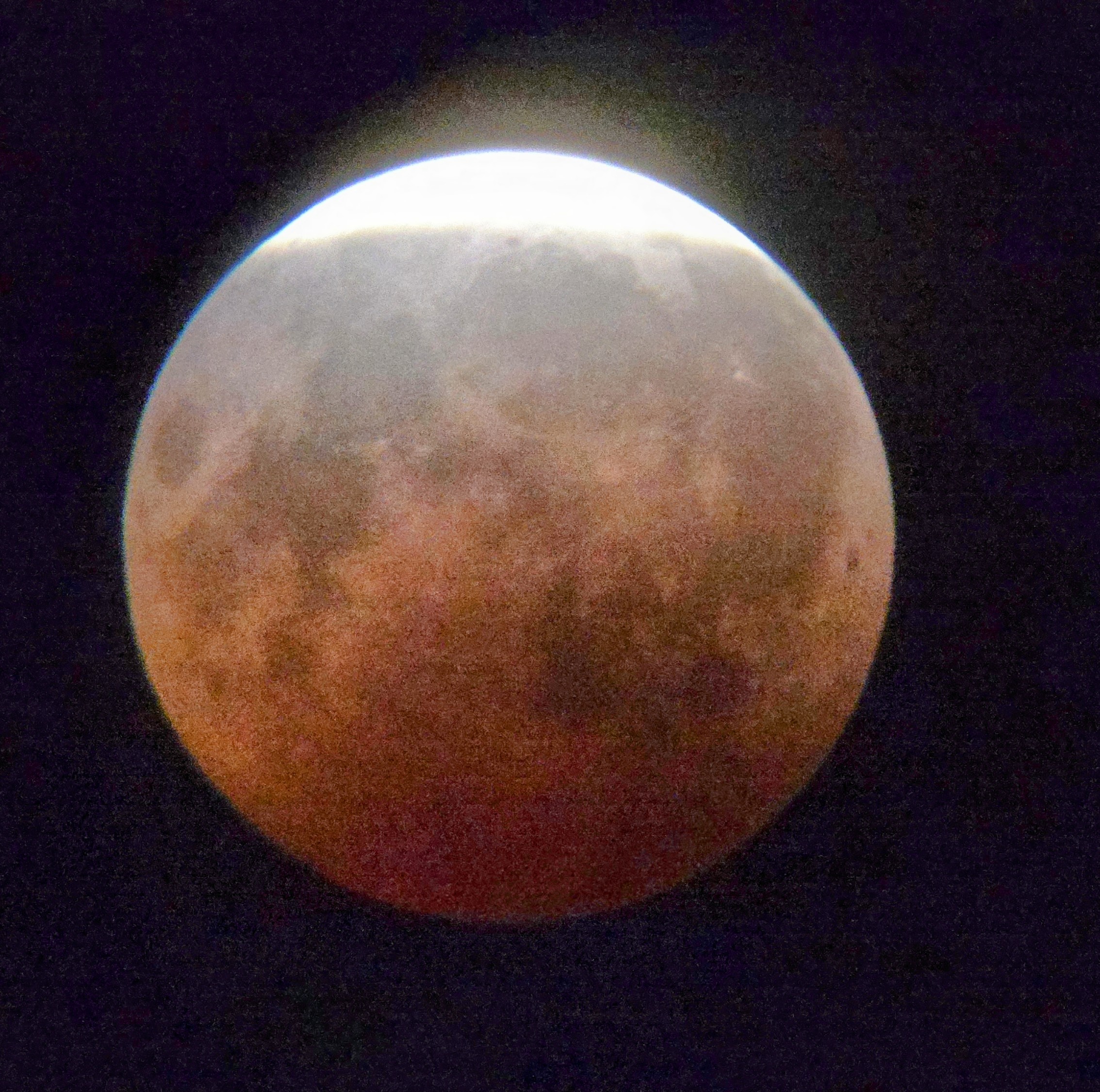
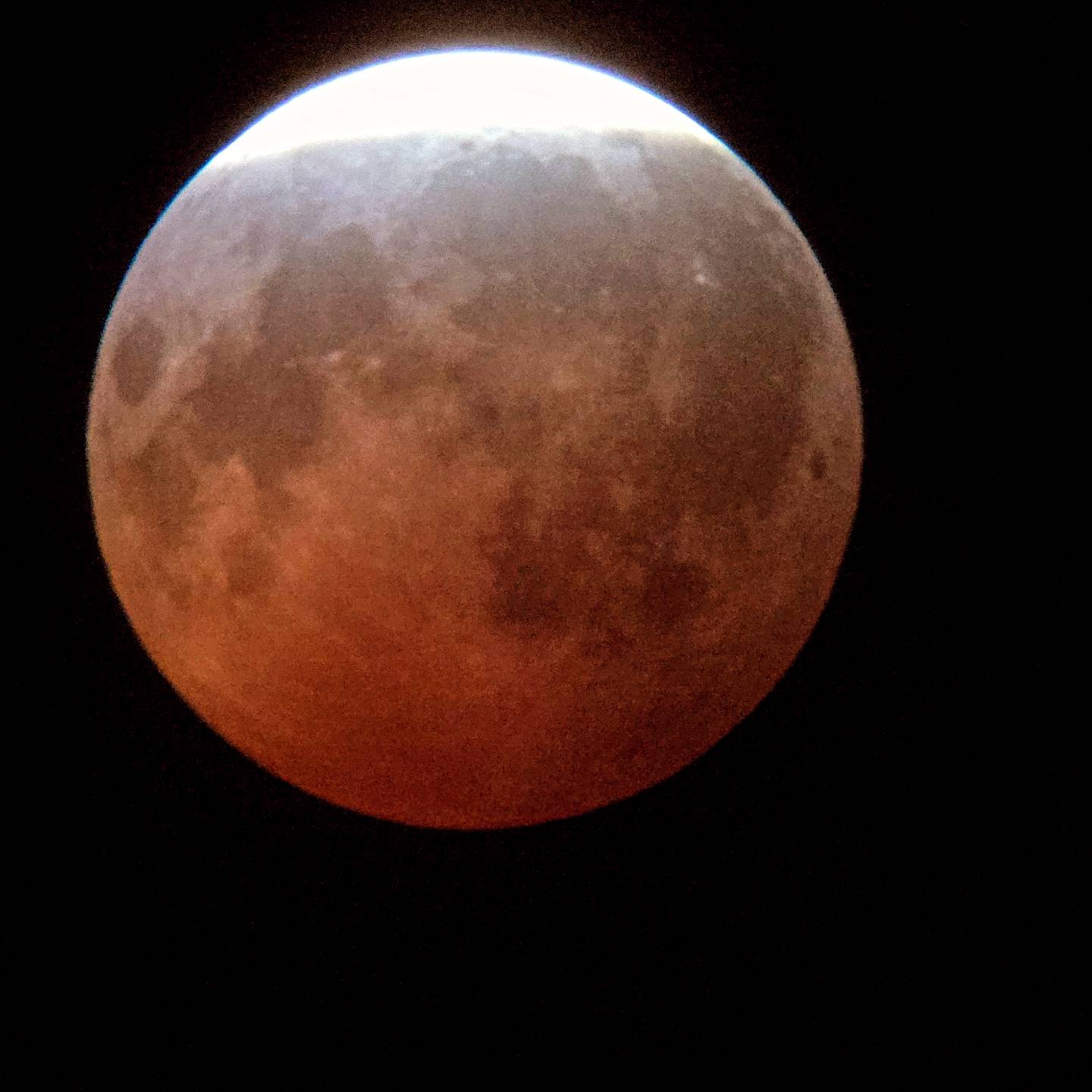
Lunar eclipse turned out really well Thursday night with peak just after 11pm Central and just after Midnight Friday Eastern Time. High clouds had no impact. Figured as much two days early but work obligations prevented me from starting a thread. I laugh about how neurotic I get about even thin clouds for a TSE; but, so chill about a lunar eclipse. Perhaps I need to do more deep breaths before a solar show. Next I propose that a deep lunar eclipse* is as beautiful or even more so than a total lunar eclipse. Get an extended lunar version of the diamond ring phase. Through binoculars I observed 3 stars with the Moon. It really felt other worldly and it was gorgeous! Telescope didn't add much value other than for photography. I feel like lunar eclipses are a naked eye and binoculars event. Here are my photos. Let's share! *** Lunar eclipses are unique in that deep partial is more than good enough. Solar eclipses are all or nothing. Get into totality or forget about it! ***
-

2026-2027 Record-breaking El Nino
EasternLI replied to Stormchaserchuck1's topic in Weather Forecasting and Discussion
Exactly right. I've been noticing the same thing for at least a month now already. I have a hunch that changes in the fall but we'll see what happens. -

Augdewst 2026: Summer's Last Stand
Chrisrotary12 replied to Prismshine Productions's topic in New England
If you applied this statement to 90% of our seasons since 2011 it’d be accurate. -
Former Dolly with a new burst of convection
-
It was clear enough for about 15 minutes around 11:30 last night. It was pretty cool to see... nothing like the solar in 2024
-

Central PA Summer 2026 Discussion/Obs Thread
TheDreamTraveler replied to Voyager's topic in Upstate New York/Pennsylvania
I made sure I checked a few days in advance if the GFS was calling for rain today. It wasn't. But it's looking like it could rain today with a 30% chance. Like I said before the model is absolutely garbo now -

2026-2027 Record-breaking El Nino
jaxjagman replied to Stormchaserchuck1's topic in Weather Forecasting and Discussion
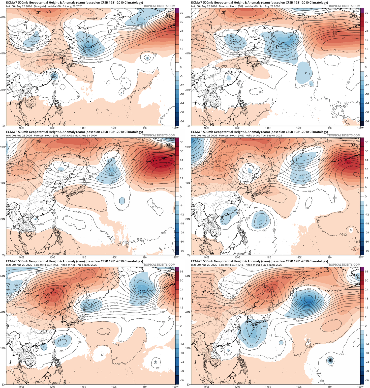
Yeah until that pesky ridge off SoithEastern Japan breaks down it shouldnt happen.Everytime you see long range models trying to show this in the long range is from troughs to fast or just not strong enough to do it to some extent and even when its gets broke down or shunted east it build back in the same parts in days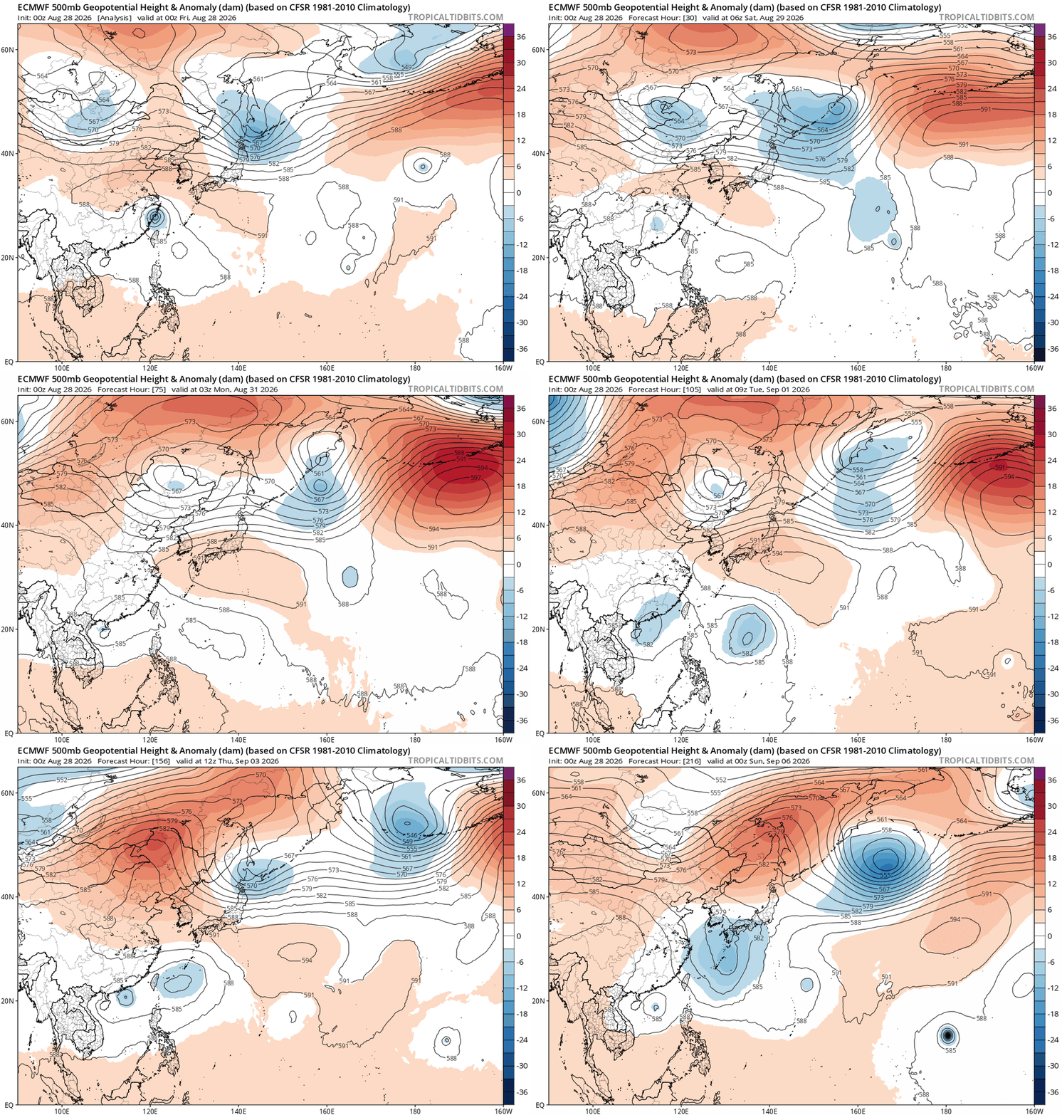
-
Grrr. This just ticks me off .

-
2026 Atlantic Hurricane Season
TheDreamTraveler replied to Stormchaserchuck1's topic in Tropical Headquarters
Here's some other notable super el nino seasons just for comparison. Shockingly 1997 and 2015 have had more activity and ACE up until this point than 2026 has so far. Though notably both did have a major hurricane with Erika in 1997 and Joaquin in 2015 in September. - Today
-
EWR currently in 4th place all time wettest months of August 2026: 10.16 Rank Year August Rainfall 1 2011 18.79" 2 1955 11.84" 3 1971 10.63" 4 1942 8.46" 5 2003 8.21" 6 1990 7.71" 7 2007 7.32" 8 1978 7.30" 9 2021 7.19" 10 1974 7.17" 11 1989 7.03" 12 1959 6.94"
-

Augdewst 2026: Summer's Last Stand
Brian5671 replied to Prismshine Productions's topic in New England
shouldn't be a surprise to anyone-another year without a US hit coming unless there's homebrew at some point -
not looking forward to heat/humidity, but nightly storm chances from an active LLJ are very welcome
-
Goin to be Interesting to say the least. https://fortune.com/2026/05/12/lake-tahoe-data-center-49000-residents-power-source/















.thumb.jpg.ad3a2e31d30aff035044689b311a0540.jpg)
