All Activity
- Past hour
-
Everyone left Lebanon, that doesn’t count.
-

December 2025 regional war/obs/disco thread
WxWatcher007 replied to Torch Tiger's topic in New England
There’s the rev we know and love -

Central PA Fall Discussions and Obs
Itstrainingtime replied to ChescoWx's topic in Upstate New York/Pennsylvania
Got some very light snow action here in Maytown. 26 degrees. -
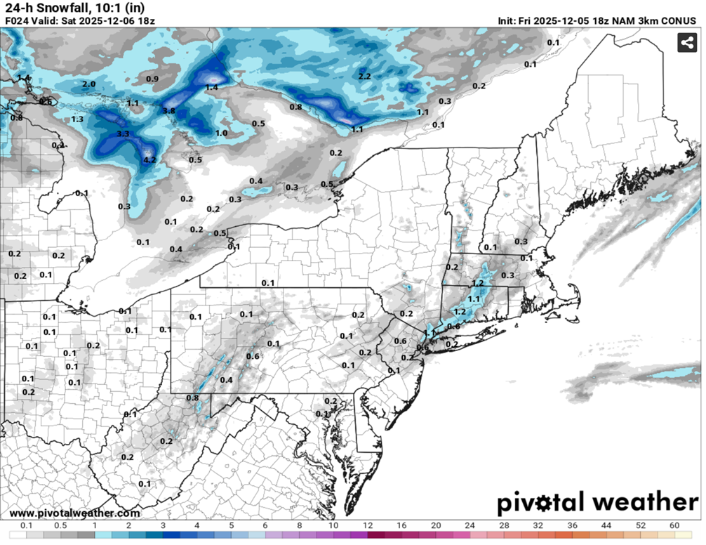
A weak system brought an area of 1"-3" of snow to parts of Virginia and Maryland with a few locally higher amounts. Washington, D.C. picked up 1.1" of snow. Meanwhile, farther north in the New York City area, the temperature fell to near record and record lows in parts of the region this morning. Low temperatures included: Albany: -1 (old record: 2°, 1886, 1926, and 1929) ***Coldest so early in the season since 1976*** Binghamton: 3° (old record: 5°, 1971 and 1989) Boston: 12° Hartford: 5° Islip: 21° New Haven: 14° (old record: 15°, 1966) New York City-Central Park: 20° New York City-JFK Airport: 20° (tied record set in 1966) New York City-LaGuardia Airport: 20° (old record: 21°, 1942) Newark: 20° Philadelphia: 25° Poughkeepsie: 6° (old record: 7°, 1966 and 1989) Providence: 13° White Plains: 14° (tied record set in 1966) The weekend will be cool but dry. A fresh surge of cold air will arrive Sunday night. The ongoing stretch of below normal temperatures will likely continue into or through the second week of December. December 1-10 will be a solidly colder than normal period. The potential exists for the coldest first 10 days of December since at least 2007 (33.4°, 5th coldest December 1-10 since 2000). The five coldest December 1-10 periods since 2000 were: 1. 30.6°, 2002 2. 32.2°, 2003 3. 32.4°, 2000 4. 33.1°, 2005 5. 33.4°, 2007 All 5 of these cases had measurable snowfall in Central Park. The ENSO Region 1+2 anomaly was -0.1°C and the Region 3.4 anomaly was -0.6°C for the week centered around November 26. For the past six weeks, the ENSO Region 1+2 anomaly has averaged -0.18°C and the ENSO Region 3.4 anomaly has averaged -0.67°C. La Niña conditions will likely continue through at least mid-winter. The SOI was -33.01 today. The preliminary Arctic Oscillation (AO) was -0.968 today.
-
Watch for storms to pop up on the models as we get closer. I am still on the train for a mid to late December snowstorm.
-
The low level moisture moving in on a SSE flow is already visible on radar off the NJ coast. If it's ZR, I can see short-fused advisories being posted. I hope it's snow/snow grains instead.
-

E PA/NJ/DE Winter 2025-26 Obs/Discussion
LVblizzard replied to LVblizzard's topic in Philadelphia Region
Some flurries falling in Allentown. Mood flakes are always nice this time of year. -
Most likelt temporary if that. We are currently in phase 8 . You also have to factor in the lag.
-
That was more due to orographical uplift I think.
-
Ended up with 1.1” in Londontowne. Most of it fell while I was asleep. Nice to wake up to. Feels good to be on the board!!
-
The 18z 3km NAM has 0.1" liquid for part of the region tonight. I'm skeptical that it can accumulate much due to snow growth problem. But sometimes these low level lift/crystallization events that linger for several hours over an area can surprise. I'll take the under for now.

-

December 2025 regional war/obs/disco thread
Damage In Tolland replied to Torch Tiger's topic in New England
Probably beginnings of the sneaky heavier Nor
-
Actually,it was intended to be a bit facetious, but accurate, joke. He actually pointed out good numbers on the SOI showing the Niña fading, but the SOI numbers themselves were "negative."
-
Was at App for this one. Good times.
-
I might be wrong here, but I feel like the Dec 2018 storm definitely had some enhanced right around the escarpment.
-
It'll come.
-
When was the last time we had a Lee side trough? It’s been a long time I believe
-
A few snow grains dropping from the sky just now. Deep deep winter vibes.
-
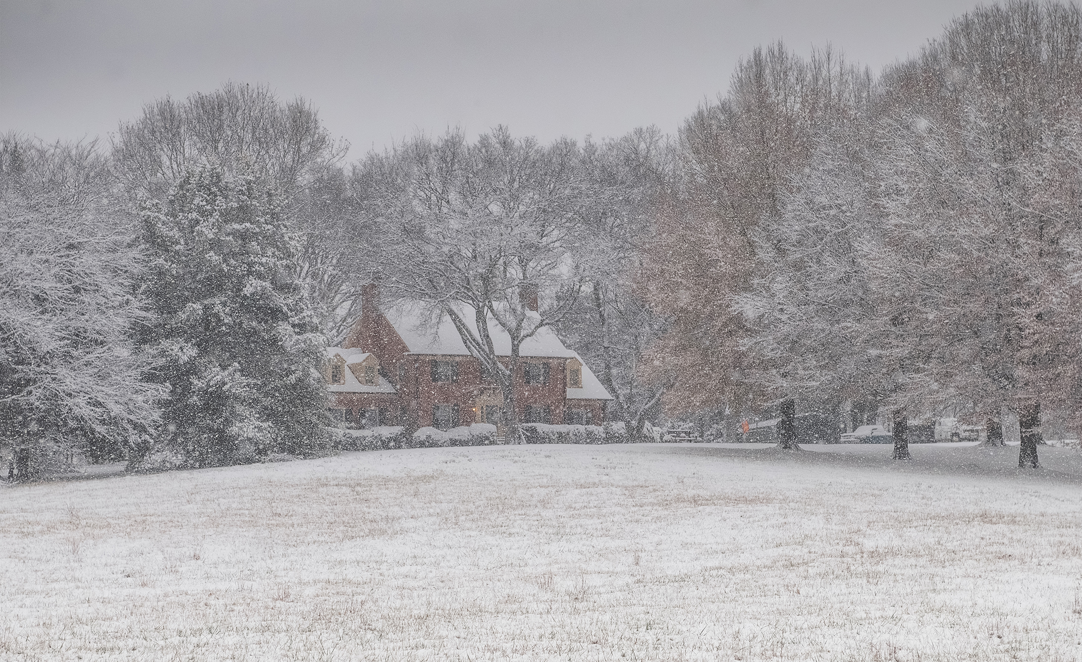
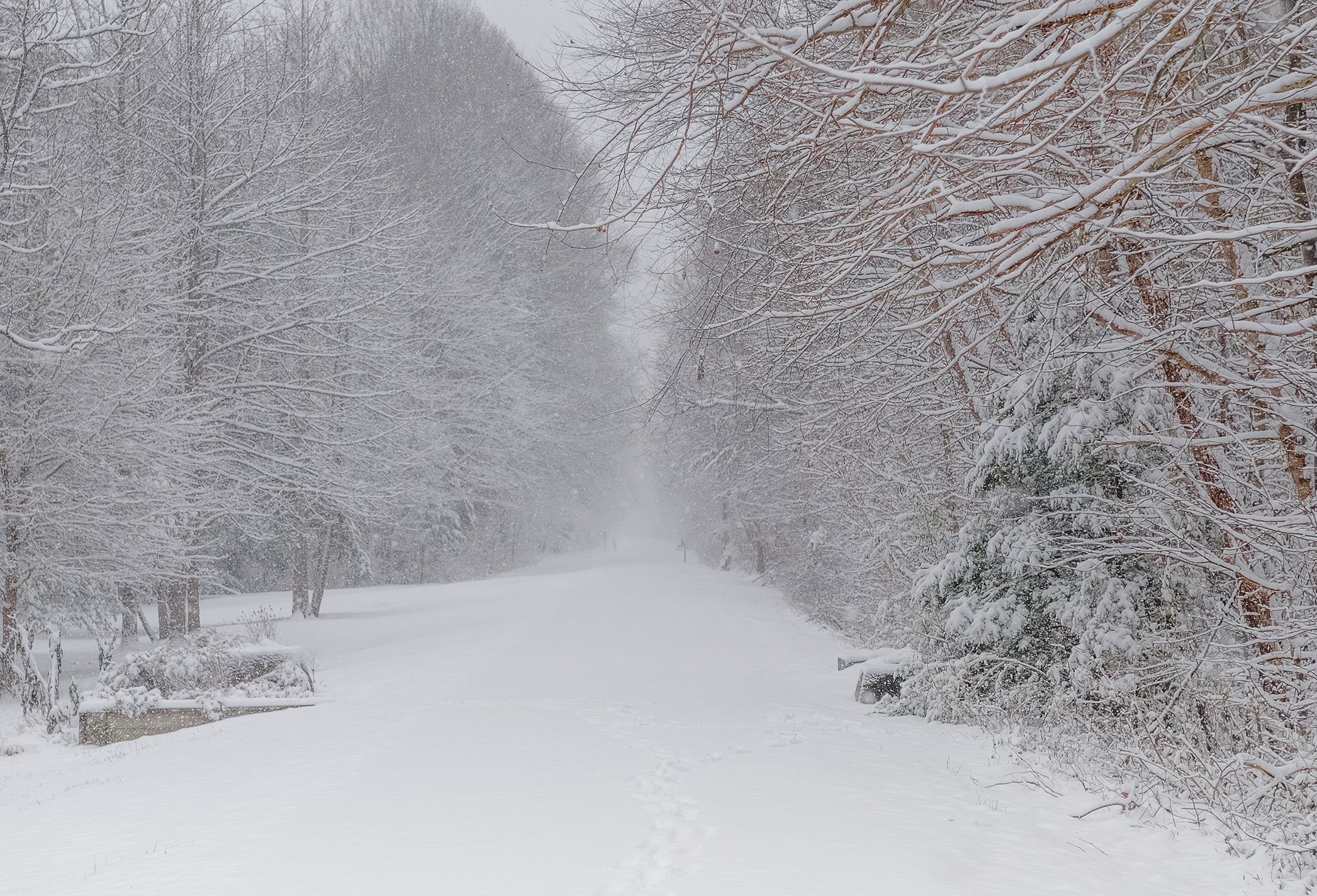
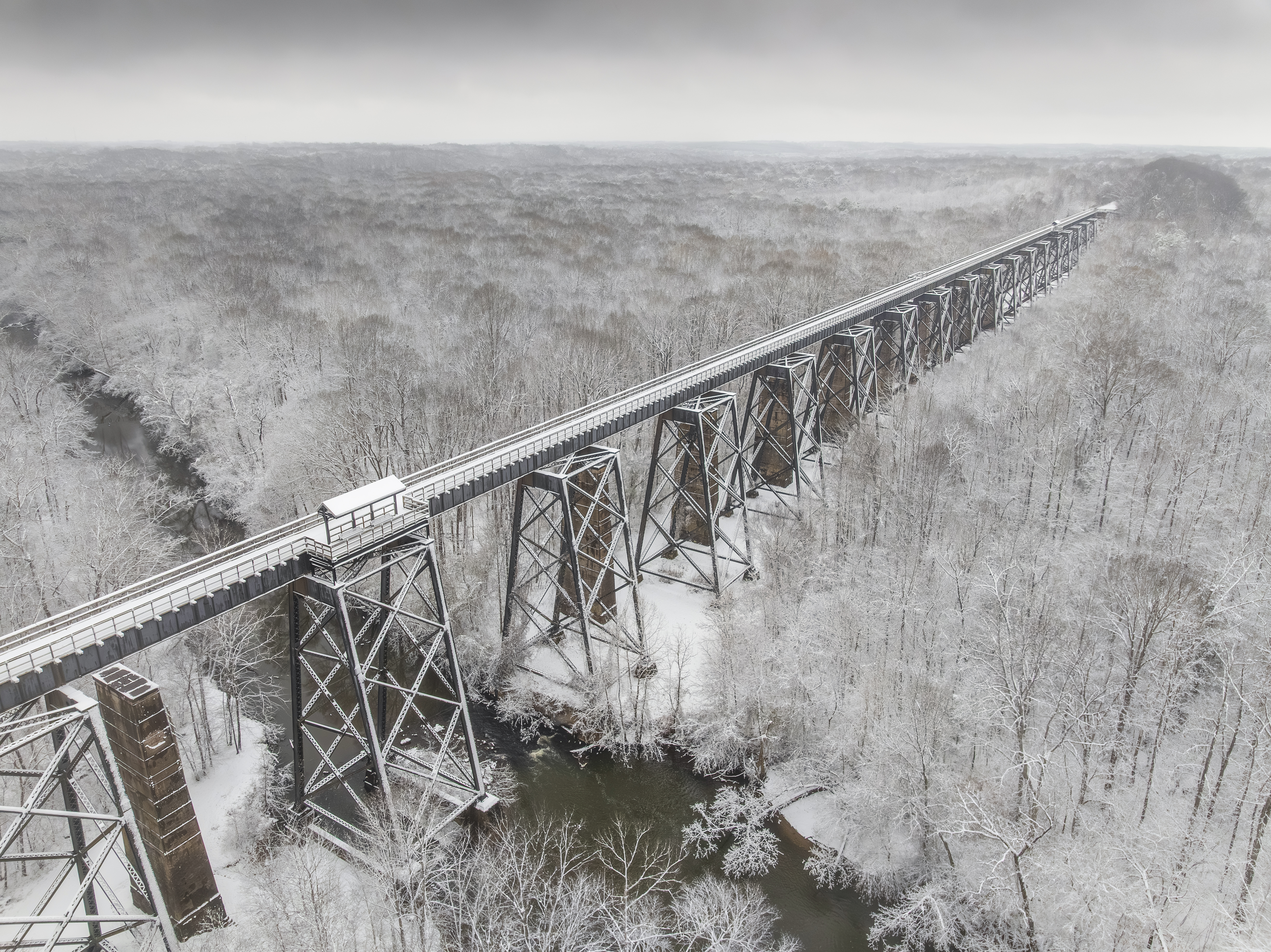
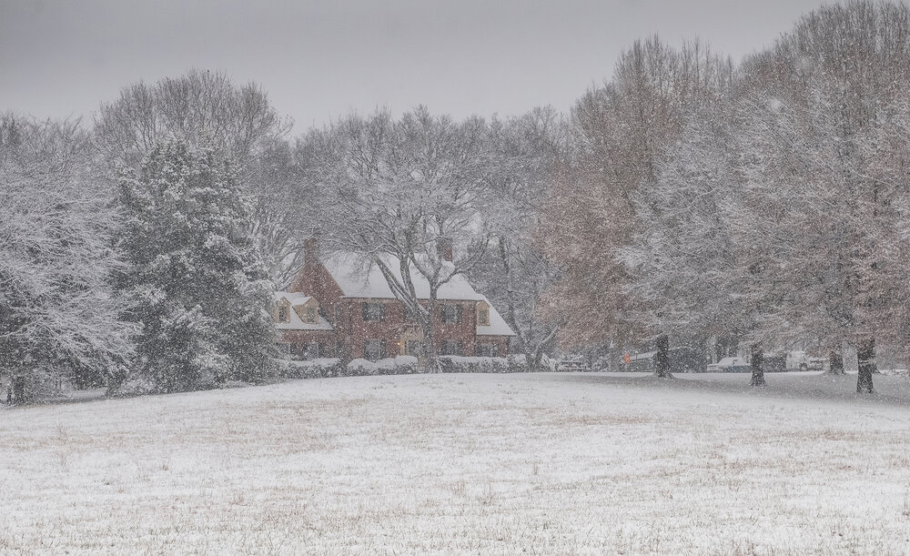
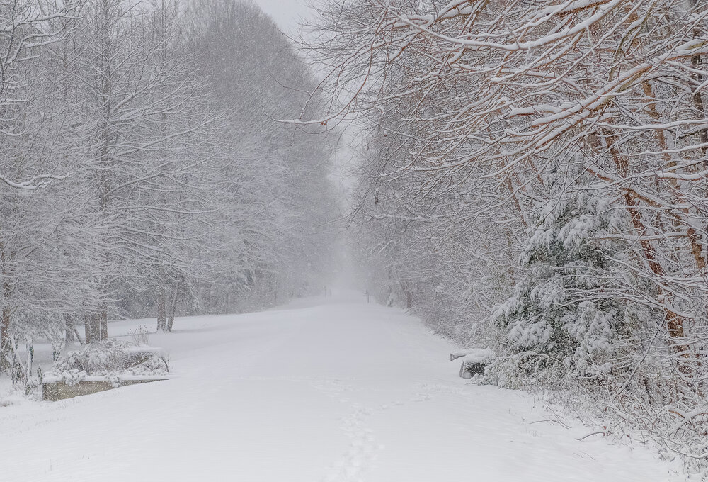
I chased to Farmville, VA and here are a few shots as I am starting to go to through them now. Total was somewhere around 3-4 inches.

-
I just did an h5 analysis of that Euro run and the intricate interplay between multiple pieces of energy(vorticity) that allows the one that induces 'our' storm to sharpen and dig that far southward and it is pretty insane how it worked out. What would really help get a NS vort to track underneath is a sharper/more amped PNA ridge, but its being kept a bit 'flat' by the positively tilted WPO ridge and downstream trough.
-
Yep a different unique storm for us leeside folks. Never been one like it since.
.gif.eee1cb47eb2aae3367633d1d2cdf33fb.gif)
-
Small lawn area with trees 60-80 feet tall. Mostly hardwoods but even they block about 1/3 of direct sun. That plus the frost pocket topography help to preserve pack. (Of course, our garden gets less sun and earlier frosts than most.)
-
Starting to go through my actual shots now from Farmville, VA:


-
Another great storm that was totally overlooked on all the local news stations was back in Jan 22-23 of 2003. Anyone else remember this one? I remember that we only had advisory's posted for 1-2" and then the storm formed a lee-side trough and snowfall was greatly enhanced in the western part of the state. The classic radar on the Weather Channel " Local on the eights" just seemed to stall the moisture over us, I remember Eric Thomas ending the late night news by saying folks, we have some updated models that just came in and these 1-2 inches totals are more than likely going to be much greater than we originally expected. Not long after that Winter Storm Warnings were post for 6-10." Was a cold storm too, temps in low 20s.
-
12/2: T .003" zr and 5-6 sleet pellets 12/5: 3.0