Sundog Posted October 29, 2012 Share Posted October 29, 2012 It does with rain John. If the landfall was up towards Sandy Hook, like models has a couple days ago, we would've had the rain as well. That would have been incredible. We haven't had anything but light rain everywhere north of say Sandy Hook or so. The one time I got something that could maybe be considered moderate rain (barely) the winds were incredible and the two combined produced what felt like bonafide hurricane conditions. The winds by themselves are erg powerful but if there was heavy rain a well it would have been epic. Link to comment Share on other sites More sharing options...
FPizz Posted October 29, 2012 Share Posted October 29, 2012 I will be the first to say it: this storm has definitely under-produced at my location here in Middlesex County, NJ. Gusts have approached 60MPH, but there has been very little damage. I just drove 15 miles through the area and only found small branches in the road and 1 small tree down. No power lines down. Clearly, when this storm is reviewed, the most significant aspect will have been the storm surge combined with the astro. tides. Of course, my lights just flickered as I was writing this. AGAIN, I am speaking only of my area in terms of the wind and rain. Obviously, this has been devastating south and east of here. Exactly. I'm in Piscataway and it seems like it is just an abnormally windy day with some drizzle/light rain. Very lucky! Link to comment Share on other sites More sharing options...
ict1523 Posted October 29, 2012 Share Posted October 29, 2012 Lights been flickering for an hour. Hope they don't go off. Link to comment Share on other sites More sharing options...
SRRTA22 Posted October 29, 2012 Share Posted October 29, 2012 I guess some people aren't satisfied with 60MPH gusts.....I'd rather keep my power then be out for god knows how long. Everyone on the shore is under water right now, and a crane is about wreak havoc in the city....This is not good Link to comment Share on other sites More sharing options...
blizzardof09 Posted October 29, 2012 Share Posted October 29, 2012 mph not kts. ok thank you trying to get as much info before i feel i inevitably lose power here Link to comment Share on other sites More sharing options...
Ridingtime Posted October 29, 2012 Share Posted October 29, 2012 My neighbors roof is destroyed. Unbelievable. I took video of it blowing apart in the wind. Not sure how to post here. Upload it to Youtube and then link it here Link to comment Share on other sites More sharing options...
earthlight Posted October 29, 2012 Share Posted October 29, 2012 6.3 ft sea level in lower manhattan Link to comment Share on other sites More sharing options...
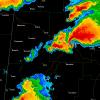
earthlight Posted October 29, 2012 Share Posted October 29, 2012 Link to comment Share on other sites More sharing options...
Sundog Posted October 29, 2012 Share Posted October 29, 2012 Everyone and their mother knew the best rain was on the southwest side of the system. On this forum you mean. Everyone they interview on the news says "when Sandy arrives..." news flash: Sandy is already here. They're waiting for the heavy rain. If it started pouring like 6 hours ago those same people would have said Sandy arrived 6 hours ago. Link to comment Share on other sites More sharing options...
Nikolai Posted October 29, 2012 Share Posted October 29, 2012 Hudson starting to breach the park again. Link to comment Share on other sites More sharing options...
Superstorm93 Posted October 29, 2012 Share Posted October 29, 2012 Pressure is the lowest I have been through since Wilma in WPB. Crazy. Sent from Tapatalk Link to comment Share on other sites More sharing options...
earthlight Posted October 29, 2012 Share Posted October 29, 2012 Link to comment Share on other sites More sharing options...
Chaser25973 Posted October 29, 2012 Share Posted October 29, 2012 Image didn't work... Link to comment Share on other sites More sharing options...
hazwoper Posted October 29, 2012 Share Posted October 29, 2012 I feel for you guys along south shore an NY harbor tonight at high tide. Stay safe Link to comment Share on other sites More sharing options...
Chaser25973 Posted October 29, 2012 Share Posted October 29, 2012 http://instagram.com/p/RYQYPCvCIs/ Even Lady Liberty is afraid of Sandy! Link to comment Share on other sites More sharing options...
iammrben Posted October 29, 2012 Share Posted October 29, 2012 http://instagram.com/p/RYQYPCvCIs/ Even Lady Liberty is afraid of Sandy! LOL. Snorted with laughter when I saw that one. Link to comment Share on other sites More sharing options...
jm1220 Posted October 29, 2012 Share Posted October 29, 2012 100 percent disagree, if it made landfall in sandy hook vs cape may its a world of difference in sensible weather for NYC This is such a large storm that it really doesn't. The south coast of SNE and places east of Montauk, much further from the center than we are, are experiencing hurricane force gusts now. That's headed our way. And the surge is going to be horrendous from a longer period of SE winds funneling water into the harbor and back bays. The water splashed over the Battery at 8am this morning and the runways at LGA flooded at close to LOW tide. Imagine an additional 6 feet or so on top of this morning? This storm will be considered horrendous to possibly catastrophic for many people when it's finally done. The tide is coming back in now and we're already seeing water rises at places like Sandy Hook. This is just the beginning here. Maybe we'll have fewer power outages and downed trees than we anticipated, but the surge was always the lead story and that looks just as bad as ever. Link to comment Share on other sites More sharing options...
Sundog Posted October 29, 2012 Share Posted October 29, 2012 Jm if this storm did the loop through Long Island like models earlier progged we would have slammed by a ton of rain in addition to the winds. That's a huge difference in sensible weather. The winds are incredible though. Link to comment Share on other sites More sharing options...
NEXtreme Posted October 29, 2012 Share Posted October 29, 2012 Joe CioffiAs per Meteorologist Joe Cioffi --------J"oe notes an area of 75-100 mph winds on the east and northeast side of Sandy is offshore and moving Northwest heading for Long Island this evening. Tides are going to be high this evening and the flooding will be at record levels south and north shore." _Adam Link to comment Share on other sites More sharing options...
jm1220 Posted October 29, 2012 Share Posted October 29, 2012 I guess some people aren't satisfied with 60MPH gusts.....I'd rather keep my power then be out for god knows how long. Everyone on the shore is under water right now, and a crane is about wreak havoc in the city....This is not good This isn't something you play around with. I'm as much a weenie as anyone, but a devastating surge into NY harbor and Long Island is NOT something anybody wants. I have a feeling that in 6 hours, a lot of people will be singing a different tune about this storm. I hope and pray I'm wrong, but I greatly fear not. Link to comment Share on other sites More sharing options...
bluewave Posted October 29, 2012 Share Posted October 29, 2012 Unbelievable wave heights south of Long Island. NY HARB ENTRANCE 2000 62 59 40/ 43/ 56 963.6 26/15 BUOY 20S FIRE IS 2000 62 60 50/ 47/ 58 960.8 29/15 Link to comment Share on other sites More sharing options...
ace0927 Posted October 29, 2012 Share Posted October 29, 2012 100 percent disagree, if it made landfall in sandy hook vs cape may its a world of difference in sensible weather for NYC i think only from a rainfall perspective. Our area has still experienced the strongest winds. Had it made landfall there these winds would likely have been pushed into S NE Link to comment Share on other sites More sharing options...
EasternLI Posted October 29, 2012 Share Posted October 29, 2012 about to lose power i will say this winds have really starting ripping good id say close to hurricane force and got a bunch of good size limbs coming down as well. really looking forward to the winds getting going in an hour or two My power has been in and out since around noon. Also some VERY large trees I think are likely to come down when the winds shift to more southerly. This one is absolutely sick out here on the island. Luckily not much rain with this since it seems that even when heavy drizzle moves in the wind picks up. Link to comment Share on other sites More sharing options...
Dosh Posted October 29, 2012 Share Posted October 29, 2012 Everyone and their mother knew the best rain was on the southwest side of the system. Yes, but the models still progged 2-3" of rainfall in the northern half of the system, and we've seen barely up to an inch in the main shield of precip so far. The fact of the matter is, not enough moisture is being put on the ground for these insane LLJ winds to be transferred. theyre just going to keep flowing around the system and feeding into the big precip block over SNJ/EPA/Delmarva Link to comment Share on other sites More sharing options...
dbc Posted October 29, 2012 Share Posted October 29, 2012 winds would have been worse if the storm hit sandy hook compaed to cape may, winds were impressive but not much more than Irene and much much less tree damage. You don't quit do you. This blew Irene away and the storm's worst is still not here. You make it sound like the storm is over and the worst winds are over with. Look at the detailed forecast. It gets significantly worse when the winds shift ESE. Link to comment Share on other sites More sharing options...
forkyfork Posted October 29, 2012 Share Posted October 29, 2012 the nam shows a surface based MAUL mixing into winds over 70 kt after we shift to the SE... wow!!! Link to comment Share on other sites More sharing options...
ace0927 Posted October 29, 2012 Share Posted October 29, 2012 SREFs just went bonkers with sustained 10m winds after the SE wind shift...over 50mph on many models and the mean between 40 and 50 mph. Terrible news for mostly everyone given the soundings showing better ability to mix and momentum transfer...and the timing of these southeast gales into NY Harbor and S Long Island at high tide. theoretically, how far can these winds push/force water inland? I am 1.5 miles from the Bay, am I in any danger? This is a serious question and what worried about all day yesterday... Link to comment Share on other sites More sharing options...
goldalex Posted October 29, 2012 Share Posted October 29, 2012 Yes, but the models still progged 2-3" of rainfall in the northern half of the system, and we've seen barely up to an inch in the main shield of precip so far. The fact of the matter is, not enough moisture is being put on the ground for these insane LLJ winds to be transferred. theyre just going to keep flowing around the system and feeding into the big precip block over SNJ/EPA/Delmarva I beg to differ. My weather station is already at 1.5" at this time. Link to comment Share on other sites More sharing options...
earthlight Posted October 29, 2012 Share Posted October 29, 2012 the nam shows a surface based MAUL mixing into winds over 70 kt after we shift to the SE... wow!!! Wow Link to comment Share on other sites More sharing options...
NorEaster27 Posted October 29, 2012 Share Posted October 29, 2012 Atlantic city basically in the eye now Link to comment Share on other sites More sharing options...

Recommended Posts
Archived
This topic is now archived and is closed to further replies.