mahk_webstah Posted October 29, 2012 Share Posted October 29, 2012 40th floor in midtown. def getting windier. Link to comment Share on other sites More sharing options...
Conclue Posted October 29, 2012 Share Posted October 29, 2012 Not gonna let you have it but helpt you understand more... - It has essentially made landfall Somewhat. Landfall's don't really matter when dealing with non-pure tropical systems as those systems tend to have their strongest surface winds wrapped tightly around the center of ciruclation which is indeed why landfall is important. Read my next answer for this to make sense... - It's no longer a 'hybrid storm'. It's more like a regular hurricane which has made landfall It was still fairly semi-tropical with unique interactions with the vorticity max associated with the upper level jet. It was just now in the past 3 hours underoing that "transition" that had been widely recognized as "the hybrid" storm the models indicated. It didn't change as rapidly as we thought... however once it did it was quickly advanced westward and as it did it's inner core is nearly ripped out of a closed circulation as it merges with the vort max associated with the jet. Thus, the storm as we speak and as it makes "the landfall" is underoing that transition that we've heard so much about. With that said now your going to see (all of us) a new interaction of a strenghtening hurricane rapidly transitioning into a extra-tropical type of storm (somehow with a warmcore that will surely be dismantled). - When hurricanes make landfall, they weaken True story. However tropical cyclones do not surive the conditions that Sandy did for as long as she did given the conditions in the atmosphere and SST's. Her "Hybrid" characteristics were because she was feeding off of baroclinic energy fed from the upper level jet interaction. Now that it's quickly transitioning we may see some intensification of winds from a different direction and or magnitude as this system reorganizes. Storm surge could be amplified into tonight due to increased mixing of winds down to the surface from SE. Extra-tropical storms do not need oceans to feed off of, however this cummulated energy will make for an interesting evolution of this system over the night and through tomorrow depending on how quickly the system becomes vertically stacked and thus shut's it self down. however storm surge, bad winds the whole thing is not over. We now have a rapidly transitioning system... will be a learning expeirence for sure. - The eye of the storm is, what, 75 miles away? I actually don't have answer for this one, lol. Who knows. The eye was being dismantled as it was speeding towards land as it was making that "extra-tropical transition) . Doesn't matter. It's not anywhere near over. Don't be confused Hope that helps. Link to comment Share on other sites More sharing options...
Manny Posted October 29, 2012 Share Posted October 29, 2012 Yeah, stronger winds and consistent wind gusts here in New Paltz, Hudson Valley. How strong will winds get in the Hudson Valley. I'm looking at 65mph gusts tonight. Link to comment Share on other sites More sharing options...
Absolute Humidity Posted October 29, 2012 Share Posted October 29, 2012 Power out for last hour, winds still kicking hard. Two trees in eye sight down and 2.23" in the bucket. Storm has not under performed here. Link to comment Share on other sites More sharing options...
gkrangers Posted October 29, 2012 Share Posted October 29, 2012 TDWR radars been good for tracking these wind bursts/streaks. Another one off of the KEWR TDWR headed for NYC/Bronx now. Link to comment Share on other sites More sharing options...
Stormlover74 Posted October 29, 2012 Share Posted October 29, 2012 Just had my 4th power flicker. I know folks a few blocks away from me are without power Link to comment Share on other sites More sharing options...
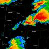
SnowGoose69 Posted October 29, 2012 Share Posted October 29, 2012 Funny looking imagery over Nassau/Suffolk/Queens on the radar, either some sort of stationary banded shower area or the radar is picking up blowing leaves or dirt. Link to comment Share on other sites More sharing options...
SquatchinNY Posted October 29, 2012 Author Share Posted October 29, 2012 Yeah, stronger winds and consistent wind gusts here in New Paltz, Hudson Valley. How strong will winds get in the Hudson Valley. I'm looking at 65mph gusts tonight. Same. I can hear when I went out a constant roar above the ground, though surface gusts were not constant. Link to comment Share on other sites More sharing options...
LovintheWhiteFluff Posted October 29, 2012 Share Posted October 29, 2012 My cousin's restaurant front in Barnaget, NJ Where in Barnegat, NJ? Link to comment Share on other sites More sharing options...
Cyg Posted October 29, 2012 Share Posted October 29, 2012 Frequent gusts of wind here in northern Union county with a constant background roar of wind. Some of these gusts have to be up around 50mph. Link to comment Share on other sites More sharing options...
pazzo83 Posted October 29, 2012 Share Posted October 29, 2012 You can hear a lot of debris being blown about in Manhattan right now, this is not that cool actually. Link to comment Share on other sites More sharing options...
Kaner587 Posted October 29, 2012 Share Posted October 29, 2012 winds are insane right now UES...strongest of the day by far Link to comment Share on other sites More sharing options...
SnowGoose69 Posted October 29, 2012 Share Posted October 29, 2012 We're just getting pounded here right now, just absolutely crazy, I don't think we've been under 45 mph for about a half hour. Link to comment Share on other sites More sharing options...
ag3 Posted October 29, 2012 Share Posted October 29, 2012 Intense winds now. And more constant. Link to comment Share on other sites More sharing options...
famartin Posted October 29, 2012 Share Posted October 29, 2012 Now gusting to 61 mph at Trenton-Mercer Airport! KTTN 292129Z AUTO 05030G53KT 1 1/2SM BR BKN015 OVC021 16/13 A2841 RMK AO2 PK WND 05053/2120 PRESFR P0003= Link to comment Share on other sites More sharing options...
gosaints Posted October 29, 2012 Share Posted October 29, 2012 Any surge updates for the battery? Link to comment Share on other sites More sharing options...
wolfsheepsheadbay Posted October 29, 2012 Share Posted October 29, 2012 Frequent gusts of wind here in northern Union county with a constant background roar of wind. Some of these gusts have to be up around 50mph. Some are much higher than 50mph. Link to comment Share on other sites More sharing options...
pazzo83 Posted October 29, 2012 Share Posted October 29, 2012 The battery approaching 9ft and we still have more than 3 hrs to high tide. Link to comment Share on other sites More sharing options...
Kaner587 Posted October 29, 2012 Share Posted October 29, 2012 Intense winds now. And more constant. ya major difference from before Link to comment Share on other sites More sharing options...
friedmators Posted October 29, 2012 Share Posted October 29, 2012 Sandy Hook just broke the surge record it looks like. Link to comment Share on other sites More sharing options...
Kaner587 Posted October 29, 2012 Share Posted October 29, 2012 The battery approaching 9ft and we still have more than 3 hrs to high tide. its rising ~1.5 ft/hr. with roughly 3 hrs left, well, you guys can figure it out. Link to comment Share on other sites More sharing options...
MJO812 Posted October 29, 2012 Share Posted October 29, 2012 Lee Goldberg has 40-50 mph winds with 80 gusts for tonight for the area. Link to comment Share on other sites More sharing options...
ace0927 Posted October 29, 2012 Share Posted October 29, 2012 This was in the Philly obs thread, shared by Quakertown needs Snow from Twitter... another friend of mine says it was taken from the Flagship Resort, Atlantic Ave. and South New Hampshire Ave in Atlantic City. WOW...that is INSANE Link to comment Share on other sites More sharing options...
Nikolai Posted October 29, 2012 Share Posted October 29, 2012 pier is still open went on winds were 70-80mph!!! surge passing the sidwwalk everywhere now Link to comment Share on other sites More sharing options...
Cfa Posted October 29, 2012 Share Posted October 29, 2012 It calmed down for a while (relatively speaking) but now we're getting gusts more intense than they were earlier. Link to comment Share on other sites More sharing options...
Superstorm93 Posted October 29, 2012 Share Posted October 29, 2012 INSANE gusts here! Neighboring town just got knocked out. Link to comment Share on other sites More sharing options...
bluewave Posted October 29, 2012 Share Posted October 29, 2012 PRELIMINARY LOCAL STORM REPORT NATIONAL WEATHER SERVICE NEW YORK NY 531 PM EDT MON OCT 29 2012 ..TIME... ...EVENT... ...CITY LOCATION... ...LAT.LON... ..DATE... ....MAG.... ..COUNTY LOCATION..ST.. ...SOURCE.... ..REMARKS.. 0500 PM NON-TSTM WND GST EATONS NECK 40.95N 73.39W 10/29/2012 M82 MPH SUFFOLK NY MESONET MESONET && Link to comment Share on other sites More sharing options...
Drz1111 Posted October 29, 2012 Share Posted October 29, 2012 It is absolutely ripping. This must be the best storm since 1893. Link to comment Share on other sites More sharing options...
CharlestonNYC Posted October 29, 2012 Share Posted October 29, 2012 its rising ~1.5 ft/hr. with roughly 3 hrs left, well, you guys can figure it out. Haha the weather-anti-magnet that is Jim Cantore makes any water rise down at the battery look meh. Jim is disappointed too haha. Link to comment Share on other sites More sharing options...
SnowKitty96 Posted October 29, 2012 Share Posted October 29, 2012 I'm in Bayville on the North Shore if Long Island and the winds have been hustings higher in the past 30 minutes or so then they have all day. The LI sound looks like an ocean and there was flooding with the high tide this morning. The bridge out/into town has been shut down since then. We lost power around 2 and got it back around 5. Sorry for the lack of scientific measurements! Link to comment Share on other sites More sharing options...

Recommended Posts
Archived
This topic is now archived and is closed to further replies.