Superstorm93
-
Posts
8,256 -
Joined
-
Last visited
About Superstorm93

- Birthday 09/16/1994
Recent Profile Visitors


-
Drops are massive here too. Wind has picked up a bit and it's just smacking them right into my window Sitting at 38/37

-
 Congrats to Long Island on this one...I didn't have you guys getting more than Orange County and Connecticut, but that's baseball Suzyn
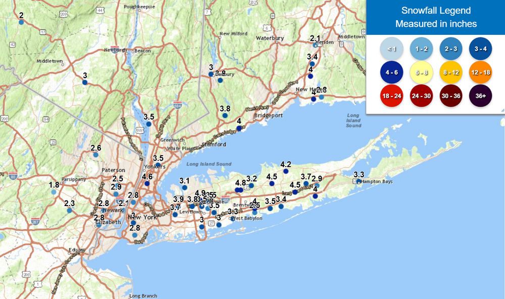
-
Snowfall NYC subforum Jan 6 and OBS if needed
Superstorm93 replied to wdrag's topic in New York City Metro
Yeah, returns are increasing across PA but everything I've seen so far has been 8-10mi light snow. Still interesting nonetheless.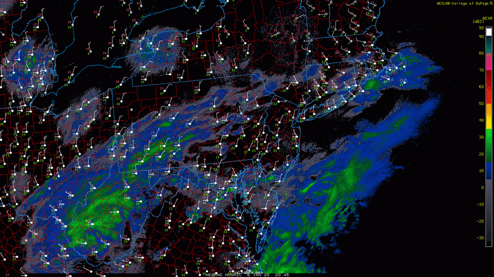
-
Snowfall NYC subforum Jan 6 and OBS if needed
Superstorm93 replied to wdrag's topic in New York City Metro
Jeez...yeah. Stay safe and thanks for the ob!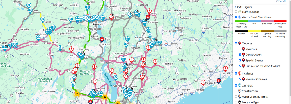
-
Snowfall NYC subforum Jan 6 and OBS if needed
Superstorm93 replied to wdrag's topic in New York City Metro
Anyone in the LHV seeing any pavement impacts with that little steadier burst that moved through?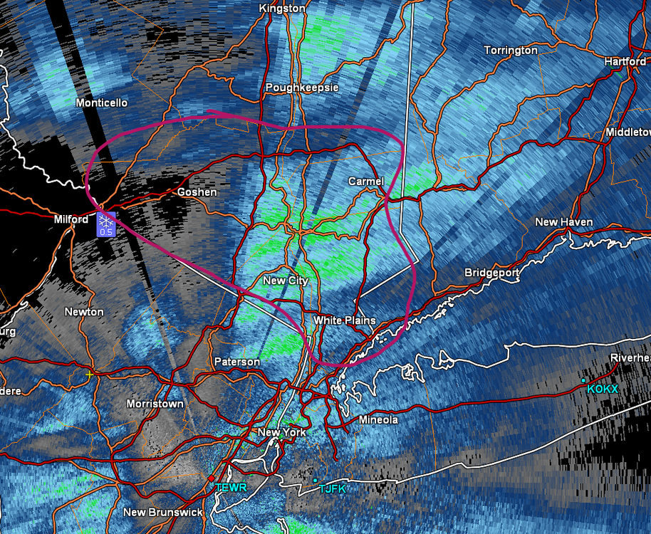
-
January: Medium/ Long Range: May the Force be with Us....
Superstorm93 replied to Weather Will's topic in Mid Atlantic
50/50 is a touch east, which helps with the confluence and gives you a better shot to phase in the northern stream vort. Not that far away from a bigger solution. Could be a fun day if these trends hold up.
-
January: Medium/ Long Range: May the Force be with Us....
Superstorm93 replied to Weather Will's topic in Mid Atlantic
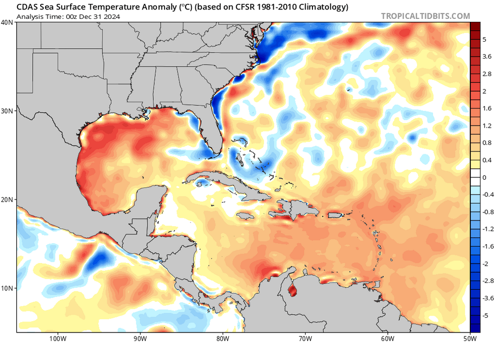
Heck of a fetch from the Gulf / Caribbean, which are still cooking as well.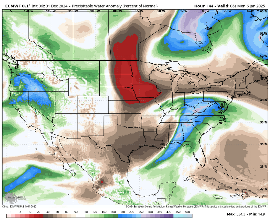
-
January: Medium/ Long Range: May the Force be with Us....
Superstorm93 replied to Weather Will's topic in Mid Atlantic
6z operational and EPS were pretty solid for you guys. Hoping the Mid-Atlantic can cash in on this one since it's been a hellish last few years..thumb.png.0999f9b76d32d3fc6fc2d49ed9240ba8.png)
.thumb.png.31b3dfc700786675b9f8cdceabc28805.png)
-
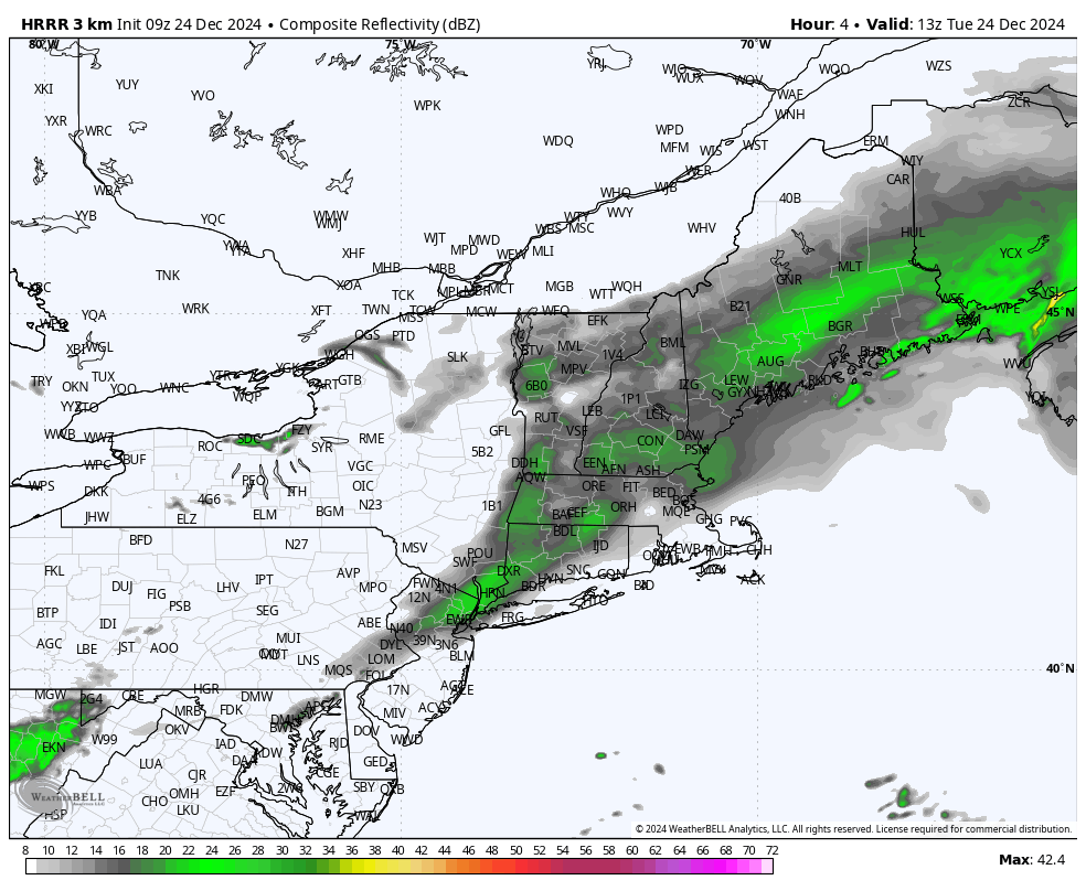
HRRR took a nice L this morning

-
Let people enjoy the snow lol I think everyone can infer what will happen when the sun comes out and temps rise above freezing.
-
Region Wide Christmas Eve Clipper Potential
Superstorm93 replied to WxWatcher007's topic in New England
GREarth...about 15/mo from AllisonHouse -
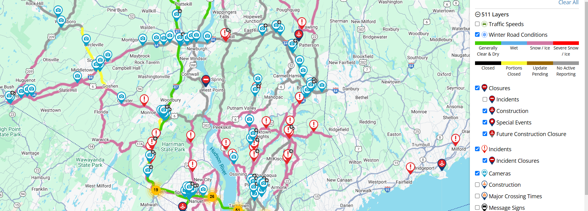
Shocked there was no WWA. Roads are pretty bad across the LHV since salt wasn't as effective
-
Region Wide Christmas Eve Clipper Potential
Superstorm93 replied to WxWatcher007's topic in New England
Pretty nice event right before Christmas! Congrats to those that got some snow!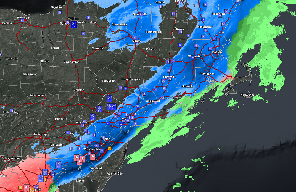
-
Region Wide Christmas Eve Clipper Potential
Superstorm93 replied to WxWatcher007's topic in New England
Awesome, appreciate it! -
Region Wide Christmas Eve Clipper Potential
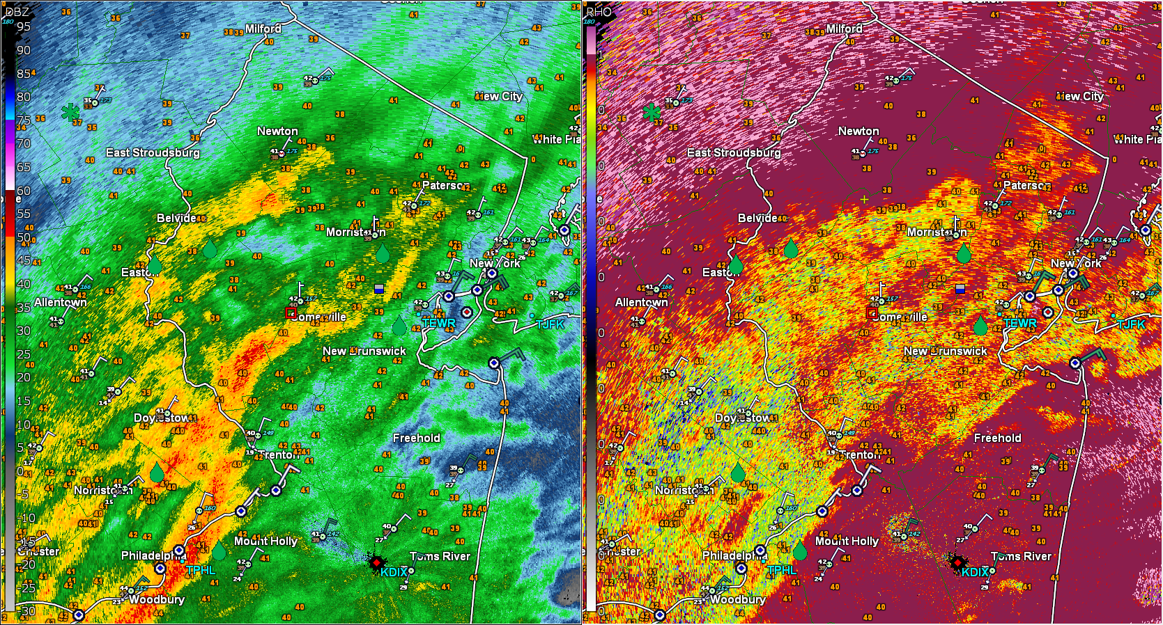
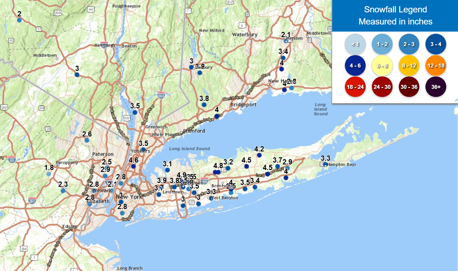
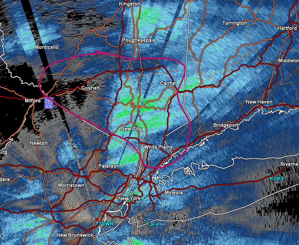
Superstorm93 replied to WxWatcher007's topic in New England
Anyone have decent obs in the circled area? Trying to fill in some gaps in the totals so far and curious how that band did.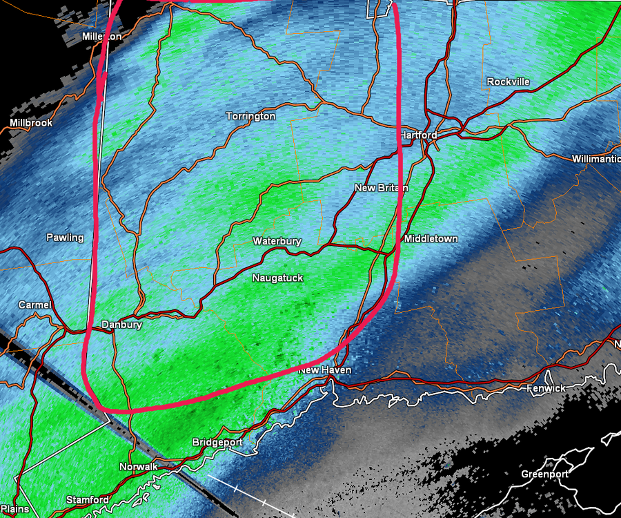


.png.e55780260e6d7fc74a5edd9ccff1a610.png)
.png.fc68eb563c52820ed76f21f57ac6010f.png)