HurricaneFrances04 Posted August 20, 2012 Share Posted August 20, 2012 Wait…what happened at 240 hr….a turn west? Link to comment Share on other sites More sharing options...
Minnesota Meso Posted August 20, 2012 Share Posted August 20, 2012 What the heck is going on with the Euro? First the storm stalls in the Caribbean. Then it jumps west and bombs at hour 240? moves across FL as a weak system, but at 228 moves it west and takes it near the Tampa area and dumps it into the GOM Link to comment Share on other sites More sharing options...
Srain Posted August 20, 2012 Share Posted August 20, 2012 Link to comment Share on other sites More sharing options...
Minnesota Meso Posted August 20, 2012 Share Posted August 20, 2012 Link to comment Share on other sites More sharing options...
Marion_NC_WX Posted August 20, 2012 Share Posted August 20, 2012 To my amateur eye, the Euro does not get the westerlies as involved in breaking down the weakness...that meaning 94L just gradually keeps moving WNW or NW into the Eastern Gulf...where as the GFS was trying to swing a trough down to scoop it out and up the East Coast. Link to comment Share on other sites More sharing options...
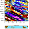
CoastalWx Posted August 20, 2012 Share Posted August 20, 2012 That is 12z yesterday I believe. Link to comment Share on other sites More sharing options...
Rjay Posted August 20, 2012 Share Posted August 20, 2012 Hurricane Hunter Observations 1 Link to comment Share on other sites More sharing options...
Superstorm93 Posted August 20, 2012 Share Posted August 20, 2012 Hurricane Hunter Observations 1 That's a glitch. No recon until tomorrow. Link to comment Share on other sites More sharing options...
PSUBlizzicane2007 Posted August 20, 2012 Share Posted August 20, 2012 That is 12z yesterday I believe. I see today's. You might need to dump your cookies/TIFs or something. Link to comment Share on other sites More sharing options...
Srain Posted August 20, 2012 Share Posted August 20, 2012 That is 12z yesterday I believe. Nah. It's today... Link to comment Share on other sites More sharing options...
Superstorm93 Posted August 20, 2012 Share Posted August 20, 2012 Hold that convection in the face of dry air and we might see a renumber within 12 hours. Buoy/Sat Obs confirm a relatively well defined circulation. Link to comment Share on other sites More sharing options...
phlwx Posted August 20, 2012 Share Posted August 20, 2012 Looks like a Fay style run on the Euro crossed with a little bit of Georges FTW. Link to comment Share on other sites More sharing options...
EasternUSWX Posted August 20, 2012 Share Posted August 20, 2012 Hold that convection in the face of dry air and we might see a renumber within 12 hours. Buoy/Sat Obs confirm a relatively well defined circulation. Lets see if dmax can really get it going. Link to comment Share on other sites More sharing options...
phil882 Posted August 20, 2012 Share Posted August 20, 2012 I mean, maybe it's right, but this Euro solution continues to be so far out from anything else, I can't buy it. (For those of you with the 6 hourlies, what in the world is it doing between 108 and 126. It's nuts.) That's my best guess. Nah, it's dissipating the small scale vortex associated with 94L, then reforming a much broader low level center 100 mi farther west with no convection over top. It just doesn't make any sense. I'm working on a post that might help to shed some light on what the ECMWF did. In short, a lee cyclone develops in the wake of strong ENE low-level flow that produces both adiabatic compression (drying out the low-level column) and lee cyclogenesis on the SW Haiti coastline. I'll be posting a diagram in the near future that attempts to make sense of it all. No doubt its a very complicated solution that will be strongly dependent on where the original low level vortex tracks. Link to comment Share on other sites More sharing options...
HurricaneJosh Posted August 20, 2012 Share Posted August 20, 2012 Wow-- just really not digging all of this freak-show complexity. Can't we just get an old-fashioned, simple, red-meat cyclone moving across the Caribbean in late August? Link to comment Share on other sites More sharing options...
Juliancolton Posted August 20, 2012 Share Posted August 20, 2012 Visible satellite loop shows some convection starting to fire right over the COC. Something to watch. Link to comment Share on other sites More sharing options...
wxsmwhrms Posted August 20, 2012 Share Posted August 20, 2012 Nah, it's dissipating the small scale vortex associated with 94L, then reforming a much broader low level center 100 mi farther west with no convection over top. It just doesn't make any sense. Obviously it is hard to tell, but just looking at 925 mb and 500 mb vorticity, it seems like as it moves toward the Islands the low level and mid level vorticity centers become better aligned as any easterly shear weakens, and eventually the vort centers strengthen and become vertically stacked. However, as the system interacts with the Greater Antilles a lot of weird disruption occurs and it becomes disjointed again. Then, once it gets past Cuba everything realigns nicely again in a light shear environment and deepening occurs. Not that any of this is any deep interpretation :-) - just more of a blow by blow of what I can see in the model. Link to comment Share on other sites More sharing options...
Superstorm93 Posted August 20, 2012 Share Posted August 20, 2012 Looks pretty tight to me. Link to comment Share on other sites More sharing options...
MarkSC Posted August 20, 2012 Share Posted August 20, 2012 Since there is now a pretty well defined center, it's worth taking a look at historical storm tracks. According the NOAA site, there have been 63 classified systems where 94L is now. Only 10 (16%) hit the U.S. and only 3 of those entered the Gulf (notably, the 1900 Galveston hurricane). A whopping 32 of the 63 (51%) were major hurricanes, though. Link to comment Share on other sites More sharing options...
Derecho! Posted August 20, 2012 Share Posted August 20, 2012 Looks like a Fay style run on the Euro crossed with a little bit of Georges FTW. I'm not a fan of TC analogs, but if the topic is general Greater Antilles-crossing Frederic is worth a mention (one of the more strangely forgotten storms.) Link to comment Share on other sites More sharing options...
GaWx Posted August 20, 2012 Share Posted August 20, 2012 To my amateur eye, the Euro does not get the westerlies as involved in breaking down the weakness...that meaning 94L just gradually keeps moving WNW or NW into the Eastern Gulf...where as the GFS was trying to swing a trough down to scoop it out and up the East Coast. I agree. Imo, the differences are quite possibly due to the respective models' biases: Euro often tends to overstrengthen E US ridging while the GFS has a tendency to overdo E US troughing. Link to comment Share on other sites More sharing options...
CoastalWx Posted August 20, 2012 Share Posted August 20, 2012 I'm working on a post that might help to shed some light on what the ECMWF did. In short, a lee cyclone develops in the wake of strong ENE low-level flow that produces both adiabatic compression (drying out the low-level column) and lee cyclogenesis on the SW Haiti coastline. I'll be posting a diagram in the near future that attempts to make sense of it all. No doubt its a very complicated solution that will be strongly dependent on where the original low level vortex tracks. Phil what was the name of the storm that kind of avoided Jamaica due to this phenomenon? I think it was 2008. It avoided Jamaica as if it "knew" it was there. I may be wrong with the year so I apologize, but you may know what I mean. Link to comment Share on other sites More sharing options...
forkyfork Posted August 20, 2012 Share Posted August 20, 2012 Phil what was the name of the storm that kind of avoided Jamaica due to this phenomenon? I think it was 2008. It avoided Jamaica as if it "knew" it was there. I may be wrong with the year so I apologize, but you may know what I mean. ivan? Link to comment Share on other sites More sharing options...
Ed Lizard Posted August 20, 2012 Share Posted August 20, 2012 My view, as an untrained hobbyist, Euro ensembles, while apparently having a member or four agreeing with the operational, also has members that might want to visit the Central Gulf. Highly paid professional w/ access to individual Euro ensemble members, how many menace New Orleans as compared to Miami? Link to comment Share on other sites More sharing options...
phil882 Posted August 20, 2012 Share Posted August 20, 2012 Here is what I got. Here is an animation of the 925 hPa heights and relative humidity. This is from 15z on the 24 Aug to 21z on 25 Aug. I've made a lot of annotations here to highlight the important features. The first thing you may notice is the low center of Invest 94L, which should presumably be a tropical cyclone by this point. As it approaches Hispaniola, the strong ENE flow associated with the system will start slamming into the north coastline of Haiti and the Dominican Republic. As we know, this Island has substancial terrain that is upwards of 3000 m in spots. As 30-40 knot flow moves over the Island, this will generate substancial lift and heavy precipitation over the Island. However, as the air flows on the downslope side of the terrain, it undergoes adiabatic compression, where flow descends in height. This causes the temperature of air parcels to warm, while the water vapor content remains constant. Its important to note that at the peak of a mountain, there is substantially less precipitable water since you are much higher in the atmosphere than near the ocean surface. Allow this same low PW air to decent in height produces an area of subsidence. This area of low relative humidity is evident in the first few frames of the animation above. However, there is a second part to this equation. In addition to adiabatic compression, a lee cyclone also forms on the downslope side of the flow. In many tropical mountain islands you often see lee vorticies produced as the prevailing flow carries alternating cyclonic and anticyclonic vorticity centers downstream. This flow, after being perturbed by the mountain flow becomes barotropically unstable, with a strip of cyclonic vorticity produced. In our case here, this extra vorticity spins up into a lee cyclone which then influences the track of the low-level circulation of 94L. Since 94L is actually smaller than the resultant lee cyclone, the binary interaction between the two vorticies results in 94L tracking into Hispaniola where the circulation becomes ill defined. At this point, the lee cyclone takes over as the chief vortex of the disturbance which continues along to the WNW now towards Jamaica. So the take home points if you could follow all of that. 1. This is an intensely complicated setup the ECMWF depicts. 2. Lee cyclones influencing TC tracks in Hispaniola are nothing new. Even very strong TCs (e.g. David 1979) are influenced by these topographical features. In fact, you see this more frequently in the Wpac near Taiwan and Luzon where we have already seen two strong TC/terrain interactions this year. 3. We are still 72-96 hours out, and large changes could still occur in the track pending on how 94L organizes in the next few days. If the storm can become much better organized over the next 24-48 hours, I wouldn't discount a WSW track for a time allowing the low and mid level centers to align. However, both the GFS and ECMWF suggest the storm will remain tilted and primarily follow the low-level flow up until land interaction with Hispaniola. At this point, I'd be inclined to agree. 4. I still think its too early to speculate what we might be dealing with post-Hispaniola. A huge amount of this depends on how much of a system we have left. For landfall lovers, the trend in the guidance is for stronger ridging in the longer range, so I'm leaning towards this system potentially having an impact on the US as opposed to recurving out into the Atlantic. Where that might be and how much of a cyclone we have left are huge ??? at this point. Link to comment Share on other sites More sharing options...
Scott747 Posted August 20, 2012 Share Posted August 20, 2012 Phil what was the name of the storm that kind of avoided Jamaica due to this phenomenon? I think it was 2008. It avoided Jamaica as if it "knew" it was there. I may be wrong with the year so I apologize, but you may know what I mean. ivan? In 08 Gustav did the classic Jamaican two-step. http://www.easternuswx.com/bb/index.php?/topic/171994-hurricane-gustav-part-iii/page__view__findpost__p__2981388 Link to comment Share on other sites More sharing options...
phil882 Posted August 20, 2012 Share Posted August 20, 2012 Phil what was the name of the storm that kind of avoided Jamaica due to this phenomenon? I think it was 2008. It avoided Jamaica as if it "knew" it was there. I may be wrong with the year so I apologize, but you may know what I mean. Gustav (2008) was the storm... and actually I think Gustav is not a horrible case to compare 94L too based on the ECMWF. If you remember Gustav was severely disrupted by Haiti and moved very erratically in the 24-36 hours following land interaction. This might have been due to the lee cyclone that developed ahead of Gustav as it interacted with land, and when the surface circulation weakened, it interacted with the larger lee cyclone produced and drifted southwest just south of Jamaica. In this case, the conditions remained favorable and convection returned to the circulation center which then skirted the south coast of Jamaica. You can see this interaction via Satellite to some degree... towards the end of this monthly loop. http://www.atmos.albany.edu/student/ppapin/maps/gridsat/2008/car/aug.html Link to comment Share on other sites More sharing options...
CoastalWx Posted August 20, 2012 Share Posted August 20, 2012 In 08 Gustav did the classic Jamaican two-step. http://www.easternus...ost__p__2981388 Gustav (2008) was the storm... and actually I think Gustav is not a horrible case to compare 94L too based on the ECMWF. If you remember Gustav was severely disrupted by Haiti and moved very erratically in the 24-36 hours following land interaction. This might have been due to the lee cyclone that developed ahead of Gustav as it interacted with land, and when the surface circulation weakened, it interacted with the larger lee cyclone produced and drifted southwest just south of Jamaica. In this case, the conditions remained favorable and convection returned to the circulation center which then skirted the south coast of Jamaica. You can see this interaction via Satellite to some degree... towards the end of this monthly loop. http://www.atmos.alb...08/car/aug.html That was it. I thought of that when I saw the euro. I mean...the euro still had a weak system, so I suppose the euro may have been trying to hint at it. Link to comment Share on other sites More sharing options...
thewxmann Posted August 20, 2012 Share Posted August 20, 2012 Actually, the 12Z Euro/GFS depiction of future 94L reminded me of Fay. Link to comment Share on other sites More sharing options...
HurricaneJosh Posted August 20, 2012 Share Posted August 20, 2012 Fun trivia for y'all: even if 94L becomes a big, bad cyclone right now, it wouldn't be a Cape Verde hurricane. It's well W of 40W. Too late! Link to comment Share on other sites More sharing options...

Recommended Posts
Archived
This topic is now archived and is closed to further replies.