nycsnow Posted August 19, 2012 Share Posted August 19, 2012 Circulation seems to be tightening up despite some dry air interaction. Could also argue theres a bit of a WSW movement. Vorticity disruption may not be hampering this too much at the moment. Maybe its just the models not handling this process well. GFS EnKF control has a much more organized system than the OP GFS FWIW What's its track? Link to comment Share on other sites More sharing options...
Snow_Miser Posted August 19, 2012 Share Posted August 19, 2012 Over half of the 12z GFS Individual members have 94L riding up or just east of the Eastern Seaboard. Could mean that the OP 12z GFS is a southwest outlier. Interesting. Link to comment Share on other sites More sharing options...
Superstorm93 Posted August 19, 2012 Share Posted August 19, 2012 What's its track? This is the 00z run. Take it with a grain of salt for now. 19/1745 UTC 14.6N 38.2W T1.5/1.5 94L -- Atlantic Link to comment Share on other sites More sharing options...
Eyewall2005 Posted August 19, 2012 Share Posted August 19, 2012 Sure HFIP Main OPS page (Pretty much everything related to the project) HFIP Model Tracks (Includes 1.5 and 2) GFS EnKF Control Insane page! Was aware of the GFS EnKF but did not have HFIP main OPS page link. Link to comment Share on other sites More sharing options...
toad strangler Posted August 19, 2012 Share Posted August 19, 2012 Can't wait for verification of closed COC. I need that before partially gluing myself to model guidance. Link to comment Share on other sites More sharing options...
wxsmwhrms Posted August 19, 2012 Share Posted August 19, 2012 FWIW, the someone less trusted CMC and NoGaps are showing or suggesting fish,,,. So that tells us it won't be, LOL. Serious note, new 12Z ECMWF, while not showing the deep system that it was a couple of days ago, looks quite a bit better organized on this run. It takes a strong, well organized 850 mb vorticity maximum that looks well correlated with a MLC (at least as it gets farther west) due west through the Islands and into the central Caribbean by Saturday morning. In any event, it is no longer showing the shearing/weakening trend in the Caribbean that it was showing the last couple of runs, at least trough day 5. Link to comment Share on other sites More sharing options...
HurricaneJosh Posted August 19, 2012 Share Posted August 19, 2012 So that tells us it won't be, LOL. Serious note, new 12Z ECMWF, while not showing the deep system that it was a couple of days ago, looks quite a bit better organized on this run. It takes a strong, well organized 850 mb vorticity maximum that looks well correlated with a MLC (at least as it gets farther west) due west through the Islands and into the central Caribbean by Saturday morning. In any event, it is no longer showing the shearing/weakening trend in the Caribbean that it was showing the last couple of runs, at least trough day 5. Link to comment Share on other sites More sharing options...
Superstorm93 Posted August 19, 2012 Share Posted August 19, 2012 Official track has been run for 94L. SHIPS coupled with that official track brings it to 108 knots. I'll have the track posted as soon as it comes out. From the Lat/Lot....this track will not disappoint. Link to comment Share on other sites More sharing options...
QVectorman Posted August 19, 2012 Share Posted August 19, 2012 With the continued westward drift of the GFS over the past 48 hrs my gut instinct is that if 94L survives its trip it will end up in the BoC on the same track as TD7/Helene/future-Issac Link to comment Share on other sites More sharing options...
toad strangler Posted August 19, 2012 Share Posted August 19, 2012 Official track has been run for 94L. SHIPS coupled with that official track brings it to 108 knots. I'll have the track posted as soon as it comes out. From the Lat/Lot....this track will not disappoint. Not disappoint who? LOL Link to comment Share on other sites More sharing options...
Superstorm93 Posted August 19, 2012 Share Posted August 19, 2012 With the continued westward drift of the GFS over the past 48 hrs my gut instinct is that if 94L survives its trip it will end up in the BoC on the same track as TD7/Helene/future-Issac With the CMC NE of Bermuda and the GFS in the GOM... Nothing would surprise me at this point. Link to comment Share on other sites More sharing options...
wxsmwhrms Posted August 19, 2012 Share Posted August 19, 2012 Not disappoint who? LOL Josh. ;-) Link to comment Share on other sites More sharing options...
QVectorman Posted August 19, 2012 Share Posted August 19, 2012 You mean the 18z SHIP track? Link to comment Share on other sites More sharing options...
wxmx Posted August 19, 2012 Share Posted August 19, 2012 12z Euro is Nern Yucatan Link to comment Share on other sites More sharing options...
Superstorm93 Posted August 19, 2012 Share Posted August 19, 2012 Not disappoint who? LOL Scratch that. Somehow, people always find a way to get disappointed. TIME (HR) 0 6 12 18 24 36 48 60 72 84 96 108 120 V (KT) NO LAND 25 26 30 34 39 52 66 78 90 99 105 107 108 V (KT) LAND 25 26 30 34 39 52 66 78 90 99 105 107 108 V (KT) LGE mod 25 24 25 27 29 37 49 65 83 99 109 112 109 FORECAST TRACK FROM OFPI Link to comment Share on other sites More sharing options...
Eyewall2005 Posted August 19, 2012 Share Posted August 19, 2012 12z GFS Esembles still suggest 94L will eventually get into the bahamas possibly threatening the southeast. Link to comment Share on other sites More sharing options...
Superstorm93 Posted August 19, 2012 Share Posted August 19, 2012 Josh. ;-) Bingo. ECMWF has a Yucatan "hit" Link to comment Share on other sites More sharing options...
WxFreak11 Posted August 19, 2012 Share Posted August 19, 2012 Until we have a declared storm..it's all a crap shoot with the models now. Link to comment Share on other sites More sharing options...
Riptide Posted August 19, 2012 Share Posted August 19, 2012 Bingo. ECMWF has a Yucatan "hit" It never really gets going on the euro, hardly anything you could put alot of confidence into; also believe the euro is too fast. Link to comment Share on other sites More sharing options...
HurricaneJosh Posted August 19, 2012 Share Posted August 19, 2012 Scratch that. Somehow, people always find a way to get disappointed. You are correct. It doesn't disappoint. It's beautiful. Link to comment Share on other sites More sharing options...
CoastalWx Posted August 19, 2012 Share Posted August 19, 2012 It's like Josh hacked into the supercomputers on both sides of the pond and programmed the track. Link to comment Share on other sites More sharing options...
HurricaneJosh Posted August 19, 2012 Share Posted August 19, 2012 Josh. ;-) Bingo. ECMWF has a Yucatan "hit" The 12Z Euro track is red-hawt. Admit it-- even you guys like it. It never really gets going on the euro, hardly anything you could put alot of confidence into; also believe the euro is too fast. Yeah, but the indication of general W motion-- as opposed to Shredderola or Fishville-- is encouraging. Link to comment Share on other sites More sharing options...
Riptide Posted August 19, 2012 Share Posted August 19, 2012 All systems that formed near 94L, assuming it gets classified within the next 24 hours. I see Josh's Yucatan cruiser. Link to comment Share on other sites More sharing options...
wxsmwhrms Posted August 19, 2012 Share Posted August 19, 2012 It never really gets going on the euro, hardly anything you could put alot of confidence into; also believe the euro is too fast. As I mentioned above, I would disagree with this characterization of the EC. Just because it only has a 1008 mb surface low doesn't mean it doesn't develop. It shows a very well developed vorticity maximum at 850 mb that looks pretty well correlated with a surface and 500 mb feature (see below). It did something very similar with Gordon several days out - it did not show a low surface pressure, but yet had a well organized looking system. Link to comment Share on other sites More sharing options...
Ed Lizard Posted August 19, 2012 Share Posted August 19, 2012 Did ed take over your acct? Excuse me, I didn't experience 1900 in the eye like Steve did. Link to comment Share on other sites More sharing options...
Ed Lizard Posted August 19, 2012 Share Posted August 19, 2012 In choosing weenie modes, I still have somewhat of a preference for 1938 over 1900. The differences in the GFS ensemble means between runs seems to be shrinking. I don't know what year to use for the Carolinas weenie storm, since Hazel wasn't an MDR long tracker. Link to comment Share on other sites More sharing options...
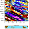
Minnesota Meso Posted August 19, 2012 Share Posted August 19, 2012 Link to comment Share on other sites More sharing options...
QVectorman Posted August 19, 2012 Share Posted August 19, 2012 As I mentioned above, I would disagree with this characterization of the EC. Just because it only has a 1008 mb surface low doesn't mean it doesn't develop. It shows a very well developed vorticity maximum at 850 mb that looks pretty well correlated with a surface and 500 mb feature (see below). It did something very similar with Gordon several days out - it did not show a low surface pressure, but yet had a well organized looking system. I'm going to take a guess and say that the multiple vort maxes at 500 mb at 156 hrs is to blame for the lack of sfc and wind organization on the Euro. during that time frame. Having two regions fighting for center of circulation dominance I would assume would induce areas of convection that would interfere with one another hindering a nice area of central organization that would promote intensification. Later on at 180 the vort max consolidates at 500 mb though. Link to comment Share on other sites More sharing options...
wxsmwhrms Posted August 19, 2012 Share Posted August 19, 2012 I'm going to take a guess and say that the multiple vort maxes at 500 mb at 156 hrs is to blame for the lack of sfc and wind organization on the Euro. during that time frame. Having two regions fighting for center of circulation dominance I would assume would induce areas of convection that would interfere with one another hindering a nice area of central organization that would promote intensification. Later on at 180 the vort max consolidates at 500 mb though. Here at home all I have is what I can see on the web, so I don't have that kind of detail. My point really just was that the previous few runs have had more of a strung out wave looking feature, while this runs has more of a look of intense vorticity center indicative of a TC. While I am definitely in the camp of believing that the global models are an excellent tool in forecasting tropical cyclone intensity trends, I just did not want to leave the idea that just because the low center is only 1008 mb that means it's not showing much development. I think it is better to look at the vorticity, its trends, and how aligned it is vertically. Gordon was a good example of that. Link to comment Share on other sites More sharing options...
andyhb Posted August 19, 2012 Share Posted August 19, 2012 After a hand full of GFS runs showing a weak system in the Western Carib...the 12z GFS maintains a stronger core and then explodes in the GOM around 240 heading for Texas... Man that thing is bombing the freak out, then again it's hard not to imagine with the hot tub water sitting in the Gulf if it does make it there (although that would be really bad for gas prices). Despite issues with outside influences (other vort maxes, the TUTT, etc.), one cannot deny that these verbatims are churning out some interesting tracks. Link to comment Share on other sites More sharing options...

Recommended Posts
Archived
This topic is now archived and is closed to further replies.