All Activity
- Past hour
-

2026-2027 Strong/Super El Nino
bluewave replied to Stormchaserchuck1's topic in Weather Forecasting and Discussion
The developing El Niño isn’t the only thing going on now. The early month pattern with the more +PNA was closer to what we typically see with the May correlation. But this coming heatwave is more related to the MJO 4-6 convection pumping the Southeast ridge. The +30C wam pool extends all the way back to the IO. -
90 seems possible there (and here)
-
AN weekend (amazing today) through Monday. Then a 2 day torch. normal for a bit after.
-
And by Friday the forecast will be 30% chance of showers with the usual .10" precip with higher amounts possible in thunderstorms.
-
Yeah but the non-ventilated warehouse is going to be sizzling...stay hydrated
-
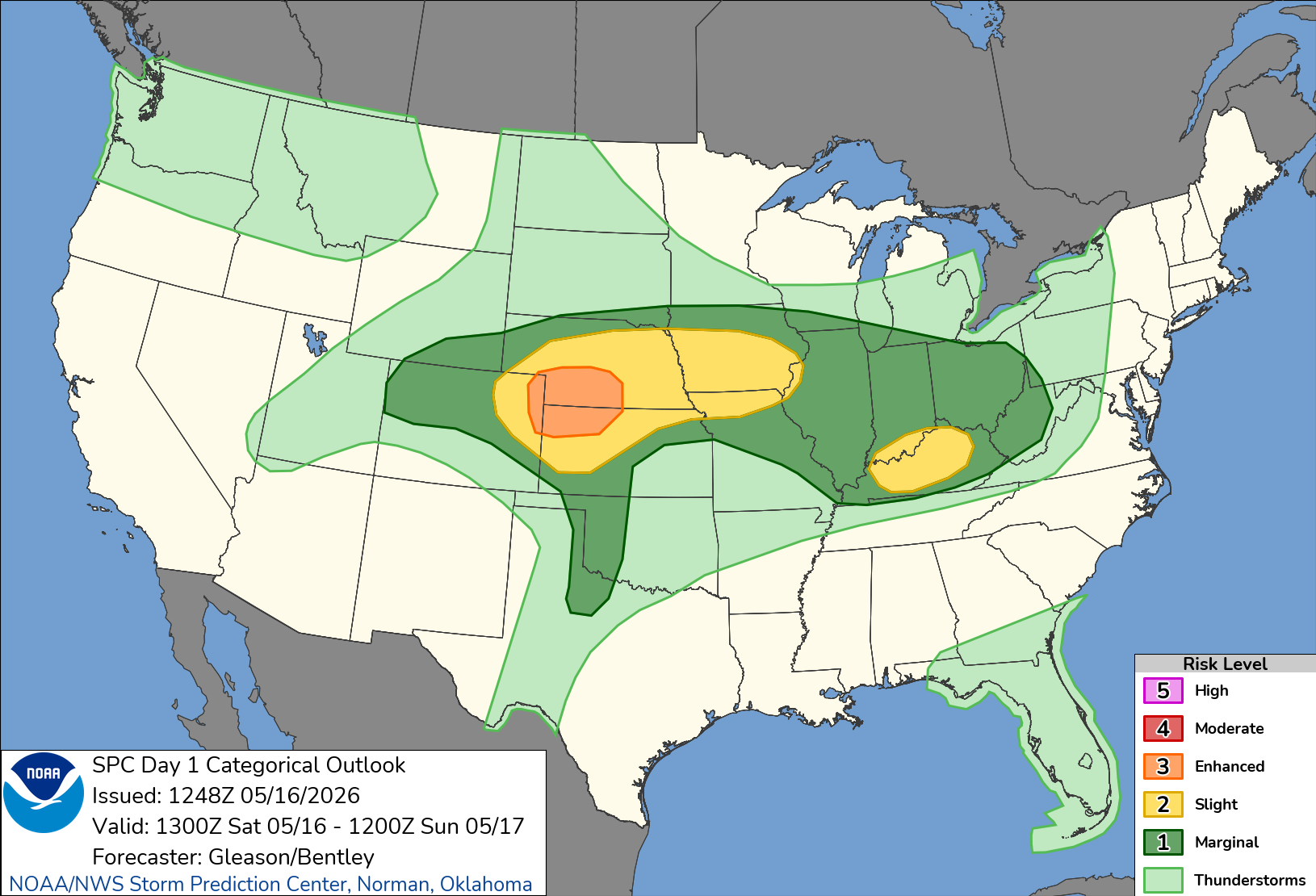
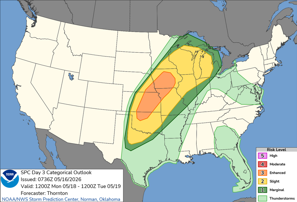
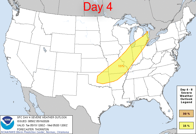
Severe Tuesday/Wednesday according to NWS forecast discussion?
-
Locked in. Attaboy, well played!
-
The 1960s drought in the Northeast 'peaked' in 1965. Thay year was the driest on record for all 3 SNE states, plus NJ, PA, DE. NY's record occurred in the drier region in the Allegheny Plateau, but the NYC records picture the drought clearly: 1931-60 norm: 44.24" Driest ranks, 1869-on: 1962 37.15" 21st 1963 34.28" 5th (4"+ event in November prevented a new record.) 1964 32.99" 2nd 1965 26.09" 1st (Remains of Camille doused one VA town with that much in 5 hours.) 1966 was tracking close to 1965 thru August. Then 5.54" fell on 9/21/66, the beginning of the drought's end. JAN-AUG SEP-DEC 1965 19.05" 7.04" 1966 19.79" 20.21"
-

2026-2027 Strong/Super El Nino
snowman19 replied to Stormchaserchuck1's topic in Weather Forecasting and Discussion
-
Today’s going to be a sneaky moderate abrose jet day. Some gusts near 40 along the south shore late this afternoon. .
- Today
-
Gonna be a long couple of days, Monday looks particularly like it has a lot of chances for long track tornadoes.


-
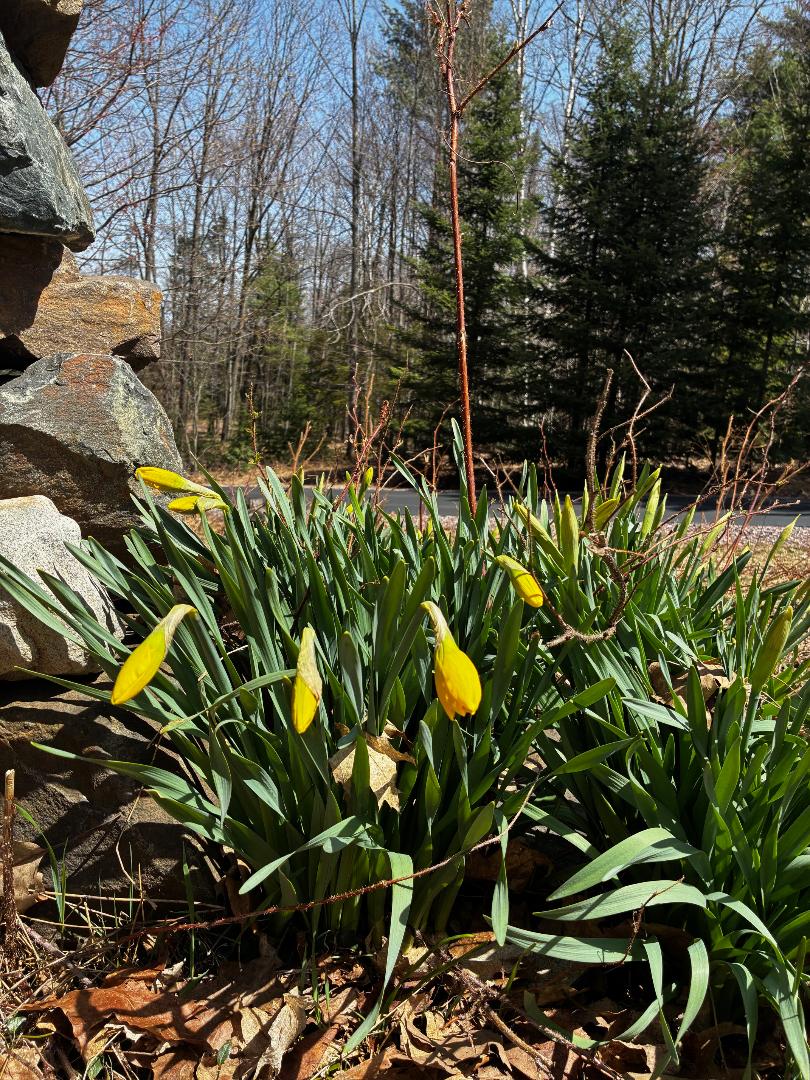
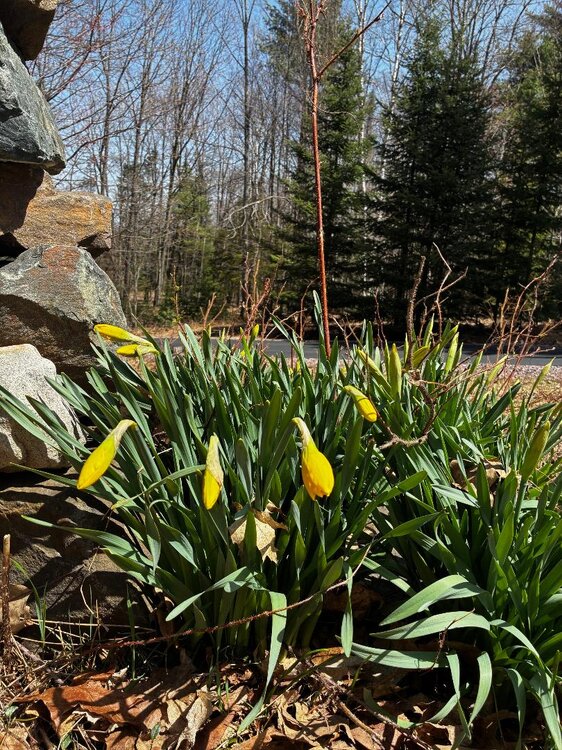
The page has turned. Spring is in full swing. Reached low 80's here yesterday as the last patches of snow in the ditches and swamps melted away. The only place where snow remains is around the pole barn where snow slid off the roof all winter. Maples are starting to bud and patches of green are replacing the blah brown. The last 80 here was October 5th.
-
67/49 SKC
-
There’s Trade offs with everything lol. You’ve had a cool damp run out there lately..enjoy the nicer weather.
-
Well if we are going to get the damn heat with no rain can we at least keep these low dewpoints?
-
Made it to June 1st last year. Now likely 5/17 this year. Will I even need to uninstall this year?!
-
Noticing the humidity getting up there. Only 66 here but with 65% humidity. Need something to clear out this pollen though. This year has been bad. Have a cat with asthma that is having a rough time of it.
-
Don't get me wrong I like the warm weather, but now I feel like stein is going to dig his mits in like a stubborn dog tick. Which is annoying for my non irrigated lawn
-
Went out and did some mowing while its still nice and the trees are filtering the sun. 69 currently. Now taking a break and drinking a 30 min IPA- perfect mid morning beer. Crushable session ale at 4% abv.
-
(002).thumb.png.6e3d9d46bca5fe41aab7a74871dd8af8.png)
Central PA Spring 2026 Discussion/Obs Thread
ChescoWx replied to Voyager's topic in Upstate New York/Pennsylvania
We start our warmup today peaking with temperatures not far from 90 by Wednesday. A cold front crosses the area later Wednesday with rain chances increasing and we trend back to near normal temperatures by Thursday and below normal temperatures for the start of Memorial Day Weekend.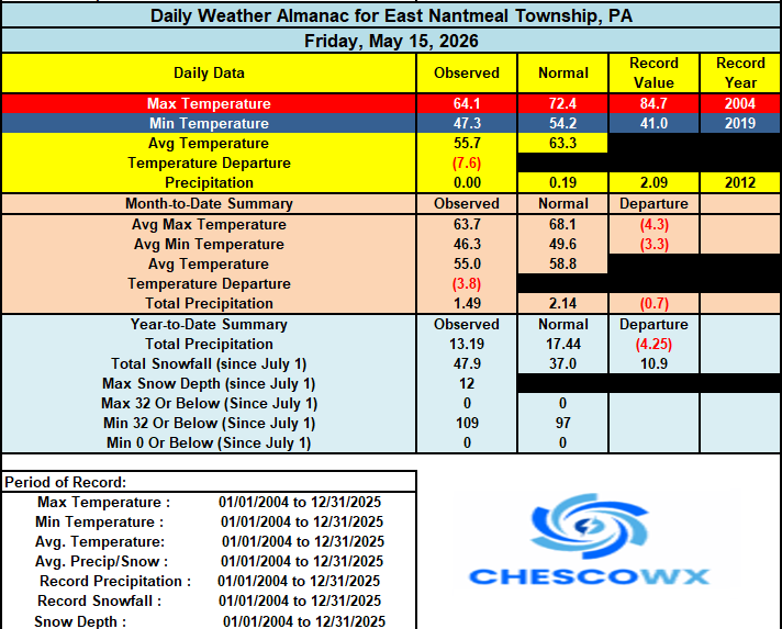

-
E PA/NJ/DE Spring 2026 Obs/Discussion
ChescoWx replied to PhiEaglesfan712's topic in Philadelphia Region
We start our warmup today peaking with temperatures not far from 90 by Wednesday. A cold front crosses the area later Wednesday with rain chances increasing and we trend back to near normal temperatures by Thursday and below normal temperatures for the start of Memorial Day Weekend.
-
May 16 1934: An extreme hot spell results in temperatures over 100 across parts of Minnesota, and record highs of 94 in St. Cloud and Minneapolis. For Saturday, May 16, 2026 1874 - The Mill Creek disaster occurred west of Northhampton MA. Dam slippage resulted in a flash flood which claimed 143 lives, and caused a million dollars property damage. (David Ludlum) 1924 - The temperature at Blitzen OR soared to 108 degrees to set a state record for the month of May. The record was later tied at Pelton Dam on the 31st of May in 1986. (The Weather Channel) 1952 - High winds in the Wasatch Canyon of Utah struck Ogden and Brigham City. Winds at Hill Air Force Base gusted to 92 mph. (The Weather Channel) 1987 - It was a summer-like day as thunderstorms abounded across the nation. Thunderstorms in Texas drenched Guadelupe County with more than three inches of rain resulting in flash flooding. (The National Weather Summary) (Storm Data) 1988 - Afternoon and evening thunderstorms developing ahead of a cold front produced severe weather from Florida to New York State. Unseasonably warm weather prevailed in the north central U.S. Havre, MT, reported a record high of 95 degrees. (The National Weather Summary) 1989 - Thunderstorms developing ahead of a cold front produced severe weather in the south central U.S. Thunderstorms spawned twenty tornadoes, and there were 180 reports of large hail and damaging winds. A tornado at Cleburne, TX, caused 30 million dollars damage. A violent (F-4) tornado touched down near Brackettville, TX, and a strong (F-3) tornado killed one person and injured 28 others at Jarrell, TX. Thunderstorms also produced softball size hail at Shamrock, TX. (The National Weather Summary) (Storm Data) 1990 - Thunderstorms produced severe weather from eastern Oklahoma and northeastern Texas to the Upper Ohio Valley. Thunderstorms spawned seventeen tornadoes, including a twister which killed one person and injured another north of Corning, AR. There were 128 reports of large hail or damaging winds. Strong thunderstorm winds killed one person and injured six others at Folsomville, IN, and injured another five persons in southeastern Hardin County KY. In Arkansas, baseball size hail was reported near Fouke and near El Dorado. (The National Weather Summary) (Storm Data)
-
2026-2027 Strong/Super El Nino
snowman19 replied to Stormchaserchuck1's topic in Weather Forecasting and Discussion
And this will spawn another DWKW -

Central PA Spring 2026 Discussion/Obs Thread
Blizzard of 93 replied to Voyager's topic in Upstate New York/Pennsylvania
Poor guy, you can’t escape the wind even up in Canada, lol. Hope you are having a great trip! Please share some pictures of your adventure. -

2026-2027 Strong/Super El Nino
GaWx replied to Stormchaserchuck1's topic in Weather Forecasting and Discussion
Pretty solid -SOIs all due to very low Tahiti SLP as Darwin is also a bit BN: 16 May 2026 1008.21 1009.70 -23.11 -7.40 -0.93 15 May 2026 1009.15 1010.00 -18.21 -6.36 -0.50 14 May 2026 1009.81 1010.30 -15.45 -5.70 -0.07 13 May 2026 1010.40 1010.50 -12.47


.thumb.gif.f92b16c631a1d15d405ed77b33f0710d.gif)