All Activity
- Past hour
-

Winter cancelled/uncancelled banter 25/26
North and West replied to Rjay's topic in New York City Metro
. -
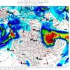
GEFS shows a terrible pattern in the long range with the -PNA returning pretty much cooking winter for weeks. EPS looks better but still not a slam dunk pattern either. Some slight changes have led for it to be warmer for most in the 7 to 14 day period. Let's hope the-NAO can trend stronger. Still not confident the Pacific is going to help us at all this winter.
-
Ice Ice Baby December 28-29 Storm Discussion
CT Valley Snowman replied to Baroclinic Zone's topic in New England
33 here and rain. About 4 miles east it's 40-42. -
Ice Ice Baby December 28-29 Storm Discussion
QuietCorner replied to Baroclinic Zone's topic in New England
Foggy upon waking up this morning and we're at 39 degrees so far this morning. -

Ice Ice Baby December 28-29 Storm Discussion
dendrite replied to Baroclinic Zone's topic in New England
So latent heating works both ways. Everything trying to melt now is acting to help cool the air. I always think of it as like a conservation of thermal energy. The ice is trying to go to a higher energy state now (solid to liquid) so it needs to gain heat for the phase change…hence it’s “taking” it from the air around it. That’s why we tend to rot at 32° so often or frequently see isothermal 0°C layers aloft. So even though the diabatic heating quickly warmed us up to 32°, the melting now is trying to help us stay there. So we’ll see how long the wedge can hold now before the cold fropa blows through later. -
January 2026 Medium/Long Range Discussion
SomeguyfromTakomaPark replied to snowfan's topic in Mid Atlantic
I like the potential around day 10 on the EPS, 0z euro op close to something too. -
Slightly above even works for us too.
-
With the intense LES of 8"/20cm and awesomely my new years eve was charged up to 10"/25cm, will be the most intense winter wx for the final days of any year I've ken. Tomorrow 7cm and still breezy has a sum of 20" in the next 72 hr!! Consensus still giving me snow every day til Jan 6.
-

2025-2026 ENSO
40/70 Benchmark replied to 40/70 Benchmark's topic in Weather Forecasting and Discussion
Completely reasonable take. -

Ice Ice Baby December 28-29 Storm Discussion
Lava Rock replied to Baroclinic Zone's topic in New England
32.5F. Was plain rn when I left for work. No need for sand to get out of driveway, but backs roads weren't great. Met a guy backing his lumber delivery truck down Tenny Hill thinking he was going to make it up the 15% grade. I told him to wait it out at the bottom at least 30min and try again as it was starting to slowly warm up. -
MSP recorded 5.8” of snow yesterday. Not sure how much if any was recorded after midnight to add to the final total. Roads are a sheet of ice this morning.
-
Measured out visibility to be less than 1,000 ft (0.18 miles) around 8AM.
-
Got down to 985mb here although that might be my wx station tripping as it hasn't budged from 987 for 5+ hr. Woke up to loud winds, snow started at 7:40 and every min got worse as the intense LES is starting to smother all of the Huron shoreline! I'm already getting some blowing snow after the glacier with nada 45 mins ago. SN+, hope to see Blizz conditions at some point. Oddly the winds aren't as strong as 5am..yet. My dendrites are also choice so I believe in the 8" forecast.
-
I'm working on SNE, Tri-State, CT maps for this event all day today, and a brand new super map i put together for southern Northeast that combines tri-state & SNE. I went back on the past 5 or 6 pages and tried to include everyone here. But if anyone has any additional reports lmk now.
-

Wounded Duck Strikes Back: Dec 26 & 27th Winter Storm Obs
The 4 Seasons replied to WxWatcher007's topic in New England
I'm working on SNE, Tri-State, CT maps for this event all day today, and a brand new super map i put together for southern Northeast that combines tri-state & SNE. I went back on the past 5 or 6 pages and tried to include everyone here. But if anyone has any additional reports lmk now. -

Ice Ice Baby December 28-29 Storm Discussion
weatherwiz replied to Baroclinic Zone's topic in New England
The fog is pretty wild -

Ice Ice Baby December 28-29 Storm Discussion
Sugarloaf1989 replied to Baroclinic Zone's topic in New England
During the ice storm of 1998 the power lines were on the ground between poles, but not broken along the access road to Sugarloaf. Never seen anything like that. We had a mixture of sleet and freezing rain. About 6" of sleet one the lower 2/3 of Sugarloaf. Never lost power. But Sugarloaf was closed. -
Yep, the wind sounds like a freight train…highest gust I’ve had is 60. Down to 39 and steadily dropping. I think we’re locked in for 8-12”+ this week…enjoy the chase! ETA: A few wet snowflakes mixing in with the rain.
-
Heaviest rains/mix north
-
E PA/NJ/DE Winter 2025-26 Obs/Discussion
Kevin Reilly replied to LVblizzard's topic in Philadelphia Region
44f humidity 99% dew point 44f up from 36f at 11:30 pm last night. I was expecting warmer honestly I’m sure the 50’s are coming by 10 am -

Ice Ice Baby December 28-29 Storm Discussion
CoastalWx replied to Baroclinic Zone's topic in New England
43 here and pack ravaged -
Adding this to 14 years later to the 1917 December cold outbreak 1933: Locations in the U.S. that reported all-time December record lows included: Burlington, VT: -29 °F-Tied, Alpena, MI: -27 °F, Milton, MA: -19 °F, and Worcester, MA: -17 °F. Locations reporting daily record lows included: Houghton Lake, MI: -25 °F, Ste. St. Marie, MI: -24 °F, Syracuse, NY: -24 °F, Concord, NH: -21 °F, Portland, ME: -18 °F, Albany, NY: -18 °F, Hartford, CT: -11 °F, Providence, RI: -10 °F, Avoca, PA: -10 °F-Tied, Buffalo, NY: -7 °F, Rochester, NY: -7 °F, Williamsport, PA: -4 °F, Newark, NJ: -2 °F, Allentown, PA: -1 °F and Wilmington, DE: 2 °F-Tied. (Ref. Wilson Wx. History ) Boston, Massachusetts had a -17 °F the coldest low temperature for the month of December. (Ref. NOAA Boston Weather Events)
-

Ice Ice Baby December 28-29 Storm Discussion
Sugarloaf1989 replied to Baroclinic Zone's topic in New England
33F here with fog and rain. The snow-cover survived the night. Went above freezing at 5am. -

E PA/NJ/DE Winter 2025-26 Obs/Discussion
Kevin Reilly replied to LVblizzard's topic in Philadelphia Region
Well that’s been the problem the cold air leaves in even these set ups hence your other 25%. -
Records: Highs: EWR: 71 (1984) NYC: 70 (1984) LGA: 68 (1984) JFK: 65 (1984) Lows: EWR: -2 (1933) NYC: -6 (1917) *start of brutal record cold wave into the city LGA: 12 (2017) JFK: 12 (2017) Historical: 1830 - A very heavy snowstorm ushered in the "winter of the deep snow." The storm produced 30 inches of snow at Peoria IL and 36 inches at Kansas City MO. Cold and snow continued until the middle of February causing great suffering among pioneers. (David Ludlum) 1876: The Pacific Express train was crossing the Ashtabula River in Ohio when the bridge collapsed. The bridge collapsed at 7:28 PM, during a snowstorm that left two feet of snow and produced 40 mph winds. The only railcar not to fall into the icy river below was the first locomotive. 1894 - A severe freeze hit Florida destroying fruit and causing considerable damage to trees. (David Ludlum) 1917: The coldest period of the winter of 1917-18 occurred from December 29th to January 4th. Brutal record cold dominated from the Plains to the East Coast. Locations that reported all-time December record lows included: Washta, IA: -40 °F, Huron, SD: -33 °F (broke previous daily record by 10 degrees), Sioux Falls, SD: -31 °F, Sioux City, IA: -28 °F and Philadelphia, PA: -1 °F. Locations reporting daily record lows included: Bismarck, ND: -37 °F, International Falls, MN: -36 °F, Aberdeen, SD: -35 °F, Aberdeen, SD: -35 °F, Grand Forks, ND: -35 °F, Wheaton, SD: -33 °F, Watertown, D: -32 °F, Kennebec, SD: -31 °F, Duluth, MN: -30 °F, St. Cloud, MN: -27 °F, Norfolk, NE: -27 °F, Minneapolis, MN: -24 °F, Burlington, VT: -23 °F, Ste. St. Marie, MI: -20 °F, Omaha, NE: -20 °F, Waterloo, IA: -18 °F, Lincoln, NE: -18 °F, Elkins, WV: -18 °F, Des Moines, IA: -17 °F-Tied, Syracuse, NY: -16 °F, Grand Island, NE: -14 °F, Green Bay, WI: -14 °F, Dubuque, IA: -13 °F, Peoria, IL: -13 °F, Peoria, IL: -13 °F, Portland, ME: -12 °F, Rockford, IL: -11 °F, Boston, MA: -11 °F, Hartford, CT: -10 °F, Milton, MA: -10 °F, Avoca, PA: -10 °F (broke previous record by 10 degrees), Concordia, KS: -9 °F, Topeka, KS: -9 °F, Kansas City, MO: -9 °F, Columbia, MO: -8 °F, Providence, RI: -8 °F, New York (Central Park), NY: -6 °F, Rochester, NY: -5 °F, Washington, DC: 2 °F, Wilmington, DE: 2 °F, Baltimore, MD: 2 °F, Beckley, WV: 2 °F, Asheville, NC: 3 °F, Lynchburg, VA: 4 °F, Richmond, VA: 5 °F, Charleston, WV: 8 °F, Raleigh, NC: 10 °F-Tied, Norfolk, VA: 11 °F, Wilmington, NC: 12 °F,Boston, Massachusetts had a +2 °F the lowest high temperature for the month of December. (Ref. Wilson Wx. Additional Temperatures Given) (Ref. NOAA Boston Weather Events) 1919: The American Meteorological Society was founded in St. Louis, MO. (Ref. Wilson Wx. History ) 1954 - Fort Scott, KS, was buried under 26 inches of snow in 24 hours to establish a state record. (28th-29th) (The Weather Channel) 1972: A late season severe weather outbreak brought tornadoes, hail, and damaging winds to central and north-central Oklahoma. A tornado in McClain County damaged a farm, destroyed a garage, and blew away a boat near Purcell. Farther north, in the Perry area, hail larger than baseballs damaged homes, businesses, and automobiles. As the storms moved east into the Stillwater area, they produced 70 to 90 mph winds, which damaged 10 trailer homes. Fortunately, no one was hurt or killed by the widespread severe weather. On the backside of the storm, heavy snow and high winds buffeted portions of eastern Nebraska through the 30th. Snowfall accumulated to depths of around a foot in this area coupled with winds of 30 to 50 mph. Norfolk clocked winds to 67 mph. (Ref. Wilson Wx. History ) 1984 - One hundred cities in the central and eastern U.S. reported record high temperatures. Kansas City, MO, experienced its warmest December day of record with a morning low of 60 degrees and an afternoon high of 71 degrees. (The National Weather Summary) (Sandra and TI Richard Sanders - 1987) 1987 - A storm off the Middle Atlantic Coast produced heavy snow in the Appalachians and the northeastern U.S. Snow and high winds created blizzard conditions in southeastern Massachusetts. Cape Cod received thirteen inches of snow, and snow drifts three feet deep were reported around Chatham MA. Strong winds produced wind chill readings as cold as 60 degrees below zero in southwestern New England. In the western U.S., a Pacific coast storm produced heavy snow in the Sierra Nevada Range of California, with 24 inches reported at Mammoth Mountain. (The National Weather Summary) (Storm Data) 1988 - A cold front brought rain and snow to the northwestern U.S. The rainfall total of 2.70 inches at Astoria OR was a record for the date. High winds along the eastern slopes of the Northern Rockies gusted to 81 mph at Livingston MT. (Storm Data) (The National Weather Summary) 1989 - Snow and ice prevailed from the southwestern U.S. to the Great Lakes Region. Flagstaff, AZ, received nine inches of snow in just six hours. Bitter cold weather continued over Maine. Portland ME reported a record twenty-two straight days with highs 32 degrees or colder. (The National Weather Summary) (Storm Data) 1992: Big time snows across the Sierra Nevada Mountains. 30 inches of snow fell at Daggett Pass CA in just 24 hours. The snow depth at the Sierra Ski Ranch had accumulated to 118 inches. (Ref. AccWeather Weather History) 1994: Wind gusts to 80 mph caused the derailment of a ski lift at NH’s Loon Mountain. Appprox. 180 skiers had to be evacuated from the lift. The winds also caused minor structural damage to the base lodge. (Ref. Weather Guide Calendar with Phenomenal Weather Events 2011 Accord Pub. 2010, USA) 1996: 27 inches of snow was on the ground at Yakima, WA to set a new record for greatest snowfall depth ever on the ground at that location. (Ref. AccWeather Weather History) 2004: The world's highest barometric pressure (adjusted to sea level) was recorded at Tonsontsengel, Mongolia at 32.25 inches of mercury or 1092 millibars. (Ref. Wilson Wx. History ) 2006: A major winter storm crippled much of southwest Kansas through the 31st. Widespread total precipitation from this storm ranged from 2 to 4 inches of rain and freezing rain and there was even an area from Garden City to Dighton that had up to 6 inches. This is incredible for any time of the year, let alone for December. Significant, widespread damage to trees and especially utility lines, poles, and towers resulted from one half to two and a half inches of ice accumulation. An area from Sublette to Garden City, north through Dighton had the most severe damage. Over 60,000 people were without electricity at one time or another from the nearly 10,000 power poles that were taken down from the weight of the ice. Some of these structures were high transmission towers. In addition to the ice accumulation, large snow amounts were reported in the western part of the area, especially near the Colorado State Line. A location 15 miles west of Johnson had 32 inches of snow. (Ref. Wilson Wx. History ) Albuquerque, New Mexico: Albuquerque, breaks its all-time 24-hour snowfall record with 10.5 inches of snow. The accumulation lifted their monthly total to 14.8 inches, breaking their all-time monthly snowfall record as well. The record would be short-lived as another 15.6 inches of snow would fall there on the 31st. (Ref. WxDoctor)


