All Activity
- Past hour
-
7am thunder is always impressive
-
It’s coming.
-
Congrats for Rhode Island again
-
I agree with the BOM. A weak La Niña the remainder of the fall into at least early winter is inevitable
-

September 2025 OBS-Discussion centered NYC subforum
Brian5671 replied to wdrag's topic in New York City Metro
yep-looks like very little after this batch-just can't buy a decent soaking -
September 2025 OBS-Discussion centered NYC subforum
Brian5671 replied to wdrag's topic in New York City Metro
if that crosses Hispanola there may not be much left on the other side -
Still stuck at 0.16” for the month
-
It’s down in PA and developing
-
later today and tonight
-
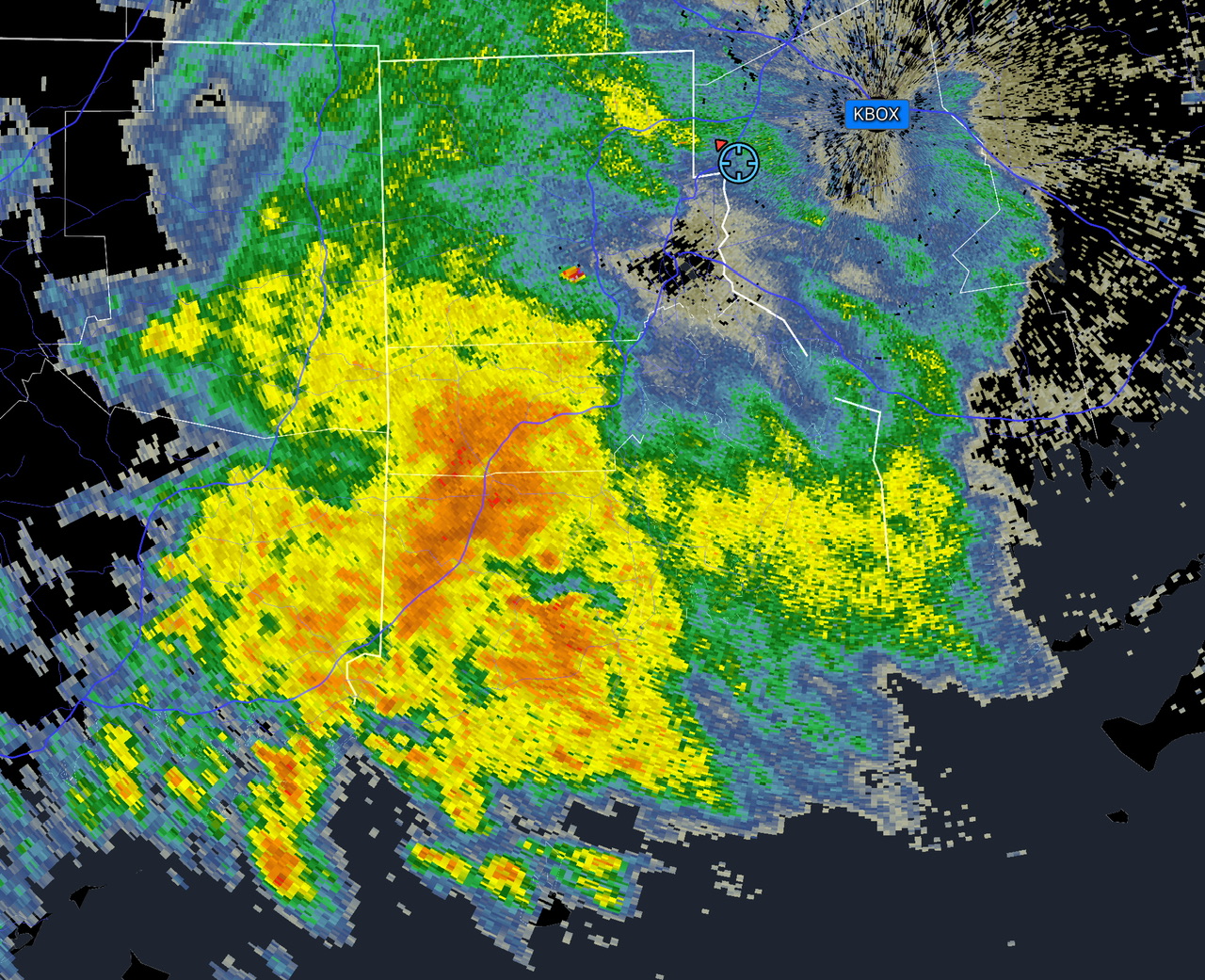
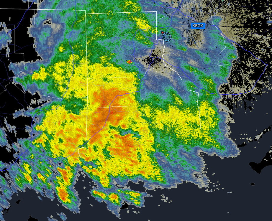
The radar looks radar benign doesn’t it?
-

September 2025 OBS-Discussion centered NYC subforum
MJO812 replied to wdrag's topic in New York City Metro
Gfs is now into the Carolinas
-

-
Invest 94L—40% 2 day and 80% seven day odds of development
MJO812 replied to WxWatcher007's topic in Tropical Headquarters

-
More rain coming in this morning.
-

September 2025 OBS-Discussion centered NYC subforum
SnoSki14 replied to wdrag's topic in New York City Metro
Big high coming in from Canada could squash this south while Humberto sneaks NE. Odds of any impacts from either are very low imo but still too early to tell. -
Just looking at things now.. we track!! I think 94l gets pushed to the west a bit and Humberto also goes west.. then gets stuck under the ridge and eventually comes up.. 6z GEFS coming west! We watch!
-
Wet AM coming
-
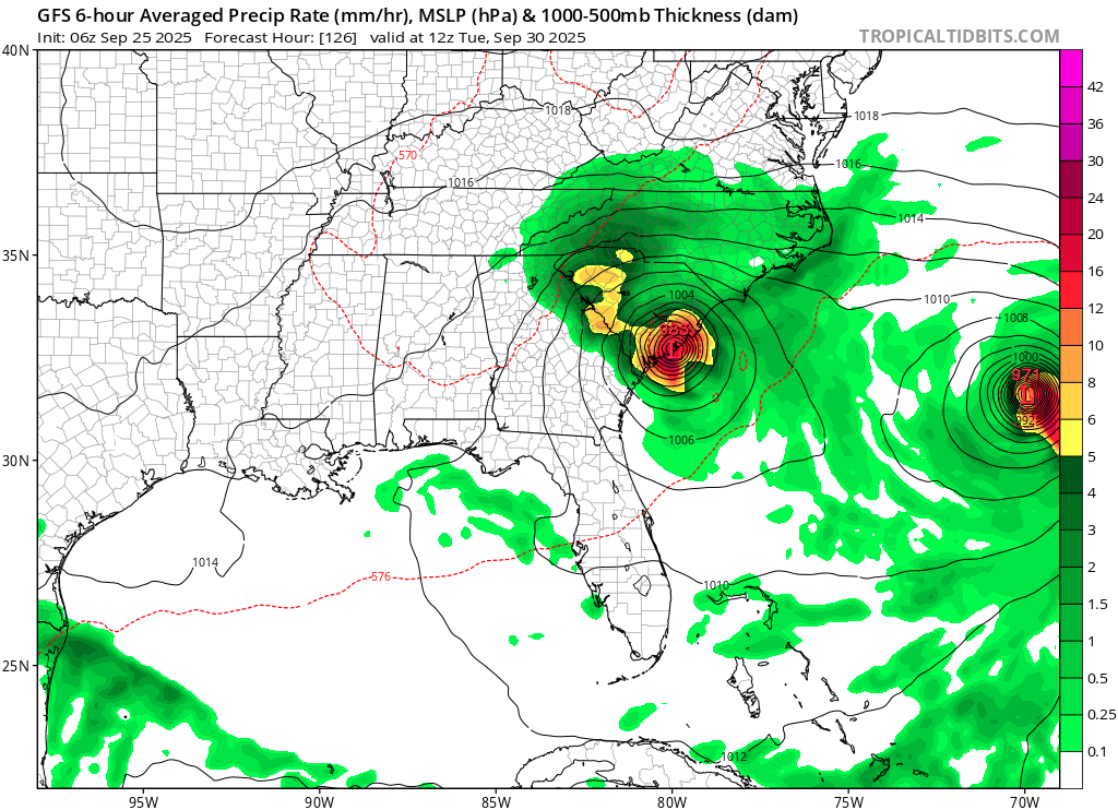
 6z GFS slams the storm into the Carolina’s as a hurricane
 -
61F/ .48"
-

September 2025 OBS-Discussion centered NYC subforum
winterwarlock replied to wdrag's topic in New York City Metro
Only. 14 for me thus far -

E PA/NJ/DE Autumn 2025 Obs/Discussion
PhiEaglesfan712 replied to PhiEaglesfan712's topic in Philadelphia Region
Where did Sandy develop? -
0z euro would up the fun meter vs the last several months.
-
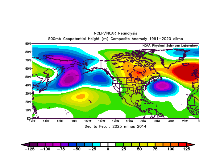
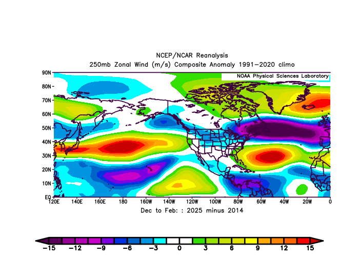
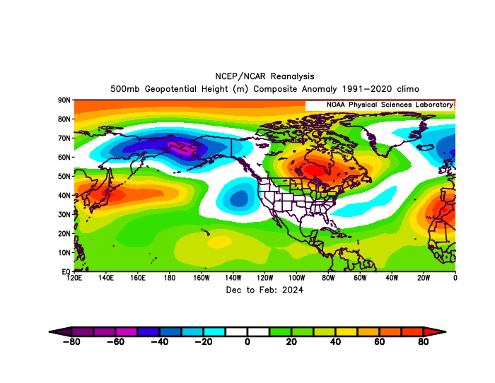
We maintained the -EPO and -WPO throughout the 13-14 and 14-15 seasons. The Pacific Jet was much weaker so frequent shortwaves weren’t constantly lowering heights in the region. Notice how much lower the -EPO and -WPO domain 500mb heights were in 2025 than 2014 with the much stronger Pacific Jet. Also look how the subtraction of 2025 from 2014 resembled 2024. Much stronger ridge last winter near Hudson Bay than 2014. This is exactly where the ridge was during 2024.
-
Looks like a predecessor rain event perhaps on the euro?
-
No posts from ineedfish.. all you need to know