All Activity
- Past hour
-
GFS setting up quite the contrast to start the month. 90s-100 around DC, 60s in Boston. Ring of Fire storms around the ridge also a possibility, maybe a well timed derecho.
-
The end of August is always a rough time for my brain. On one hand, I love the warm days and promises of football to come. On the other hand, my snow addiction starts to rear its ugly head and I find myself reading past snow event thread. Send help.
-
 The weather pattern across the CONUS the past few months has been dominated by a large ridge of high pressure across the southern Plains with the ridge centered within the New Mexico - Louisiana vicinity. This has resulted in a prolonged period of some extreme heat within this region while also yielding convectively active periods within portions of the Great Plains, upper-Midwest, and Ohio Valley region. Computer forecast models have been consistent in the eastward expansion of this ridge across the deep South with an eastwards shift in the ridge axis farther northeast, potentially into the Mississippi or Tennessee Valley region (this does greatly impact us). The shift in the ridge axis would push the periphery of the jet stream across the northern tier of the Great Lakes region and across New England. As we speak, high pressure is building into the region and will dominate through the weekend, however, late Sunday a weak cold front approaches from the north. Computer forecast models then stall the front within the region on Monday and this is where the fun begins. An unseasonably strong northwesterly flow is expected to overspread the region along the periphery of the upper-level ridge early in the week, meanwhile a more westerly surface flow (south of the weak stationary front) will advect warmer and more humid air from the Ohio Valley into the region. Multiple shortwave impulses will traverse the jet, originating from the upper-Midwest/Canada. This will offer the opportunity for multiple thunderstorm clusters to develop across southern Canada and the northern Great Lakes which and traversing the region Monday and again on Tuesday. The biggest key here is where will the instability gradient reside? Historically, this seems to favor New York, Pennsylvania, New Jersey, and perhaps far southwest Connecticut but this is going to be highly dependent on where that stationary front resides and how strong is the push of warmer and more moist low-level air. The more intriguing day is expected to be on Wednesday. This is when computer forecast model guidance advances a sharper trough across southeast Canada with a cold front moving into the region at the surface with the stationary front perhaps lifting back northeast as a warm front. In addition, there have been some hints at the potential advection of remnant elevated mixed-layer air. In addition, flow aloft, particularly in the lower levels is expected to increase and should the low-level flow become more southwesterly or southerly, this would result in a greater surge of moisture into the region and potential for moisture pooling. Within the warm sector, 850mb temperatures are forecast to climb to +17C to +20Cwith 850mb dewpoints +15C to +17C. This would yield potential for surface temperatures well into the 80's and surface dewpoints well into the 60's to lower 70's. This combination, potentially under the presence of steep mid-level lapse rates under the presence of an advecting elevated mixed-layer would yield potential for moderate instability (MLCAPE > 2500 J/KG) to develop. The combination of a moderate unstable airmass with increasing shear and forcing would net the likelihood for scattered-to-numerous thunderstorms developing during the afternoon on Wednesday; including potential for line-segments and supercells with hazards of damaging wind gusts, large hail, and perhaps even the risk for a few tornadoes if we can get some turning of the low-level flow and enlarged hodographs. At this time, the greatest potential seems to be across Pennsylvania, New York, and northwest New Jersey, however, this is all highly dependent on key surface features but western southern New England would definitely be in play. While the threat for strong-to-severe thunderstorms would gradually wane with the loss of daytime heating, showers and thunderstorms could work their way through the coast Wednesday night. Lots of details to iron out over the coming days!
 -

2026-2027 Record-breaking El Nino
bluewave replied to Stormchaserchuck1's topic in Weather Forecasting and Discussion
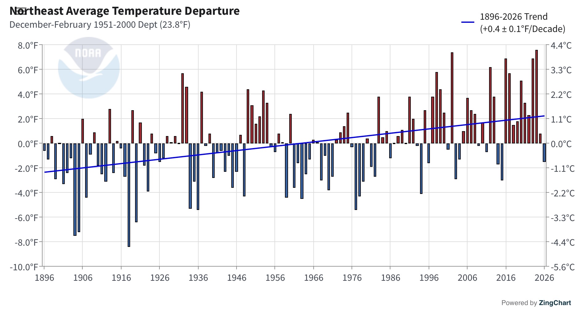
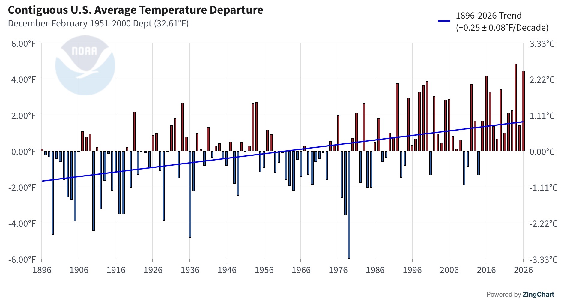
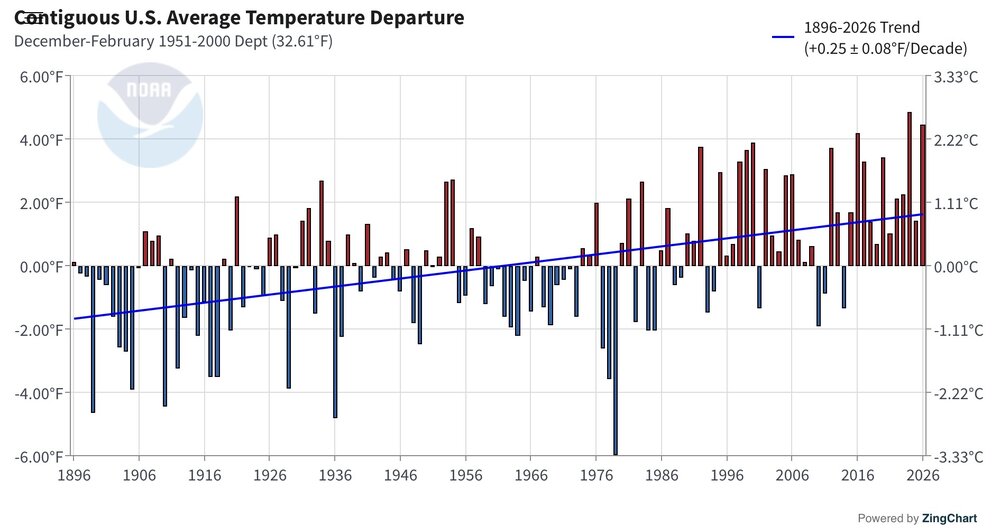
Yeah, the winters in the Northeast and across the CONUS really warmed following the 2015-2016 baseline temperature jump. Last winter was our first colder winter against the long term means since 2014-2015 in the Northeast. Almost seems like the 2015-2016 caused more of a non-linear shift than something gradual. So it will be interesting to see what things look like following this significantly stronger El Niño. Getting 3 baseline increases from 2015-2016 to 2023-2024 and now 2026-2027 is very extreme for such a short period of time. We had to wait 18 years from 1997-1998 to 2015-2016. Now we are getting our first super El Niños only 3 years apart. Matches with the findings of the recent corals studies showing stronger El Niños as the climate warms.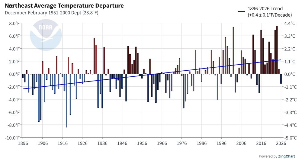
-
Looks like the misery continues for the next 10+ days. Hot, humid, and actually a little bit dry. Which after the deluge of rain for 6 weeks, won't be the worst news. I always look forward to the first 40s in September.
-
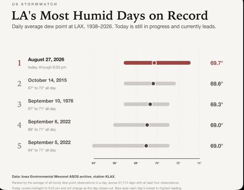
https://nypost.com/2026/08/28/us-news/southern-california-sets-record-most-humid-place-in-us-amid-heatwave/
-
Lots of la nina years on this list. 1955 and 2007 were developing strong la ninas; 2011, 1974, and 1989 were exiting strong la nina years; 1971 and 2021 were also moderate la nina years.
-

Augdewst 2026: Summer's Last Stand
40/70 Benchmark replied to Prismshine Productions's topic in New England
Yea, it was feverish pace for several years...used the opportunity to dig deeper on winter seasonal stuff and hone my methods. -
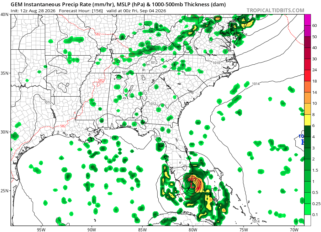
I'm not convinced this is the end of Dolly. There's still a pretty clear center of rotation visible on satellite and it looks like it's gaining in latitude much faster than forecasted. If the circulation goes north of the islands, which it seems that it might, then I think game is on once it makes it closer to the Bahamas. The big factor will be whether the weak LLC stays intact, which it probably wouldn't if it went over the islands, whereas it could if it goes north of them...
-
lot of wet records this summer/monthly
-

Augdewst 2026: Summer's Last Stand
WxWatcher007 replied to Prismshine Productions's topic in New England
Been a minute since we’ve had something to really talk about, but of course, ‘17-‘25 (added 2025 because of the behemoth that was Melissa) was a pace we couldn’t sustain much longer. -
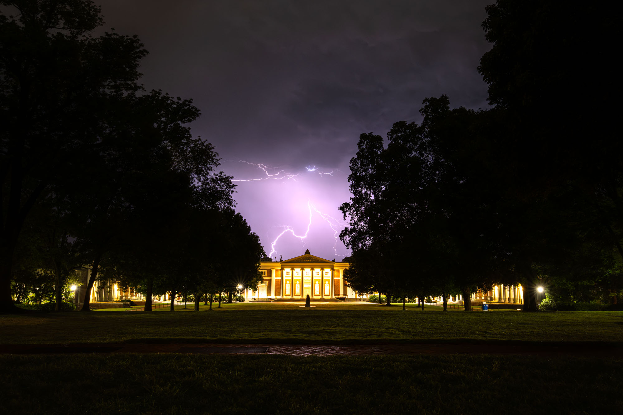
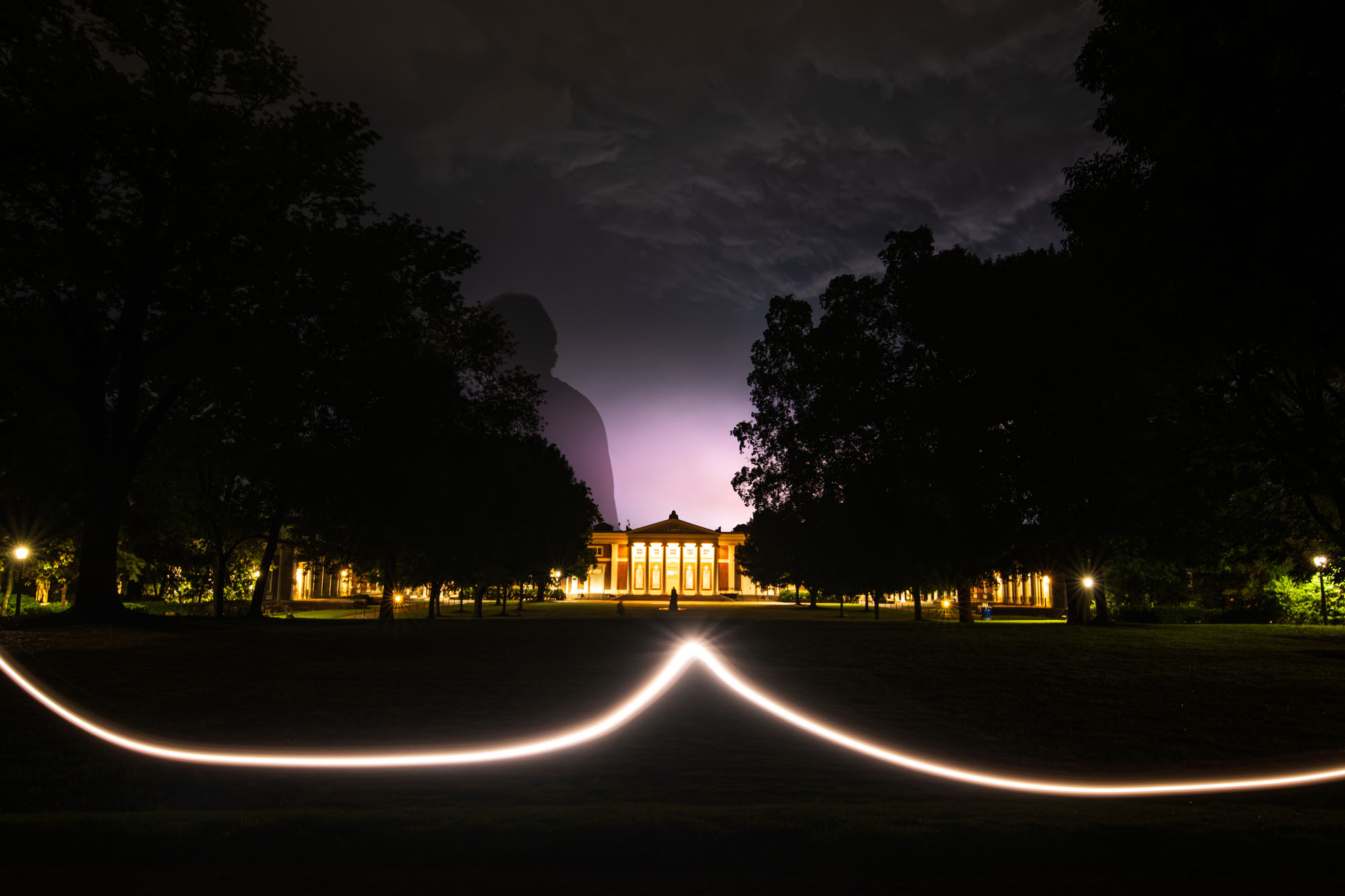
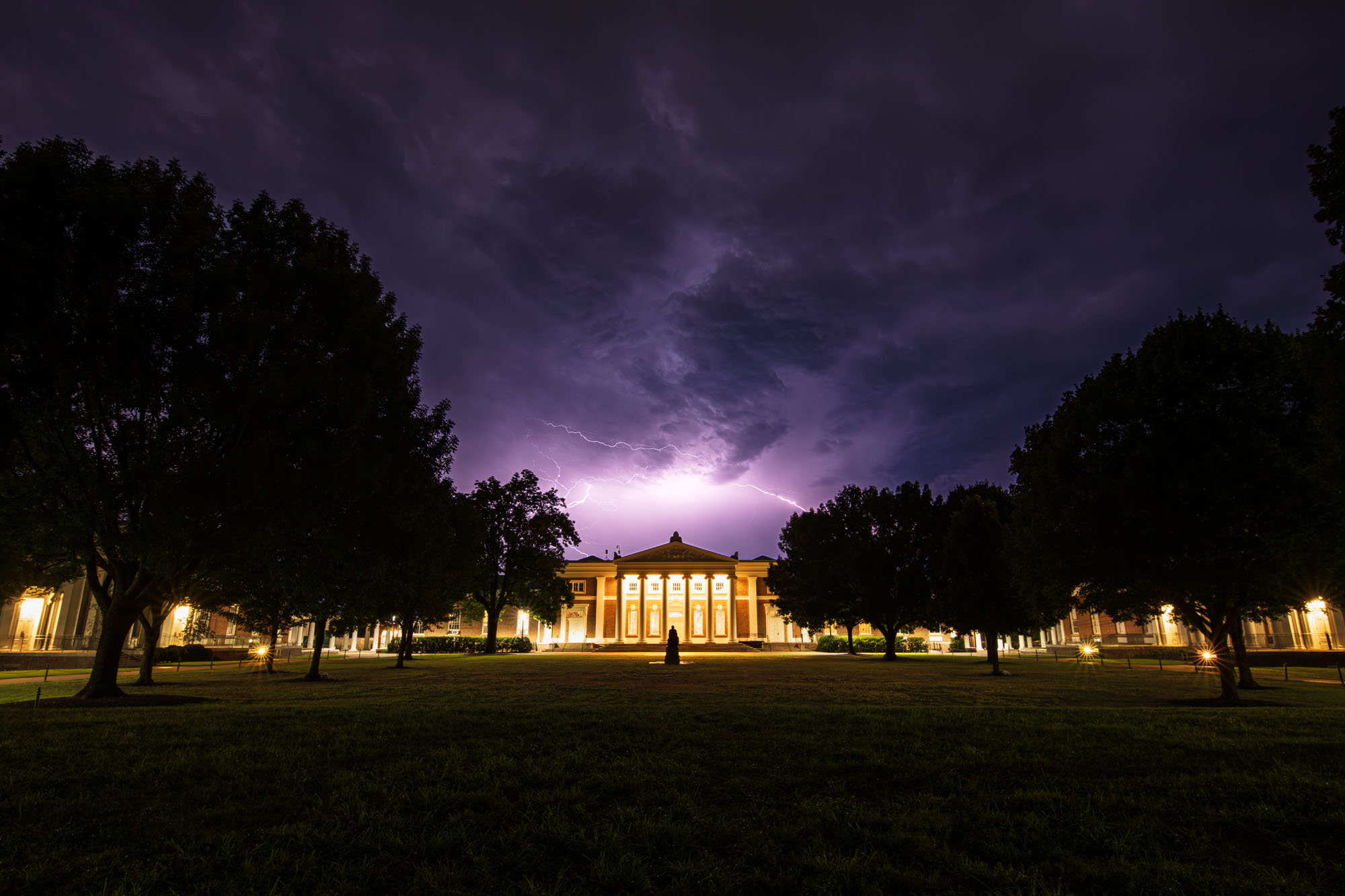
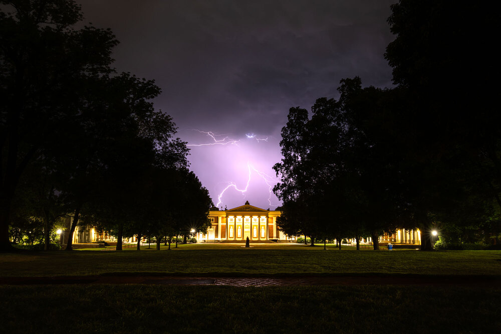
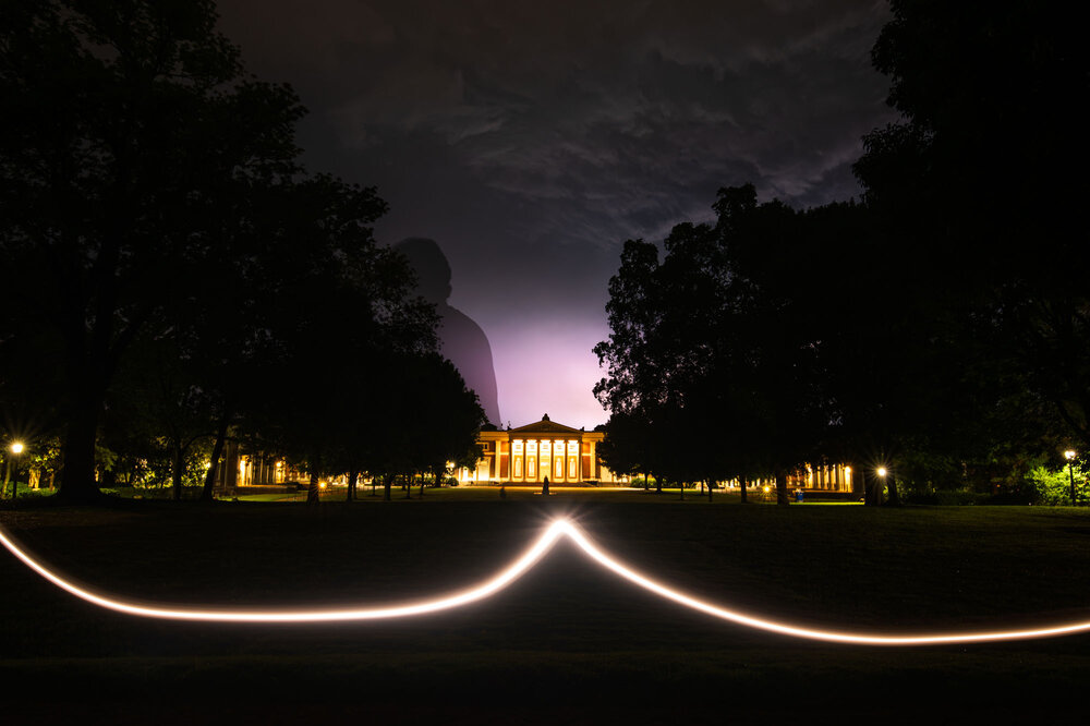
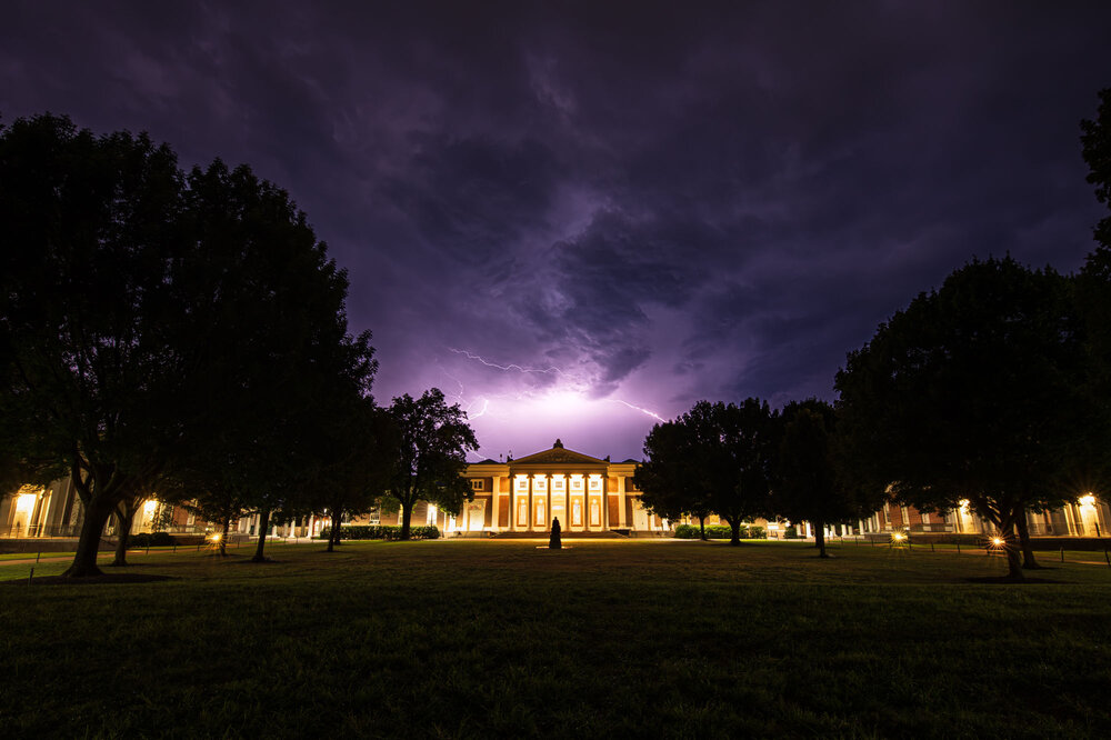
Super cool! Way to take advantage of UVA’s status as supercell alley these days. I’ve been feinding for good lightning this summer and have been annoyed - clearly I need to visit Cville. Hope you are ready to cheer us on vs. NC State tomorrow!! Big game.
-

Central PA Summer 2026 Discussion/Obs Thread
canderson replied to Voyager's topic in Upstate New York/Pennsylvania
CTP has no rain mention in my grid until next Tuesday night. -
I can’t post the maps because they’re too large for the space allowed here, but comparing today’s 12Z UKMET 120 hour map with the 168 hour map of the 12Z UK of 48 hours ago using Pivotal shows they’re very similar with regard to both with a somewhat healthy Dolly (1007 mb/well organized vs 999 mb on the run from 48 hours ago) recurving and the preliminary low back to being just a weak (1012ish) low that’s not designated a TC and headed toward NE FL.
-
Augdewst 2026: Summer's Last Stand
40/70 Benchmark replied to Prismshine Productions's topic in New England
My last post on the tropics was a post-mortem on Hurricane Milton on October 10th, 2024. https://easternmassweather.blogspot.com/2024/10/hurricane-milton-verification-devil-is.html All you need to know. -
@NorthArlington101Turns out UVA liked them too as I'm now a post on their Instagram. https://www.instagram.com/p/DclqopRDcKi/?utm_source=ig_web_copy_link&igsi=MzRlODBiNWFlZA%3D%3D
-
 Here is a good post about it: MedGuide USA. Good luck!
 -
Looking at them both, which was painful...I agree that 2015 was worse from a synopitc standpoint at H5...2023 was bad, but December 2015 was as bad as it gets.
-
Will finish August with 4.08" unless we get some more on Sunday. Not 2 shabby.
-
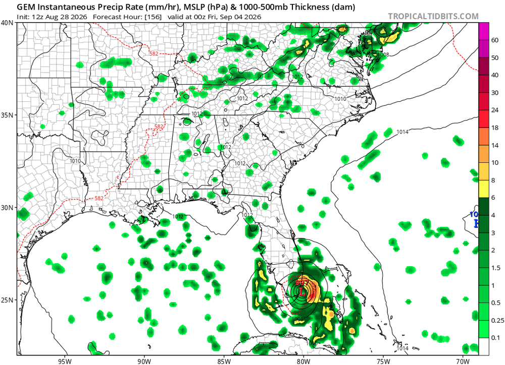
Cmc is still consistent with a south Florida hit.
-
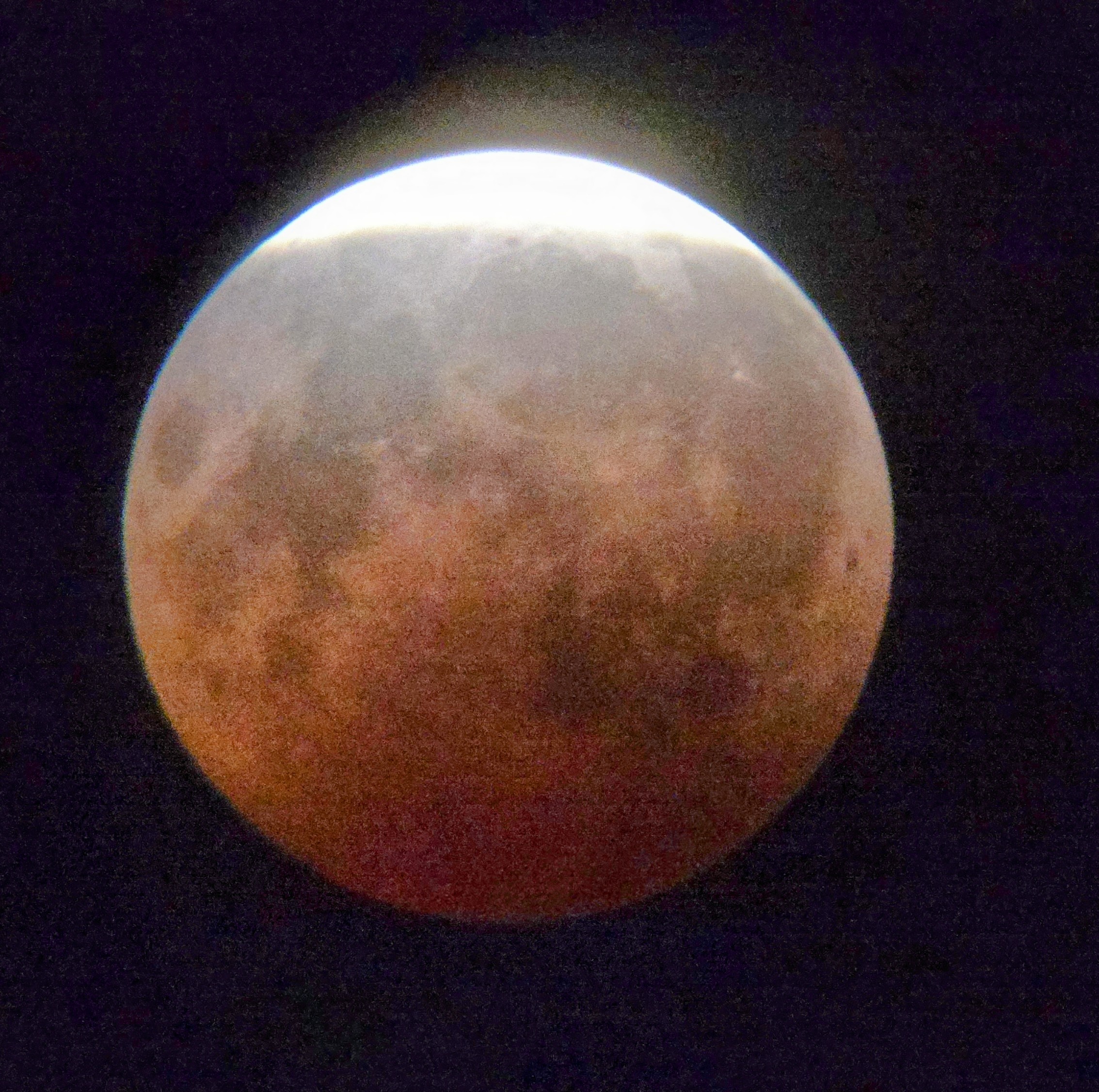
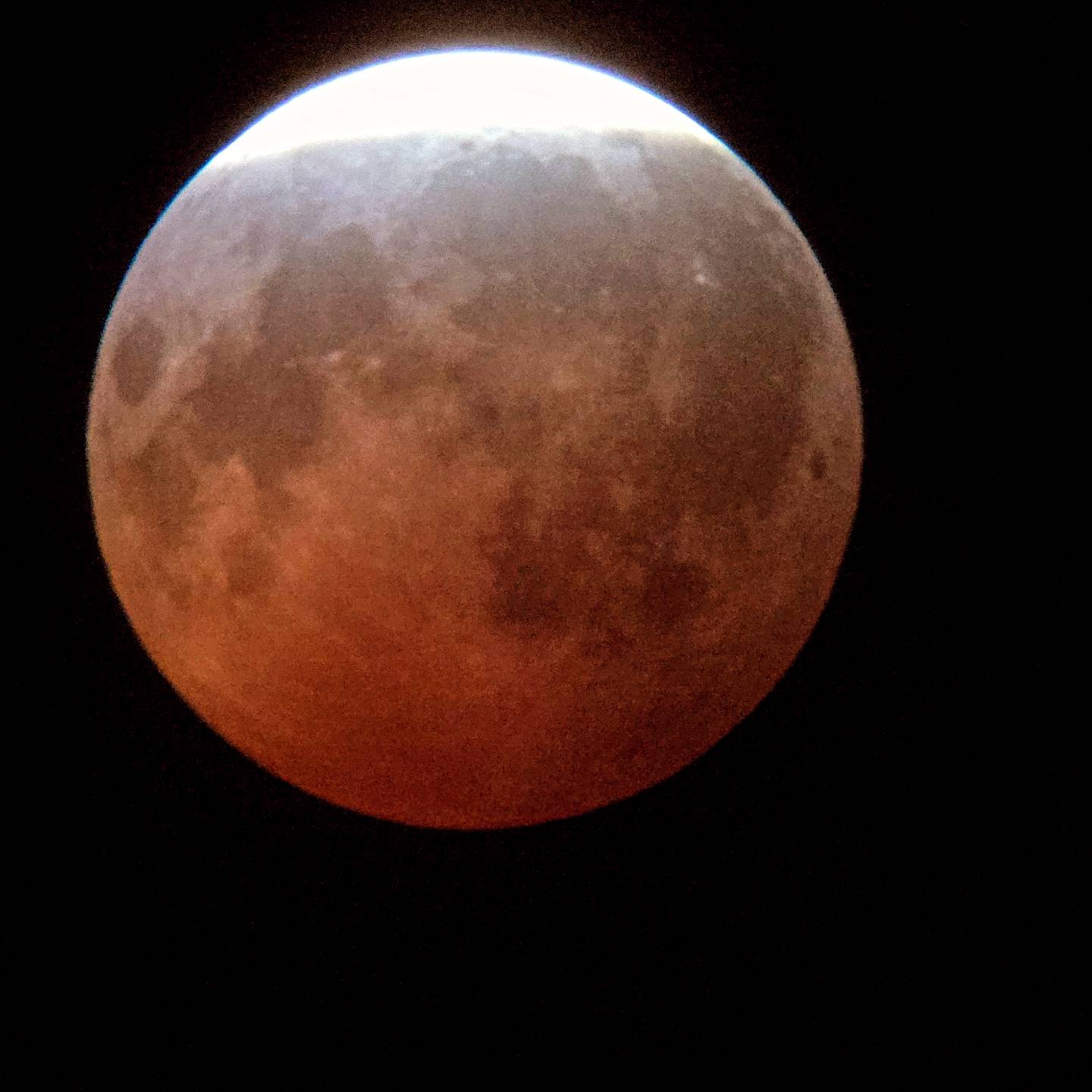
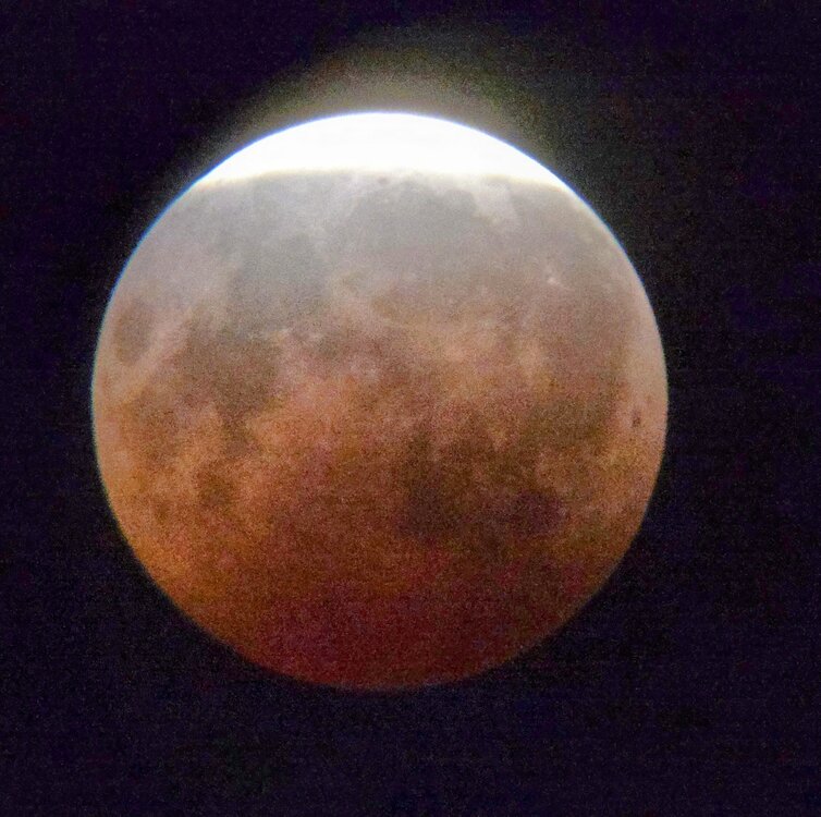
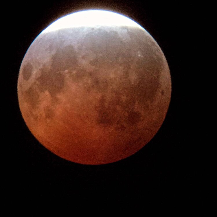
Lunar eclipse turned out really well Thursday night with peak just after 11pm Central and just after Midnight Friday Eastern Time. High clouds had no impact. Figured as much two days early but work obligations prevented me from starting a thread. I laugh about how neurotic I get about even thin clouds for a TSE; but, so chill about a lunar eclipse. Perhaps I need to do more deep breaths before a solar show. Next I propose that a deep lunar eclipse* is as beautiful or even more so than a total lunar eclipse. Get an extended lunar version of the diamond ring phase. Through binoculars I observed 3 stars with the Moon. It really felt other worldly and it was gorgeous! Telescope didn't add much value other than for photography. I feel like lunar eclipses are a naked eye and binoculars event. Here are my photos. Let's share! *** Lunar eclipses are unique in that deep partial is more than good enough. Solar eclipses are all or nothing. Get into totality or forget about it! ***
-

2026-2027 Record-breaking El Nino
EasternLI replied to Stormchaserchuck1's topic in Weather Forecasting and Discussion
Exactly right. I've been noticing the same thing for at least a month now already. I have a hunch that changes in the fall but we'll see what happens. -

Augdewst 2026: Summer's Last Stand
Chrisrotary12 replied to Prismshine Productions's topic in New England
If you applied this statement to 90% of our seasons since 2011 it’d be accurate. -
Former Dolly with a new burst of convection
-
It was clear enough for about 15 minutes around 11:30 last night. It was pretty cool to see... nothing like the solar in 2024