All Activity
- Past hour
-
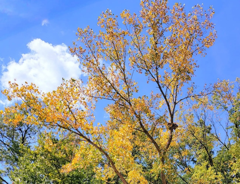
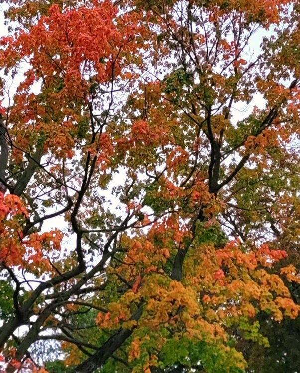
Between the dry August and the recent stretch of cool nights, the color is not wasting time this year.
-
As of this writing, I'm approaching an inch on the Day. Alot of lightning and thunder. Kmrx put a severe t storm warning out for Jonesville. It just missed my local about a mile to my South as Wallen Ridge and Powell Mountain appeared to do their thing of pulling the Storm South with their Lift.
-

2025-2026 ENSO
michsnowfreak replied to 40/70 Benchmark's topic in Weather Forecasting and Discussion
Actually, a snowy Thanksgiving to New Years would be a classic weak Nina in the Great Lakes (not sure about the east coast). The issue in recent years has been Ninas have had a tendency to flip flop Dec & Feb. -

Central & Eastern Pacific Thread
gallopinggertie replied to Windspeed's topic in Tropical Headquarters
-
Hey! What's this liquid stuff falling from the sky? 64.2/59.0 and things are almost wet now, MAYBE we get a few hundredths??
-
Eric Webb posted some preliminary thoughts. Tl;dr is more canonical Nina look than last winter but with some +TNH flavor. May average AN in the SE (where he focuses on) but with some cold shots and snow.
-

Occasional Thoughts on Climate Change
donsutherland1 replied to donsutherland1's topic in Climate Change
The old record was 40.0C, which was most recently tied at Lytton on September 2 (third such occurrence on record in Canada). -
Ugh, just in time for the start of fall sports. Lets keep the rain confined to the weekdays please
-

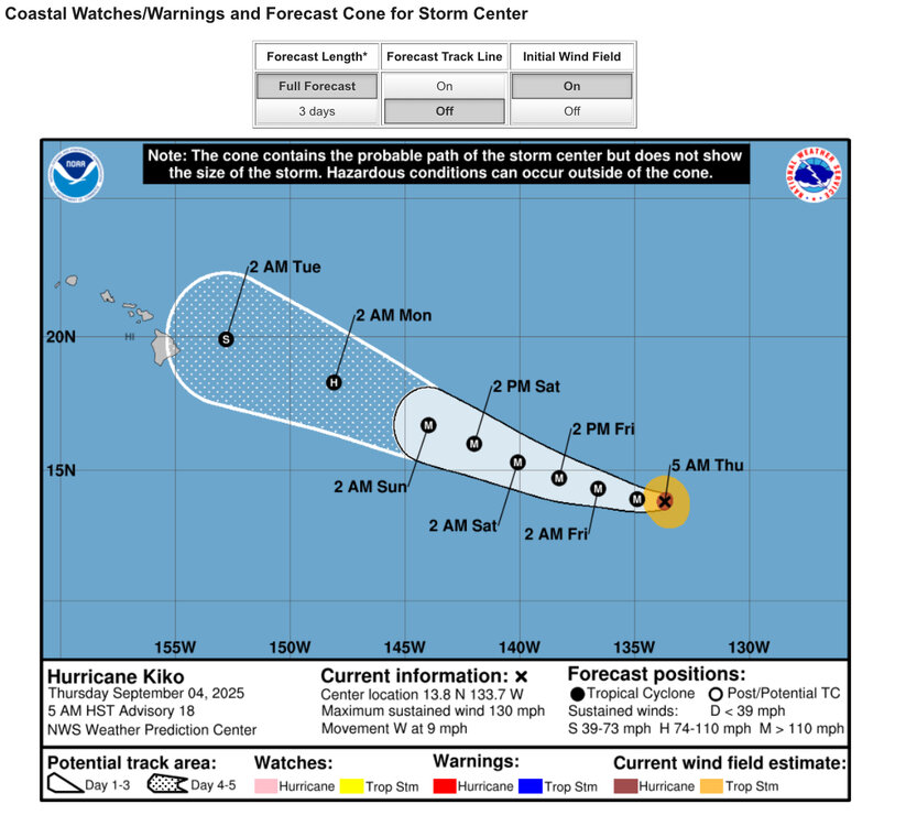
2025 Atlantic Hurricane Season
BarryStantonGBP replied to BarryStantonGBP's topic in Tropical Headquarters
mate what are your thoughts now ensembles have been showing a gulf threat every bloody day -
79 and sunny at 11:15. Southerlies are pumping in more humid air now quickly.
-
The indices ( at least from CPC ) still bear some modest signal, but the operational runs aren't really getting any memos. They seem to favor a bounce back flat ridge and/or relaxation back to a base-line modest above normal heights in the east ( continent) after this weeks trough anomaly lifts out early next week. It's after that ... late next week and beyond that is a period of any eventual interest. It's most likely just way too early. It may be worth it to bide time and see if or when a CPC's strong +PNA, with a shallow -NAO beginning to manifest in the operational cinemas. Right now, from this far out, the GFS's depictions are likely just coincident and not related. Because the stronger +d(PNA) over at Climate Prediction Center is a bit in conflict with these longer range operational handling.
-
QBO actually works well with ENSO state for 10mb. El Nino/-QBO gives about 75% odds for Winter Stratosphere warmings, and La Nina/+QBO gives about 75% for Winter cold Stratosphere. Last year was Weak La Nina per RONI and with +QBO, it was one of the coldest 10mb's on record Nov-Feb. 2 years ago in -QBO/Strong El Nino we had 4 separate Stratosphere warmings. ENSO and the QBO are at odds this Winter. In an unconnected ENSO state it runs about 55-60% warm 10mb for -QBO and 55-60% cold for +QBO. Remember, the QBO is a Stratosphere index, What it means at the surface depends on a lot of in between factors. I think we are pretty split this Winter on -NAO or +NAO indicators, with this recent 6-7 month consecutive +AO/+NAO usually rolling forward to the Winter for the same thing at about 0.2 correlation or 60% probability. Cold H5 during the Summer since the Arctic ice melt low in 2012 has usually put a following Winter ridge at 90N. I think we can possibly be looking at some -AO this Winter, but further south in the N. Atlantic it may be +NAO. The Stratosphere should be warm some of the time with strong -QBO in place, but that occurrence has time lag to -AO events at +15-45 days (depending when in the Winter the Stratosphere warming happens). It's actually really hard to say what XQBO will do to the pattern, since it occurs >30,000ft in the atmosphere. There is some Asia Mountain Torque possibility, which sometimes leads to +PNA, but the correlation on that is actually really weak.
-
.20 in a downpour this morning. Hope to get a little more with the front this afternoon.
-
Yes, its the GFS, and far out, but there's a major one hitting the Carolinas on Sept 18th/19th. I am sure it will change many times, but something to keep an eye on.
-
82 and humid already at 11 am. Think we blow past the forecast high of 86. Hit 88 yesterday, with a forecast high of 84. Its definitely been a bit cooler in my area, but nothing like what it was supposed to be. I am hopeful the next cool blast Monday materializes for us.
- Today
-

2025-2026 ENSO
PhiEaglesfan712 replied to 40/70 Benchmark's topic in Weather Forecasting and Discussion
If Nino 1+2 does not return to an el nino state, then this winter will have a more la nina feel to it. Last year felt like a tug-of-war between the la nina in 3.4 and the el nino in 1+2. It certainly did not behave like a la nina. -

September 2025 OBS-Discussion centered NYC subforum
MANDA replied to wdrag's topic in New York City Metro
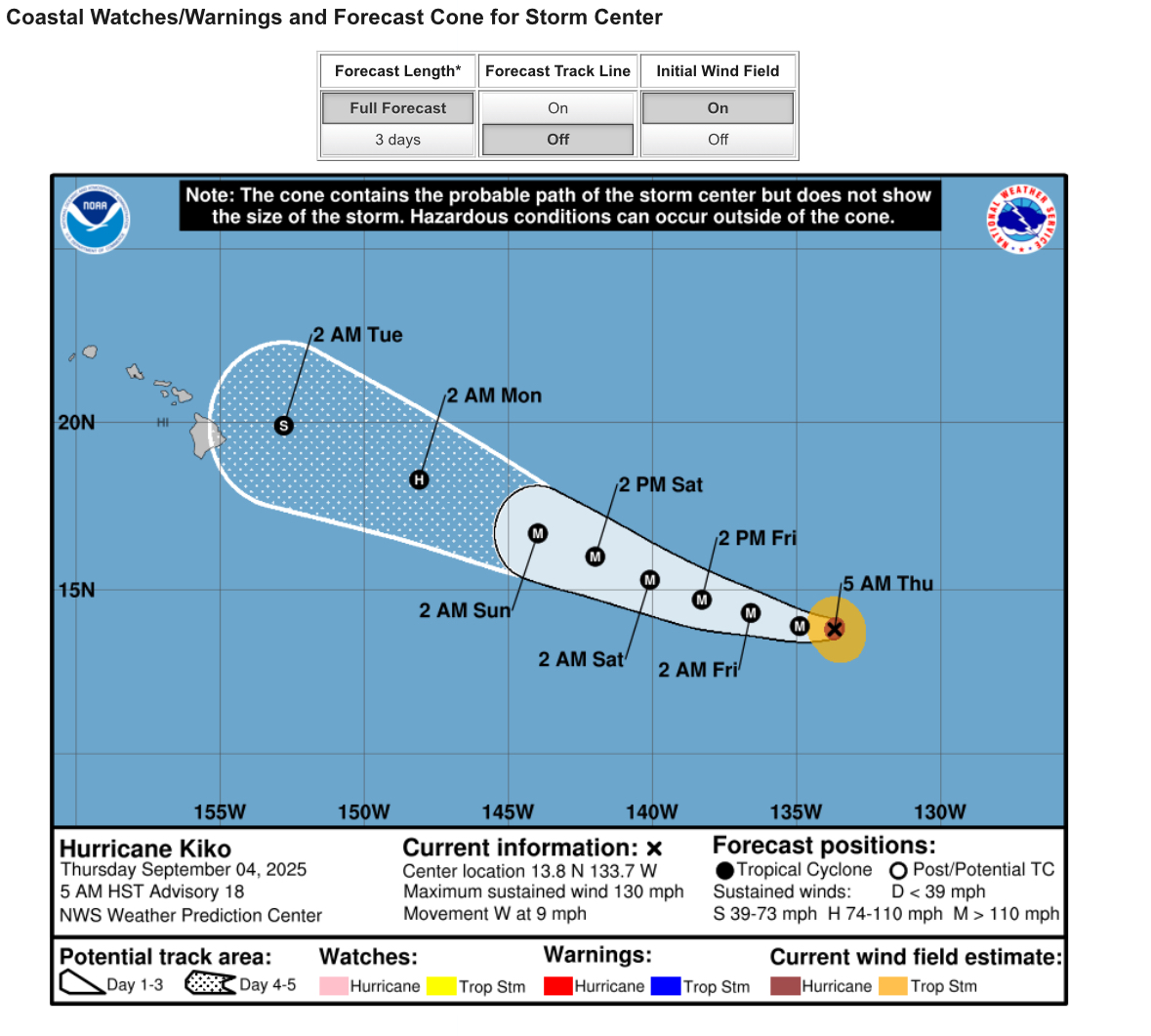
Invest 91L just designated for Atlantic wave. -
We have Invest 91L in the eastern Atlantic.
-
RONI-ONI differences have been slowly dropping since late in 2024 and especially since FMA: 2024: JJA -0.54 JAS -0.52 ASO -0.54 SON -0.55 OND -0.55 NDJ -0.54 DJF -0.53 2025: JFM -0.51 FMA -0.49 MAM -0.43 AMJ -0.38 MJJ -0.32 JJA -0.29
-
Let’s goooo 12z 3k NAM!
-
Are we jumping the gun on the ENSO state being La Niña? No
-
Heat Island kept MSP at a relatively mild 46 overnight.
-

Occasional Thoughts on Climate Change
Typhoon Tip replied to donsutherland1's topic in Climate Change
Curious what the previous record was -
If we get one it’ll be weak. There will be other factors at play that’ll determine what kind of winter we get.
-
Stein coming at us in all directions.. crushing everything as he moves in