All Activity
- Past hour
-

Richmond Metro/Hampton Roads Area Discussion
migratingwx replied to RIC Airport's topic in Mid Atlantic
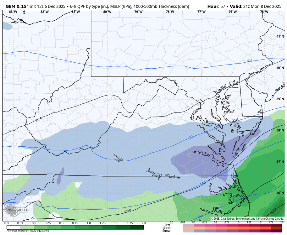
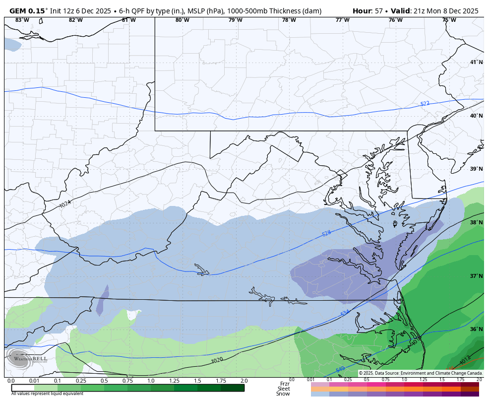
Here is the 2z GFS for Monday still showing the next potential. The Canadian has it farther north.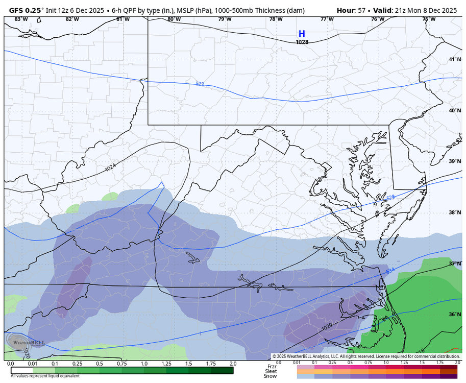

-

Dec 6-7th (It's not a clipper) Clipper
hawkeye_wx replied to Chicago Storm's topic in Lakes/Ohio Valley
Our 11" shrunk by half pretty quickly. -

Dec 6-7th (It's not a clipper) Clipper
KeenerWx replied to Chicago Storm's topic in Lakes/Ohio Valley
Meh, on southern fringe so not expecting much. Hope it overperforms for those further north, though! -

December 2025 regional war/obs/disco thread
weathafella replied to Torch Tiger's topic in New England
I guess we should be patient. This is kind of similar to how December played out in 2010 before Boxing Day delivered for many of us. -

December 2025 regional war/obs/disco thread
WinterWolf replied to Torch Tiger's topic in New England
Lots of them…especially for you out that way. You’ll be ok. -
That long duration event helped Newark to reach the 6th snowiest calendar year since the 1840s. Time Series Summary for NEWARK LIBERTY INTL AP, NJ - Jan through Dec top 10 highest calendar year snowfall Click column heading to sort ascending, click again to sort descending. 1 1907 73.1 123 2 1867 72.0 0 3 1868 68.8 0 4 1978 65.8 0 5 1961 63.5 0 6 2003 63.3 0 7 1854 62.8 0 8 1916 62.7 31 9 1996 62.6 0 - 1862 62.6 0 10 1896 61.4 2
-
December 2025 regional war/obs/disco thread
WinterWolf replied to Torch Tiger's topic in New England
Sorry bro..but go spin some tunes. -

2025-2026 Fall/Winter Mountain Thread
Maggie Valley Steve replied to Buckethead's topic in Southeastern States
The 12Z GFS remains aggressive for a nice little event Sunday night/Monday/early Tuesday..thumb.png.cde71be4ba36dbae733bf48b5a53b8e5.png)
-
Clear blue skies this morning. -sd/sd's around the area with some -10's around I-Falls. Nice to have the Sun shining. Lots of cloudy days in the Winter. Reflected light really brightens things up (almost too much sometimes).
-
December 2025 regional war/obs/disco thread
WinterWolf replied to Torch Tiger's topic in New England
Nope! -
Gfs trying for the 12th.
-
11/30/2025: T (A mix of rain/sleet from the 4am hour through about 9am. Intensity got up to light/moderate intensity at times. Temps: low/mid 30s 12/02/2025: T (Probably had a brief period of sleet w/ rain sometime between 4:30am and 5am when precip started before quickly changing to a cold rain that became moderate at times during the morning.) 12/05-06/2025: 1.4" (Flurries/very light snow starting in the 4am hour intensifying to light snow between 6am and 10am (light/moderate at times). Flurries to very light snow showers continuing through the rest of the morning ending during the 12pm hour. ETA: Another few bursts of sometimes moderate snow with big aggregates between 10:30pm and around midnight or so dropping an additional 0.2".) Snow totals as of December 6th, 2025: 1.4"
-

Dec 6-7th (It's not a clipper) Clipper
mannynyc replied to Chicago Storm's topic in Lakes/Ohio Valley
Pack is starting to melt so I'm just hopeful for a nice refresher. Would be very happy with three solid inches. -

December 2025 regional war/obs/disco thread
TauntonBlizzard2013 replied to Torch Tiger's topic in New England
Right. This is the kind of stuff that’s a little crazy. Snowcover data is a very factual, as is data point. It’s not subjective. You can’t not believe it. You can make the argument our ceiling might be higher on a smaller scale, but, yeah, the snow cover decline is real, and we feel it -
December 2025 regional war/obs/disco thread
TauntonBlizzard2013 replied to Torch Tiger's topic in New England
It’s an objective fact dude, it’s not up for debate. But there have been some epic years mixed in -
I needed that and Dendrite’s carol. Well done.
-
What a cold and miserable week we have had. If it's gonna be cold, at least dump some snow. Raining again this morning, 40 degrees.
-
Ugh, State Highway obs again this year! Only better if you're a weenie like us and 0.2" makes a difference
-
BTV is down on it, but some models are looking juicy
-

December 2025 regional war/obs/disco thread
DavisStraight replied to Torch Tiger's topic in New England
Been snowing here all morning, probably have 1/4 inch. -
Looks like a nice little event Sunday night into Monday. Hope yall enjoy. I'll be in Charleston this next week.
-
.thumb.jpg.ad3a2e31d30aff035044689b311a0540.jpg)
Winter 2025-26 Medium/Long Range Discussion
nvck replied to michsnowfreak's topic in Lakes/Ohio Valley
#lockingitin (its 15mb weaker and a fifth of the snow on the new runs) -

December 2025 regional war/obs/disco thread
cleetussnow replied to Torch Tiger's topic in New England
Pure gold. -
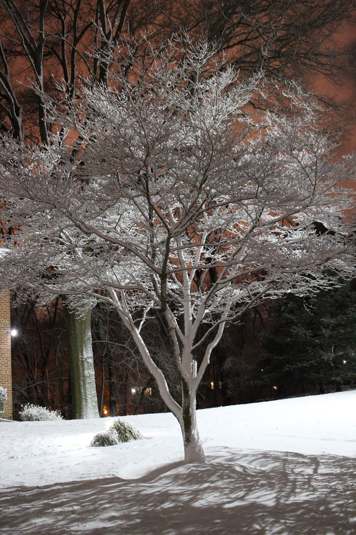
That Valentine's Day 2015 mini-event is STILL one of my favorites! About 2" total fell within a couple of hours as the Arctic front blew through the area in the early evening, attended by strong winds and rapidly falling temperatures. And yeah, I remember @Bob Chill talking about watching the event occur while grilling in his garage!! That event ushered in an amazing period of winter weather that went through early March! Here's a shot soon after the snow ended...

-
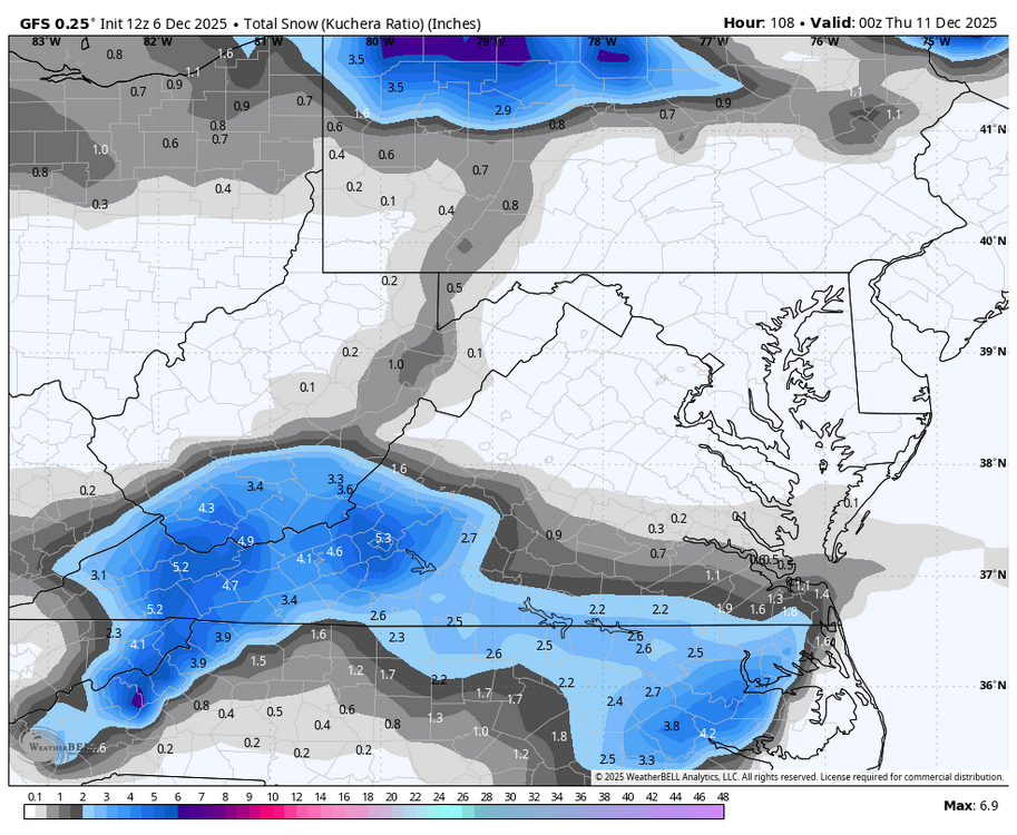
GFS keeps amping up a little more each run
.thumb.png.d12f201238658bafc2568af22a9f7e5e.png)


.png.b51b71007800fbd025524d151ccca91f.png)


.png.1d99c045e356ff4a9940e15e502ef2ad.png)